- Monte Beigua
-
Monte Beigua 
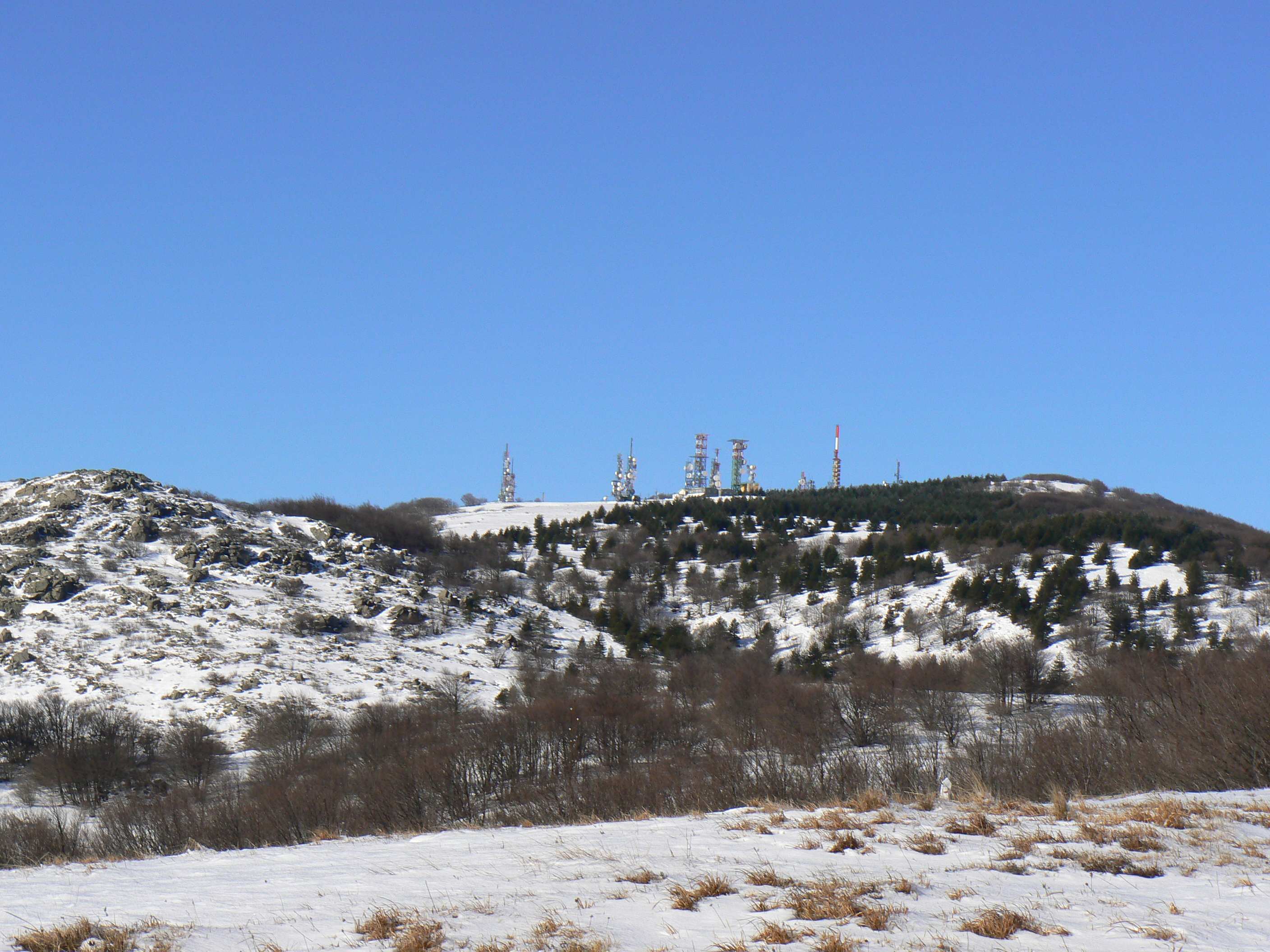
The peak of Mount BeiguaElevation 1,287 m (4,222 ft) Location Location Liguria,  Italy
ItalyRange Ligurian Apennines Coordinates 44°26′00″N 08°33′55″E / 44.4333333°N 8.56528°E Monte Beigua (also in Ligurian: Monte Peigoa) is a mountain in the Ligurian Apennines in Liguria, northern Italy, between the two communes of Varazze and Sassello. It is included in the eponymous Regional Park, and, at 1,287 m is the highest peak in the so-called Gruppo del Beigua including Monte Grosso (1,265 m), Monte Ermetta (1,267 m) and Bric Veciri (1,263).
It has been hypothized that it was a sacred mountain to the Liguri tribe living here in pre-Roman times, together with the Mont Bégo and Monte Sagro. The upper part of the mount houses transmission antennas used by RAI (Italian state television) and other private networks.
Sources
- Parco Naturale Regional del Beigua (Italian) (English) (German) (French)
External links
- Monte Beigua peak webcam
 Mountains of LiguriaMonte Antola · Monte Beigua · Monte Bignone · Bric Agnellino · Bric del Terma · Bric delle Camere · Monte Buio · Monte Bano · Monte Carmo di Loano · Monte Carmo · Monte Castello (Liguria) · Monte Caucaso (Liguria) · Monte Colma · Monte Colombin · Monte Fasce · Monte delle Figne · Monte Figogna · Monte Frontè · Monte Galero · Monte Grammondo · Monte Groppo Rosso · Monte Leco · Monte Maggiorasca · Punta Martin · Monte Penello · Monte delle Tre Croci · Monte Orditano · Monte Penna (Liguria) · Piani di Praglia · Monte Porale · Monte Pracaban · Monte Prelà · Monte Rama · Monte Reale · Monte Reixa · Rocche del Reopasso · Monte Ramaceto · Monte Roncalla · Ronco di Maglio · Monte Saccarello · Monte Santa Croce · Monte Sciguello · Monte Settepani · Monte TacconeCategories:
- Global Geoparks Network members
- Mountains of Liguria
- Liguria geography stubs
Wikimedia Foundation. 2010.