- Moorhouse and Cross Fell
-
Moorhouse and Cross Fell Site of Special Scientific Interest  Summit of Cross Fell, with Great Dun Fell in the distance
Country England Region North East District Wear Valley, Durham
Eden, CumbriaLocation NY715365 - coordinates 54°43′N 2°23′W / 54.717°N 2.383°W Area 13,707 ha (33,871 acres) Notification 1951 / 1963 Management Natural England Area of Search County Durham Interest Biological
Geological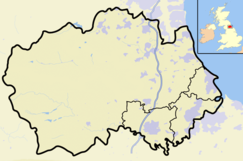
 Location of Moorhouse and Cross Fell, Cumbria / Durham
Website: Map of site Moorhouse and Cross Fell is a Site of Special Scientific Interest covering an extensive area of moorland in the Wear Valley district of west County Durham and the Eden district of Cumbria, England. It is contiguous with Upper Teesdale SSSI to the east and Appleby Fells SSSI to the south. The area covered extends roughly from an arc through the villages of Gamblesby, Leadgate and Garrigill southward as far as Milburn in the west and Cow Green Reservoir in the east. It includes the whole of Cross Fell, the summit of which, at 893 metres asl, is the highest point in the Pennines and in England outside the Lake District.
The area is important for its wide variety of upland habitats, especially blanket bog, sub-montane and montane heath, montane bryophyte heath, limestone grassland and flushes, and for the fauna and flora that they support. The site also includes a number of localities of geological interest.[1]
More than forty species of birds breed in the area, including several raptors—merlin, peregrine, common buzzard, common kestrel, short-eared owl—and waders—Eurasian golden plover, dunlin, common sandpiper, Northern lapwing, Eurasian curlew, common redshank, and common snipe—whose survival is threatened; four (merlin, peregrine, golden plover and short-eared owl) are listed in Annex 1 of the European Commission's Birds Directive as requiring special protection and others (including lapwing and dunlin) are listed in the United Kingdom's Red Data Book (Birds).[1][2]
The invertebrate fauna is best known from studies conducted over many years at the Moor House NNR.[3] The area shares many characteristics with the Cairngorms region of Scotland but there are some notable rarities, including a rove beetle, Olophrum assimile, which is known from only one other locality in Britain, a carabid beetle, Nebria nivalis, which has not been found anywhere else in the North Pennines and is known elsewhere in Britain only from North Wales, the Cairngorms and Scafell Pike, and a leiodid beetle, Hydnobius spinipes, which is known from only four other localities in Britain. In all, some 27 endangered species and over 70 nationally scarce species have been recorded from the Moor House reserve.[1]
Although the area has a variety of habitats, it is the montane vegetation that is particularly notable. The summit of Cross Fell is dominated by a heath in which the moss Racromitium lanuginosum is dominant and is the most extensive area of such heath in England. Other notable montane and sub-montane species include hair sedge, Carex capillaris, northern bedstraw, Galium boreale, mountain everlasting, Antennaria dioica, and alpine forget-me-not, Myosotis alpestris.[1]
Within the site are five localities of geological interest, of which the following are particularly notable:[1]
- Knock Fell Caverns — situated at the head of Knock Ore Gill, this is the most extensive maze cave system in Britain.
- Cross Fell — together with the Dun Fells and Knock Fell, this area is important both for its examples of periglacial landforms and because some periglacial processes are still active.
SSSI history
Moorhouse and Cross Fell SSSI was created in 1990 as part of a substantial revision of existing SSSIs that had originally been notified under the National Parks and Access to the Countryside Act 1949. In the course of the revision, parts of the Cross Fell SSSI and Upper Teesdale and Appleby Fells SSSI were amalgamated with Moor House NNR to form the new Moorhouse and Cross Fell SSSI.
In 1975, Moor House NNR was the first site in Britain to be declared a Biosphere Reserve by UNESCO and in 1983 it was declared a Special Protection Area under the EC 1979 Directive on the Conservation of Wild Birds.
The site is within the North Pennines Area of Outstanding Natural Beauty.
References
- ^ a b c d e "Moorhouse and Cross Fell". English Nature. 1990. http://www.english-nature.org.uk/citation/citation_photo/1005550.pdf. Retrieved 23 July 2010.
- ^ Eaton, M A; A F Brown, D G Noble, A J Musgrove, R Hearn, N J Aebischer, D W Gibbons, A Evans and R D Gregory (2009). "Birds of Conservation Concern 3: the population status of birds in the United Kingdom, Channel Islands and the Isle of Man". British Birds 102: 296–341.
- ^ Downie, I S; J C Coulson, L J Bauer, J E L Butterfield, L Davies, S A Goodyear (1994). "The invertebrate fauna of Cross Fell and Dun Fell summits". Vasculum 79: 48–62.
Backstone Bank and Baal Hill Woods • Baldersdale Woodlands • Bishop Middleham Quarry • Bollihope, Pikestone, Eggleston and Woodland Fells • Botany Hill • Bowes Moor • Bowlees and Friar House Meadows • Brasside Pond • Brignall Banks • Burnhope Burn • Butterby Oxbow • Cassop Vale • Castle Eden Dene • Causey Bank Mires • Charity Land • Close House Mine • Cornriggs Meadows • Cotherstone Moor • Crag Gill • Crime Rigg and Sherburn Hill Quarries • Dabble Bank • Derwent Gorge and Horsleyhope Ravine • Durham Coast • Fairy Holes Cave • Far High House Meadows • Fishburn Grassland • Foster's Hush • Frog Wood Bog • God's Bridge • Grains o' th' Beck Meadows • Green Croft and Langley Moor • Greenfoot Quarry • Hannah's Meadows • Hawthorn Dene • Hawthorn Quarry • Hell Kettles • Hesledon Moor East • Hesledon Moor West • Hexhamshire Moors • Hisehope Burn Valley • Hulam Fen • Hunder Beck Juniper • Kilmond Scar • Low Redford Meadows • Lune Forest • Mere Beck Meadows • Middle Crossthwaite • Middle Side and Stonygill Meadows • Middleton Quarry • Middridge Quarry • Moorhouse and Cross Fell • Muggleswick, Stanhope and Edmundbyers Commons and Blanchland Moor • Neasham Fen • Newton Ketton Meadow • Old Moss Lead Vein • Park End Wood • Pig Hill • Pike Whin Bog • Pittington Hill • Pow Hill Bog • Quarrington Hill Grasslands • Railway Stell West • Raisby Hill Grassland • Raisby Hill Quarry • Redcar Field • Rigg Farm and Stake Hill Meadows • Rogerley Quarry • Sherburn Hill • Shipley and Great Woods • Sleightholme Beck Gorge - The Troughs • Slit Woods • Stony Cut, Cold Hesledon • Teesdale Allotments • The Bottoms • The Carrs • Thrislington Plantation • Town Kelloe Bank • Trimdon Limestone Quarry • Tuthill Quarry • Upper Teesdale • Waldridge Fell • West Newlandside Meadows • West Park Meadows • West Rigg Open Cutting • Westernhope Burn Wood • Wingate Quarry • Witton-le-Wear • Yoden Village QuarryNeighbouring areas: Cleveland • Northumberland • Tyne and Wear Categories:- Sites of Special Scientific Interest in County Durham
- Sites of Special Scientific Interest in Cumbria


Wikimedia Foundation. 2010.