- Moortown, Isle of Wight
-
Coordinates: 50°38′52″N 1°23′53″W / 50.647697°N 1.398098°W
Moortown 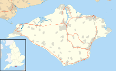
 Moortown
Moortown shown within the Isle of WightOS grid reference SZ425833 Parish Brighstone Unitary authority Isle of Wight Ceremonial county Isle of Wight Region South East Country England Sovereign state United Kingdom Post town VENTNOR Postcode district PO38 Dialling code 01983 Police Hampshire Fire Isle of Wight Ambulance Isle of Wight EU Parliament South East England UK Parliament Isle of Wight List of places: UK • England • Isle of Wight Moortown is a part of Brighstone on the west side of the island. The area is known as the Back of the Wight.[1] The only form of public transport to pass through the village is infrequent Wightbus service 36, connecting the village with Newport and Brighstone.[2]
References
- ^ "Geograph - Moortown, Brighstone, Isle of Wight". www.geograph.org.uk. http://www.geograph.org.uk/photo/495593. Retrieved 2008-12-31.
- ^ "Traveline - Wightbus route 36". www.traveline.org.uk. http://www.travelinesoutheast.org.uk/se/XSLT_TTB_REQUEST?language=en&command=direct&net=set&line=08036&sup=A&project=y08&contentFilter=TIMINGPOINTS&outputFormat=0&itdLPxx_displayHeader=false. Retrieved 2008-12-31.
,
Categories:- Isle of Wight geography stubs
- Villages on the Isle of Wight

Wikimedia Foundation. 2010.