- Moortown, Leeds
-
For other uses, see Moortown (disambiguation).
Coordinates: 53°50′40″N 1°32′02″W / 53.8445°N 1.5339°W
Moortown 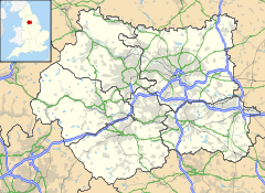
 Moortown
Moortown shown within West YorkshireMetropolitan borough City of Leeds Metropolitan county West Yorkshire Region Yorkshire and the Humber Country England Sovereign state United Kingdom Post town LEEDS Postcode district LS17 Dialling code 0113 Police West Yorkshire Fire West Yorkshire Ambulance Yorkshire EU Parliament Yorkshire and the Humber List of places: UK • England • Yorkshire Moortown is a suburb of Leeds, West Yorkshire, England in the LS17 postcode area. It is a civil parish and electoral ward in the north of the city. It is situated between Roundhay and Brackenwood on the east and Weetwood on the west, with Chapel Allerton to the south, and Alwoodley to the north. It is essentially synonymous with Moor Allerton,[1][2] and institutions in the area use either name.[3][4]
Contents
General Description
 Moortown Water Tower, north of the Ring Road
The suburb is around the junction of the (North-South) Harrogate Road A61 road and the Leeds Outer Ring Road (A6120) (West-East), at that point called the Moortown Ring Road, and overlooked by a Water Tower. Scott Hall Road (A61) and Harrogate Road lead southwards to Leeds city centre. However, the council ward boundary is the Ring Road, with properties to the North now being in the Alwoodley ward. The Church of England parish includes areas north of the Ring Road. A set of woods north and south of the Ring Road and by the water tower are called the Moortown Plantation.[5]
It includes substantial estates of council housing around the junction of King Lane and the Moortown Ring Road.[6]
Housing Estates
Black Moor
 Moortown Social Club, Cranmer Gardens
To the north of the ring road and west of King Lane is the Black Moor estate, named after the moor on which Moortown was situated.[1] This has varied housing from the 1950s to recent, and contains some shops, the Moortown Social Club and Moortown Methodist Church plus St Stephen's Church (C of E).
Lingfield
 Flats on the Lingfield Estate, viewed from King Lane
To the north of the ring road and east of King Lane is the Lingfield estate, mainly low-rise flats, though Lingfield Towers is south of the ring road.
Queenshill
 Moortown Baptist Church, King Lane
To the south of the ring road and east of King Lane is the Queenshill estate, mainly low-rise flats built in the 1950s and 60s.[7] This area contains a small row of shops, a fire station, Moortown Baptist Church, and the offices of the Leeds Jewish Housing Association, who have plans to redevelop the area for the benefit of its clients.[7]
 Darkwood housing estate
Leafield
A smaller development of public housing is the south of the ring road and west of King Lane, essentially in the grounds of a former mansion, now Leafield Clinic.
Darkwood
A small 1990 development low-rise flats off Shadwell Lane, in woods known as Blackwoods, part of the Forest of Leeds.[8]
Moortown Corner
 Moortown Corner, looking South from Harrogate Road
Moortown Corner is the junction between Street Lane and Harrogate Road, a local shopping area and geographical reference. The building known as the Corner House was built as a cinema (1938–1940), ballroom and restaurant but now contains shops. From 1968 to 2008 it contained a casino.[9] Nearby is a large Marks and Spencer Simply Food supermarket which serves the surrounding area. Branches of Leeds Building Society, Yorkshire Bank and Halifax can also be found at Moortown Corner.
Moortown Corner is served by First Leeds service 2, which is represented red on the 10-minute frequency Overground network. Less regularly, services 35, 38, 45 and 48 run through Moortown Corner. Harrogate & District service 36 also serves Moortown Corner between central Leeds and Harrogate every 20 minutes.
Moor Allerton District Centre
 Penny Fun
 Sainsbury's Moortown
Moor Allerton District Centre is adjacent to the Black Moor estate, north of the Ring Road and west of the junction with King Lane, which opened in 1982.[10] It includes a public library which is the busiest in Leeds, apart from the Central Library.[11] However it is mainly a shopping centre, with a large Sainsbury's,a Homebase a Comet, a newsagent, cobbler's and several other small shops. It includes a public house, the Penny Fun, whose name relates to the history of the area as follows. The word 'pen' comes from the Celtic for 'hill'. What is now Tunnel How Hill is visible from the Centre to the south-west. It was previously Pen-how-fyn, and a hamlet around what is now the Centre was Paenfynaen (where fynaen means settlement). Tunnel How Hill was referred to as Penny Fun in the 19th century and several houses in the vicinity used the name.[12] There is a Penny Field nearby in Meanwood Park.
Religions
Moortown has longstanding Jewish and Roman Catholic communities, with schools and places of worship for both these groups, and also a Sikh community. There are secular schools as well. Moortown and neighbouring Alwoodley are the centre of the Leeds Jewish Community.
St Gemma's Hospice
 St Gemma's Hospice, Moortown, Leeds
Moortown is home to St Gemma's Hospice. This is situated to the south of Moortown Corner on Harrogate Road. St Gemmas Hospice have many charity shops around Leeds, assisting funding for the hospice, with branches in Wetherby, Otley, Moor Grange, Guiseley, Horsforth, Alwoodley, Roundhay, Oakwood, Cross Gates, Halton, Beeston, Pudsey and Morley. Outside of the City of Leeds there is also a branch in Ilkley.[13]
Sport
There is a Rugby Union football club. Moortown Golf Club hosted the 1929 Ryder Cup, but is well North of the Ring Road and is now in the Alwoodley ward. Moor Allerton Sports and Social Centre [1] has bowls, tennis and indoor activities.
Location grid

Alwoodley Adel 
Roundhay  Moortown, Leeds

Chapel Allerton Notes and references
- ^ a b Ralph Thoresby (1715) Ducatus Leodiensis: or, the topography of the ancient and populous town and parish of Leedes,and parts adjacent in the West Riding of York, page 135
- ^ A History of Leeds, compiled from various authors (1797) (Leeds) page 57
- ^ The Ordnance Survey gives the name Moor Allerton to the southeasternmost part (where Moor Allerton School is), whereas the Moor Allerton shopping Centre, containing Moor Allerton Library, is to the west by the junction of King Lane and the Ring Road (A6120). This is actually on the site of the original village of Moore Allerton.
- ^ Likewise Chapeltown and Chapel Allerton
- ^ Forest of Leeds Moortown Plantation
- ^ Welcome to Moortown Leeds City Council publication.
- ^ a b Leeds Jewish Housing Association Queenshill Masterplan Proposals: the need for development
- ^ The Forest of Leeds
- ^ Yorkshire Evening Post 15 October 2008 Wheel spins at Leeds casino for last time
- ^ http://www.leodis.net/display.aspx?resourceIdentifier=2002326_73720950
- ^ www.leeds.gove.uk Moor Allerton Library
- ^ Leeds Mercury 29 May 1886 "Local Notes and Queries"
- ^ http://www.st-gemma.co.uk/shops/location1.htm
External links
- YEP Moortown Today Community Website
- Moortown Corner House 2003, Leodis Photographic Archive
- Moortown Corner 1950, with tram tracks along Street Lane, Leodis Photographic Archive
- Moortown Plantation, Forest of Leeds
- "The Ancient Parish of Leeds". GENUKI. http://www.genuki.org.uk/big/eng/YKS/WRY/Leeds/index.html. Historical and genealogical resource for area including Moortown
Schools
- Allerton Grange High School
- Cardinal Heenan Catholic High School
- Carr Manor High School
- Carr Manor Primary School
- Immaculate Heart of Mary Catholic Primary School
- Moortown Primary School
Religion
- Immaculate Heart of Mary RC Church
- Moortown Baptist Church
- Moortown Methodist Church
- All Nations Community Church
- Sinai Synagogue, Roman Avenue, Moortown
Leeds Topics Culture Places List of towns, villages, areas and suburbsGovernment City of Leeds • Leeds City CouncilPeople Categories:- Places in Leeds


Wikimedia Foundation. 2010.