- Moravian–Silesian Region
-
Moravia-Silesia
MoravskoslezskoUndermined church in Karviná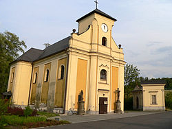

Flag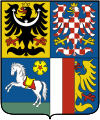
Coat of arms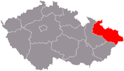
Country Czech Republic Government - Hetman Jaroslav Palas (ČSSD) Area - Total 5,445 km2 (2,102.3 sq mi) Highest elevation 1,491 m (4,892 ft) Population (03/2011) - Total 1,260,503 - Density 231.5/km2 (599.6/sq mi) Time zone CET (UTC+1) - Summer (DST) CEST (UTC+2) ISO 3166-2 CZ-MO Licence plate T NUTS code CZ08 GDP per capita (PPS) € 15,300[1] Website www.kr-moravskoslezsky.cz Moravian-Silesian Region (Czech: Moravskoslezský kraj), or Moravo-Silesian Region, is one of 14 administrative Regions of the Czech Republic, until May 2001 it was formerly called the Ostrava Region (Czech: Ostravský kraj). The region is located in the north-eastern part of its historical region of Moravia and in most of the Czech part of the historical region of Silesia. The region borders the Olomouc Region (to the west) and Zlín Region (to the south). It also borders two other countries – Poland to the north and Slovakia to the east.
Once a highly industrialized region, it was called the "Steel Heart of the Country" in the communist era. There are, in addition, several mountainous areas where the landscape is relatively preserved.
Nowadays, the economy of the region benefits from its location on the borders of two other Central European countries: Poland and Slovakia.
Contents
Geography
The geography of the region varies considerably, compromising many landforms from lowlands to high mountains whose summits lie above the tree line.
In the west lie the Hrubý Jeseník mountains, with the highest mountain of the region, and all Moravia), Praděd, rising 1491 meters. The mountains are heavily forested, with many spectacular places and famous spas such as Karlova Studánka and Jeseník) and are therefore very popular with tourists. There are also several ski resorts, including Červenohorské Sedlo and Ovčárna, with long-lasting snow cover. The Hrubý Jeseník mountains slowly merge into the rolling hills of the Nízký Jeseníks and Oderské Vrchy, rising to 800m at Slunečná and 680m at Fidlův Kopec respectively.
To the east, the landscape gradually descends into the Moravian Gate (Moravská brána) valley with the Bečva and Odra rivers. The former flows to the south-west, the latter to the north-east, where the terrain spreads into the flat Ostrava and Opava basins (Ostravská a Opavská pánev), where most of the population lives. The region's heavy industry, which has been in decline for the last decade, is located there too, benefiting from huge deposits of hard coal. The confluence of the rivers Odra and Olše is the lowest point of the region, at 195 m.
To the south-east, towards the Slovakian border, the landscape sharply rises into the Moravian-Silesian Beskids (Czech: Moravskoskoslezské Beskydy) (often referred to just as Beskydy), with its highest mountain Lysá Hora (Bald Mountain) at 1323 m, which is considered to be the place with the highest annual rainfall in the Czech Republic, 1,500 mm (100 in) a year. The mountains are heavily forested and serve as a holiday resort for the industrial north.
Nature Conservation
There are three large Landscape Protected Areas (Chráněné krajinné oblasti, CHKO) and a number of smaller nature reserves in the region. Countryside more affected by humans, yet still scenic is protected in five Nature Parks (Přírodní parky).
The CHKO Jeseníky (with an area of 745 km²) lies in the mountain range of the same name in the north east of the region. The terrain is very diverse, with steep slopes and deep valleys. Eighty percent of the area is forested, mostly by secondary plantations of Norway spruce, which were seriously damaged by industrial emissions. Due to local weather conditions, the tree line in the area descends to 1200–1300 m. Alpine meadows can be found in particularly low elevations in the Jeseník mountains. There are also a few peat moors, which are otherwise non-existent in Moravia.
The CHKO Poodří (81.5 km²) lies in the Moravian Gate, in close proximity to the region's capital Ostrava, on the banks of the meandering Odra. It is an area of floodplain forests (one of the last preserved in Central Europe), flooded meadows and a lot of shallow ponds, on which water birds thrive.
The CHKO Beskydy (1,160 km²) is the largest Czech CHKO. It lies in the south-east of the region, along the Slovakian boundary. In the north, the mountains rise steeply from the Ostrava basin, to the south their elevation and severity decreases. Most of the area is forested, mainly by Norway spruce plantations, which are not indigenous to the area. Many of these were severely damaged by emissions from the Ostrava industrial region. There are, however, also a lot of either newly planted or preserved forests of European beech, which in the past covered most of the mountains. The CHKO is typical by its mosaic of forests and highland meadows and pastures with hamlets scattered throughout all the mountains. In recent years bear and wolf sighting have become more frequent.
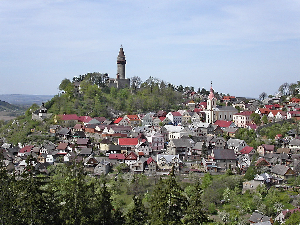
There are altogether 125 small, protected nature areas covering an area of 52 km². The most notable of them is the lime Šipka Cave (Jeskyně Šipka) near Štramberk, where remnants of a Neanderthal man were discovered in the late nineteenth century.
Places of Interest
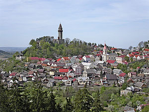 Štramberk
There are three towns with protected historical centers. Příbor, the birthplace of Sigmund Freud, was an important center of education for northern Moravia from the 17th century to the first half of the 20th. Nový Jičín, founded under the castle of Starý Jičín, has a well preserved central square dating back to the 14th century, with the Žerotínský château nearby. Štramberk is a unique small town nestled in a valley between lime hills, with many timber houses and the Trúba Spire rising on a hill above the town.
There are many castles and châteaus in the region; the most famous being Hradec nad Moravicí, Raduň, Kravaře and Fulnek. Hukvaldy, in a village of the same name under the Moravian-Silesian Beskids mountains, is one the region's many castle ruins, known for a musical festival dedicated to the composer Leoš Janáček, who was born there. Another well-known castle ruin is Sovinec under the Hrubý Jeseníks.
Due to the importance of industry in the region, there are many museums displaying products of local technical development: The Automobile Museum in Kopřivnice exhibits the history Tatra, the Train Car Museum in Studénka, the Mining Museum and the former Michal Mine (Důl Michal) in Ostrava, and many others.
Population
The total population of the region was 1,262,660 (men 48.83%, women 51.20%) in 2002, which makes it the most populous Region in the Czech Republic. 86.9% are Czechs, 3.3% Slovaks, 3.0% Poles, 2.3% Moravians,0.8% Silesians, 0.3% Germans and 0.2% Roma, though this last figure might be considerably higher as Roma often do not officially admit their nationality. 40.2% of the population are religious, mostly Roman Catholic, while 52.3% declare themselves atheists.
The population density is 227.3 inhabitants per km², which is the second highest in the country, after the capital Prague (Praha). Most of the population is urban, 62% living in towns with over 20,000 inhabitants.
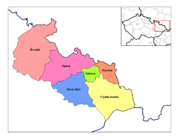
Administrative division
There are 302 municipalities, of which there are 39 towns, 16 with population over 10,000 inhabitants and 5 towns with over 60,000. These are the capital of the region Ostrava (314,102 in 2002), Havířov (85,271), Karviná (61,146), Opava (60,731) and Frýdek-Místek (60,603).
Municipalities with Extended Competence
Since 2003-01-01 the region has been divided into 22 Municipalities with Extended Competence which took over most of the administration of the former District Authorities. Some of these are further divided into Municipalities with Commissioned Local Authority. They are unofficially named Little Districts (Czech: malé okresy). They are:
- Bílovec
- Bohumín
- Bruntál
- Český Těšín
- Frenštát pod Radhoštěm
- Frýdek-Místek
- Frýdlant nad Ostravicí
- Havířov
- Hlučín
- Jablunkov
- Karviná
- Kopřivnice
- Kravaře
- Krnov
- Nový Jičín
- Odry
- Opava
- Orlová
- Ostrava
- Rýmařov
- Třinec
- Vítkov.
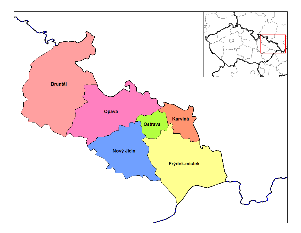
Districts
 Districts of Moravia-Silesia
Traditionally, the region has been divided into six Districts (Czech: okresy) which still exist as regional units though most administration has been shifted to the Municipalities with Extended Competence and the Municipalities with Commissioned Local Authority.
History
Until 2000 the current region did not exist as such but was only a part of a larger administrative unit called the North Moravian Region (Severomoravský kraj). 6 of its Districts (okresy), Bruntál, Frýdek-Místek, Karviná, Nový Jičín, Opava and Ostrava, were in 2000 put into the newly established Moravian-Silesian Region. The old North Moravian Region still exists and jurisdiction of some administrative bodies is defined by its borders.
References
External links
Regions of the Czech Republic 
Central Bohemia · Hradec Králové · Karlovy Vary · Liberec · Moravia-Silesia · Olomouc · Pardubice · Plzeň · Prague · South Bohemia · South Moravia · Ústí nad Labem · Vysočina · Zlín

Silesia topics History Symbols Coats of arms · Flags · Unofficial Anthems: Schlesien Unvergessene Heimat · Schlesierlied · Slezská hymnaEconomy Tourism · Upper Silesian Coal Basin (with: Upper Silesian Industrial Region · Rybnik Coal Area · Ostrava-Karviná Coal Area) · Lower Silesian Coal Basin · Legnicko-Głogowski Okręg Miedziowy · Bielski Okręg Przemysłowy · Silesian metropolitan area · Katowice urban areaCuisine Silesian dumplings · Black noodles · Makówki · Siemieniotka · Żur śląski · Wodzionka · Szałot · Kreple · Kołocz · Galert · Krupniok · Karminadle · Bryja · Moczka · Modra kapusta · Ciapkapusta · HauskyjzaLanguages Silesian (Cieszyn Silesian dialect · Lach Silesian dialect · Niemodlin Silesian dialect · Bytom Silesian dialect · Jabłonków Silesian dialect · Namysłów Silesian dialect · Prudnik Silesian dialect · Opole Silesian dialect · Syców Silesian dialect · Lower Silesian dialect · Sulkovian Silesian dialect · Texas Silesian) · German · Polish · Czech · Lower SilesianAdministrative
divisionsFormerDuchies (Piasts · Dukes) · Silesian Voivodeship (1920–1939) (Parliament · Treasury · Politicians) · State country · Province of Silesia / Upper Silesia / Lower Silesia · Sudetenland · New Silesia · Austrian Silesia · Eastern SilesiaPresentSilesian · Opole · Lower Silesian · Lubusz Voivodeships · Silesian-Moravian Region · Jeseník District · part of Saxony and Brandenburg (mainly in Niederschlesischer Oberlausitzkreis/Görlitz (district))Geography MountainsRiversLakesHighlands
Lowlands
OtherSilesian Highlands · Silesian Lowlands · Silesian-Lusatian Lowlands · Silesian Foothills · Silesian-Moravian Foothills · Oświęcim Valley · Ostrava Valley · Jelenia Góra valley · Kłodzko Valley · Zielona Góra Acclivity · Wał Trzebnicki · Przedgórze Sudeckie · Obniżenie Milicko-Głogowskie · Silesia Walls · Lower Silesian Wilderness · Silesian PrzesiekaOther Silesians · Silesian regional costumes (Śląskie stroje ludowe) · Silesian Autonomy Movement · Landsmannschaft Schlesien · Silesian architecture · Silesia national football team · Silesian Stadium · Silesian Football Association · Silesian-Moravian Football League · Silesian (European Parliament constituency) · Lower Silesian and Opole (European Parliament constituency) · Evangelical Church of Berlin-Brandenburg-Silesian Upper Lusatia · Silesian Evangelical Church of Augsburg Confession · FamilokWikiProject Silesia · Portal Categories:- Moravian-Silesian Region
- Regions of the Czech Republic
- NUTS 2 statistical regions of the European Union


Wikimedia Foundation. 2010.