- Morestead
-
Coordinates: 51°01′34″N 1°16′29″W / 51.026173°N 1.2746360°W
Morestead 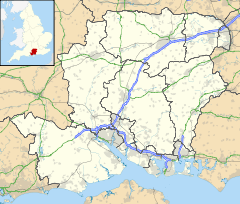
 Morestead
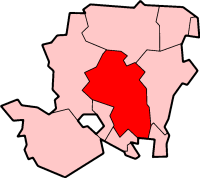
Morestead shown within HampshireOS grid reference SU5096825451 District Winchester Shire county Hampshire Region South East Country England Sovereign state United Kingdom Post town WINCHESTER Postcode district SO24 Dialling code 01962 Police Hampshire Fire Hampshire Ambulance South Central EU Parliament South East England UK Parliament Winchester List of places: UK • England • Hampshire Morestead is a small village situated near the South Downs in the City of Winchester district of Hampshire, England. It lies 3 miles (5 km) south-east from its county town, Winchester.
Categories:- Hampshire geography stubs
- Civil parishes in Winchester
- City of Winchester
- Villages in Hampshire

Wikimedia Foundation. 2010.