- Morris Dam
-
Samuel B. Morris Dam 
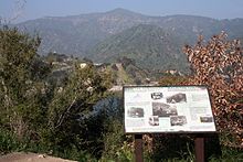
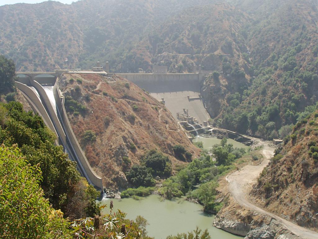
Morris Dam viewed from the unofficial overlook on State Route 39Country United States Location Los Angeles County, California Coordinates 34°10′29″N 117°52′52″W / 34.17472°N 117.88111°WCoordinates: 34°10′29″N 117°52′52″W / 34.17472°N 117.88111°W[1] Construction began 1932 Opening date 1934 Owner(s) Los Angeles Department of Water and Power Dam and spillways Type of dam Concrete arch-gravity Height 245 ft (75 m)[n 1] Length 750 ft (230 m) Impounds San Gabriel River Type of spillway Gated concrete overflow Spillway capacity 80,000 cu ft/s (2,300 m3/s) Reservoir Creates Morris Reservoir Capacity 39,300 acre·ft (48,500,000 m3) (nominal)
27,800 acre·ft (34,300,000 m3) (current)Surface area 417 acres (169 ha) Normal elevation 1,152 ft (351 m)[n 2] Power station Installed capacity N/A For the dam in New York State, see Mount Morris Dam.Morris Dam (officially the Samuel B. Morris Dam) is a concrete gravity dam across the San Gabriel River in the U.S. state of California. The dam was built in the 1930s as a water supply facility for the city of Pasadena, but is now mostly utilized for flood control and flow regulation for groundwater recharge. Situated in northern Los Angeles County, the dam impounds the 417-acre (169 ha) Morris Reservoir in the Angeles National Forest, a few miles northeast of Azusa. From the 1940s to the 1990s, the reservoir was also used for underwater missile testing by the United States military.
Contents
Design and location
This dam sits south of Silver Mountain and north of Glendora Ridge, which flank the spectacular 1,500-foot (460 m) deep San Gabriel Canyon. It is roughly 37 miles (60 km) upstream of the San Gabriel's mouth on the Pacific Ocean and 6 miles (9.7 km) downstream of the river's beginning at the confluence of its East and West Forks.[2] The reservoir is about 3 miles (4.8 km) long and 1,152 feet (351 m) above sea level at maximum pool, covering 417 acres (169 ha).[3] The dam's crest itself is at an elevation of 1,161 feet (354 m).[1][4]
Serving mainly flood control, flow regulation and groundwater recharge purposes, the slightly arched Art Deco-style gravity dam is 245 feet (75 m) high and 750 feet (230 m) long. Its spillway, located slightly north of the main structure, is a concrete-lined chute controlled by three steel drum gates. The dam was capable of storing 39,300 acre feet (48,500,000 m3) of water when first put to use, but sedimentation has since reduced its capacity by about 29%, giving it a present full volume of about 27,800 acre feet (34,300,000 m3).[5]
History
Morris Dam was originally slated to be called Pine Canyon Dam, but was renamed for the chief engineer of construction, Samuel Brooks Morris of the Pasadena Water Department.[6] With the dam envisioned as a private structure for Pasadena, groundbreaking was in April 1932 and construction was completed in May 1934, four months behind schedule.[7] Upon completion the dam was dedicated by former United States President Herbert Hoover.[8] In 1935, contrary to its original purpose, Morris Dam was sold to the Metropolitan Water District of Southern California (MWD), which owned it through most of the 20th century.[8]
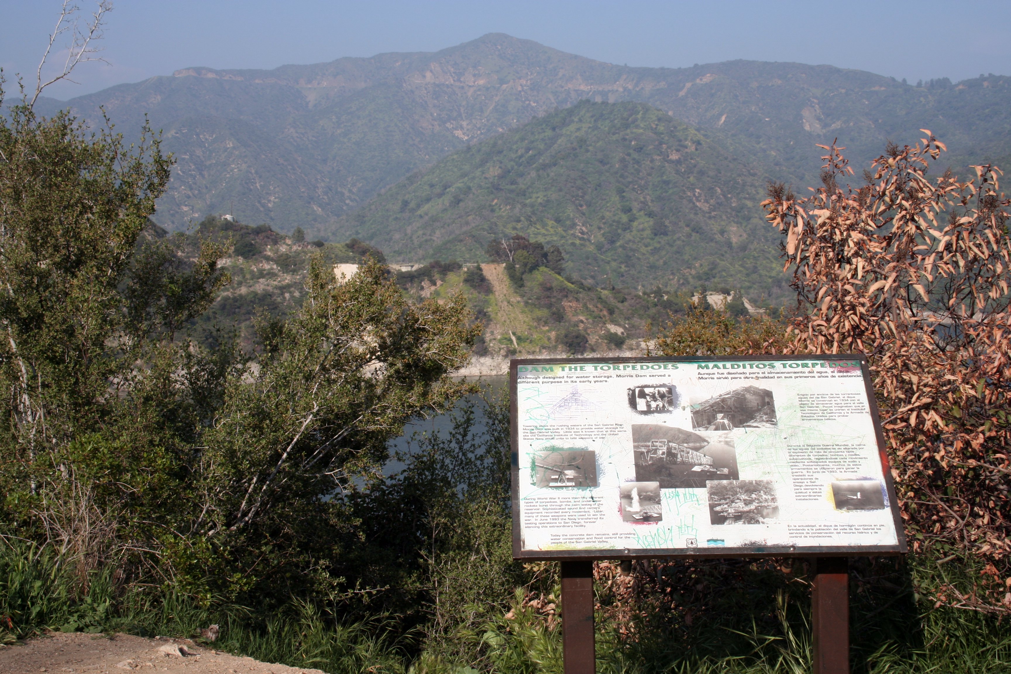
 The plaque commemorating the old naval weapons test center at Morris Dam
The dam was completed in time for the catastrophic Los Angeles Flood of 1938, the most severe flood recorded in Southern California since the Great Flood of 1862. Along with San Gabriel Dam (then still under construction) and Cogswell Dam upstream, Morris greatly reduced the flood peak on the San Gabriel River, saving downstream cities millions of dollars' worth of damages. If it were not for the three dams, the flow past Azusa may have exceeded 150,000 cu ft/s (4,200 m3/s), but was limited to just 65,700 cu ft/s (1,860 m3/s), with Morris Dam alone reducing the flood peak by some 30,000 cu ft/s (850 m3/s).[9]
Beginning in World War II, Morris Reservoir was used as a naval weapons test facility for the U.S. Navy in conjunction with the California Institute of Technology.[10] A wide variety of weapons, including torpedoes and ballistic missiles, had their trial runs here. Testing continued until the 1990s, when most of the structures at the associated military compound were demolished. However, the concrete foundations remain and are easily seen from State Route 39, which runs past the dam and reservoir.[10] In 1995, MWD sold the dam to the Los Angeles County Department of Public Works, which continues to operate it today.[11]
See also
Notes
References
- ^ a b "Morris Dam". Geographic Names Information System, U.S. Geological Survey. 1981-01-19. http://geonames.usgs.gov/pls/gnispublic/f?p=gnispq:3:::NO::P3_FID:246223. Retrieved 2011-07-06.
- ^ U.S. Geological Survey. National Hydrography Dataset high-resolution flowline data. The National Map, accessed March 10, 2011
- ^ Sheng, Jingfen; Wilson, John P.. "Watershed Assets Assessment Repor". The Green Visions Plan for 21st Century Southern California. USC Dornsife College of Letters, Arts and Sciences. p. 51. http://dornsife.usc.edu/geography/ESPE/publications/green_visions_16_green_watershed.pdf. Retrieved 2011-07-06.
- ^ ACME Mapper. USGS Topo Maps for United States (Map). Cartography by United States Geological Survey. http://mapper.acme.com/. Retrieved 2011-07-06.
- ^ "Flood Control and Water Conservation". San Gabriel River Flood Control. California State University Fullerton. http://groundwater.fullerton.edu/groundwater/Ongoing_Research/San_Gabriel_Watershed_files/Page%2013.pdf. Retrieved 2011-07-06.
- ^ "The Morris San Gabriel Dam, San Gabriel River Canyon, California". Online Archive of California. http://www.oac.cdlib.org/ark:/13030/kt3x0nd8xp/?layout=metadata&brand=oac4. Retrieved 2011-07-06.
- ^ "Hydroelectric Plant Acquisition Study for Azusa Light & Water". Azusa Light & Water. City of Azusa. 2011-05-17. http://www.ci.azusa.ca.us/documents/Light%20&%20Water/Water/Azusa%20Hydro%20RFP.PDF. Retrieved 2011-07-06.
- ^ a b "Samuel Brooks Morris Papers". Online Archive of California. http://cdn.calisphere.org/data/13030/6t/tf2489n56t/files/tf2489n56t.pdf. Retrieved 2011-07-06.
- ^ "Los Angeles Basin's 1938 Catastrophic Flood Event". Suburban Emergency Management Project. 2006-06-07. http://www.semp.us/publications/biot_reader.php?BiotID=369&Letter=. Retrieved 2011-07-06.
- ^ a b "Morris Reservoir Test Site". Center for Land Use Interpretation. http://ludb.clui.org/ex/i/CA6080/. Retrieved 2011-07-06.
- ^ "San Gabriel River and Montebello Forebay Water Conservation System". Los Angeles County Department of Public Works. http://ladpw.org/wrd/publication/system/canyon.cfm. Retrieved 2011-07-06.
External links
Categories:- Dams in California
- Los Angeles County, California
Wikimedia Foundation. 2010.