- Mosby Creek Bridge
-
Mosby Creek Bridge 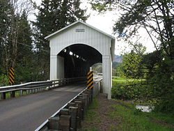
Design Covered, Howe truss Total length 90 feet (27 m) Width 13.5 feet (4.1 m) Vertical clearance 12.3 feet (3.7 m) Constructed by Walter and Miller Sorenson Construction end 1920 Closed 1979 Coordinates 43°46′42″N 123°00′17″W / 43.77833°N 123.00472°WCoordinates: 43°46′42″N 123°00′17″W / 43.77833°N 123.00472°W Mosby Creek Bridge

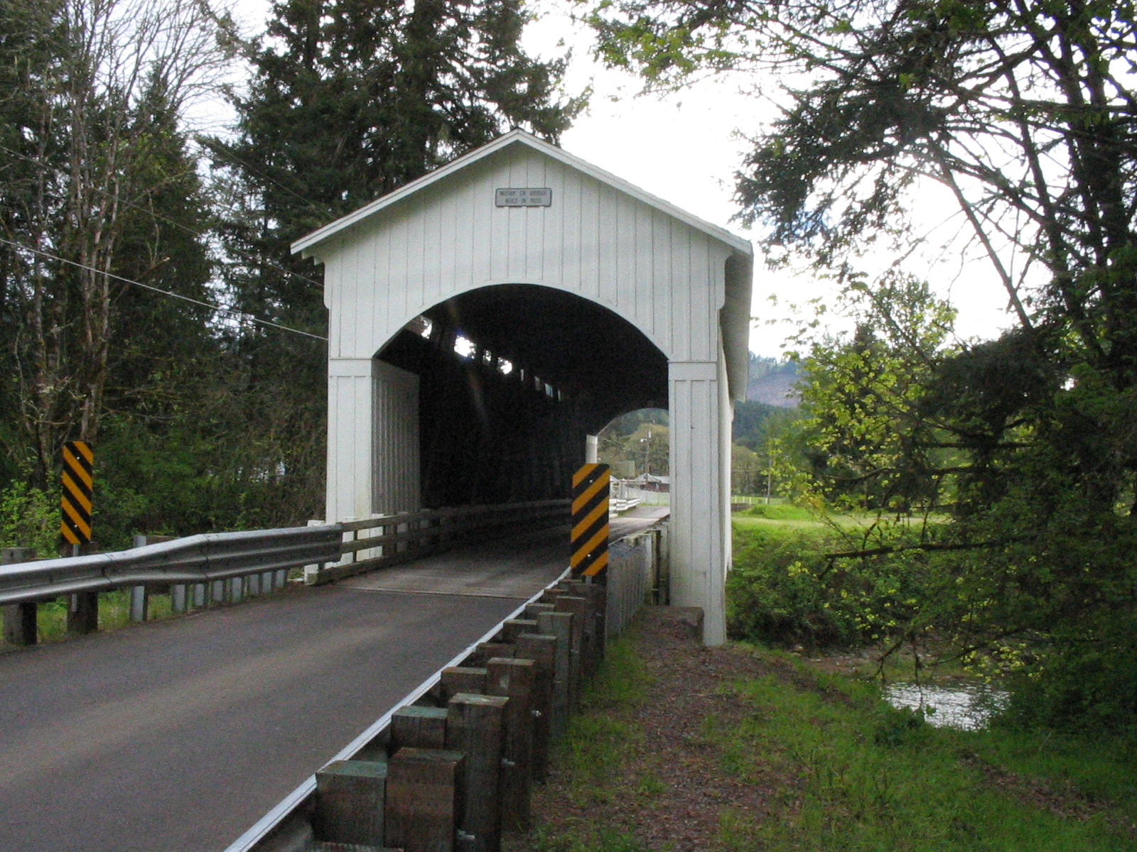
Nearest city: Cottage Grove, Oregon Coordinates: 43°46′42″N 123°0′17″W / 43.77833°N 123.00472°W Area: 0.1 acres (0.04 ha) Built: 1920 Architectural style: Howe Truss Governing body: Local MPS: Oregon Covered Bridges TR NRHP Reference#: 79002083[1] Added to NRHP: November 29, 1979 The Mosby Creek Bridge, also called the Layng Bridge, is a covered bridge that uses the Howe truss. It is located near Cottage Grove, Oregon. The bridge was constructed in 1920, making it the oldest covered bridge in Lane County, Oregon.[2]
The Mosby Creek Bridge was built in 1920 for a cost of $4125 (US$45,224 in 2011) by Walter and Miller Sorenson.[3] The bridge was named after the American pioneer David Mosby. He settled east of present-day Cottage Grove (near the area where the Mosby Creek Bridge would be built) on a 1,600 acres (650 ha) staked land claim.[4] The bridge is one of the few bridges in Lane County that can be spotted from the Oregon, Pacific and Eastern Railway, in particular the steam excursion train known as "The Goose," before the locomotive was sold to Yreka, California in 1987.[5][6]
Unique design elements to the Mosby Creek Bridge include semi-circular portal arches (the entrances to the bridge), ribbon openings at the roofline, and board-and-batten siding, as well as modifications to the basic Howe truss design.[3] In 1990, the bridge underwent a major restoration.[7] In 2002, the corrugated metal roof that capped the bridge gated roof was replaced with synthetic material, as well as other repairs.[3][6]
In 1979, the bridge was added to the U.S. National Register of Historic Places. However, unlike the nearby Currin Bridge, which was added to the Register the same day, the Mosby Creek Bridge remained open to traffic, instead of being bypassed. The Mosby Creek Bridge is still open to traffic, the only bridge in the area still open to traffic.[2] The Mosby Creek Bridge still receives regular maintenances by Lane County as well.
See also
References
- ^ "National Register Information System". National Register of Historic Places. National Park Service. 2009-03-13. http://nrhp.focus.nps.gov/natreg/docs/All_Data.html.
- ^ a b "Covered Bridges Of Cottage Grove, Oregon". cottagegrove.net. 2010. http://cottagegrove.net/history/covered_bridges/index.html. Retrieved February 19, 2010.
- ^ a b c http://web.oregon.com/covered_bridges/bridges/mosby.cfm
- ^ Mosby Creek Bridge on the Oregon tourism website.
- ^ "Mosby Creek (Layng) Covered Bridge". Oregon Interactive Corporation. http://www.oregon.com/covered_bridges/mosby. Retrieved 31 August 2011.
- ^ a b Matthews, Larry (February 17, 2008). "Mosby Creek Covered Bridge". bridgehunter.com. http://bridgehunter.com/or/lane/bh36272/. Retrieved February 19, 2010.
- ^ Mosby Creek Bridge on cottagegrove.net
Categories:- Bridges completed in 1920
- National Register of Historic Places in Lane County, Oregon
- Covered bridges in Lane County, Oregon
- Bridges on the National Register of Historic Places in Oregon
- Road bridges in Oregon

Wikimedia Foundation. 2010.