- Mount Hōō
-
Mount Hōō 鳳凰山 
Mount Hōō as seen from ŌkambazawaElevation 2,840 m (9,318 ft) Listing • List of mountains and hills of Japan by height
• 100 Famous Japanese MountainsLocation Yamanashi Prefecture,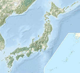
 Mount Hōō
 Japan
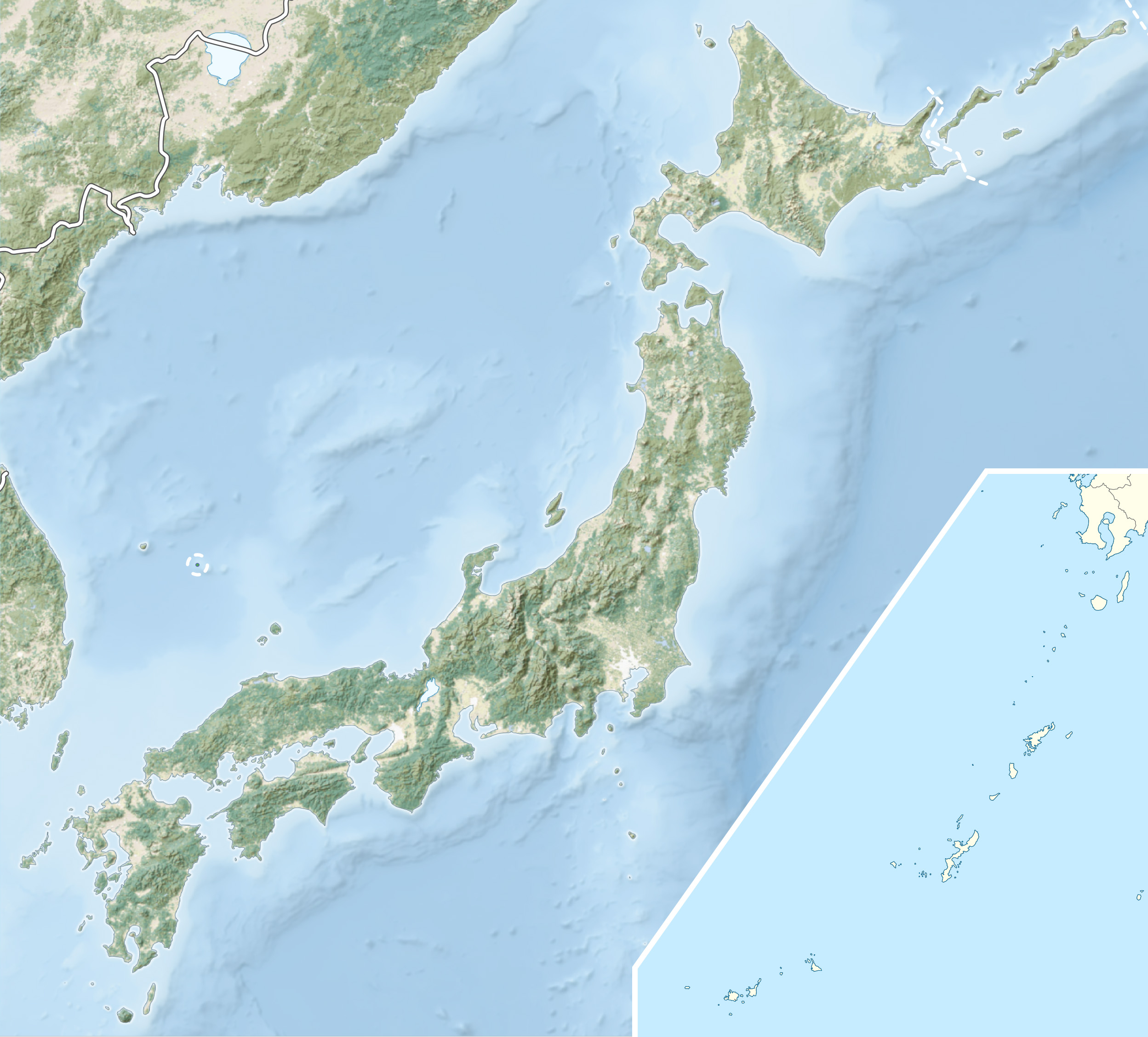
JapanRange Akaishi Mountains Coordinates 35°42′06″N 138°18′16″E / 35.70167°N 138.30444°ECoordinates: 35°42′06″N 138°18′16″E / 35.70167°N 138.30444°E Geology Type Granite Mount Hōō (鳳凰山 Hōō-san) is located in the eastern portion of Yamanashi Prefecture, Japan. Because the mountain has three peaks, it is also called Hōō Sanzan (鳳凰三山). It is in Minami Alps National Park[1] and is one of the 100 Famous Japanese Mountains.
Contents
Outline
Mount Hōō has three peaks:
Image Mountain Elevation Triangulation
stationNote 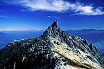
Jizō-dake
地蔵岳2,764 m (9,068 ft) The rock of the huge Granite
in the top is called Obelisk.
Mountain hut Hōō
in the east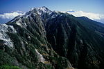
Kannon-dake
観音岳2,840 m (9,318 ft) (stopped)[2] the highest point 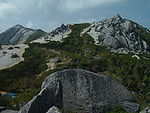
Yakushi-dake
薬師岳2,780 m (9,121 ft) .
Mountain hut Yakushi-dake
in the southMount Hōō is separated from most of the other mountains in the Akaishi range, giving a wider view of the surrounding mountains. Also, most mountains int the range have a reddish-brown color ("Akaishi" means "red stone" in Japanese), but Mount Hōō and Mount Kaikoma are the two exceptions, as they are granite mountains.
History
Metal ore was found in the mountain during the Sengoku period and, by the Edo period, the mountain was exploited for its metals and forest products.
- In 1904, Walter Weston became the first to climb the obelisk on top of Jizōdake.[3]
- On June 1, 1964, this area was specified to the Minami Alps National Park.[1]
- In 1990, Sumie Tanaka (田中澄江 Tanaka Sumie) completed New Flowers of the 100 Mountains, which featured many of the alpine plants on Mount Hōō.[4]
Geography
Nearby mountains
Mount Hōō is on the subridge (from Mount Komatsu) of the main ridge line in the northern part of the Akaishi Mountains.
Image Mountain Elevation Distance
from the TopNote 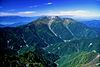
Mt. Senjō
仙丈ヶ岳3,033 m (9,951 ft) 11.1 km (6.9 mi) 100 Famous Japanese Mountains 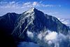
Mt. Kaikoma
甲斐駒ヶ岳2,967 m (9,734 ft) 8.7 km (5 mi) 100 Famous Japanese Mountains 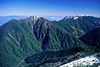
Mt. Asayo
アサヨ峰2,799 m (9,183 ft) 6.6 km (4.1 mi) 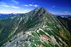
Mt. Kita
北岳3,193 m (10,476 ft) 6.7 km (4.2 mi) Tallest of the Akaishi Mountains
100 Famous Japanese Mountains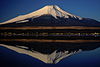
Mt. Fuji
富士山3,776 m (12,388 ft) 56.4 km (35.0 mi) Tallest mountain in Japan
100 Famous Japanese MountainsRivers
The mountain is the source of the following rivers, each of which flows to the Pacific Ocean.
- Noro River (a tributary of the Fuji River)
- Ōtake River, Kotake River (tributaries of the Tenryū River)
Gallery
-

Mount Hōō and Mount Fuji from Mount Komatsu at the sunrise
-

Mount Hōō and Mount Fuji from Mount Kaikoma
-

Mount Hōō
-
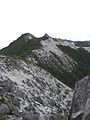
Mount Yakushidake from Mount Kannondake
References
- ^ a b "Minami Alps National Park". Ministry of the Environment (Japan). http://www.env.go.jp/en/nature/nps/park/parks/minamialps.html. Retrieved 2010-11-27.
- ^ Triangulation station(rank 2) was stopped."Inspection service of the information". Geospatial Information Authority of Japan. http://sokuservice1.gsi.go.jp/datums/. Retrieved 2010-11-28.
- ^ The Playground of the Far East in 1918 by Walter Weston , translated into Japanese Visit to Japanese Alps again (日本アルプス再訪),Heibonsha Library, in 1996 new edition, ISBN 4-582-76161-5, Pg. 454
- ^ New Flowers of the 100 Mountains(新・花の百名山), Bunsyunbunko, in 1995 by Sumie Tanaka, ISBN 4-16-731304-9
See also
Categories:- Mountains of Yamagata Prefecture
- Visitor attractions in Yamagata Prefecture


Wikimedia Foundation. 2010.