- Mount Rainier Historic District
-
Mount Rainier Historic District
 Mount Rainer, Maryland, welcome sign with trolley, November 2005
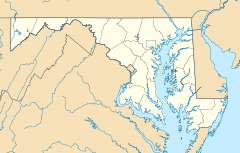

Location: Roughly bounded by Arundel St., 37th St., Bladensburg Rd. and Eastern Ave., Mount Rainier, Maryland Coordinates: 38°56′21″N 76°57′42″W / 38.93917°N 76.96167°WCoordinates: 38°56′21″N 76°57′42″W / 38.93917°N 76.96167°W Built: 1900 Architect: Multiple Architectural style: Queen Anne, Late 19th And Early 20th Century American Movements Governing body: Local NRHP Reference#: 90001319
[1]Added to NRHP: September 07, 1990 The Mount Rainier Historic District is a national historic district located at Mount Rainier, Prince George's County, Maryland, originally a streetcar suburb located northeast of Washington, D.C. The district has the varied and picturesque character, laid over a gently rolling, formerly rural landscape, developed ca. 1900 to 1940. The district contains more than 1,000 buildings, which are modestly scaled, detached, single-family, frame houses sited closely together with common setbacks. The district buildings consist primarily of single-family homes, with some small apartment buildings, the occasional duplex, and the single family residence that incorporates a small storefront, usually located at the corner of an intersection interspersed. With the exception of five churches and a bank building known to have been designed by local architects, the remainder of the district's buildings are vernacular in inspiration. Some homes contain Queen Anne detailing.[2]
It was listed on the National Register of Historic Places in 1990.[1]
References
- ^ a b "National Register Information System". National Register of Historic Places. National Park Service. 2008-04-15. http://nrhp.focus.nps.gov/natreg/docs/All_Data.html.
- ^ "Mount Rainier Historic District". Maryland Historical Trust. http://www.mht.maryland.gov/nr/NRDetail.aspx?HDID=1069&COUNTY=Prince%20Georges&FROM=NRCountyList.aspx?COUNTY=Prince%20Georges. Retrieved 2008-10-29.
External links
- Mount Rainier Historic District, Prince George's County, Inventory No.: PG:68-74, including photo in 1989, at Maryland Historical Trust website
- Map of the Mount Rainier Historic District, Prince George's County, at Maryland Historical Trust
U.S. National Register of Historic Places in Maryland Lists by county Allegany • Anne Arundel • Baltimore County • Calvert • Caroline • Carroll • Cecil • Charles • Dorchester • Frederick • Garrett • Harford • Howard • Kent • Montgomery • Prince George's • Queen Anne's • Somerset • St. Mary's • Talbot • Washington • Wicomico • Worcester
Lists by city Other lists Categories:- Historic districts in Maryland
- Historic districts in Prince George's County, Maryland
- Queen Anne architecture in Maryland
- Houses on the National Register of Historic Places in Maryland
- Maryland Registered Historic Place stubs


Wikimedia Foundation. 2010.