- Tavan Bogd
-
Tavan Bogd 
View of Tavan Bogd from Russian AltayElevation 4,374 m (14,350 ft) Prominence 2,342 m (7,684 ft) Parent peak Hüiten Peak Listing Ultra Location Location in Mongolia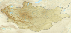
 Tavan Bogd
Location  Mongolia
Range Mongol-Altai Mountains Coordinates 49°8′45″N 87°49′9″E / 49.14583°N 87.81917°ECoordinates: 49°8′45″N 87°49′9″E / 49.14583°N 87.81917°E[1] Tavan Bogd (Mongolian: Таван богд, lit. "five saints") is the highest mountain in Mongolia and have massif-type. Tavan Bogd mountain located in Bayan-Olgii Province and its Hüiten Peak is the highest point of Mongolia at 4374 meters above sea level. Besides Hüiten, the mountain includes four peaks as Nairamdal, Malchin, Bürged (eagle) and Olgii (motherland).[2]
The its Nairamdal Peak forms the border tripoint between Mongolia, Russia, and the Xinjiang province of China.
Around the area is listing Altai Tavan Bogd National Park covers 6,362 km². It includes the lakes Khoton, Khurgan, and Dayan. The protected area offers a home for many species of alpine animal, such as the Argali sheep, Ibex, Red deer, Beech marten, Moose, Snow cock, and Golden eagle.
Contents
Peaks
The main peaks of the Tavanbogd massif are:
Name Height (metres) Hüiten Peak 4,374 Nairamdal Peak 4,180 Bürged Peak 4,068 Malchin Peak 4,050 Olgii Peak 4,050 See also
- List of mountains in Mongolia
References
External links
Categories:- Altai
- Mountains of China
- Mountains of Mongolia
- Mountains of Russia
- China–Mongolia border
- Mongolia–Russia border
- China–Russia border
- International mountains of Asia
- Siberia geography stubs
- Xinjiang geography stubs
- Mongolia geography stubs


Wikimedia Foundation. 2010.