- Mount Washington, Los Angeles
-
Mount Washington — Neighborhoods of Los Angeles — Mount Washington Location within Central Los Angeles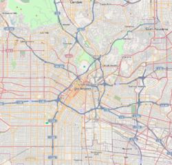
 Mount Washington
Coordinates: 34°06′02″N 118°12′58″W / 34.10056°N 118.21611°W Country United States State California County County of Los Angeles City City of Los Angeles Government – City Council José Huizar, Ed Reyes – State Assembly Kevin de León (D) – State Senate Gilbert Cedillo (D) – U.S. House Xavier Becerra (D) Area[1] – Total 1.9 sq mi (4.9 km2) Population (2000)[1] – Total 12,728 – Density 6,878/sq mi (2,655.6/km2) ZIP Code 90065, 90042 Area code(s) 323 Mount Washington is a neighborhood located in the hills of northeastern Los Angeles, California.
Contents
Geography
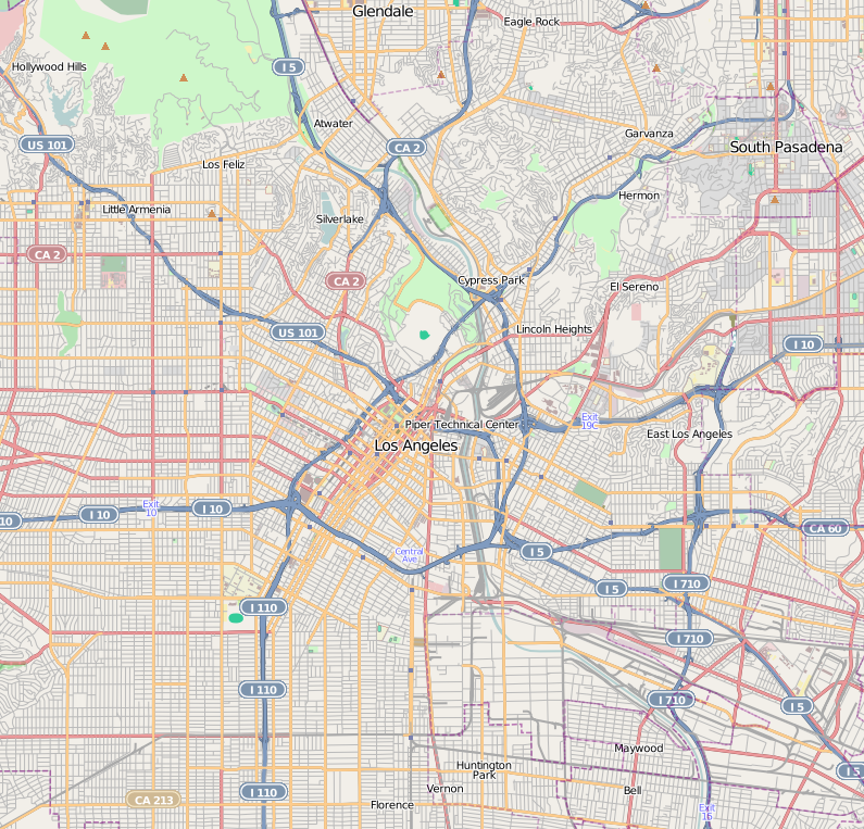
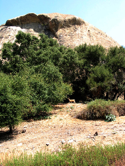
The boundaries of Mount Washington are roughly defined by Division Street on the west, El Paso Drive and Avenue 50 on the northeast, Marmion Way on the southeast, and Isabel street on the southwest.[2] One of many beautiful neighborhoods in northeast L.A., Mount Washington's hills provide mounds of green. Different parts of the neighborhood provide views of downtown L.A., the San Gabriel mountains, tranquil canyons, hillsides, and valleys. Adjacent neighborhoods include Glassell Park to the northwest, Eagle Rock to the north, Highland Park to the northeast, Montecito Heights to the southeast, across the Arroyo Seco, and Cypress Park to the southwest. Mount Washington contains views of the San Gabriel Valley and Los Angeles Basin to the Pacific Ocean on clear days.
Mount Washington is split between Los Angeles City Council districts 1 and 14[3] and is part of California's 31st congressional district. The neighborhood lies mostly within ZIP code 90065, with an eastern portion in 90042, and the area code is 323.
Transportation
Owing to its hilly geography, Mount Washington lacks major arterial streets. However, nearby transportation options allow easy access to Downtown Los Angeles, Pasadena, and other areas of Los Angeles. Several major thoroughfares run through adjacent neighborhoods, including Figueroa Street, San Fernando Road, York Boulevard, and Eagle Rock Boulevard. The area is also served by several freeways: the Pasadena Freeway, Glendale Freeway, and Golden State Freeway. The Metro Gold Line serves southeastern parts of the neighborhood with a station near the Southwest Museum.
History
Mount Washington was founded in 1909 as a subdivision laid out by real estate developer Robert Marsh. Marsh built the Mount Washington Hotel at the summit of Mount Washington, and the Los Angeles and Mount Washington Railway Company was soon established as a funicular railway up the hill as an alternative to constructing roads up the area's steep hillsides. The railway operated until January 1919.[4]
As Los Angeles grew outward from its core, Mount Washington was eventually absorbed into the city proper. In the early part of the 1900s, some moved as Mid-Wilshire and the West Side sub-divisions flowered in the 1930s, and especially after the construction of the Arroyo Seco Parkway.[citation needed] Others who lived elsewhere in L.A. owned hunting lodges in this neighborhood.[citation needed] After World War II, it became a hot destination for middle-class Mexican Americans.[citation needed] By the late 2000s, the neighborhood attracted middle- and upper-income residents, mostly whites, Latinos, and Asians.[5]
In the 1950s and 1960s Modernist homes, similar to those found in the Hollywood Hills or Brentwood were built in the district.[citation needed] The district is generally considered the most affluent area of the East Side, and also contains the region's largest concentration of non-Latino whites (though not as affluent as the neighboring cities of South Pasadena, San Marino, and Southwest Pasadena; for instance 30% of the census tract 1851 (Mount Washington) has incomes of $100,000 or greater; while 35% of census tract 4806 (South Pasadena) has incomes of $100,000 or greater).[6] During the 70's and 80's, the "Hill" attracted a bohemian element.[citation needed] Today, the population is mainly professional class with some involved in the arts, music, and writing.[citation needed] The "beauty and the quirky nature of Mount Washington" has inspired songs.[7]
In recent years, many homebuyers have become attracted to the area as a relatively affordable alternative to the Westside.[8] It is one of the only neighborhoods in metro Los Angeles that still has significant numbers of trees and wildlife. Also to be noted, home prices in this neighborhood can range greatly from $300,000 - 10 million depending on extent of development, views, location, elementary school district, square footage, and lot size.
Demographics
Mount Washington is split among several U.S. Census tracts that include portions of other districts, making an exact population difficult to determine. As of 2000, the ethnic/racial breakdown was 61.2% Latino, 20.8% White, 12.7% Asian, 2.6% Black, and 2.8% other.[1] The median household income was $57,725.[1] The average age of residents was 33 years.[1]
Over the last decade, the demographics have been shifting. As of 2009, Mount Washington has no racial or ethnic group in a majority. According to the American Community Survey (2009), Mount Washington is 33% White, 3% Black, 47% Latino, 9% Asian, and 7% other (census tract 1851).[5] The only census tract entirely within Mount Washington's boundaries is census tract 1851 (census tracts 1852 and 1862 are also in Mount Washington but also include surrounding neighborhoods). Census tract 1851 is on the east side of Mount Washington, and includes Moon Canyon Park and the Carlin Smith Recreation area; and it is extremely racially and ethnically diverse, even for Los Angeles.
Mount Washington (tract 1851) has a median household income of about $60,000; and 30% of its residents have a household income greater than $100,000 per year; neighboring census tracts shared with Mount Washington and other neighborhoods also have somewhat similar income data.[9]
Landmarks
- Southwest Museum
- World Headquarters of the Self-Realization Fellowship
- Eldred Street, between Avenue 50 and Cross Avenue on the northeast side of Mount Washington, with a slope of 33% grade, is one of the three steepest streets in Los Angeles[10] and one of the steepest streets in the world (Baldwin Street, Dunedin, New Zealand is 35%). Bottom of the steep climb is 34°06′31″N 118°12′29″W / 34.10853°N 118.2081°W
- Mount Washington Elementary School, a hilltop campus with beautiful views where students "consistently score among the top schools in Los Angeles on the Academic Performance Index."[11]
Notable residents
- Patrick Bristow, character actor and theater director
- Robert Steven Connett, noted Los Angeles artist
- Guy Hendrix Dyas, Designer and feature film production designer
- Daddy Kev, acclaimed music producer and engineer
- Tomas Osinski, highly admired architect, works closely with Frank Gehry
- Gloria Molina, Los Angeles County Supervisor
- Patt Morrison, Los Angeles Times columnist
- Richard G. Polanco, former California State Senate Majority leader and member of the California State Assembly
- Ed Reyes, Los Angeles City Councilman for the 1st district.
- Jack Smith, author and Los Angeles Times columnist
- Antonio Villaraigosa, Mayor of Los Angeles (2005-) and former speaker of the California State Assembly
- Gerard Way, singer and artist.
- Emerson Woelffer (1914-2003) artist, former teacher & Chair, Painting Dept., Otis Art Institute
See also
- Los Angeles Historic-Cultural Monuments on the East and Northeast Sides
References
- ^ a b c d e "Mapping L.A.". The Los Angeles Times. http://projects.latimes.com/mapping-la/neighborhoods/neighborhood/mount-washington/. Retrieved 2010-05-27.
- ^ http://www.asnc.us/Elections-2007/StreetFinder_map.pdf Arroyo Seco Neighborhood Council Map
- ^ http://www.lacity.org/council/cd14/cd14map.pdf LA Council District 14 Map
- ^ http://www.cable-car-guy.com/html/cclafun.html#mtw Mount Washington Railway
- ^ a b "N.Y. Times, Mapping America: Every City, Every Block". The New York Times. http://projects.nytimes.com/census/2010/explorer/. Retrieved 2010-12-17.
- ^ "N.Y. Times, Mapping America: Every City, Every Block". The New York Times. http://projects.nytimes.com/census/2010/explorer/. Retrieved 2010-12-17.
- ^ "A Mount Washington Love Song". Eastsider. http://www.theeastsiderla.com/2010/12/a-mount-washington-love-song/. Retrieved 2010-12-17.
- ^ http://www.nytimes.com/2007/03/25/business/yourmoney/25natreal.html New York Times article, retrieved 20 May 2008
- ^ "N.Y. Times, Mapping America: Every City, Every Block". The New York Times. http://projects.nytimes.com/census/2010/explorer/. Retrieved 2010-12-17.
- ^ "Getting the Slant on L.A.'s Steepest Street"
- ^ "Mount Washington Elementary PTA"
External links
- Arroyo Seco Neighborhood Council, serving Mount Washington
- Mount Washington Association
- Bob Taylor Properties - history of Mount Washington
- History of the Mount Washington hotel and funicular
- Mount Washington Elementary PTA
Coordinates: 34°06′02″N 118°12′58″W / 34.10056°N 118.21611°W
Eastside/Northeast, Los Angeles Districts and
neighborhoodsAtwater Village · Boyle Heights · Brooklyn Heights · Cypress Park · Eagle Rock · El Sereno · Garvanza · Glassell Park · Hermon · Highland Park · Lincoln Heights · Montecito Heights · Monterey Hills · Mt. Washington · University Hills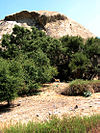
Points of
interestSee also Downtown · Eastside/Northeast · Harbor Area · Greater Hollywood · Westlake/Silver Lake/Los Feliz · San Fernando and Crescenta Valleys · South Los Angeles · Westside · WilshireCategories:- Neighborhoods in Los Angeles, California
- Populated places established in 1909
Wikimedia Foundation. 2010.