- Mud River Covered Bridge
-
Mud River Covered Bridge
 Mud River Covered Bridge, August 1975
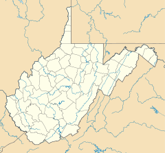

Location: Off U.S. 60 on SR 25 over Mud River, Milton, West Virginia Coordinates: 38°25′51″N 82°8′22″W / 38.43083°N 82.13944°WCoordinates: 38°25′51″N 82°8′22″W / 38.43083°N 82.13944°W Area: 0.5 acres (0.20 ha) Built: 1875 Architectural style: Other, Modified Howe truss MPS: West Virginia Covered Bridges TR NRHP Reference#: 75001883
[1]Added to NRHP: June 10, 1975 Mud River Covered Bridge is a historic covered bridge over the Mud River at Milton, Cabell County, West Virginia. It was built about 1875, and is a single-span, modified Howe truss structure. It measures approximately 112 feet in length and 14 feet in width. The bridge was restored in 1971.[2]
It was listed on the National Register of Historic Places in 1975.[1]
References
- ^ a b "National Register Information System". National Register of Historic Places. National Park Service. 2010-07-09. http://nrhp.focus.nps.gov/natreg/docs/All_Data.html.
- ^ James E. Harding (March 1975). "National Register of Historic Places Inventory Nomination Form: Mud River Covered Bridge". State of West Virginia, West Virginia Division of Culture and History, Historic Preservation. http://www.wvculture.org/shpo/nr/pdf/cabell/75001883.pdf. Retrieved 2011-07-23.
External links
- Milton Covered Bridge, County Route 25, U.S. Route 60 vicinity, Milton, Cabell, WV: 4 photos, 3 data pages, and 1 photo caption page at Historic American Building Survey
U.S. National Register of Historic Places in West Virginia Lists by county Barbour • Berkeley • Boone • Braxton • Brooke • Cabell • Calhoun • Clay • Doddridge • Fayette • Gilmer • Grant • Greenbrier • Hampshire • Hancock • Hardy • Harrison • Jackson • Jefferson • Kanawha • Lewis • Lincoln • Logan • Marion • Marshall • Mason • McDowell • Mercer • Mineral • Mingo • Monongalia • Monroe • Morgan • Nicholas • Ohio • Pendleton • Pleasants • Pocahontas • Preston • Putnam • Raleigh • Randolph • Ritchie • Roane • Summers • Taylor • Tucker • Tyler • Upshur • Wayne • Webster • Wetzel • Wirt • Wood • Wyoming

Other lists Keeper of the Register • History of the National Register of Historic Places • Property types • Historic district • Contributing property Bridges and tunnels on the National Register of Historic Places Alabama · Alaska · Arizona · Arkansas · California · Colorado · Connecticut · Delaware · Florida · Georgia · Guam · Hawaii · Idaho · Illinois · Indiana · Iowa · Kansas · Kentucky · Louisiana · Maine · Maryland · Massachusetts · Michigan · Minnesota · Mississippi · Missouri · Montana · Nebraska · Nevada · New Hampshire · New Jersey · New Mexico · New York · North Carolina · North Dakota · Ohio · Oklahoma · Oregon · Pennsylvania (covered) · Puerto Rico · Rhode Island · South Carolina · South Dakota · Tennessee · Texas · Utah · Vermont · Virginia · Washington · Washington, D.C. · West Virginia · Wisconsin · Wyoming
Categories:- Bridges on the National Register of Historic Places in West Virginia
- Covered bridges in West Virginia
- Buildings and structures in Cabell County, West Virginia
- Road bridges in West Virginia
- National Register of Historic Places listings in Cabell County, West Virginia
- West Virginia Registered Historic Place stubs


Wikimedia Foundation. 2010.