Muddy Creek (Conestoga River)
- Muddy Creek (Conestoga River)
-
Muddy Creek is a 15.7-mile-long (25.3 km)[1] tributary of the Conestoga River in Lancaster County, Pennsylvania in the United States. Muddy Creek was formerly spanned by the Red Run Covered Bridge.
The tributary Little Muddy Creek joins Muddy Creek 3.7 miles (6.0 km)[1] from the Conestoga River.
Muddy Creek joins the Conestoga River 7.5 miles (12.1 km)[1] upstream from Brownstown.
See also
Notes
- ^ a b c U.S. Geological Survey. National Hydrography Dataset high-resolution flowline data. The National Map, accessed August 8, 2011
References
Categories:
- Rivers of Pennsylvania
- Tributaries of the Susquehanna River
- Geography of Lancaster County, Pennsylvania
- Pennsylvania geography stubs
Wikimedia Foundation.
2010.
Look at other dictionaries:
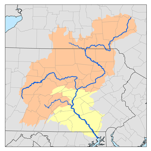
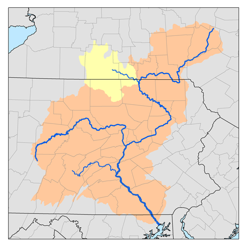
Muddy Creek (Susquehanna River) — For the Muddy Creek in Lancaster County, see Muddy Creek (Conestoga River). Muddy Creek is a tributary of the Susquehanna River in York County, Pennsylvania in the United States. Muddy Creek, formed by the confluence of the North and South… … Wikipedia
Muddy Creek — may refer to: Muddy Creek (Colorado), a tributary of the Colorado River Muddy Creek (Maryland) Muddy Creek (North Carolina) Muddy Creek (Oregon), a list of Muddy Creeks in the state In Pennsylvania Muddy Creek (Conestoga River), a tributary of… … Wikipedia
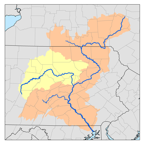
Mill Creek (Conestoga River) — Mill Creek is a 26.7 mile long (43.0 km)[1] tributary of the Conestoga River in Lancaster County, Pennsylvania in the United States. Mill Creek joins the Conestoga River near the community of Lyndon. See also List of rivers of Pennsylvania… … Wikipedia
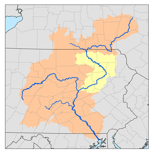
Conestoga River — Origin Berks County, Pennsylvania Mouth Susquehanna River … Wikipedia
Crooked Creek (Tioga River) — Crooked Creek Origin Chatham Township Mouth Tioga River Tioga, Basin countries Tioga County, Pennsylvania, United States Length 26.3 miles (42.3 km) … Wikipedia
Mill Creek (Tioga River) — Mill Creek is an 18.7 mile long (30.1 km)[1] tributary of the Tioga River in Tioga County, Pennsylvania, in the United States. Mill Creek joins the Tioga River approximately 6.0 miles (9.7 km) downstream of the borough of Mansfield. See … Wikipedia
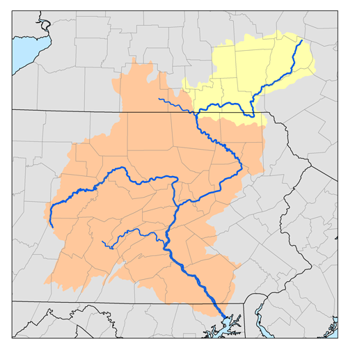
Susquehanna River — Coordinates: 39°32′35″N 76°04′32″W / 39.54306°N 76.07556°W / 39.54306; 76.07556 … Wikipedia
Cocalico Creek — Bucher s Mill Covered Bridge spans Cocalico Creek in Lancaster County, Pennsylvania Origin Stricklerstown, Pennsylvania … Wikipedia
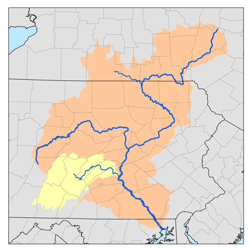
Octoraro Creek — is a 22.1 mile long (35.6 km)[1] tributary of the Susquehanna River, joining it 9 miles (14 km) above the Susquehanna s mouth at Chesapeake Bay. The Octoraro rises as an East and West Branch in Pennsylvania. The East Branch and Octoraro … Wikipedia
Yellow Breeches Creek — Fishing in the Boiling Springs Lake tributary to the Yellow Breeches Creek in Boiling Springs Yellow Breeches Creek,[1] also known as Minnimingo Creek,[citat … Wikipedia