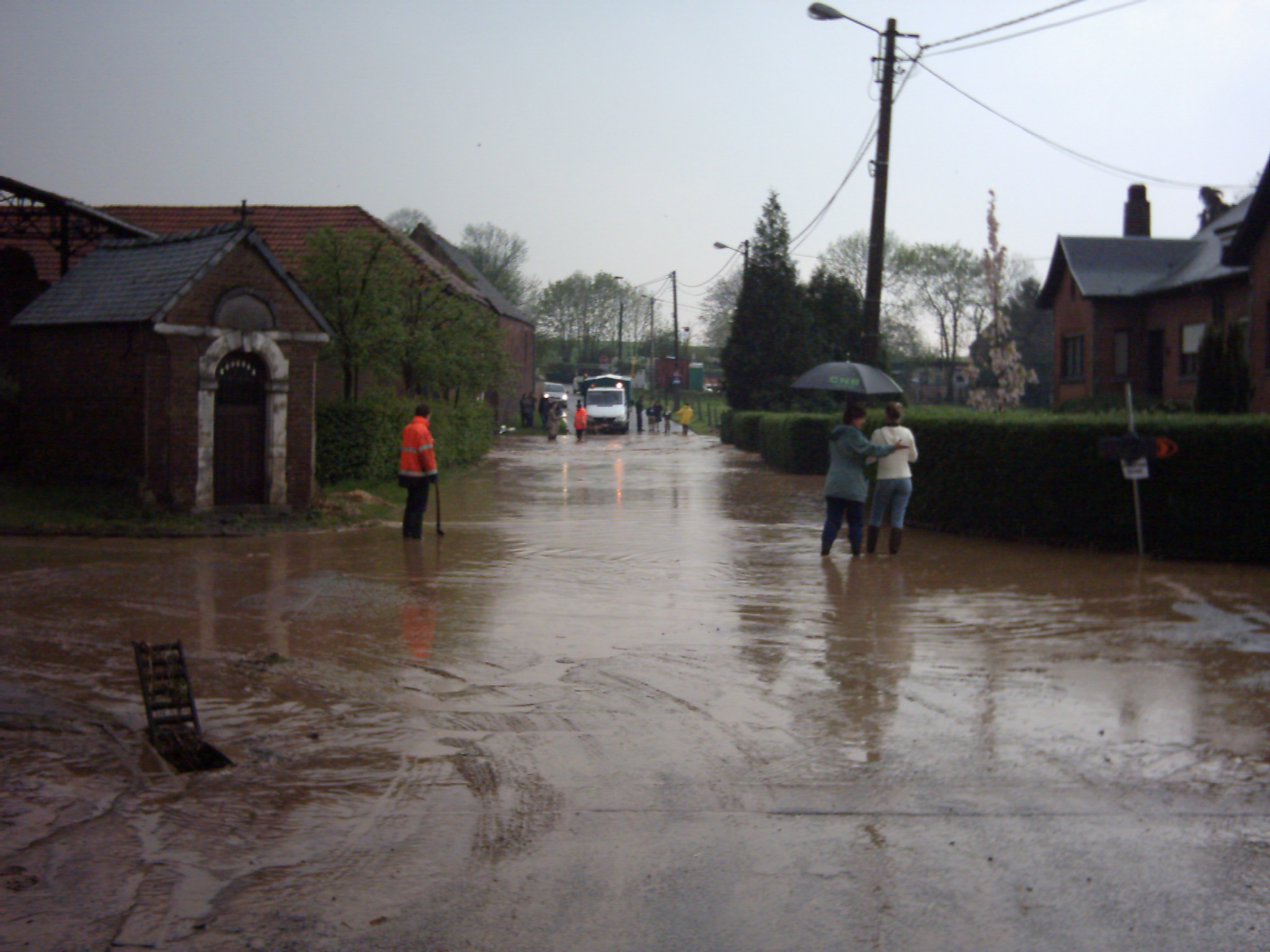
- Muddy flood
-
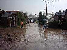
A muddy flood is produced by an accumulation of runoff generated on cropland. Sediments are then detached by runoff and carried as suspended matter or bedload. Muddy runoff is more likely detected when it reaches inhabited areas.
Muddy floods are therefore a hillslope process, and confusion with mudflows produced by mass movements should be avoided.
Muddy floods mostly lead to damage to road infrastructure (leaving a mud blanket on it or clogging sewage network) and to private property.).
It has been referred to 'muddy floods' since 1980s[1]. A similar designation appeared in French ('inondations boueuses'[2]) during the same period.
Contents
Muddy flood generation
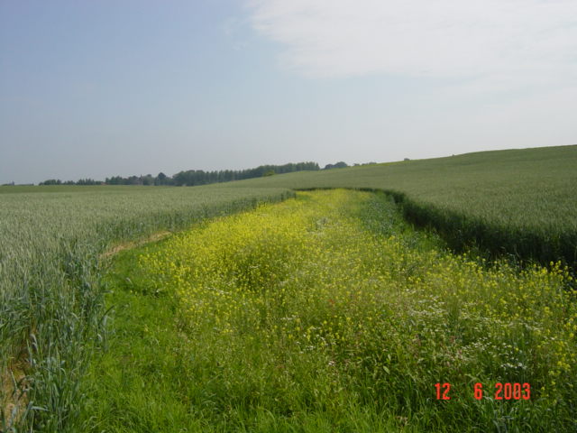
 Difference of soil cover by vegetation for two crops (winter wheat vs. maize) at the end of May, in central Belgium
Muddy runoff is generated on cropland when the soil surface is crusted and sparsely covered by vegetation. Large quantities of runoff (several hundreds or thousands of cubic meters) must be generated to trigger a muddy flood. This situation mostly occurs during heavy storms [3].
Muddy flood occurrence
Muddy floods are observed in the entire European loess belt. Most severely affected areas are the South Downs (southern England), Normandy and Picardie (France), central Belgium and southern Limburg, the Netherlands.
Muddy floods have also been recently observed in Slovakia and Poland.
Temporal evolution
An increase in muddy flood frequency has been observed during the last twenty years (e.g. in central Belgium,[4]). This increase in their frequency can be due to the coincidence of the following factors:
- shift to crops that are more sensitive to soil erosion;
- land consolidation (enlargement of fields, removal of landscape buffer elements like hedges, road constructions in thalwegs, etc.);
- construction of new houses, downstream of cropland;
- increased frequency of heavy rainfall.
Control measures
 Grassed waterway during a beautiful day in Velm, Belgium
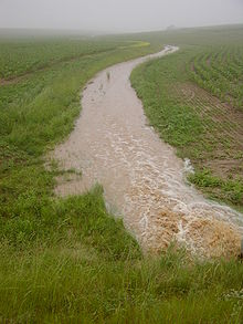 Grassed waterway in Velm, Belgium, after a thunderstorm
Preventive or curative measures can be implemented to control muddy floods.
Preventive measures consist in limiting runoff generation and sediment production at the source. Farmers can for instance implement alternative farming practices (e.g. reduced tillage) to increase runoff infiltration and limit erosion in their fields.
Curative measures generally consist in installing retention ponds at the boundary between cropland and inhabited areas [5].
An alternative is to apply other measures than can be referred to as intermediate measures. Grass buffer strips along or within fields, a grassed waterway (in the thalwegs of dry valleys) or earthen dams are good examples of this type of measures. They act as a buffer within landscape, retaining runoff temporarily and trapping sediments [6].
Implementation of these measures is best coordinated at the catchment scale.
References
- ^ Boardman, J. (1984). Soil erosion and flooding on downland areas. The Surveyor, 164, 8-11.
- ^ Auzet, A.V. (1987). L'érosion des sols cultivés en France sous l'action du ruissellement. Annales de Géographie, 537, 529-555.
- ^ Evrard, O., Vandaele, K., Bielders, C.L., van Wesemael, B. (2008). Seasonal evolution of runoff generation on agricultural land in the Belgian loess belt and implications for muddy flood triggering. Earth Surface Processes & Landforms 33(8), 1285-1301.
- ^ Evrard, O., Bielders, C., Vandaele, K., van Wesemael, B. (2007). Spatial and temporal variation of muddy floods in central Belgium, off-site impacts and potential control measures. Catena 70 (3), 443-454.
- ^ Verstraeten, G., Poesen, J., (2001). The nature of small-scale flooding, muddy floods and retention pond sedimentation in central Belgium. Geomorphology, 29, 275–292.
- ^ Evrard, O., Vandaele, K., van Wesemael, B., Bielders, C.L, 2008. A grassed waterway and earthen dams to control muddy floods from a cultivated catchment of the Belgian loess belt. Geomorphology 100, 419-428.
Also see
- November 2010 European Windstorms
External links
Categories:


Wikimedia Foundation. 2010.