- Mueang Suphanburi District
-
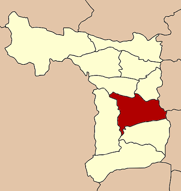
Mueang Suphanburi
เมืองสุพรรณบุรี— Amphoe — Amphoe location in Suphanburi Province
Coordinates: 14°29′4″N 100°7′25″E / 14.48444°N 100.12361°ECoordinates: 14°29′4″N 100°7′25″E / 14.48444°N 100.12361°E Country  Thailand
Province Suphanburi Seat Tambon Muban Amphoe established Area - Total 540.9 km2 (208.8 sq mi) Population (2000) - Total 158,087 - Density 292.3/km2 (757.1/sq mi) Time zone THA (UTC+7) Postal code 72000 Geocode 7201 Mueang Suphanburi (Thai: เมืองสุพรรณบุรี; IPA: [mɯ̄aŋ sù.pʰān būrīː]) is the capital district (Amphoe Mueang) of Suphanburi Province, central Thailand.
Contents
History
Suphan Buri is an old city. In the era of Ankorian king Jayavarman VII, inscription called Prasat Phra Khan (จารึกปราสาทพระขรรค์) was made and which mentions the name of Suvarnapura[1]. Later Suphan Buri become important city of Ayutthaya kingdom. According to Chinese Annals called "Da Ming Shi Lu" (『大明実録』), Nakharinthathirat (Intharatcha or Nakhon In), before ascending the throne of Ayutthaya, was a ruler of Suphan Buri and tribute to Chinese Emperor as a King of Supan Buri (Su Men Bang Wang or 蘇門邦王)[2]. Later in 16th century, Suphanburi become battle field of King Naresuan and Burmese crown prince[1].
This area was the center of Mueang Suphanburi, called San Khwaeng Suphanburi (ศาลแขวงสุพรรณบุรี). When the government created a district, it was called Wihan Daeng. Later the district name was changed to be Tha Phi Liang. In 1939 the district name was changed to be Mueang Suphanburi to correspong with the province name.
Geography
Neighboring districts are (from the south clockwise) Bang Pla Ma, U Thong, Don Chedi, Si Prachan of Suphanburi province, Wiset Chai Chan of Ang Thong province and Phak Hai of Ayutthaya Province.
The main water resource of the district is the Tha Chin river or Suphan river.
Administration
The district is subdivided into 20 subdistricts (tambon), which are further subdivided into 123 villages (muban). Suphanburi itself is a town (thesaban mueang) which covers the tambon Tha Philiang completely and parts of Rua Yai and Tha Rahat. There are further three townships (thesaban tambon) - Tha Sedet covers the complete tambon Sa Kaeo, Suan Taeng covers parts of the tambon Suan Taeng and Sala Khao, and Pho Phraya covers parts of the tambon Pho Phraya. There are further 18 Tambon administrative organizations.
1. Tha Phi Liang ท่าพี่เลี้ยง 2. Rua Yai รั้วใหญ่ 3. Thap Ti Lek ทับตีเหล็ก 4. Tha Rahat ท่าระหัด 5. Phai Khwang ไผ่ขวาง 6. Khok Kho Thao โคกโคเฒ่า 7. Don Tan ดอนตาล 8. Don Masang ดอนมะสังข์ 9. Phihan Daeng พิหารแดง 10. Don Kamyan ดอนกำยาน 11. Don Pho Thong ดอนโพธิ์ทอง 12. Ban Pho บ้านโพธิ์ 13. Sa Kaeo สระแก้ว 14. Taling Chan ตลิ่งชัน 15. Bang Kung บางกุ้ง 16. Sala Khao ศาลาขาว 17. Suan Taeng สวนแตง 18. Sanam Chai สนามชัย 19. Pho Phraya โพธิ์พระยา 20. Sanam Khli สนามคลี References
- ^ a b เข้าใจถิ่นเข้าใจเที่ยว สุพรรณบุรี, การท่องเที่ยวแหงประเทศไทย, 2547, p.7 ISBN 9789747177145 or Appriciate the Locality, Travel Knowaladgableably, Suphan Buri Tourism Authority of Thailand, 2000, p.7 ISBN 9789747177459
- ^ Fujiwara, Riichiro "Relations between China and Siam in the Early period of the Ming Dynasty", Studies on History of South-East Asia, Kyoto: Hozokan, 1988, pp.3-43 (Japanese Thesis)
Amphoe of Suphanburi Categories:- Amphoe of Suphanburi
Wikimedia Foundation. 2010.