- Multilayered Mapping of the Cap-Vert
-
Introduction
Traditional mapping can represent only one surface and therefore implies a choice from the authors about the most pertinent information to highlight. For example, traditional geological maps, printed on paper, choose generally to show the substratum of rocks underneath unrepresented soil cover.
Multilayered mapping holds differents layers of information in a Geographical Information System (GIS) and allows to represent each layer or a combination of them at request. While the geological substratum may be of interest for scientists and explorationists looking for mineral resources, the superficial formations are important for the urbanists and builders in need of construction material. Multilayered mapping may thus cater for the needs of both sectors.
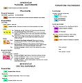
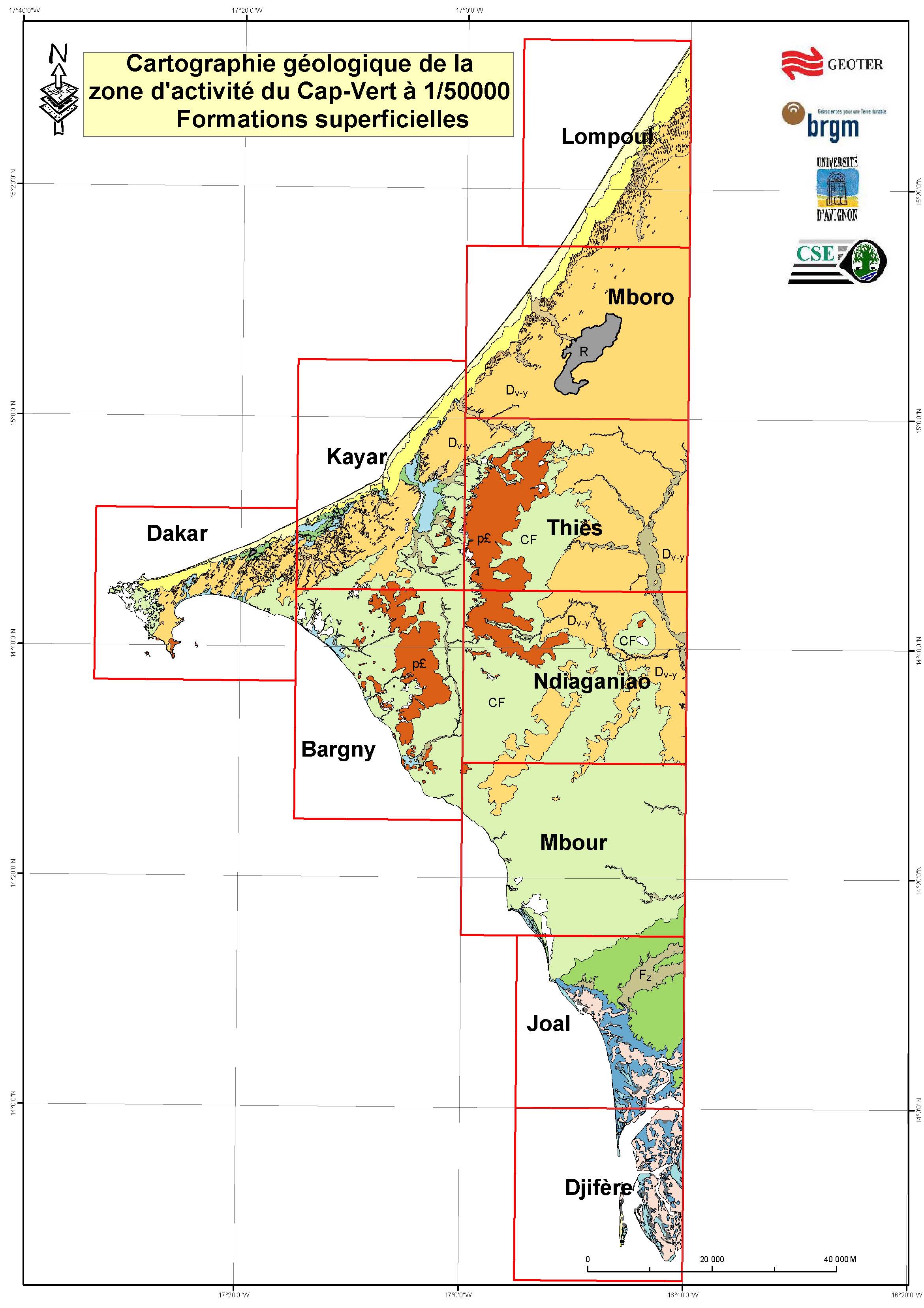
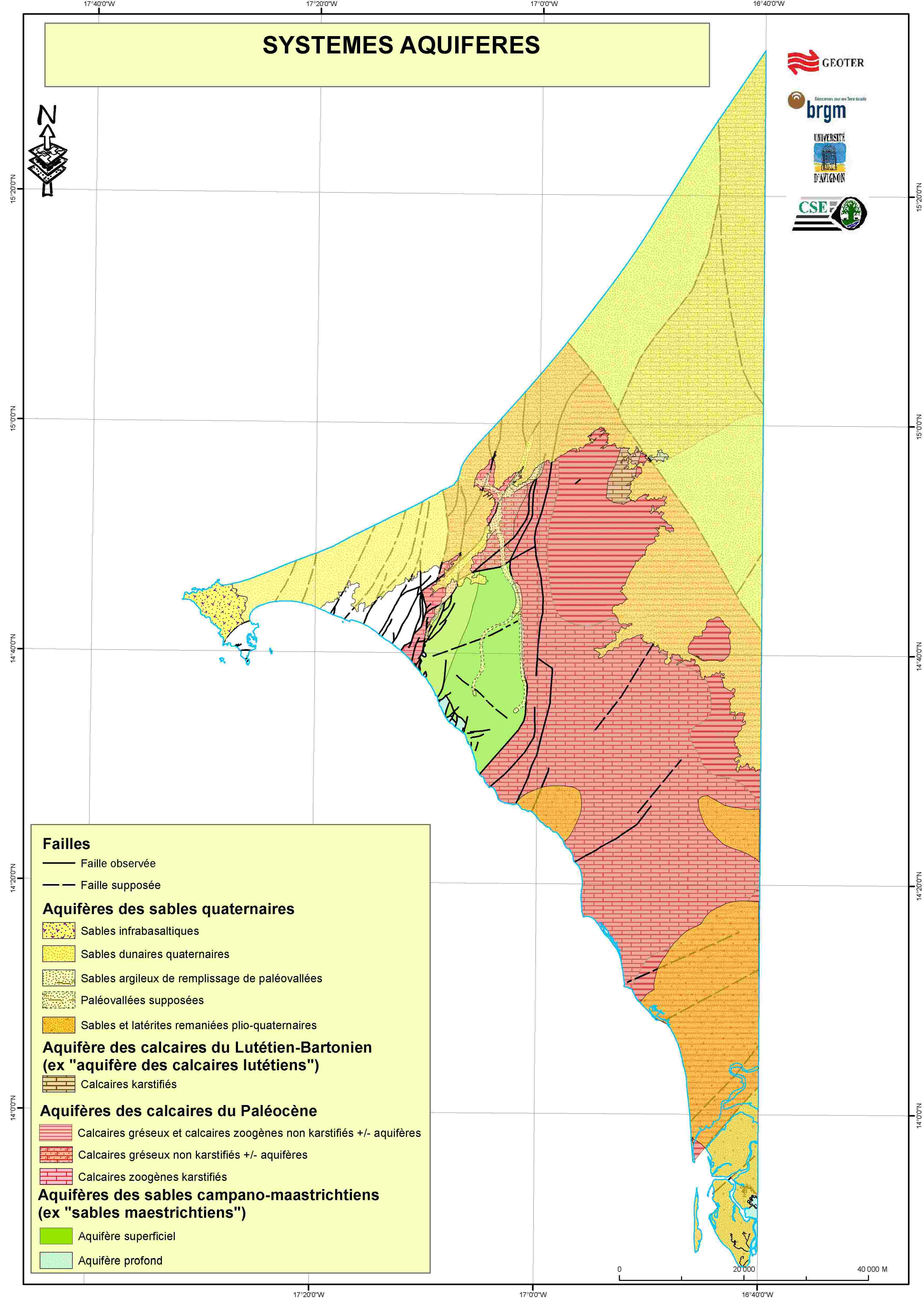
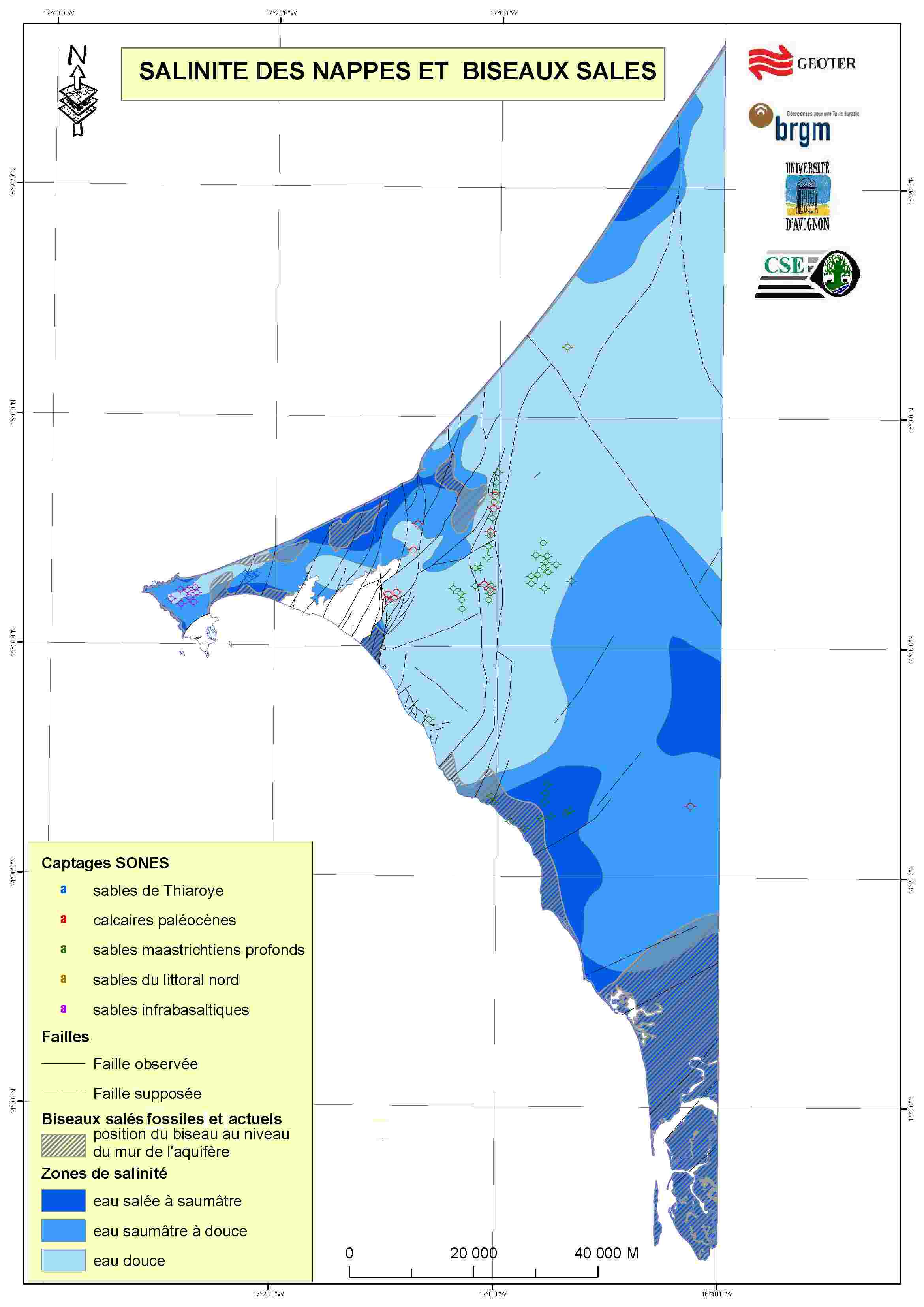
Numerical multilayered mapping at 1/50 000 of the area of activity of the Cap-Vert (2009)
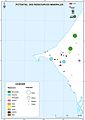
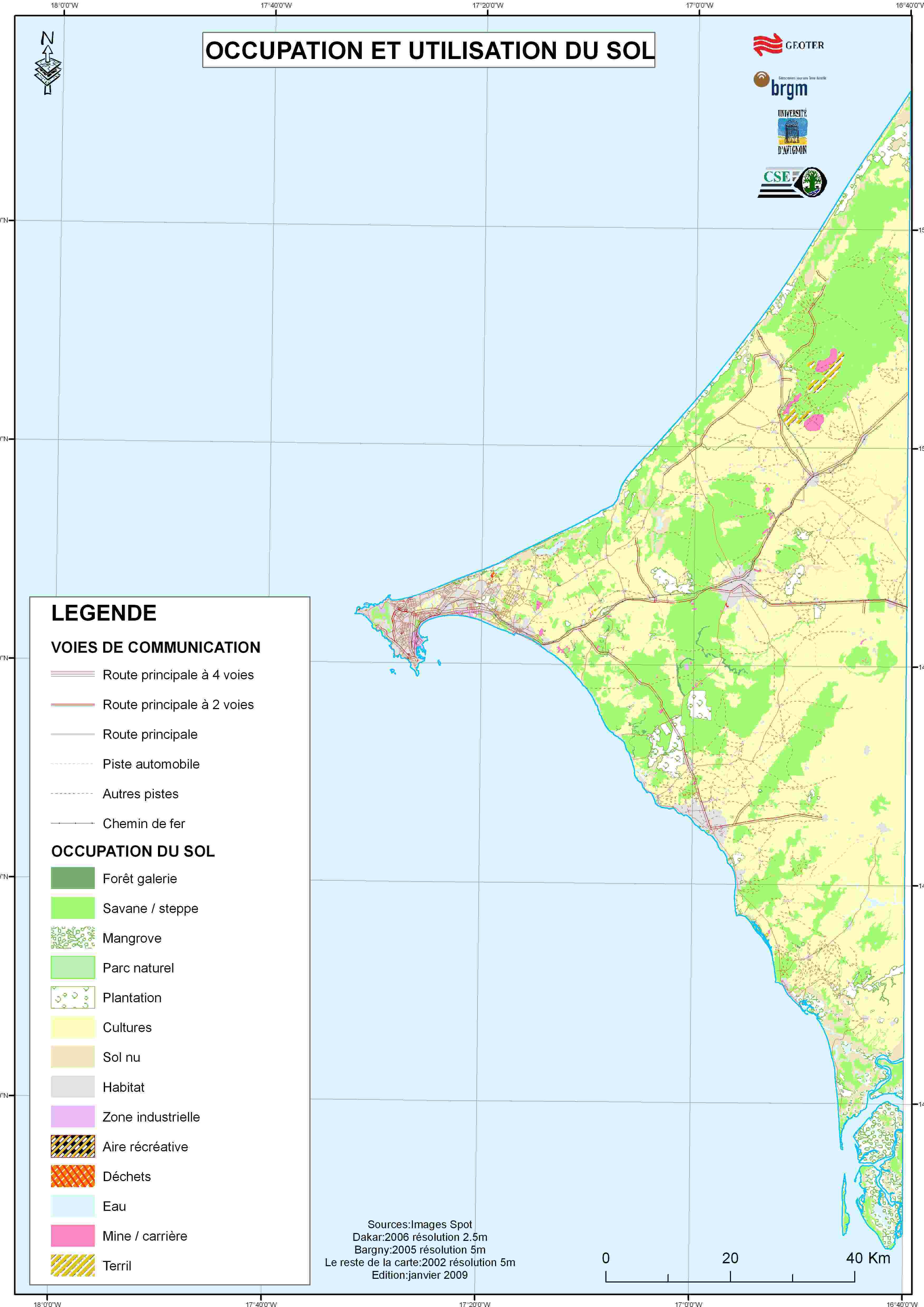
The numerical multilayered mapping at 1/50 000 of the area of activity of the Cap-Vert to the west of the 16°40’W meridian, provides Senegal with her first geological maps at this scale. The multilayered mapping fully developed on the Geographical Information System (GIS) presents layers of topography, substratum geology, geology of cover formations, aquifers hydrogeology, aquifer potential, piezometry, hydrogeochemistry, aquifer vulnerability, underground invasion by brackish waters, listing of mines and quarries, mineral resources’ potential and ground occupation.
-
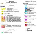
Legende of substratum
-

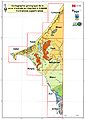
Geological map of substratum
-
Geological map of superficial facies
-
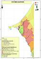
Aquifer systems
-
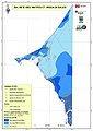
Brackish waters
-
Mineral resources
-
Ground occupation
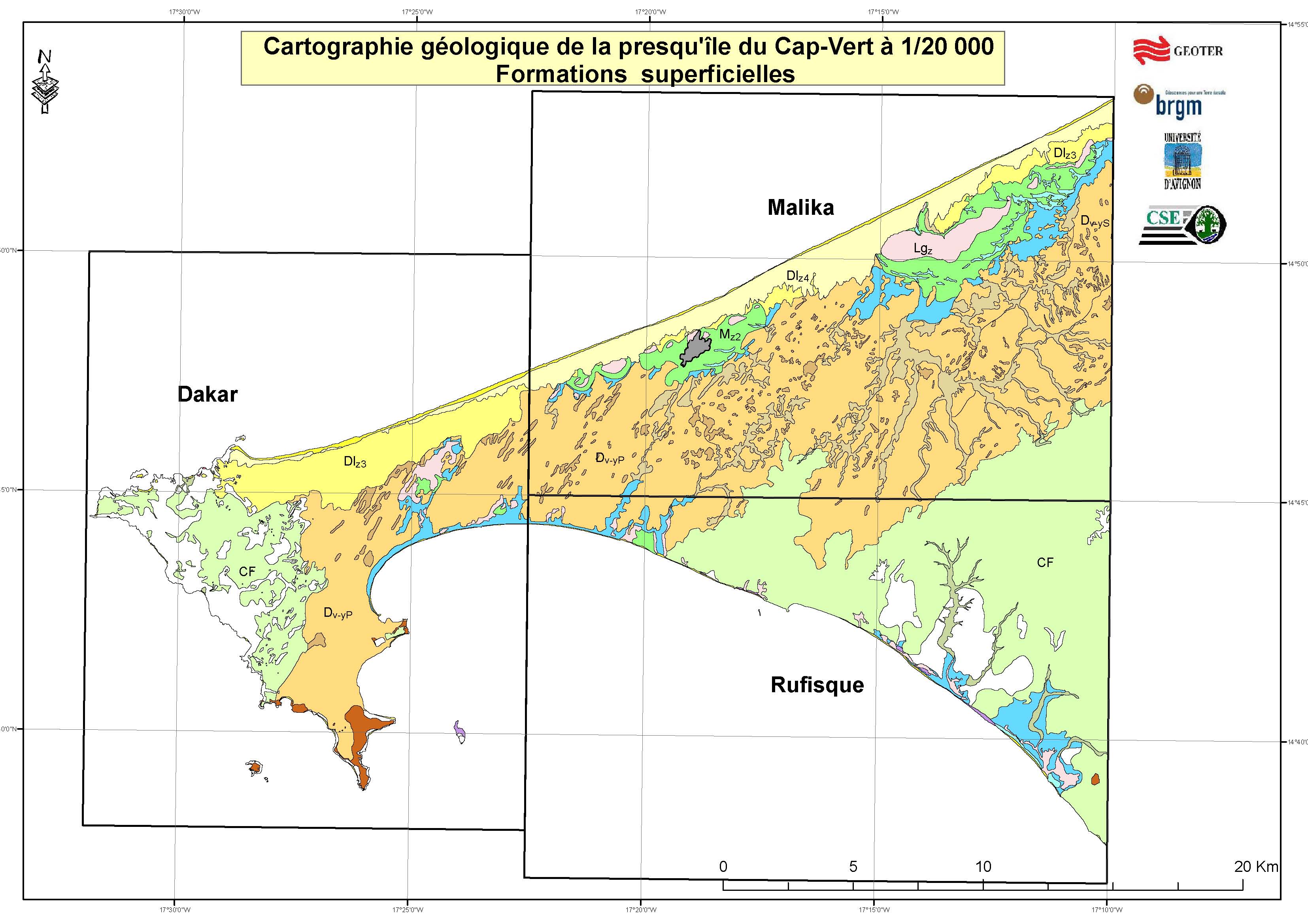
Numerical multilayered mapping at 1/20 000 of the Cap-Vert peninsula (2009)
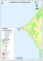
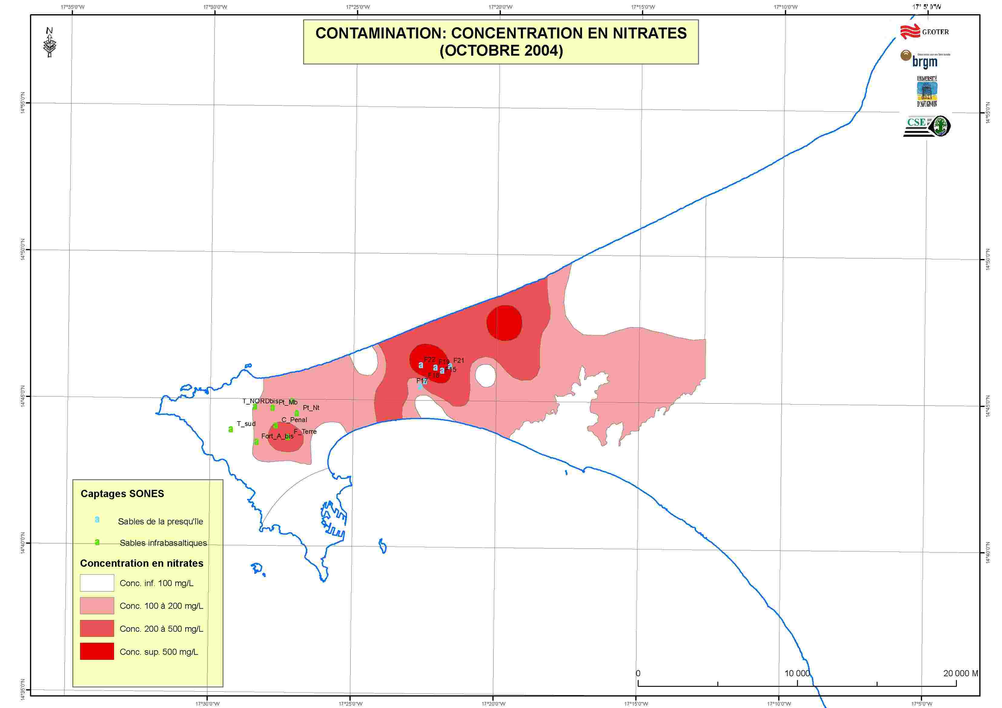
The numerical multilayered mapping at 1/20 000 of the Cap-Vert peninsula, to the west of the 17°10’W meridian, updates the geological maps by Elouard, Hébrard et al. (1976). However, the new dispensation proposes different maps for the solid geology and for the soft cover. Additional layers concern: aquifer contamination by nitrates and pesticides, susceptibility to the phenomena of swelling and shrinking soils, and geotechnical ability.
-
Legende of substratum
-
Geological map of substratum
-

Geological map of superficial facies
-

Contamination by nitrates
-
Contamination by pesticides
-

Geotechnical map
Observation points from archives, boreholes and field operations have been stored in the GIS, where they can easily be consulted along with the relevant information, documentation, sketches and pictures. The GIS is a dynamic, interactive tool with its layers ready for continuous updating.
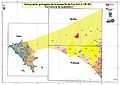
Geometrical modelling of the volcanic and sedimentary formations reveals an unsuspected dense faulting system on the eastern side of the peninsula.
Present building above potentially risky areas, on the western coast of the peninsula, is bound to draw a renewed attention to geotechnics in the foreseeable future.
Availability
New Geological maps of Senegal (2009) also exist at the scales of 1/500 000 for three quarters of the territory and of 1/200 000 for the left bank of the Senegal River. Those maps are available as printed documents.
These printed maps, the numerical maps of the multilayered cartography, the explanatory notices and the access to the GIS are available at the Direction des Mines et de la Géologie (DMG), Centre de Documentation et du Cadastre minier, Boulevard de la République 72, Dakar, Senegal (Telephone/ Fax: +221 338 220 408).
References
ELOUARD P., BRANCART R. & HEBRARD L. (1976) – Cartes géologiques à 1/20 000 et Notices explicatives des cartes de Bargny et Rufisque (Presqu’île du Cap-Vert). Ministère du développement industriel et de l’environnement, Direction des Mines et de la Géologie, République du Sénégal, 43 et 35 pages.ELOUARD P. & HEBRARD L. (1976) – Cartes géologiques à 1/20 000 et Notices explicatives des cartes de Deni Biram Ndao Lac Retba et Sangalkam(Presqu’île du Cap-Vert). Ministère du développement industriel et de l’environnement, Direction des Mines et de la Géologie, République du Sénégal, 35 et 33 pages.
ELOUARD P. & NDIAYE I. (1976) – Carte géologique à 1/20 000 et Notice explicative de la carte de Niakoul Rap (Presqu’île du Cap-Vert). Ministère du développement industriel et de l’environnement, Direction des Mines et de la Géologie, République du Sénégal, 31 p.
HEBRARD L. & ELOUARD P. (1976) – Carte géologique à 1/20 000 et Notice explicative de la carte de Tiaroye (Presqu’île du Cap-Vert). Ministère du développement industriel et de l’environnement, Direction des Mines et de la Géologie, République du Sénégal, 35 pages.
ROGER J., BANTON O., BARUSSEAU J.P., CASTAIGNE P., COMTE J-C., DUVAIL C., NEHLIG P., NOËL B.J., SERRANO O., TRAVI Y. (2009d) - Notice explicative de la cartographie multi-couches à 1/50 000 et 1/20 000 de la zone d’activité du Cap-Vert. Ministère des Mines, de l’Industrie et des PME, Direction des Mines et de la Géologie, Dakar, 245 pages.
Categories:- Regional geology
-


Wikimedia Foundation. 2010.