- Tekom Municipality
-
For the Taiwanese consumer electronics company, see Tekom Technologies.
Tekom — Municipality — Location of Tekom in Yucatán Location of Tekom in Mexico
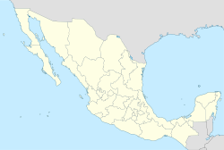
 Tekom
TekomCoordinates: 20°28′0″N 88°15′0″W / 20.466667°N 88.25°WCoordinates: 20°28′0″N 88°15′0″W / 20.466667°N 88.25°W Country  Mexico
State  Yucatán
Mexico Ind. 1821 Yucatán Est. 1824 Municipality Est. 1921 Government – Type PRI  2007-2010
– Municipal President William Edilberto Can Tec [1] Area – Total 201.83 km2 (77.9 sq mi) Population (2005 [2][3]) – Total 2,933 – Density 14.5/km2 (37.6/sq mi) Time zone Central Standard Time (UTC-6) – Summer (DST) Central Daylight Time (UTC-5) INEGI Code 081 Major Airport Merida (Manuel Crescencio Rejón) International Airport IATA Code MID ICAO Code MMMD Website Official Website Municipalities of Yucatán Tekom is a Mexican municipio (municipality) in the state of Yucatán. Tekom is also the name of the municipality's largest settlement and seat of the municipal government (cabecera municipal). In the XII national census (Censo General de Población y Vivienda) conducted by INEGI in 2000, Tekom municipality recorded a population of 2,660 inhabitants. In the intermediate census count undertaken by INEGI in 2005 (the II Conteo de Población y Vivienda), the total municipal population was recorded as 2,933 inhabitants,[4] 2,413 of whom[5] spoke one of the recognised indigenous languages of Mexico (Yucatec Maya).[6]
The municipality is located in the southeastern portion of the state in the north-central Yucatán Peninsula, and covers a total area of some 201.83 square kilometres (77.93 sq mi). The terrain is a virtually flat plain, with a median elevation of 27 metres (89 ft) above mean sea level.[7] As with most of the Yucatán Peninsula there are no surface rivers or creeks, but there are subterranean water-filled sinkholes (cenotes) some of which are naturally exposed at the surface. Average annual rainfall, which is regular in the summer months, amounts to approximately 82 millimetres (3 in). The climate is classed as subhumid.[7]
Tekom was created as a municipio libre of Yucatán state on 1 January 1920. In 1957 the southern half of Tekom's territory was partitioned off to form a new municipality, Chikindzonot.[7]
See also
-
- CEDEMUN (1988). Los municipios de Yucatán. Colección Enciclopedia de los municipios de México, vol. 30. México, D.F.: Centro Nacional de Desarrollo Municipal [CEDEMUN], Secretaría de Gobernación [SEGOB], and Gobierno del Estado de Yucatán. OCLC 23698319. (Spanish)
- INAFED (2005). "Tekom" (updated online edition of Enciclopedia de los municipios de México [1987–88] at E-Local). Enciclopedia de los municipios de México: Estado de Yucatán. México, D.F.: Instituto Nacional para el Federalismo y el Desarrollo Municipal [INAFED], Secretaría de Gobernación [SEGOB], Gobierno del Estado de Yucatán. http://www.e-local.gob.mx/work/templates/enciclo/yucatan/municipios/31081a.htm. Retrieved 2009-08-04. (Spanish)
- INALI [Instituto Nacional de Lenguas Indígenas] (14 January 2008). "Catálogo de las lenguas indígenas nacionales: Variantes lingüísticas de México con sus autodenominaciones y referencias geoestadísticas" (PDF online facsimile). Diario Oficial de la Federación (México, D.F.: Imprenta del Gobierno Federal, Secretaría de Gobernación [SEGOB]) 652 (9): pp.22–78 (first section),1–96 (second section),1–112 (third section). OCLC 46461036. http://www.inali.gob.mx/pdf/CLIN_completo.pdf. (Spanish)
- INEGI (2006). "Yucatán: Población de 5 años y más por municipio, sexo y grupos quinquenales de edad según condición de habla indígena y habla española" (PDF). II Conteo de Población y Vivienda 2005. Resultados definitivos. Tabulados básicos por entidad federativa. México, D.F.: Instituto Nacional de Estadística, Geografía e Informática [INEGI]. http://www.inegi.org.mx/est/contenidos/espanol/sistemas/conteo2005/datos/31/pdf/cpv31_li_1.pdf. Retrieved 2009-08-04. (Spanish)
References
- ^ "Nuestros municipios - Tekom". http://www.yucatan.gob.mx/estado/municipios/31081a.htm. Retrieved 2009-11-12.
- ^ "Encyclopedia of the Municipalities of Mexico: Yucatan". http://www.e-local.gob.mx/wb2/ELOCAL/EMM_yucatan. Retrieved 2009-11-01.
- ^ Census Results by Locality, 2005 INEGI.
- ^ INAFED (2005); INEGI (2006, pp.60–61)
- ^ Aged five years or older
- ^ INEGI (2006, pp.60–61)
- ^ a b c INAFED (2005)
External links
- H. Ayuntamiento de Tekom, website of Tekom's municipal government (Spanish)
Topics 
Metros Larger cities Smaller cities Akil · Tzucacab · Tekit · Halachó · Tecoh · Dzidzantún · Seyé · Buctzotz · Caucel · Conkal · Cacalchén · Celestún · Temax · Temozón · Homún · Dzilam González · Kinchil · Teabo · Sotuta · Panabá · Cholul · Chichimilá · Itzincab · Hoctún · X-Can · Dzan · Pisté · Huhí · Cansahcab · Baca · Chocholá · Opichén · Hocabá · Maní · Chicxulub · Popolá · Komchén · Tetiz · Sucilá · Cuzamá · Timucuy · Ixil · Kimbilá · Kantunil · Sacalum · Tahmek · Telchac Pueblo · Tixpéhual · Santa Elena · Tahdziú · Popolnáh · Tixcacalcupul · Chablecal · Tekantó · Cenotillo · San José Tzal · Dzemul · Chelem
Municipalities Abalá · Acanceh · Akil · Baca · Bokobá · Buctzotz · Cacalchén · Calotmul · Cansahcab · Cantamayec · Celestún · Cenotillo · Chacsinkín · Chankom · Chapab · Chemax · Chicxulub Pueblo · Chichimilá · Chikindzonot · Chocholá · Chumayel · Conkal · Cuncunul · Cuzamá · Dzan · Dzemul · Dzidzantún · Dzilam de Bravo · Dzilam González · Dzitás · Dzoncauich · Espita · Halachó · Hocabá · Hoctún · Homún · Huhí · Hunucmá · Ixil · Izamal · Kanasín · Kantunil · Kaua · Kinchil · Kopomá · Mama · Maní · Maxcanú · Mayapán · Mérida · Mocochá · Motul · Muna · Muxupip · Opichén · Oxkutzcab · Panabá · Peto · Progreso · Quintana Roo · Río Lagartos · Sacalum · Samahil · Sanahcat · San Felipe · Santa Elena · Seyé · Sinanché · Sotuta · Sucilá · Sudzal · Suma · Tahdziú · Tahmek · Teabo · Tecoh · Tekal de Venegas · Tekantó · Tekax · Tekit · Tekom · Telchac Pueblo · Telchac Puerto · Temax · Temozón · Tepakán · Tetiz · Teya · Ticul · Timucuy · Tinúm · Tixcacalcupul · Tixkokob · Tixméhuac · Tixpéhual · Tizimín · Tunkás · Tzucacab · Uayma · Ucú · Umán · Valladolid · Xocchel · Yaxcabá · Yaxkukul · Yobaín
Categories: -


Wikimedia Foundation. 2010.