- Muzambinho
-
Muzambinho — Municipality and town — Country  Brazil
Region Southeast State Minas Gerais Mesoregion Sul/Sudoeste de Minas Time zone UTC -3 Muzambinho is a town and municipality in the state of Minas Gerais in the Southeast region of Brazil.[1][2][3][4]
See also
References
- ^ "Divisão Territorial do Brasil" (in Portuguese). Divisão Territorial do Brasil e Limites Territoriais, Instituto Brasileiro de Geografia e Estatística (IBGE). July 1, 2008. ftp://geoftp.ibge.gov.br/Organizacao/Divisao_Territorial/2008/DTB_2008.zip. Retrieved December 17, 2009.
- ^ "Estimativas da população para 1º de julho de 2009" (in Portuguese) (PDF). Estimativas de População, Instituto Brasileiro de Geografia e Estatística (IBGE). August 14, 2009. http://www.ibge.gov.br/home/estatistica/populacao/estimativa2009/POP2009_DOU.pdf. Retrieved December 17, 2009.
- ^ "Ranking decrescente do IDH-M dos municípios do Brasil" (in Portuguese). Atlas do Desenvolvimento Humano, Programa das Nações Unidas para o Desenvolvimento (PNUD). 2000. http://www.pnud.org.br/atlas/ranking/IDH-M%2091%2000%20Ranking%20decrescente%20(pelos%20dados%20de%202000).htm. Retrieved December 17, 2009.
- ^ "Produto Interno Bruto dos Municípios 2002-2005" (in Portuguese). Instituto Brasileiro de Geografia e Estatística (IBGE). December 19, 2007. http://www.ibge.gov.br/home/estatistica/economia/pibmunicipios/2005/tab01.pdf. Retrieved December 17, 2009.
 Municipalities of Minas Gerais
Capital: Belo Horizonte Mesoregion Campo das Vertentes BarbacenaLavrasCarrancas • Ijaci • Ingaí • Itumirim • Itutinga • Lavras • Luminárias • Nepomuceno • Ribeirão VermelhoSão João del Rei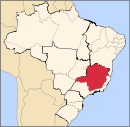
Mesoregion Central Mineira Bom DespachoCurveloTrês MariasMesoregion Jequitinhonha AlmenaraAlmenara • Bandeira • Divisópolis • Felisburgo • Jacinto • Jequitinhonha • Joaíma • Jordânia • Mata Verde • Monte Formoso • Palmópolis • Rio do Prado • Rubim • Salto da Divisa • Santa Maria do Salto • Santo Antônio do JacintoAraçuaíCapelinhaDiamantinaPedra AzulMesoregion Metropolitana de Belo Horizonte Belo HorizonteBelo Horizonte • Betim • Brumadinho • Caeté • Confins • Contagem • Esmeraldas • Ibirité • Igarapé • Juatuba • Lagoa Santa • Mário Campos • Mateus Leme • Nova Lima • Pedro Leopoldo • Raposos • Ribeirão das Neves • Rio Acima • Sabará • Santa Luzia • São Joaquim de Bicas • São José da Lapa • Sarzedo • VespasianoConceição do Mato DentroConselheiro LafaieteItabiraAlvinópolis • Barão de Cocais • Bela Vista de Minas • Bom Jesus do Amparo • Catas Altas • Dionísio • Ferros • Itabira • João Monlevade • Nova Era • Nova União • Rio Piracicaba • Santa Bárbara • Santa Maria de Itabira • São Domingos do Prata • São Gonçalo do Rio Abaixo • São José do Goiabal • Taquaraçu de MinasItaguaraBelo Vale • Bonfim • Crucilândia • Itaguara • Itatiaiuçu • Jeceaba • Moeda • Piedade dos Gerais • Rio MansoOuro PretoPará de MinasFlorestal • Onça de Pitangui • Pará de Minas • Pitangui • São José da VarginhaSete LagoasAraçaí • Baldim • Cachoeira da Prata • Caetanópolis • Capim Branco • Cordisburgo • Fortuna de Minas • Funilândia • Inhaúma • Jaboticatubas • Jequitibá • Maravilhas • Matozinhos • Papagaios • Paraopeba • Pequi • Prudente de Morais • Santana de Pirapama • Santana do Riacho • Sete LagoasMesoregion Noroeste de Minas ParacatuUnaíArinos • Bonfinópolis de Minas • Buritis • Cabeceira Grande • Dom Bosco • Formoso • Natalândia • Unaí • Uruana de MinasMesoregion Norte de Minas BocaiúvaGrão MogolJanaúbaCatuti • Espinosa • Gameleiras • Jaíba • Janaúba • Mamonas • Mato Verde • Monte Azul • Nova Porteirinha • Pai Pedro • Porteirinha • Riacho dos Machados • Serranópolis de MinasJanuáriaMontes ClarosBrasília de Minas • Campo Azul • Capitão Enéas • Claro dos Poções • Coração de Jesus • Francisco Sá • Glaucilândia • Ibiracatu • Japonvar • Juramento • Lontra • Luislândia • Mirabela • Montes Claros • Patis • Ponto Chique • São João da Lagoa • São João da Ponte • São João do Pacuí • Ubaí • Varzelândia • VerdelândiaPiraporaBuritizeiro • Ibiaí • Jequitaí • Lagoa dos Patos • Lassance • Pirapora • Riachinho • Santa Fé de Minas • São Romão • Várzea da PalmaSalinasMesoregion Oeste de Minas Campo BeloDivinópolisCarmo do Cajuru • Cláudio • Conceição do Pará • Divinópolis • Igaratinga • Itaúna • Nova Serrana • Perdigão • Santo Antônio do Monte • São Gonçalo do Pará • São Sebastião do OesteFormigaOliveiraBom Sucesso • Carmo da Mata • Carmópolis de Minas • Ibituruna • Oliveira • Passa Tempo • Piracema • Santo Antônio do Amparo • São Francisco de PaulaPiuiBambuí • Córrego Danta • Doresópolis • Iguatama • Medeiros • Piumhi • São Roque de Minas • Tapiraí • Vargem BonitaMesoregion Sudoeste de Minas AlfenasAlfenas • Alterosa • Areado • Carmo do Rio Claro • Carvalhópolis • Conceição da Aparecida • Divisa Nova • Fama • Machado • Paraguaçu • Poço Fundo • SerraniaAndrelândiaAiuruoca • Andrelândia • Arantina • Bocaina de Minas • Bom Jardim de Minas • Carvalhos • Cruzília • Liberdade • Minduri • Passa-Vinte • São Vicente de Minas • Seritinga • SerranosItajubáBrasópolis • Consolação • Cristina • Delfim Moreira • Dom Viçoso • Itajubá • Maria da Fé • Marmelópolis • Paraisópolis • Piranguçu • Piranguinho • Virgínia • Wenceslau BrazPassosAlpinópolis • Bom Jesus da Penha • Capetinga • Capitólio • Cássia • Claraval • Delfinópolis • Fortaleza de Minas • Ibiraci • Itaú de Minas • Passos • Pratápolis • São João Batista do Glória • São José da BarraPoços de CaldasAlbertina • Andradas • Bandeira do Sul • Botelhos • Caldas • Campestre • Ibitiúra de Minas • Inconfidentes • Jacutinga • Monte Sião • Ouro Fino • Poços de Caldas • Santa Rita de CaldasPouso AlegreBom Repouso • Borda da Mata • Bueno Brandão • Camanducaia • Cambuí • Congonhal • Córrego do Bom Jesus • Espírito Santo do Dourado • Estiva • Extrema • Gonçalves • Ipuiúna • Itapeva • Munhoz • Pouso Alegre • Sapucaí-Mirim • Senador Amaral • Senador José Bento • Tocos do Moji • ToledoSanta Rita do SapucaíCachoeira de Minas • Careaçu • Conceição das Pedras • Conceição dos Ouros • Cordislândia • Heliodora • Natércia • Pedralva • Santa Rita do Sapucaí • São Gonçalo do Sapucaí • São João da Mata • São José do Alegre • São Sebastião da Bela Vista • Silvianópolis • TurvolândiaSão LourencoAlagoa • Baependi • Cambuquira • Carmo de Minas • Caxambu • Conceição do Rio Verde • Itamonte • Itanhandu • Jesuânia • Lambari • Olímpio Noronha • Passa Quatro • Pouso Alto • São Lourenço • São Sebastião do Rio Verde • Soledade de MinasSão Sebastiao do ParaísoArceburgo • Cabo Verde • Guaranesia • Guaxupé • Itamogi • Jacuí • Juruaia • Monte Belo • Monte Santo de Minas • Muzambinho • Nova Resende • São Pedro da União • São Sebastião do Paraíso • São Tomás de AquinoVarginhaBoa Esperança • Campanha • Campo do Meio • Campos Gerais • Carmo da Cachoeira • Coqueiral • Elói Mendes • Guapé • Ilicínea • Monsenhor Paulo • Santana da Vargem • São Bento Abade • São Thomé das Letras • Três Corações • Três Pontas • VarginhaMesoregion Triângulo Mineiro/Alto Paranaiba AraxáAraxá • Campos Altos • Ibiá • Nova Ponte • Pedrinópolis • Perdizes • Pratinha • Sacramento • Santa Juliana • TapiraFrutalItuiutabaPatos de MinasPatrocínioUberabaUberlândiaAraguari • Araporã • Canápolis • Cascalho Rico • Centralina • Indianópolis • Monte Alegre de Minas • Prata • Tupaciguara • UberlândiaMesoregion Vale do Mucuri NanuqueTeófilo OtoniAtaléia • Catuji • Franciscópolis • Frei Gaspar • Itaipé • Ladainha • Malacacheta • Novo Oriente de Minas • Ouro Verde de Minas • Pavão • Poté • Setubinha • Teófilo OtoniMesoregion Vale do Rio Doce AimorésAimorés • Alvarenga • Conceição de Ipanema • Conselheiro Pena • Cuparaque • Goiabeira • Ipanema • Itueta • Mutum • Pocrane • Resplendor • Santa Rita do Itueto • TaparubaCaratingaBom Jesus do Galho • Bugre • Caratinga • Córrego Novo • Dom Cavati • Entre Folhas • Iapu • Imbé de Minas • Inhapim • Ipaba • Piedade de Caratinga • Pingo-d'Água • Santa Bárbara do Leste • Santa Rita de Minas • São Domingos das Dores • São João do Oriente • São Sebastião do Anta • Tarumirim • Ubaporanga • Vargem AlegreGovernador ValadaresAlpercata • Campanário • Capitão Andrade • Coroaci • Divino das Laranjeiras • Engenheiro Caldas • Fernandes Tourinho • Frei Inocêncio • Galiléia • Governador Valadares • Itambacuri • Itanhomi • Jampruca • Marilac • Mathias Lobato • Nacip Raydan • Nova Módica • Pescador • São Geraldo da Piedade • São Geraldo do Baixio • São José da Safira • São José do Divino • Sobrália • Tumiritinga • VirgolândiaGuanhãesBraúnas • Carmésia • Coluna • Divinolândia de Minas • Dores de Guanhães • Gonzaga • Guanhães • Materlândia • Paulistas • Sabinópolis • Santa Efigênia de Minas • São João Evangelista • Sardoá • Senhora do Porto • VirginópolisIpatingaAçucena • Antônio Dias • Belo Oriente • Coronel Fabriciano • Ipatinga • Jaguaraçu • Joanésia • Marliéria • Mesquita • Naque • Periquito • Santana do Paraíso • TimóteoMantenaCentral de Minas • Itabirinha de Mantena • Mantena • Mendes Pimentel • Nova Belém • São Félix de Minas • São João do ManteninhaPeçanhaÁgua Boa • Cantagalo • Frei Lagonegro • José Raydan • Peçanha • Santa Maria do Suaçuí • São José do Jacuri • São Pedro do Suaçuí • São Sebastião do MaranhãoCategories:- Municipalities of Brazil
- Minas Gerais geography stubs
- Populated places in Minas Gerais

Wikimedia Foundation. 2010.