- River Muzizi
-
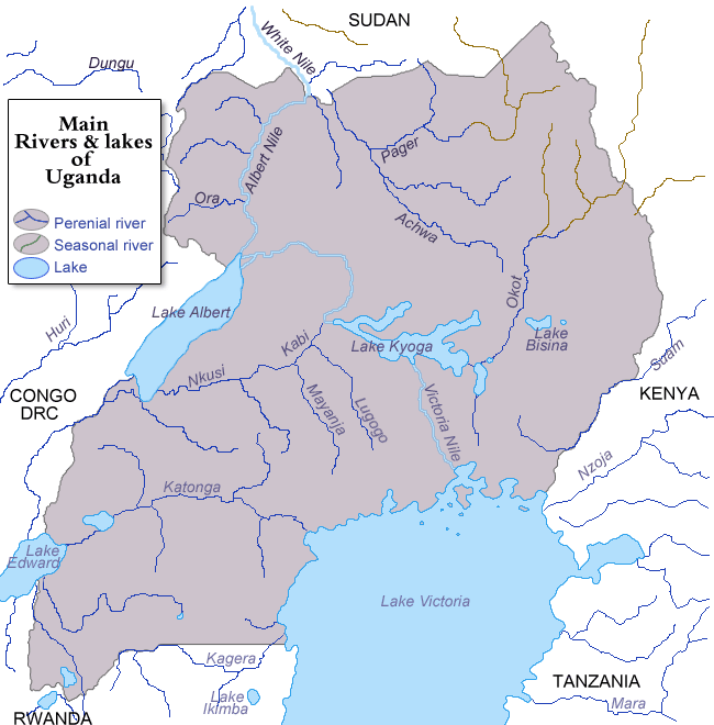
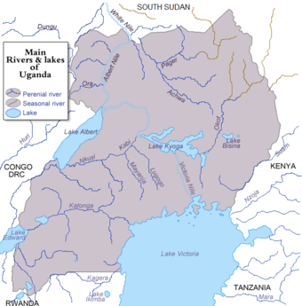 Rivers and lakes of Uganda
Muzizi River Country Uganda Source Mubende Hills, Mubende District - location Mubende, Central Region, Uganda - elevation 1,300 m (4,265 ft) - coordinates 00°34′38″N 31°11′42″E / 0.57722°N 31.195°E Mouth Lake Albert, Kibaale District - location Ndaiga, Western Region, Uganda - elevation 650 m (2,133 ft) - coordinates 01°00′32″N 30°32′13″E / 1.00889°N 30.53694°E Length 120 km (75 mi) River Muzizi is a river in Uganda, in East Africa.
Contents
Location
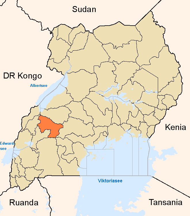
The Muzizi River is located in the western part of Uganda. It starts from the hills, northwest of the town of Mubende in Mubende District, Central Uganda. It flows in a northwestern direction to empty into Lake Albert, on the border between Uganda and the Democratic Republic of the Congo.
The source of River Muzizi is located in Mubende, with coordinates: Latitude:0.5772; Longitude:31.1950.[1] River Muzizi enters Lake Albert at Ndaiga, in Kibaale District, with coordinates: Latitude:1.0090; Longitude:30.5370.[2] On its course northwestwards, the river traverses or forms the borders of the following districts : Mubende District, Kyegegwa District, Kibaale District, Kyenjojo District, Kabarole District, Kibaale District and Ntoroko District. At its source, the altitude is approximately 1,300 metres (4,300 ft). At its point of entry into Lake Albert, the altitude is approximately 650 metres (2,130 ft).
The length of Muzizi River, is approximately 120 kilometres (75 mi) from source to end. [3]
Muzizi Power Station
Main article: Muzizi Power StationApproximately 10 kilometres (6.2 mi), before River Muzizi empties into Lake Albert, it cascades from an elevation of approximately 1,000 metres (3,300 ft), above sea level to an elevation of about 700 metres (2,300 ft) above sea level. At this site, the Government of Uganda, plans to construct a 26 MW min-hydropower station, known as Muzizi Power Station. Construction is expected to begin in 2013, with commissioning expected bin 2018.
External links
See also
References
 Mubende DistrictCapital: Mubende
Parishes Bagezza · Bukuya · Butoloogo · Kalwana · Kasambya · Kassanda · Kiganda · Kigando · Kitenga · Kitumbi · Kiyuuni · Maduudu · Mubende Town Council · Mwezi · NabingoolaTowns and villages Mubende · KabambaGeography Economy Frontpage Microfinance · Centenary Bank · Stanbic BankNotable landmarks Education Uganda Military AcademyNotable people Capital: KyegegwaTowns and villages KyegegwaGeography River MuziziEconomy Mobile Branch of PostBankNotable landmarks Mubende-Fort Portal Highway Kibaale DistrictCapital: KibaaleCounties and
sub-countiesBuyaga County · Bugangaizi County · Buyanja CountyTowns and villages Kibaale · Bwamiramira · Kagadi · KigwabyaGeography Economy Stanbic Bank · PostBank Uganda · Muzizi Power StationNotable landmarks Kibale National Park · Kagadi HospitalEducation Uganda Women's UniversityNotable people Kyenjojo DistrictCapital: KyenjojoCounties and
sub-counties
Towns and
villagesKyenjojoGeography River MuziziEconomy Centenary Bank · PostBank UgandaNotable
landmarksKyenjojo Central MarketNotable people Aston Kajara Kabarole DistrictCapital: KabaroleCounties and
sub-countiesBunyangabu County · Burahya County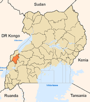
Towns and
villagesEconomy Centenary Bank · Crane Bank · Equity Bank · Kenya Commercial Bank · PostBank Uganda · Stanbic Bank · United Bank for Africa · Pride Microfinance Limited · Uganda Finance Trust LimitedNotable
landmarksKibaale National Park · Rwenzori National Park · Rwenzori Mountains · Fort Portal Airport · Kabarole Missionary Hospital · Palace of Omukama of Toro · Kitojo Hospital · Fort Portal Regional Referral Hospital · Omukama's Palace · Lake Albert · Roman Catholic Diocese of Fort PortalEducation Mountains of the Moon University · Uganda Pentecostal University · Makerere University Western CampusNotable people Capital: NtorokoTowns and villages NtorokoGeography Economy Notable landmarks River Muzizi · Fort Portal-Ntoroko RoadRivers of Uganda Rivers Categories:- Rivers of Uganda
- River Muzizi
- Mubende District
- Kyegegwa District
- Kibaale District
- Kyenjojo District
- Kabarole District
- Ntoroko District

Wikimedia Foundation. 2010.