- National Register of Historic Places listings in Wasco County, Oregon
-
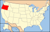
 Location of Wasco County in Oregon
The following list includes all of the National Register of Historic Places listings in Wasco County, Oregon, and offers brief descriptive information about each of them. The National Register of Historic Places (NRHP) recognizes buildings, structures, objects, sites, and districts of national, state, or local historic significance across the United States.[1] Out of over 80,000 NRHP sites nationwide,[2] Oregon is home to approximately 1,900,[3] and approximately 33 of those are found in Wasco County.
-
- This National Park Service list is complete through NPS recent listings posted November 10, 2011.[4]
Contents
Current listings
[5] Site name[6] Image Date listed[6] Location[7] City or Town[8] Summary 1 Lewis Anderson House, Barn and Granary 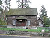
March 20, 1980 508 W. 16th Street
45°35′45″N 121°11′51″W / 45.59578°N 121.1975°WThe Dalles 2 Balch Hotel 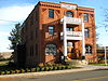
September 8, 1987 40 S. Main Street
45°27′01.6″N 121°07′52.5″W / 45.450444°N 121.13125°WDufur 3 Barlow Road 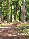
April 13, 1992 Mount Hood National Forest, north of the line of the Salmon and White rivers from southwest of Wamic to Rhododendron[9] (See also Hood River and Clackamas counties.)
45°13′50″N 121°34′47″W / 45.23065°N 121.5797°W (approx.)Wamic to Rhododendron[6] Beginning with its construction by Sam Barlow in 1846, this toll road provided the first overland connection for wagons between The Dalles and Oregon City over the south flanks of Mount Hood, and offered a majority of Oregon Trail emigrants an alternative to the hazardous raft passage down the Columbia River from The Dalles to Fort Vancouver.[10] 4 Bennett–Williams House 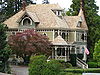
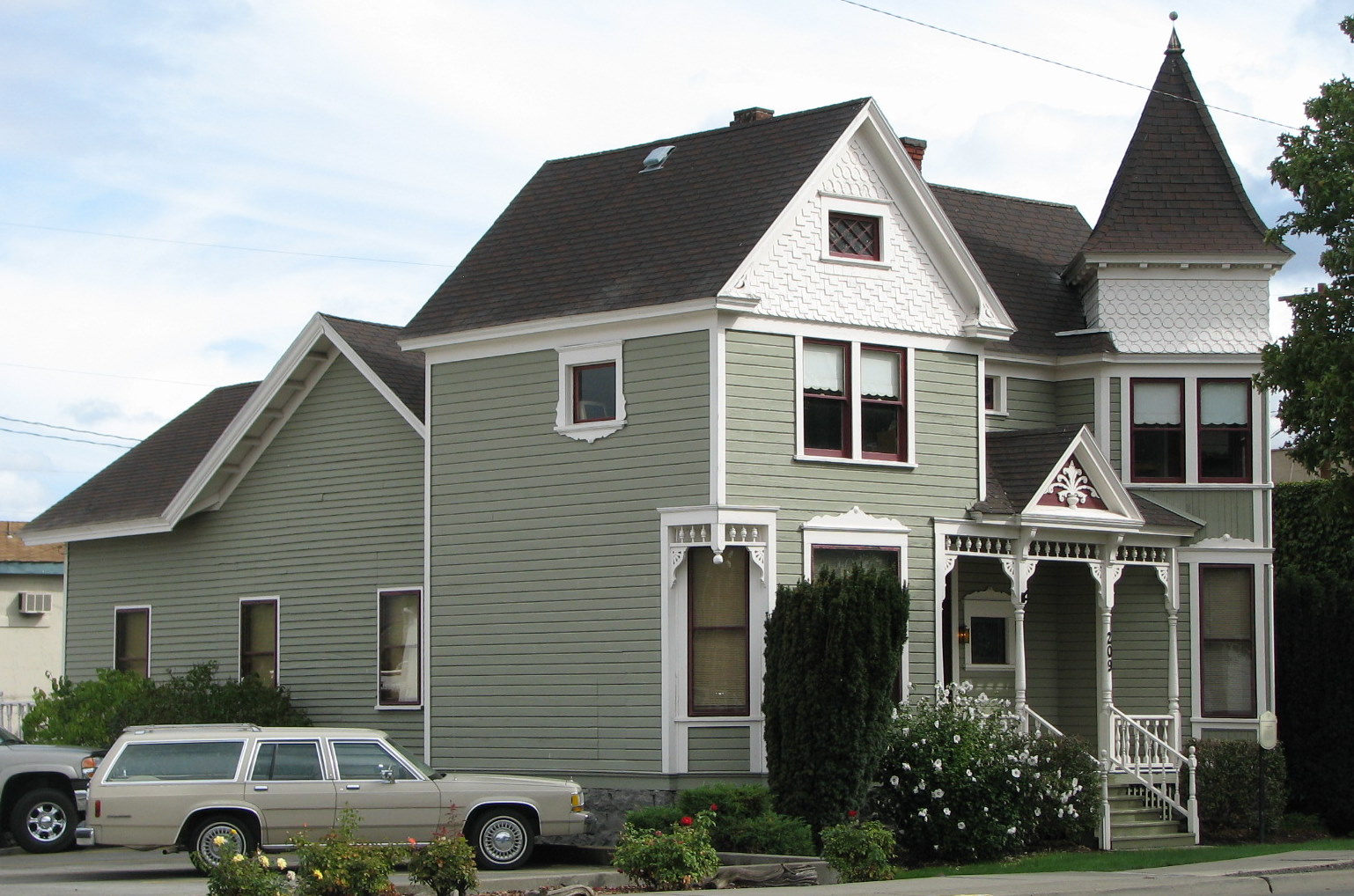
February 27, 1986 608 W. 6th Street
45°36′09″N 121°11′33″W / 45.60263°N 121.1925°WThe Dalles Built circa 1899 for prominent local lawyer, judge, and Oregon Supreme Court justice Alfred S. Bennett, this house is the most outstanding and best preserved example of Queen Anne architecture in The Dalles. It later became the home of leading members of the Williams family, a notable local merchant family.[11][12] 5 Columbia River Highway Historic District 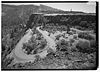
December 12, 1983 Linear district roughly bounded by the Chenoweth Creek Bridge, The Dalles, on the east, and the Sandy River Bridge, Troutdale, on the west[9] (See also Hood River and Multnomah counties.)
45°40′55.99″N 121°18′00.50″W / 45.6822194°N 121.300139°W (approx.)The Dalles to Troutdale[13] Constructed between 1913 and 1922, this was the first scenic highway in the United States. Designed specifically to provide visitors access to the most outstanding of the scenic features of the Columbia River Gorge, the highway is also an outstanding example of modern highway development for its pioneering advances in road engineering, and is the single most important contribution to the fields of civil engineering and landscape architecture by Samuel C. Lancaster.[14] 6 Columbia Southern Hotel 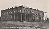
October 31, 1979 4th and E Streets
45°00′13″N 120°45′09″W / 45.00354°N 120.7525°WShaniko 7 First Wasco County Courthouse 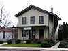
March 18, 1998 410 W. Second Place
45°36′14″N 121°11′17″W / 45.60375°N 121.188°WThe Dalles One of only two remaining courthouses from prior to Oregon statehood, this building served Wasco County from 1859 until 1882, and then as The Dalles city hall until 1907. From its original location in downtown The Dalles, it has been moved several times before its current location within Trevitt's Addition Historic District.[11] 8 Fort Dalles Surgeon's Quarters 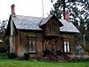
September 10, 1971 15th and Garrison Streets
45°35′47″N 121°11′48″W / 45.59633°N 121.1967°WThe Dalles 9 Edward French House 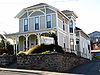
October 2, 1992 515 Liberty Street
45°36′05″N 121°11′12″W / 45.60152°N 121.1867°WThe Dalles Originally dating from circa 1865, this home was acquired by the French family in 1892 and renovated by them in the Italianate style in circa 1900. Edward French, along with his uncle Daniel and other members of the French family, were prominent bankers and businessmen from early The Dalles until the 1920s.[11] 10 Fulton–Taylor House 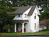
September 9, 1993 704 Case Street
45°35′54″N 121°11′02″W / 45.59835°N 121.1838°WThe Dalles 11 Hugh Glenn House 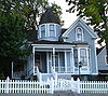
February 20, 1991 100 W. 9th Street
45°35′53″N 121°11′19″W / 45.59798°N 121.1886°WThe Dalles 12 Heimrich–Seufert House 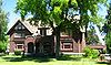
June 1, 1990 303 E. 10th Street
45°35′47″N 121°11′12″W / 45.59632°N 121.1868°WThe Dalles 13 Orlando Humason House 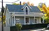
June 21, 1991 908 Court Street
45°35′52″N 121°11′14″W / 45.59772°N 121.1871°WThe Dalles 14 Imperial Stock Ranch Headquarters Complex 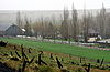
August 5, 1994 Hinton Road
45°05′55″N 120°47′23″W / 45.09869°N 120.7896°WShaniko vicinity 15 Indian Shaker Church and Gulick Homestead 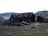
April 4, 1978 Near the junction of Interstate 84 and U.S. Route 197
45°36′21″N 121°08′03″W / 45.6059°N 121.1341°WThe Dalles 16 Joseph D. and Margaret Kelly House 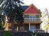
May 27, 1999 921 E. 7th Street
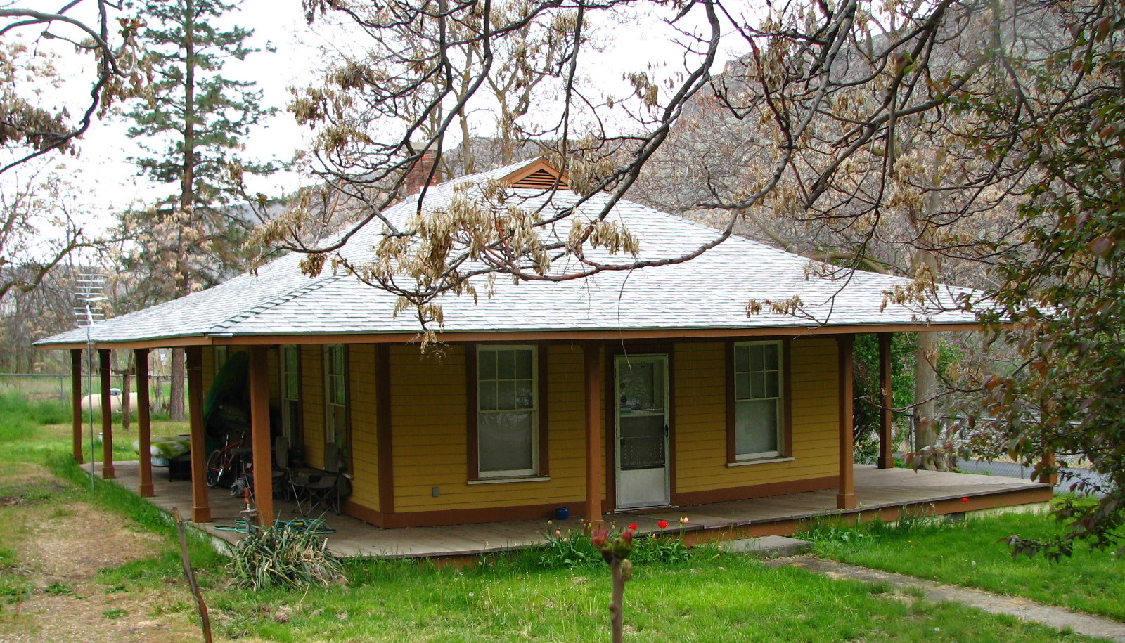
45°35′50″N 121°10′42″W / 45.59712°N 121.1782°WThe Dalles 17 Maupin Section Foreman's House 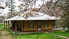
November 29, 2006 601 Deschutes Access Road
45°10′06″N 121°05′03″W / 45.16842°N 121.0843°WMaupin 18 Malcolm A. Moody House 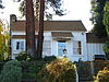
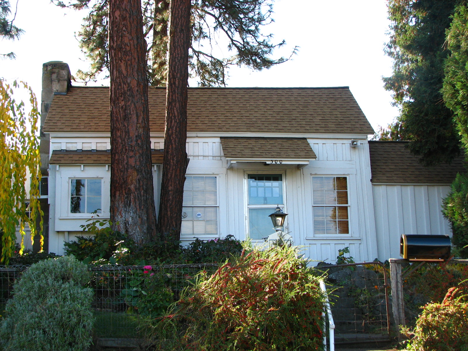
October 10, 1980 300 W. 13th Street
45°35′47″N 121°11′36″W / 45.59652°N 121.1933°WThe Dalles Originally built in 1850 as a two-room private home for a non-commissioned officer from Fort Dalles, this is the oldest remaining house in The Dalles. It was subsequently occupied by U.S. Representative Malcolm A. Moody, and has ultimately become a museum.[15] 19 Jefferson Mosier House 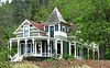
February 23, 1990 704 3rd Avenue
45°40′56″N 121°23′29″W / 45.68219°N 121.3913°WMosier 20 Dr. J.A. Reuter House 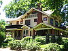
June 27, 1997 420 E. 8th Street
45°35′50″N 121°11′01″W / 45.59729°N 121.1835°WThe Dalles 21 Rock Fort Campsite 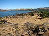
September 4, 1980 W. 1st Street
45°36′25″N 121°11′17″W / 45.60705°N 121.1881°WThe Dalles The Lewis and Clark Expedition camped at this natural riverside fortification for four nights in late October 1805, just after it passed Celilo Falls on its descent to the Pacific. It was here that the expedition first made significant contact and commerce with the Chinookan-speaking peoples of the lower Columbia.[16] 22 St. Peter's Roman Catholic Church 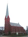
June 20, 1974 3rd and Lincoln Streets
45°36′10″N 121°11′13″W / 45.60274°N 121.1869°WThe Dalles 23 Shaniko Historic District 
March 18, 1982 U.S. Route 97 and Oregon Route 218
45°00′15″N 120°45′09″W / 45.00417°N 120.7525°WShaniko 24 Edward F. Sharp Residential Ensemble 
October 25, 1991 400 and 404 E. 4th Street and 504 Federal Street
45°35′57″N 121°10′55″W / 45.59925°N 121.182°WThe Dalles 25 The Dalles Carnegie Library 
December 8, 1978 220 E. 4th Street
45°36′00″N 121°10′59″W / 45.60006°N 121.1831°WThe Dalles 26 The Dalles Civic Auditorium 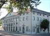
December 12, 1978 323 E. 4th Street
45°35′58″N 121°10′55″W / 45.59946°N 121.1819°WThe Dalles 27 The Dalles Commercial Historic District 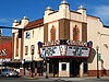
November 4, 1986 Roughly bounded by the Columbia River and Laughlin, 5th, and Union Streets[6]
45°36′07.00″N 121°11′07.20″W / 45.60194°N 121.185333°WThe Dalles 28 John L. Thompson House 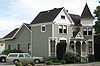
November 6, 1980 209 W. 3rd Street
45°36′09″N 121°11′10″W / 45.60237°N 121.1861°WThe Dalles 29 Trevitt's Addition Historic District 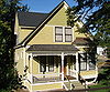
June 20, 1995 Roughly bounded by 2nd, Liberty, and 6th Streets and Mill Creek[6]
45°36′09″N 121°11′24″W / 45.60262°N 121.19°WThe Dalles Victor Trevitt platted the first expansion of the original 1855 "Dalles City" townsite in 1860, and continued to extend his addition in response to economic developments. The district saw the first flour mill and electrical and water systems in The Dalles, one of the area's earliest Catholic churches, and direct connection to transportation networks including the Columbia River Highway and the railroad. Surviving buildings in the district, primarily residential, reflect a continuous spectrum of architectural styles from 1864 to 1937.[11] 30 US Post Office 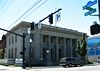
March 4, 1985 100 W. 2nd Street
45°36′09″N 121°11′03″W / 45.60243°N 121.1843°WThe Dalles 31 John and Murta Van Dellen House 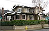
February 20, 1991 400 E. 8th Street
45°35′50″N 121°11′01″W / 45.59736°N 121.1837°WThe Dalles Restricted listings
Certain individual listings on the NRHP are archaeological sites or other sensitive areas that could be subject to looting or other damage. Consequently, the National Park Service and the State Historic Preservation Office — the authorities that oversee the NRHP and its information — sometimes choose to restrict (i.e. decline to publish or otherwise release) details regarding the locations of such sites. In order to respect this restriction, the two such listings in Wasco County are presented below without photos or location details.
[5] Site name[6] Date listed[6] City or Town Vicinity[8] Summary 32 Fivemile Rapids Site (35 WS 4) December 19, 1974 The Dalles[6] Yielding remains beginning soon after the end of the last glacial period, this archeological site (along with other nearby sites) provides a nearly continuous record of human occupation from at least 9000 BCE to 1820 CE. It also provides some of the earliest available evidence of fishing in human economy.[17] 33 Mosier Mounds Complex February 24, 2003 Mosier This collection of stone walls, pits, and mounds amid a basalt talus slope is the largest and most complex of a number of similar Native American sites in the southern Columbia Plateau. The site predates the arrival of Europeans and probably the local ascendance of Chinookan peoples, but has resisted more precise dating or cultural affiliation.[18] See also
- National Register of Historic Places listings in Oregon
- Listings in adjacent counties: Clackamas, Gilliam, Hood River, Jefferson, Klickitat, Marion, Sherman, Wheeler
- List of National Historic Landmarks in Oregon
- Historic preservation
- History of Oregon
- Lists of Oregon-related topics
References
- ^ National Park Service (1997), How to Apply the National Register Criteria for Evaluation, National Register Bulletins, http://www.nps.gov/history/nr/publications/bulletins/nrb15/nrb15.pdf, retrieved 2008-12-17
- ^ National Park Service, "National Register Research", National Register of Historic Places, http://www.nps.gov/nr/research/index.htm, retrieved 2008-12-17
- ^ Oregon Parks and Recreation Department (2009-01-05), Oregon National Register List, http://www.oregonheritage.org/OPRD/HCD/NATREG/docs/oregon_nr_list.pdf, retrieved 2009-02-14
- ^ "National Register of Historic Places: Weekly List Actions". National Park Service, United States Department of the Interior. Retrieved on November 10, 2011.
- ^ a b Numbers represent an ordering by significant words (e.g. last name). Various colorings (defined here) differentiate standalone NRHP sites from NRHP sites that also hold status as National Historic Landmarks, historic districts, National Historical Parks, or hold other historic designations.
- ^ a b c d e f g h National Park Service, National Register Information System, http://www.cr.nps.gov/NR/research/nris.htm, retrieved 2008-10-13
- ^ Text: Except as otherwise noted, all entries are drawn from: Oregon Parks and Recreation Department (2008-08-08), Oregon National Register List, http://www.oregonheritage.org/OPRD/HCD/NATREG/docs/oregon_nr_list.pdf.
Coordinates: Except as otherwise noted, all entries are drawn from Google Earth KMZ files available at: National Park Service, National Register Information System, http://www.cr.nps.gov/NR/research/nris.htm In limited instances, editors have adjusted coordinates for accuracy. - ^ a b Except as otherwise noted, all entries are drawn from: Oregon Parks and Recreation Department (2008-08-08), Oregon National Register List, http://www.oregonheritage.org/OPRD/HCD/NATREG/docs/oregon_nr_list.pdf, retrieved 2008-10-09
- ^ a b National Park Service, National Register Information System, http://www.cr.nps.gov/NR/research/nris.htm, retrieved 2010-09-09
- ^ Clackamas Heritage Partners (2008), "The Final Leg of the Trail", Historic Oregon City, http://www.historicoregoncity.org/HOC/index.php?option=com_content&view=article&id=142:final-leg&catid=70:oregon-trail-history&Itemid=75, retrieved 2009-02-22
- ^ a b c d Donovan, Sally; Howard, Bruce (July 30, 1994), National Register of Historic Places Registration Form: Trevitt's Addition Historic District
- ^ Williams, E.D. (August 14, 1985), National Register of Historic Places Inventory–Nomination Form: Bennett–Williams House
- ^ Smith, Dwight A. (October 3, 1983), National Register of Historic Places Inventory–Nomination Form: Columbia River Highway Historic District, OCLC 12786411
- ^ National Park Service, National Historic Landmark Program: NHL Database, http://tps.cr.nps.gov/nhl/default.cfm, retrieved 2007-10-14
- ^ Wasco County Historical Society (January 3, 2010), Oldest Home in The Dalles, http://www.wascochs.org/, retrieved January 6, 2010
- ^ Ambrose, Stephen E. (1996), Undaunted Courage: Meriwether Lewis, Thomas Jefferson, and the Opening of the American West, New York: Simon & Schuster, pp. 305–307, ISBN 9780684826974
- ^ Cole, D.L. (August 16, 1974), National Register of Historic Places Inventory–Nomination Form: Fivemile Rapids Site
- ^ Anderson, Kirsten J.; Connolly, Tom (November 20, 2001), National Register of Historic Places Registration Form: Mosier Mounds Complex
External links
U.S. National Register of Historic Places in Oregon Lists by county Baker • Benton • Clackamas • Clatsop • Columbia • Coos • Crook • Curry • Deschutes • Douglas • Gilliam • Grant • Harney • Hood River • Jackson • Jefferson • Josephine • Klamath • Lake • Lane • Lincoln • Linn • Malheur • Marion • Morrow • Multnomah: Portland North • Multnomah: Portland Northeast • Multnomah: Portland Northwest • Multnomah: Portland Southeast • Multnomah: Portland Southwest • Multnomah: Other • Polk • Sherman • Tillamook • Umatilla • Union • Wallowa • Wasco • Washington • Wheeler • Yamhill
Other lists U.S. National Register of Historic Places Topics Lists by states Alabama • Alaska • Arizona • Arkansas • California • Colorado • Connecticut • Delaware • Florida • Georgia • Hawaii • Idaho • Illinois • Indiana • Iowa • Kansas • Kentucky • Louisiana • Maine • Maryland • Massachusetts • Michigan • Minnesota • Mississippi • Missouri • Montana • Nebraska • Nevada • New Hampshire • New Jersey • New Mexico • New York • North Carolina • North Dakota • Ohio • Oklahoma • Oregon • Pennsylvania • Rhode Island • South Carolina • South Dakota • Tennessee • Texas • Utah • Vermont • Virginia • Washington • West Virginia • Wisconsin • WyomingLists by territories Lists by associated states Other Categories:- Oregon-related lists
- National Register of Historic Places in Wasco County, Oregon
-


Wikimedia Foundation. 2010.