- New York State Route 103
-
NYS Route 103
Route information Maintained by NYSDOT Length: 0.50 mi[3] (0.80 km) Existed: early 1930s[1][2] – present Major junctions South end:  NY 5S in Rotterdam
North end:  NY 5 in Glenville
Location Counties: Schenectady Highway system Numbered highways in New York
Interstate • U.S. • N.Y. (former) • Reference • County←  NY 102
NY 104  →
→New York State Route 103 (NY 103) is a state highway in Schenectady County, New York, in the United States. It runs from the hamlet of Rotterdam Junction across the Mohawk River/Erie Canal at Lock 9 to the town of Rotterdam. The route is officially only 0.50 miles (0.80 km) in length and runs from NY 5S to NY 5 in Schenectady County. It also overlaps part of New York State Bicycle Route 5[4]
Contents
Route description
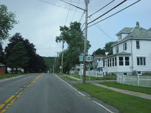 Route 103 heading northbound through Rotterdam. The bridge across the Mohawk RIver is visible in the distance
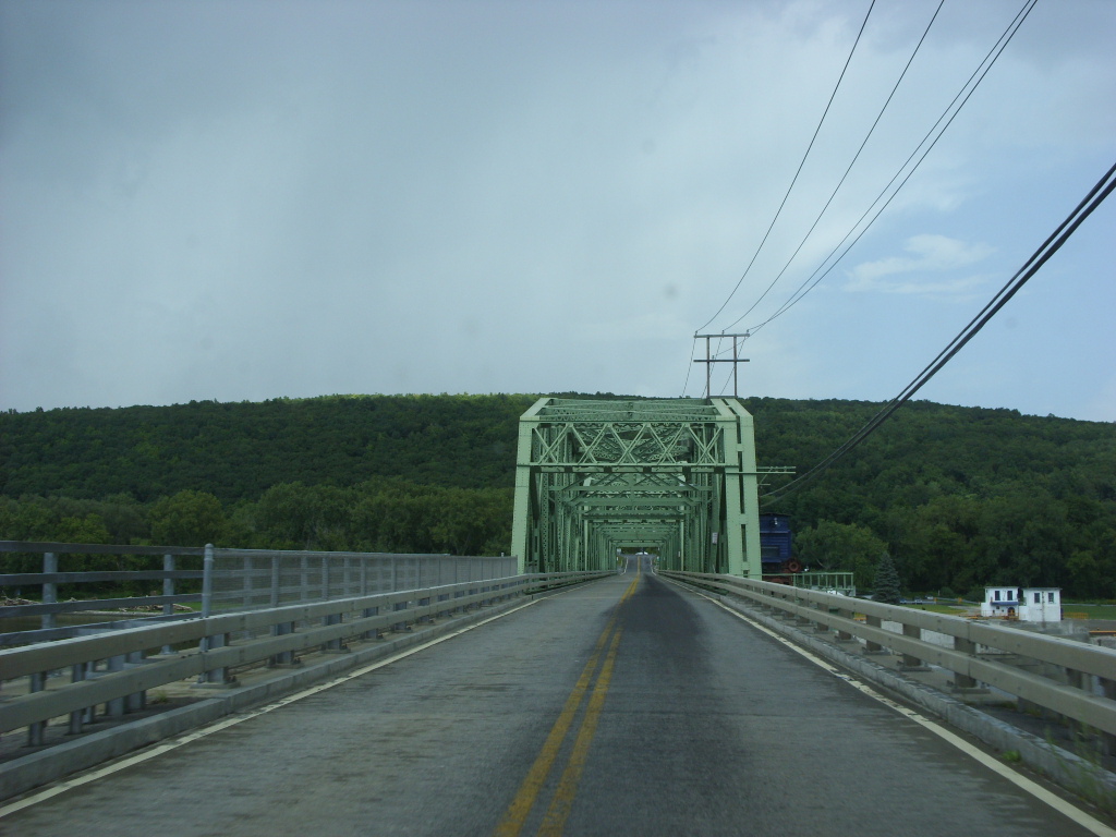
Route 103 begins at an intersection with NY 5S in Rotterdam Junction, a hamlet of Rotterdam, New York. The highway heads northward, passing several houses. Of the few intersections along Route 103 (also known as Bridge Street), the first ones are with Alexander Drive and Leonard Road. After the intersection with Riverside Drive, Route 103 passes the only bit of commercial activity along the highway. After the intersection with Ulrich Drive, the highway begins to rise and then starts crossing the steel truss bridge. After the last one-third of the span, there is a view of Erie Canal Lock 9. The route, after crossing the bridge, passes a picnic area. After passing a small patch of trees, Route 103 terminates at an intersection with the northern route of NY 5 in Glenville.[5]
History
NY 103 was assigned in the early 1930s to its current alignment.[1][2]
Until the creation of NY 890, NY 103 was a key link for shunpiking the nearby Thruway, as it carried traffic from Amsterdam and other points west across the Mohawk via NY 5S to I-890 and Schenectady, avoiding Scotia. When I-890 was created, there had been a plan to extend it across the river to NY 5. A couple of unused overpasses were built and ramp routes were built up but unpaved. At that point, NY 5S ended with traffic entering directly onto I-890, and vice versa.
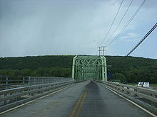 Route 103 crossing over the Mohawk River in Rotterdam
To avoid or reduce Thruway tolls, motorists from communities such as Amsterdam, Johnstown and Gloversville often would use NY 5 with its four-lane route. NY 5S could be used, but its limitations include being only two-lanes, and having a lower speed limit in Pattersonville. At NY 103, there was an option: Continue on NY 5 and drive the village streets of Scotia or use NY 103 to cut to 5S and I-890. As a result, from Rotterdam Junction to I-890, there was often a high volume of traffic for the two-lane road. Adding a complication was that the bridge on NY 103 had a steel deck, which was slippery when wet and always a danger to motorcycles. Such a deck also reduced the weight limit of the bridge. One might actually be stopped on the bridge, as there is no traffic signal at NY 5S.
With the completion of the NY 890 bridge over the Mohawk River, NY 103 ceased to have the same importance as before. It was temporarily closed, and the bridge was reconstructed to have its current concrete deck. Today, NY 103 remains and is the only access to Lock 9 of the Erie Canal, with its picnic and fishing area.
Major intersections
The entire route is in Schenectady County.
Location Mile[3] Destinations Notes Town of Rotterdam 0.00 NY 5SHamlet of Rotterdam Junction Glenville 0.50 NY 51.000 mi = 1.609 km; 1.000 km = 0.621 mi References
- ^ a b Standard Oil Company of New York (1930). Road Map of New York (Map). Cartography by General Drafting.
- ^ a b Texas Oil Company (1932). Texaco Road Map – New York (Map). Cartography by Rand McNally and Company.
- ^ a b "2008 Traffic Data Report for New York State" (PDF). New York State Department of Transportation. June 16, 2009. p. 237. https://www.nysdot.gov/divisions/engineering/technical-services/hds-respository/NYSDOT_Traffic_Data_Report_2008.pdf. Retrieved January 10, 2010.
- ^ Rotterdam Junction; New York State Bicycle Route 5 (New York State Department of Transportation)
- ^ Yahoo! Inc. Yahoo! Maps – overview map of NY 103 (Map). Cartography by NAVTEQ. http://maps.yahoo.com/#mvt=m&lat=42.876151&lon=-74.044971&zoom=16&q1=42.874578%2C-74.046302&q2=42.879956%2C-74.040122. Retrieved November 1, 2008.
External links
Categories:- State highways in New York
- Transportation in Schenectady County, New York


Wikimedia Foundation. 2010.