- Namaklwe
-
Namaklwe — Village — Location in Burma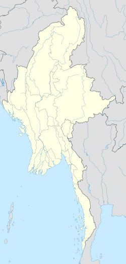
 Namaklwe
Coordinates: 19°48′24″N 98°56′30″E / 19.80667°N 98.94167°ECoordinates: 19°48′24″N 98°56′30″E / 19.80667°N 98.94167°E Country  Burma
BurmaState Shan State District Loilen District Township Mong Ton Township Time zone MST (UTC+6.30) Namaklwe is a village near the Burma-Thai border in Mong Ton Township of Shan State in eastern Burma. It lies along National Highway 45 which connects it to Mong Ton in the north and leads into Thailand, just to the south.[1][2] It has been a site of conflict when the Burma Frontier Force once gunned down Siamese invaders at Namaklwe. [3]
References
- ^ Google Maps. Maps (Map).
- ^ Microsoft and Harris Corporation Earthstar Geographics LLC. Bing Maps (Map).
- ^ Astor, Gerald (2004). The jungle war: mavericks, marauders, and madmen in the China-Burma-India theater of World War II. J. Wiley & Sons. p. 56. ISBN 978-0-471-27393-6. http://books.google.com/books?id=z_1mAAAAMAAJ. Retrieved 28 September 2011.
External links
Capital: Mong TonA-wu • Ho-yawt • Hpya-hsumhkam • Hpya-hsumhkam • Hsā-lā-taw • Hsenhkip • Hsenhpam • Hsonghka-lè • Hsongsaka • Hsuphāng • Hwe-hsanhsinmaw • Hwè-möng • Hwè-pa-lai (20°18'31"N 98°58'9"E) • Hwè-pa-lai (20°17'41"N 98°58'50"E) • Kang Noi • Kiu-kaw • Kiu-menglöng • Maklu-la • Mānkea-li • Mawkhkamhpu • Möng Hang • Möng Htön • Möng It • Möng Kyawt (19°57'9"N 98°44'38"E) • Möng Kyawt (19°56'53"N 98°44'53"E) • Möng Ton • Mönhkam-u • Na-hpakhi • Namaklwe • Nā-mo • Pānghpak • Ponghkai • Pū-nā-sai • Pūngpa-hkyem • Tā Sawktaw • Tuntawng • Wān Awnglawng • Wān Hāngna • Wān Hāngnawng (20°3'26"N 99°0'28"E) • Wān Hāngnawng (20°3'0"N 98°58'0"E) • Wān Hawnglen • Wān Hkamhai • Wān Hkè • Wān Hkom • Wān Ho-hwè • Wān Ho-nā-liu • Wān Ho-pāng • Wān Ho-sai (20°11'0"N 98°58'0"E) • Wān Ho-sai (20°10'47"N 99°0'31"E) • Wān Hpakkum • Wān Hpya • Wān Hpya-hpom • Wān Hsai-len • Wan Hsa-la • Wān Hsanghpaw • Wān Hsè • Wān Hsenhkamwang • Wān Hsöngngön • Wān Hsuphsān • Wān Hsuphsim • Wān Hsupnam • Wān Hsupsai • Wān Htāngnammān • Wān Hwè-aw • Wān Hwè-hkit • Wān Hwè-hpakkut • Wān Hwè-hsan • Wān Hwè-hum • Wān Hwè-mi • Wān Kang • Wān Kawngmè-salan (20°3'8"N 99°0'47"E) • Wān Kawngme-salan (20°3'0"N 98°58'0"E) • Wān Kawpa • Wān Konghai • Wān Ksengae-lo • Wān Langkwai • Wān Loi • Wān Loi-hpakmān • Wān Loi-htwe • Wān Longhpakhpit • Wān Longtawng • Wān Mākhkangnoi (20°4'0"N 98°58'0"E) • Wān Mākhkangnoi (20°3'26"N 99°0'2"E) • Wān Mākho • Wān Māksawk • Wān Mau (20°17'0"N 98°54'0"E) • Wān Maü (19°57'13"N 98°45'7"E) • Wān Mèhai • Wān Mè-hong • Wān Mè-kin • Wān Me-lawng • Wān Mèsai • Wān Me-sai • Wān Mè-salin • Wān Mōng Sit • Wān Na • Wān Nā-kawngmu • Wān Nā-liu • Wān Nam-hu (20°4'0"N 98°58'0"E) • Wān Nam-hu (20°3'47"N 99°0'35"E) • Wān Nāmhu • Wān Namhū-omhkom • Wān Namyūm • Wān Nā-niu • Wān Nā-pā-kao (20°13'10"N 98°59'55"E) • Wān Nā-pa-kao (20°13'3"N 99°2'22"E) • Wān Nawnghoi • Wān Nawnglen • Wān Pā-hsak (20°13'0"N 98°59'0"E) • Wān Pā-hsak (20°12'50"N 99°1'40"E) • Wān Pā-neng • Wān Pangkā-tawm • Wān Pāngkaw • Wān Pāngkeng • Wān Pāngpao • Wān Pawmöng (20°7'0"N 98°48'0"E) • Wān Pawmöng (20°6'0"N 98°43'0"E) • Wān Pa-yong • Wān Pong (20°32'0"N 98°58'0"E) • Wān Pong (20°22'0"N 98°52'0"E) • Wān Ponghan • Wān Pu-mao • Wan Püng-hüng • Wān Pūngnamhsaü • Wãn Sa-le • Wān Sa-mè • Wān Tā-hsamngok • Wān Tā-na • Wān Tawnghsawk • Wān Tinloi • Wān Tunhong • Wān Yang • Wat-hek • Wengloi • Yanghkam • Ye-ling
Categories:- Shan State geography stubs
- Populated places in Loilen District
- Mong Ton Township
- Burma–Thailand border crossings

Wikimedia Foundation. 2010.