- Natashquan, Quebec (reserve)
-
Natashquan — Reserve — 
 Natashquan
Coordinates: 50°08′N 61°48′W / 50.133°N 61.8°WCoordinates: 50°08′N 61°48′W / 50.133°N 61.8°W Country  Canada
Province  Quebec
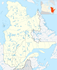
Region Côte-Nord Regional county none Settled Formed 1953 Government[1] - Chief François Bellefleur - Federal riding Manicouagan - Prov. riding Duplessis Area[2] - Land 0.65 km2 (0.3 sq mi) Population (2006)[2] - Total 810 - Density 1,246.5/km2 (3,228.4/sq mi) Time zone Within the AST legislated time zone boundary but observes EST [3] (UTC-5) - Summer (DST) EDT (UTC-4) Postal Code G0G 2E0 Area code(s) 418 and 581 Natashquan (officially Natashquan 1 and known in Innu as Nutashkuan) is a First Nations reserve in the Canadian province of Quebec, belonging to the Natashquan Innu band. The reserve is located on the north shore of the Gulf of Saint Lawrence at the mouth of the Natashquan River, 336 kilometres (209 mi) east of Sept-Îles and has been accessible by Route 138 since 1996.
The reserve should not be confused with the adjacent but distinct township of Natashquan just to the north and east.
The community is serviced by a nursing station, community radio station, municipal water and sewer system, fire station, and an aboriginal police force.[4]
The site was mapped in 1684 by Louis Jolliet who called it Noutascoüan. It was subsequently spelled as Nontascouanne (1734), Natasquan (1831), Nataskwan (1844), Natashkwan (1846), Natosquan (1857), Nataskouan (1858), and taking its current form, Natashquan, circa 1895. This name, spelled Nutahkuant or Nutashkuan in the contemporary Innu language, is usually translated as "where the black bear is taken" or "where one hunts for bear."[5]
Contents
History
Historically, the nomadic Innu lived on their hunting grounds of the interior during the winter and would move to the coast in the summer for salmon fishing and seal hunting. From as early as 1710, a trading post was established on the left (south) bank of the Natashquan River and later on the opposite bank to conduct fur trade with the indigenous. They gathered at the post during their annual migration and began to settle there permanently. The post was acquired by the Hudson's Bay Company in the middle of the 19th century, but abandoned circa 1914 due to lack of profitability.[5][6]
In 1909, the first land survey was conducted for the creation of a reserve. In 1952, the first 20.5 acres (83,000 m2) of land were bought by the Government of Canada and transferred for the use by the Innu on March 31, 1953. The reserve was incrementally enlarged in 1954, 1970, and 1993.[7]
Demographics
As of December 2009, the band counted 984 members, of which 920 persons lived on the reserve.[4] There are 177 private dwellings that are occupied by usual residents, out of a total of 181. The mother tongue of the residents is:[2]
- English as first language: 0 %
- French as first language: 1.9 %
- English and French as first language: 0 %
- Other as first language: 98.1 %
Population trend:[8]
- Population in 2006: 810 (2001 to 2006 population change: 6.4 %)
- Population in 2001: 761
- Population in 1996: 639
- Population in 1991: 598
Climate
Climate data for Natashquan Month Jan Feb Mar Apr May Jun Jul Aug Sep Oct Nov Dec Year Record high °C (°F) 8.2
(46.8)6.7
(44.1)12.8
(55.0)17.8
(64.0)23.9
(75.0)26.4
(79.5)28.9
(84.0)28.3
(82.9)26.1
(79.0)19.4
(66.9)14.4
(57.9)9.4
(48.9)28.9
(84.0)Average high °C (°F) −7.9
(17.8)−7.2
(19.0)−2
(28)3.3
(37.9)9.6
(49.3)15.2
(59.4)18.7
(65.7)18
(64)13.8
(56.8)7.9
(46.2)2
(36)−4.8
(23.4)5.5 Average low °C (°F) −19.1
(−2.4)−18.2
(−0.8)−12
(10)−4.1
(24.6)−1
(30)6.3
(43.3)10.3
(50.5)9.5
(49.1)5.3
(41.5)0
(32)−5.7
(21.7)−14.5
(5.9)−3.4 Record low °C (°F) −42.8
(−45.0)−37.2
(−35.0)−33.7
(−28.7)−22.5
(−8.5)−12.8
(9.0)−3.9
(25.0)1.1
(34.0)−1.1
(30.0)−7.8
(18.0)−15
(5)−31.7
(−25.1)−35
(−31)−42.8
(−45.0)Precipitation mm (inches) 95.7
(3.768)67.4
(2.654)95.2
(3.748)81.7
(3.217)88.6
(3.488)86.2
(3.394)99
(3.9)96
(3.78)100.5
(3.957)107.9
(4.248)106.4
(4.189)105.3
(4.146)1,129.8
(44.48)Source: Environment Canada[9] Economy
Natashquan's economy is mostly based on arts and handicrafts, trapping, tourism, and some construction, transport, and commercial fishing. In all there are some 20 businesses on the reserve. The Band council owns a boat and holds a crab-fishing licence.[4]
Local economic development is promoted by and the responsibility of the Corporation de développement économique de Natashquan.
Education
There is only one school on the reserve, École Uauitshitun, that provides pre-Kindergarten to Secondary grade 3.[4]
References
- ^ Ministère des Affaires Municipales, Régions et Occupation du territoire - Répertoire des municipalités: Natashquan réserve indienne
- ^ a b c Statistics Canada 2006 Census - Natashquan (indian reserve) community profile
- ^ National Research Council Canada - Time Zones & Daylight Saving Time
- ^ a b c d "Natashquan First Nation". Aboriginal Community profiles. Indian and Northern Affairs Canada. http://www.ainc-inac.gc.ca/ai/scr/qc/aqc/prof/Natashquan-eng.asp. Retrieved 2010-09-15.
- ^ a b "Natashquan (Réserve indienne)" (in French). Commission de toponymie du Québec. http://www.toponymie.gouv.qc.ca/ct/ToposWeb/fiche.aspx?no_seq=43498. Retrieved 2010-09-15.
- ^ "Natashquan (Municipalité de canton)" (in French). Commission de toponymie du Québec. http://www.toponymie.gouv.qc.ca/ct/ToposWeb/fiche.aspx?no_seq=43497. Retrieved 2010-09-15.
- ^ Natural Resources Canada - Legal Surveys Division, Historical Review - Natashquan land title history
- ^ Statistics Canada: 1996, 2001, 2006 census
- ^ Environment Canada Canadian Climate Normals 1971–2000, accessed 27 July 2009
External links
- Conseil tribal Mamuitun - Nutashkuan
- Indian and Northern Affairs Canada - Aboriginal Community profiles: Natashquan First Nation

Natashquan Twp. Jacques Cartier Strait (Natashquan Bay) 
Natashquan Twp.  Natashquan reserve

Natashquan River / Côte-Nord-du-Golfe-du-St-Laurent Labrador communities Natuashish (Naskapi) • Sheshatshiu
Quebec communities Betsiamites (Pessamit) • Essipit • Kawawachikamach (Naskapi) • Lac-John • Mashteuiatsh • Matimekosh • Mingan (Ekuantshit) • Natashquan (Nutashkuan) • Pakuashipi • La Romaine (Unamenshipit) • Uashat-MaliotenamSee also: Category:Innu, Naskapi Administrative divisions of Côte-Nord (Region 09)Regional county municipalities
and equivalent territoriesLa Haute-Côte-Nord · Le Golfe-du-Saint-Laurent · Manicouagan · Sept-Rivières · Caniapiscau · Minganie
Municipalities Forestville · Baie-Comeau · Sept-Îles · Port-Cartier · Havre-Saint-Pierre · Fermont · Schefferville
Administrative divisions of Quebec Categories:- Innu communities in Quebec
- Communities in Côte-Nord
- Hudson's Bay Company trading posts


Wikimedia Foundation. 2010.