- List of National Historic Sites of Canada in Ontario
-
This is a list of National Historic Sites of Canada (French: Lieux historiques nationaux du Canada) in the province of Ontario. There are 263 sites designated in Ontario,[1] of which 37 are administered by Parks Canada.[2] Of all provinces and territories, Ontario has the greatest number of National Historic Sites, and the largest number under Parks Canada administration, with a dense concentration in southern Ontario. The five largest clusters are listed separately:
-
- · List of National Historic Sites in Hamilton
- · List of National Historic Sites in Kingston
- · List of National Historic Sites in Niagara Region
- · List of National Historic Sites in Ottawa
- · List of National Historic Sites in Toronto
This list uses names designated by the Historic Sites and Monuments Board of Canada, which may differ from other names for these sites.
National Historic Sites
Site [3] Date(s) Designated [3] Location Description Image Adelaide Hunter Hoodless Homestead [4][5] 1839 (completed) 1995 Brant County
43°01′54″N 80°20′20″W / 43.031608°N 80.338898°WThe childhood home of activist and organizer Adelaide Hunter Hoodless, educational reformer and co-founder of the Women's Institute, the National Council of Women of Canada and the Victorian Order of Nurses Algoma Central Engine House [6] 1912 (completed) 1992 Sault Ste. Marie
46°31′41.38″N 84°21′1.94″W / 46.5281611°N 84.3505389°WA well-preserved example of a brick engine house, and the first in Canada to have an internal turntable Algonquin Provincial Park [7] 1893 (established) 1992 Nipissing - Unorganized South Part (primarily)
45°35′03″N 78°21′30″W / 45.58417°N 78.35833°WThe first provincial park in Canada, noted for its pionering role in park management, visitor interpretation programs and the development of park buildings and structures, as well as its role in inspiring artists such as the Group of Seven 
Amherstburg Navy Yard [8] 1796 (established) 1928 Amherstburg
42°6′6.78″N 83°6′45.21″W / 42.1018833°N 83.1125583°WThe site of a Royal Navy shipyard from 1796–1813, which served as the hub of the British naval presence on the upper Great Lakes Annandale House/Tillsonburg Museum [9][10] 1882 (completed) 1997 Tillsonburg
42°51′45″N 80°43′18″W / 42.8625°N 80.72167°WOne of the best surviving illustrations in Canada of the Aesthetic Movement and the movement's major impact on domestic architecture in Canada 
Backhouse Grist Mill [11] 1798 (completed) 1998 Norfolk County
42°38′34″N 80°28′29″W / 42.6427°N 80.4748°WOne of the few gristmills in this region not to be burned during the War of 1812, it is one of the oldest and best preserved examples in Canada of the small-scale, water-powered establishments found throughout the country in the 19th and early 20th centuries Banting House [12] 1900 (completed) 1997 London
42°59′23.85″N 81°13′54.46″W / 42.9899583°N 81.2317944°WA yellow-brick house recognized as the site of the defining moment in the discovery of insulin by Frederick Banting 
Barnum House [13] 1820 (completed) 1959 Grafton
43°59′39.97″N 78°0′57.2″W / 43.9944361°N 78.015889°WA noted example of Neoclassic domestic architecture as brought to Canada by settlers from New England 
Battle Hill [14] 1814 (battle) 1924 Southwest Middlesex
42°41′39″N 81°42′18″W / 42.69417°N 81.705°WThe site of the Battle of Longwoods during the War of 1812 Battle of Crysler's Farm [15] 1813 (battle) 1920 South Dundas
44°56′31.12″N 75°04′12.62″W / 44.9419778°N 75.0701722°WThe site of a victory by badly outnumbered British troops in the War of 1812, prompting the American forces to abandon the St. Lawrence Campaign; the original battle site was submerged in 1958 by the construction of the Saint Lawrence Seaway, so the 1895 monument was relocated to its current location in Crysler’s Farm Battlefield Park near Upper Canada Village 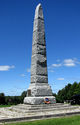
Battle of the Windmill [16] 1838 (battle) 1920 Prescott
44°43′15″N 75°29′14″W / 44.7209°N 75.4871°WThe site a battle fought during the Upper Canada Rebellion, whereby Loyalist forces defeated an invasion attempt by Hunter Patriot insurgents based in the United States 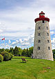
Beechcroft and Lakehurst Gardens [17] 1870 (ca.) (established) 1978 Roches Point
44°16′24″N 79°30′11″W / 44.273312°N 79.503025°WGardens reportedly designed by Frederick Law Olmsted Bell Homestead [18] 1858 (completed) 1996 Brantford
43°06′29″N 80°16′15″W / 43.107918°N 80.270837°WThe first home of Alexander Graham Bell in North America, it is associated with the conception of and early long-distance trials of the telephone 
Belle Vue [19] 1819 (completed) 1959 Amherstburg
42°5′35.6″N 83°6′45.99″W / 42.093222°N 83.112775°WA two-storey, white painted, brick house constructed for the Deputy Assistant Commissary General of the garrison at Fort Malden, ranking among the finest examples of Palladian architecture in Canada Belleville Railway Station (Grand Trunk) [20][21] 1856 (completed) 1973 Belleville
44°10′44.41″N 77°22′29.05″W / 44.1790028°N 77.3747361°WA railway station representative of the larger stations erected for the newly-formed Grand Trunk Railway along the key Toronto to Montreal line during the mid-19th century, it is the oldest continuously operating passenger train station in Canada 
Bethune Memorial House [22] 1880 (completed) 1996 Gravenhurst
44°55′13.45″N 79°22′34.09″W / 44.9204028°N 79.3761361°WThe birthplace of Dr. Norman Bethune 
Bethune-Thompson House / White House [23] 1805 (completed) 1966 Williamstown
45°08′38″N 74°34′29″W / 45.143798°N 74.574788°WA noted early Ontario home, representative of the design and construction techniques from the period; portions date to the 1780s when Loyalist Peter Ferguson settled on the site, but the main structure was built in 1805 as a manse for Reverend John Bethune, the first Presbyterian minister in Upper Canada and was later the residence of explorer David Thompson Billy Bishop Boyhood Home [24] 1884 (completed) 2002 Owen Sound
44°33′59″N 80°56′51.5″W / 44.56639°N 80.947639°WThe birthplace and childhood home of First World War flying ace Billy Bishop 
Bois Blanc Island Lighthouse and Blockhouse [25] 1837 (lighthouse completed), 1839 (blockhouse completed) 1955 Bois Blanc Island
42°5′16.17″N 83°7′11.48″W / 42.087825°N 83.1198556°WThe site of the attack by Canadian rebels and their American supporters in January 1838 during the Upper Canada Rebellion; in response to the raid, the blockhouse was built to complement the reconstructed Fort Malden Bridge Island / Chimney Island [26][27] 1814 (blockhouse completed) 1936 Front of Yonge
44°28′7.11″N 75°50′4.21″W / 44.4686417°N 75.8345028°WFormerly the site of a naval station during the War of 1812 Buxton Settlement [28] 1849 (established) 1999 Chatham-Kent
42°18′20.4″N 82°13′13.5″W / 42.305667°N 82.220417°WA community founded by abolitionist Reverend William King, 15 former American slaves, and an association which included James Bruce, 8th Earl of Elgin, then the Governor General of Canada, to create a haven for fugitive slaves escaping via the Underground Railroad Canadian Car & Foundry [29] 1912 (completed) 2009 Thunder Bay
48°21′25.37″N 89°18′20.42″W / 48.3570472°N 89.3056722°WLocated within the Bombardier Transportation facility, the historic complex was the main plant of Canada's largest aircraft manufacturer during the Second World War, with 10% of the world's production of the Hurricane built there; representative of the wartime contributions made by women workers and of the country's post-war mass-transit manufacturing industry 
Canal Lake Concrete Arch Bridge [30] 1905 (completed) 1988 Bolsover
44°33′29.91″N 79°2′46.02″W / 44.5583083°N 79.0461167°WA bridge spanning the Trent-Severn Waterway, it is the earliest known reinforced concrete bridge in Canada Carrying Place of the Bay of Quinte [31] 1787 (treaty negotiated) 1929 Carrying Place
44°2′54.77″N 77°34′58.35″W / 44.0485472°N 77.582875°WThe location where Sir John Johnson and Chiefs of the Mississauga negotiated a treaty ceding a river and portage route between Lake Ontario and Lake Huron 
Castle Kilbride [32] 1877 (completed) 1993 Baden
43°24′15″N 80°40′17″W / 43.40417°N 80.67139°WAn Italianate villa, the former residence of the "Flax and Oil King of Canada" James Livingston, known for its interior decorative mural paintings 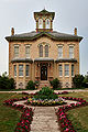
Chiefswood [33][34] 1856 (completed) 1953 Six Nations of the Grand River First Nation
43°6′3.88″N 80°5′41.88″W / 43.1010778°N 80.0949667°WItalianate-style birthplace of poet E. Pauline Johnson 
Christ Church, Her Majesty's Chapel Royal of the Mohawk [35] 1843 (completed) 1995 Deseronto
44°11′08″N 77°04′24″W / 44.185535°N 77.073405°WA historic chapel linked with establishment of Mohawk nation in Ontario; one of only two Royal chapels in Canada, representing the historic alliance between the British Crown and the Mohawk peoples 
Claverleigh [36] 1871 (completed) 1990 Creemore
44°19′4.85″N 80°6′7.84″W / 44.3180139°N 80.1021778°WA noted example of a Gothic Revival-style wood villa Cliff Site [37] 1670 (event) 1919 Port Dover
42°47′8.13″N 80°11′46.72″W / 42.7855917°N 80.1963111°WMarked by a large memorial cross, the site where two Sulpician priests, François Dollier de Casson and René de Bréhant de Galinée, laid claim to the north shore of Lake Erie in the name of France Cobalt Mining District [38] 1903 (established) 2002 Cobalt
47°23′51.34″N 79°40′27.67″W / 47.3975944°N 79.6743528°WA cultural landscape comprising buildings and structures associated with early 20th-century silver mining and urban settlement, once one of the largest silver producing areas in the world 
Cox Terrace [39][40] 1884 (completed) 1991 Peterborough
44°18′13.56″N 78°19′34.4″W / 44.3037667°N 78.326222°WA noted example of a residential terrace built in the Second Empire style 
Cummins Pre-contact Site [41] 1981 Thunder Bay Extensive late Paleo-Indian quarry Darlingside [42] 1840 1992 Leeds and the Thousand Islands
44°22.097′N 75°58.159′W / 44.368283°N 75.969317°WWood depot on St. Lawrence River Donaldson Site [43] 500 BC - 300 AD 1982 Chippewa Hill Aboriginal archaeological site Ermatinger House [44] 1823 (completed) 1957 Sault Ste. Marie
46°30′22.53″N 84°19′28.66″W / 46.5062583°N 84.3246278°WA stone house believed to be the oldest surviving house in Northwestern Ontario, it was built by Charles Oakes Ermatinger, an active partner of the North West Company, and was used as a temporary headquarters by Garnet Wolseley, 1st Viscount Wolseley during the Red River Expedition 
Etharita Site [45] 1647–49 1982 Duntroon The main village of the Wolf Tribe of the Petun Fairfield on the Thames [46] 1792 (established), 1813 (destroyed) 1945 Chatham–Kent
42°37′55.77″N 81°52′11.03″W / 42.6321583°N 81.8697306°WThe site of the original village of Fairfield, founded in 1792 by Aboriginal refugees and Moravian missionaries who came to Canada from Ohio, fleeing persecution in the United States after refusing to take sides during the American Revolutionary War; the village was destroyed in 1813 by American invaders during the War of 1812, when the inhabitants were accused of sheltering British officers 
First Commercial Oil Field [47] 1858 (discovery of oil) 1925 Oil Springs
42°47′0.3″N 82°7′0.38″W / 42.783417°N 82.1167722°WThe site of the first commercial oil well in the world, the first drilled well in Canada, the first gumbeds that were commercially used in the world, and the first gas gusher in Canada Forbes Textile Mill [48] 1863 (established) 1989 Cambridge
43°25′39″N 80°19′13″W / 43.427510°N 80.320160°WA wool mill that was, for a time in the early decades of the twentieth century, the largest woollen and worsted mill in Canada Former Almonte Post Office [49][50] 1891 (completed) 1983 Almonte
45°13′31.95″N 76°11′42.51″W / 45.2255417°N 76.1951417°WA stone post office with a steep gabled roof and central clock tower; designed by Thomas Fuller, the building has undergone no major exterior alterations, so remains an excellent representative example of early multi-use federal buildings in small communities 
Former Brockville Post Office [51] 1886 (completed) 1983 Brockville
44°35′23.32″N 75°41′5.58″W / 44.5898111°N 75.6848833°WA stone post office, blending Flemish, Queen Anne and classical elements; a good example of the post offices erected by the Department of Public Works in smaller urban centres during Thomas Fuller's term as Chief Dominion Architect 
Former Elora Drill Shed [52] 1865 (completed) 1989 Elora
43°40′48.2″N 80°25′44.01″W / 43.680056°N 80.4288917°WA good representative example of the early stage in drill hall construction in Canada (when rural militia units, rather than the Department of Defence, were responsible for their construction), noted for its classical proportions, the fanlight over the door and the oculus in the gable Former Galt Post Office [53] 1887 (completed) 1983 Cambridge
43°21′30.08″N 80°18′55.99″W / 43.3583556°N 80.3155528°WA limestone-clad post office, blending elements of Romanesque Revival, Gothic Revival and Second Empire architectural styles; representative of small urban post offices designed by Thomas Fuller 
Former Port Perry Town Hall [54] 1873 (completed) 1984 Port Perry
44°6′11.87″N 78°56′50.16″W / 44.1032972°N 78.9472667°WA noted example of a municipal meeting hall; the lower hall was used for village council meetings, and the balconied opera house on the second storey served as the village's social centre Fort Malden [55] 1799 (Fort Amherstburg completed), 1815 (fort initially rebuilt) 1921 Amherstburg
42°6′27.76″N 83°6′45.52″W / 42.1077111°N 83.1126444°WBritish fort (initially known as Fort Amherstburg) that served as the principal defence of the western frontier for the period until 1813 (when it was captured and later destroyed by the Americans), and also served as an important fortification during the border raids associated with the Upper Canada Rebellion in 1837-38 
Fort Norfolk (Turkey Point)[56][57][58] 1814 (completed) 1925 Norfolk County
42°41′57.86″N 80°19′29.9″W / 42.6994056°N 80.324972°WThe site of a British military and naval post between 1814 and 1815; abandoned shortly after the War of 1812 Fort Sainte Marie II [59] 1649 (established) 1920 Christian Island
44°49′26.98″N 80°9′51.24″W / 44.8241611°N 80.1642333°WA Jesuit mission to the Huron-Wendat 1649-50; in 1651, remaining Huron-Wendat made their last stand against the Iroquois from this mission before fleeing to Quebec Fort St. Joseph [60] 1796 (established) 1923 St. Joseph Island
46°03′48″N 83°56′48″W / 46.06333°N 83.94667°WBuilt as a counterpoint to an American garrison on Mackinac Island, Fort St. Joseph was the British Empire's most westerly outpost; destroyed by the Americans in 1812 when British forces left to take Fort Michilimackinac; the ruins of the fortifications and the archaeological resources on the site reveal the complex aspects of military, domestic and commercial life (both Aboriginal and European) in a frontier outpost 
Fort St. Pierre [61] 1731 (established) 1934 Fort Frances
48°37′6.19″N 93°21′36.36″W / 48.6183861°N 93.3601°WThe first French fort built west of Fort Kaministiquia by Pierre La Vérendrye in Northwestern Ontario Fort Wellington [62] 1813 (established) 1920 Prescott
44°42′46″N 75°30′31″W / 44.7129°N 75.5085°WOne of the best preserved nineteenth-century fortifications in Canada, the fort protected shipping along the St. Lawrence River during War of 1812 
Fort William [63] 1803 (established) 1923 Thunder Bay
48°20′34″N 89°21′30″W / 48.34278°N 89.35833°WImportant North West Company post, now serving as a reconstructed living history site 
François Bâby House [64] 1812 (completed) 1950 Windsor
42°19′07″N 83°02′33″W / 42.3185°N 83.0424°WDuring the War of 1812, American forces crossed the Detroit River and used the house as headquarters for their invasion; when the Americans retreated one month later, the Bâby House was occupied by British forces under Major-General Isaac Brock, who built an artillery battery on the property and used it to open fire on Fort Detroit 
Fulford Place [65] 1901 (completed) 1992 Brockville
44°35′50.24″N 75°40′14.97″W / 44.5972889°N 75.670825°WAn excellent intact example of the type of mansion erected by wealthy Canadians in the late 19th and early 20th centuries, with the general layout of the site remaining as it was originally laid out by the Olmsted Brothers 
Gillies Grove and House [66] 1937 (completed) 1993 Arnprior
45°26′41.96″N 76°21′32.22″W / 45.4449889°N 76.35895°WHouse associated with two of the most prominent forest industry families in the Ottawa Valley, the McLachlins and the Gillies; surrounded by one of the few remaining accessible woodlots containing significant stands of old growth Ottawa Valley White Pine Glanmore / Phillips-Faulkner House [67] 1937 (completed) 1969 Belleville
45°26′41.96″N 76°21′32.22″W / 45.4449889°N 76.35895°WHouse designed by architect Thomas Hanley for J.P.C Phillips, a wealthy Belleville banker and financier; an excellent representative example of the Second Empire style popular among the upper middle class in late 19th-century Canada Glengarry Cairn [68] 1840 (completed) 1921 South Glengarry
45°7′18.19″N 74°29′23.33″W / 45.1217194°N 74.4898139°WLarge cairn erected by the Glengarry militia to commemorate the services of Sir John Colborne, commander-in-chief of the armed forces during the Upper Canada Rebellion 
Glengarry House [69] 1792 (completed) 1921 Cornwall
45°2′22″N 74°37′8.75″W / 45.03944°N 74.6190972°WThe ruins of the residence of Lieutenant Colonel John Macdonell, a pioneer in the settlement of Ontario, first Speaker of the Legislative Assembly of Upper Canada, and a hero of the Battle of Queenston Heights Glengarry Landing [70] 1814 (flotilla construction) 1923 Edenvale
44°27′6.58″N 79°54′0.24″W / 44.4518278°N 79.9000667°WSite at the junction of the Nottawasaga River and Marl Creek, where in 1814 the Glengarry Light Infantry Fencibles, under the command of Lieutenant-Colonel Robert McDouall, constructed a flotilla of boats to relieve the British garrison at Fort Michilimackinac and to effect the subsequent capture of Prairie du Chien during the War of 1812 
Guelph City Hall [71] 1857 (completed) 1984 Guelph
43°32′38.7″N 80°14′51.9″W / 43.544083°N 80.24775°WA two-storey, limestone building built in the Renaissance Revival style, it is an excellent example of a multi-functional city hall, which contained the market, fire hall, police office and jail, library, a reading room, a large public hall, along with town offices and a council chamber; symbolic of Guelph's mid-19th-century confidence following the arrival of the Grand Trunk Railway in the community 
Hamilton and Scourge [72] 1813 (sinking) 1976 Lake Ontario (11 kilometres (6.8 mi) north of St. Catharines)
43°17′46.32″N 79°17′52.6″W / 43.2962°N 79.297944°WThe USS Hamilton and USS Scourge were two merchant schooners pressed into service by the Americans in the War of 1812, both of which capsized and sank in a sudden squall; the ships are in remarkable condition at the underwater wreckage site and are rare examples of surviving War of 1812 vessels 
Her Majesty's / St. Paul's Chapel of the Mohawks [73] 1785 (completed) 1981 Brantford
43°7′28.01″N 80°14′5.84″W / 43.1244472°N 80.2349556°WThe first Protestant church in Upper Canada, now the oldest surviving church in Ontario, and one of only two Royal Chapels in Canada; symbolic of the important role played by the Loyalist Mohawks in the development of the province 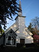
Hillary House [74] 1862 (completed) 1973 Aurora
44°0′10.09″N 79°28′7.06″W / 44.0028028°N 79.4686278°WNow operating as the Koffler Museum of Medicine, an excellent example of a Picturesque house in the Gothic Revival style Homer Watson House / Doon School of Fine Arts [75] 1834 (completed) 1980 Kitchener
43°23′41.52″N 80°25′6.58″W / 43.3948667°N 80.4184944°WOnce the home and studio of Canadian landscape artist Homer Watson; some of Watson’s most well-known works are views of the surrounding countryside from various vantage points on this property 
Homewood [76] 1801 (completed) 1982 Augusta
44°37′59.55″N 75°37′0.73″W / 44.6332083°N 75.6168694°WA two-storey fieldstone residence built for Dr. Solomon Jones, a prominent Loyalist; the house reflects the lifestyle of a prominent rural professional in the early 19th century and its design uniquely melds the Palladian style and the rural architectural traditions of nearby Quebec 
Huron County Gaol [77] 1841 (completed) 1973 Goderich
43°44′58.83″N 81°42′29.82″W / 43.749675°N 81.7082833°WA distinctive octagonal jail design in the Panopticon style of prison construction 
Inverarden House [78] 1823 (completed) 1968 Cornwall
45°01′53″N 74°40′16″W / 45.031325°N 74.671071°WBuilt for retired North West Company partner John McDonald of Garth, the manor house is an excellent early example of Regency architecture in Canada Joseph Schneider Haus [79] 1816 (completed) 1999 Kitchener
43°26′41.35″N 80°29′40.66″W / 43.4448194°N 80.4946278°WA house museum associated with the migration of German Mennonites from Lancaster County, Pennsylvania to Waterloo County in the early 19th century, and illustrative of the typical Mennonite house plan from the period Kay-Nah-Chi-Wah-Nung (Rainy River Mounds) [80][81][82] 3000 BCE (ca.) 1969 Morley (Stratton)
48°38.816′N 94°05.641′W / 48.646933°N 94.094017°WOne of the most significant centres of early habitation and ceremonial burial in Canada, with evidence of 5,000 years of human habitation, including burial mounds from the Laurel and Blackduck cultures; a cultural and historic focal point for the Rainy Lake and River Bands of Saulteaux Lansdowne Iron Works [83][84] 1801 (established) 1932 Leeds and the Thousand Islands
44°32′57.58″N 76°7′33.7″W / 44.5493278°N 76.126028°WThe first ironworks in Upper Canada, destroyed by fire after a decade in operation Leaskdale Manse [85] 1886 (completed) 1996 Leaskdale
44°12′11″N 79°09′38″W / 44.203097°N 79.160434°WThe home of Lucy Maud Montgomery when she wrote 11 of the 22 works published during her lifetime; the house and its immediate area figure prominently in her posthumously published journals 
Leeds and Grenville County Court House [86] 1844 (completed) 1966 Brockville
44°35′27.11″N 75°41′8.69″W / 44.5908639°N 75.6857472°WA landmark building set on a hill at the top of the historic Brockville town square; one of the most grandiose district courthouses built in Upper Canada 
Lynnwood / Campbell-Reid House [87] 1851 (completed) 1972 Simcoe
42°50′16.43″N 80°18′11.96″W / 42.8378972°N 80.3033222°WExcellent example of a modestly-sized house in the Neoclassical style; located on a rise overlooking the Lynn River Macdonell-Williamson House [88] 1819 (completed) 1969 East Hawkesbury
45°33′49.06″N 74°22′59.72″W / 45.5636278°N 74.3832556°WA stone house built on the banks of the Ottawa River as a retirement home for former North West Company partner John Macdonell 
Matheson House [89] 1840 (completed) 1966 Perth
44°54′3.92″N 76°15′2.39″W / 44.9010889°N 76.2506639°WBuilt for Roderick Matheson, a local merchant and politician, the house is a good example of an affluent, pre-Confederation residence; it occupies a key position in one of the best surviving historic streetscapes in Canada, and now serves as the Perth Museum 
Mazinaw Pictographs [90] 1982 Bon Echo Provincial Park
44°54′2.06″N 77°12′23.12″W / 44.9005722°N 77.2064222°WThe largest rock art site on the southern Canadian Shield and the only major pictograph site in Southern Ontario 
McCrae House [91][92] 1858 (ca.) (completed) 1966 Guelph
43°32′9.7″N 80°14′42.1″W / 43.536028°N 80.245028°WThe birthplace of John McCrae, the author of In Flanders Fields 
McMartin House [93] 1830 (completed) 1972 Perth
44°53′52.13″N 76°14′48.99″W / 44.8978139°N 76.2469417°WBuilt for Daniel McMartin, a member of Upper Canada's Tory Loyalist elite; an example of American federal architecture that was elaborate for the time and place of construction 
Merrickville Blockhouse [94] 1833 (completed) 1939 Merrickville–Wolford
44°55′0.54″N 75°50′16.03″W / 44.9168167°N 75.8377861°WA relatively large, British-designed blockhouse, considered an excellent example of the structures erected for the defence of the Rideau Canal in the 19th-century 
Middleport Site [95] 1953 Middleport
43°05′54″N 80°04′04″W / 43.098337°N 80.067828°WArchaeological site related to the Middle Ontario Iroquois Middlesex County Court House [96] 1829 (completed) 1955 London
42°58′55.59″N 81°15′15.65″W / 42.9821083°N 81.2543472°WA very early and nationally significant example of the Gothic Revival style in Canada; associated with the early government of the province, as the site of the building was proposed by John Graves Simcoe for the provincial capital 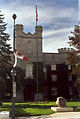
Mnjikaning Fish Weirs [97] 3300 BCE (ca.) 1982 Ramara
44°36′15.63″N 79°22′10.6″W / 44.6043417°N 79.369611°WThe site of the largest and best preserved wooden fish weirs known in eastern North America, in use from about 3300 B.C. until the recent past Moose Factory Buildings [98] 1673 (established) 1957 Moose Factory
51°16′43.21″N 80°38′21.5″W / 51.2786694°N 80.639306°W19th century buildings associated with the second Hudson's Bay Company post in Canada; after the 1821 merger with the North West Company, Moose Factory became the supply point for posts inland as far as Lake Timiskaming 
Nanticoke [99] 1813 (battle) 1924 Nanticoke
42°47′51.38″N 80°3′12.02″W / 42.7976056°N 80.0533389°WThe site where the Norfolk volunteer militia routed a band of American marauders who had been pillaging area farms and terrorizing the country, an exploit that inspired the British military forces and the people of Upper Canada during the War of 1812; now the location of the Nanticoke Generating Station Napanee Town Hall [100] 1856 (completed) 1984 Greater Napanee
44°14′54.92″N 76°57′2.48″W / 44.2485889°N 76.9506889°WAn early Ontario example of a combination town hall and market, and a rare extant example in Canada of a town hall in the Greek Revival style; symbolic of the development of local government in Ontario in the 19th century 
Nazrey African Methodist Episcopal Church [101] 1848 (completed) 1999 Amherstburg
42°6′4.89″N 83°6′21.65″W / 42.1013583°N 83.1060139°WA simple fieldstone chapel, now part of the North American Black Historical Museum complex; it has an important association with Bishop Willis Nazery, the first leader of a wholly Canadian denomination (the British Methodist Episcopal Church) founded by Underground Railroad refugees Normandale Furnace [102] 1818 (commenced operations) 1927 Normandale
42°42.585′N 80°18.593′W / 42.70975°N 80.309883°WThe site of an early 19th century Ontario iron smelter Old Hay Bay Church [103] 1792 (completed) 2001 Greater Napanee
44°6′11.45″N 77°1′1.33″W / 44.1031806°N 77.0170361°WBuilt by United Empire Loyalist settlers, it is the oldest surviving Methodist building in Canada and is associated with the role played by Methodists in Upper Canada’s early development; a significant element of the history of the United Church of Canada 
Old Stone Church [104] 1853 (completed) 1991 Beaverton
44°25′34.63″N 79°6′57.15″W / 44.4262861°N 79.115875°WA small rural fieldstone church; a particularly good example of the few early stone vernacular churches surviving in Canada Old Stone Mill [105] 1810 (completed) 1970 Delta
44°36′36.74″N 76°7′20.57″W / 44.6102056°N 76.1223806°WA three-storey stone gristmill which played an important role in the settlement and economic development of Leeds County; one of the oldest surviving mills in Ontario 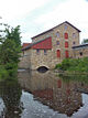
Old Woodstock Town Hall [106] 1853 (completed) 1955 Woodstock
43°7′45.77″N 80°45′26.9″W / 43.1293806°N 80.757472°WA two-storey, buff-brick, Italianate-style town hall building; an excellent example of a Canadian colonial adaptation of a British town hall 
Oro African Methodist Episcopal Church [107] 1849 (completed) 2000 Edgar
44°30′9.68″N 79°38′10.87″W / 44.5026889°N 79.6363528°WA log church with an unmarked cemetery; the last built remnant of a community of Black Canadians with United Empire Loyalist roots 
Ossossane Sites [108] 1982 Ossossane Beach Archaeological site of the principal village of Bear Clan of the Hurons Our Lady of the Immaculate Conception [109] 1888 (completed) 1990 Guelph
43°32′34.78″N 80°15′5.87″W / 43.5429944°N 80.2516306°WInfluenced by the medieval cathedrals of France, the church on a hill is an exceptional example of the Victorian High Gothic style in Canadian architecture 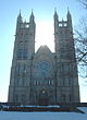
Oxford-on-Rideau Township Hall [110] 1875 (completed) 1984 Oxford Mills
44°57′45.35″N 75°40′43.16″W / 44.9625972°N 75.6786556°WA two-storey stone building with a cupola, this small town hall is representative of early local government in Canada Parkhill [111][112] 8000 BCE (ca.) 1982 Parkhill The first major Palaeo-Indian habitation site reported in Ontario, consisting of concentrations of stone artifactual material distributed over 6 hectares (15 acres) Parkwood [113] 1940 (completed) 1989 Oshawa
43°54′11.95″N 78°52′6.48″W / 43.9033194°N 78.8684667°WA residential estate developed between 1915 and 1940 by Canadian industrialist Samuel McLaughlin; among the finest and most intact surviving examples of Canadian architectural and landscape design, featuring the work of Pearson and Darling, Frances Loring, John M. Lyle, Florence Wyle and others 
Penman Textile Mill [114] 1874 (completed) 1989 Paris
43°11′51″N 80°23′23″W / 43.197577°N 80.389683°WA knitting mill complex 
Perth Town Hall [115] 1864 (completed) 1984 Perth
44°53′56.86″N 76°14′55.98″W / 44.8991278°N 76.2488833°WA two-storey stone building topped by a layered cupola with clock, symbolic of the role and importance of local government in the 19th century 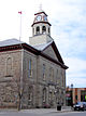
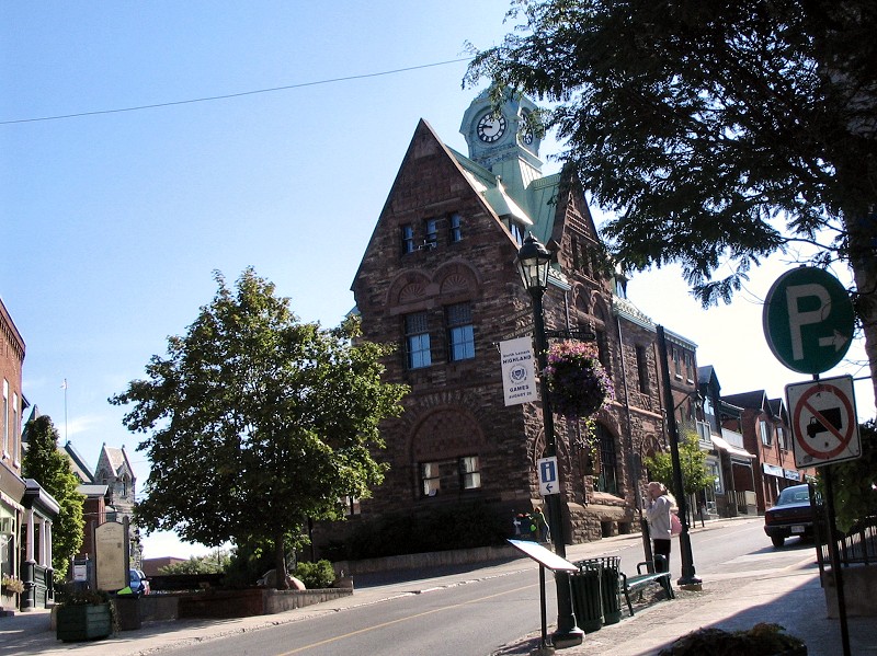
Peterborough Drill Hall / Armoury [116] 1909 (completed) 1989 Peterborough
44°18′31.16″N 78°19′20.26″W / 44.3086556°N 78.3222944°WBuilt in the Romanesque Revival style, the armoury is representative of the third phase of drill hall construction in Canada (1896–1918); one of the largest and best designed examples from the 1907-1909 period 
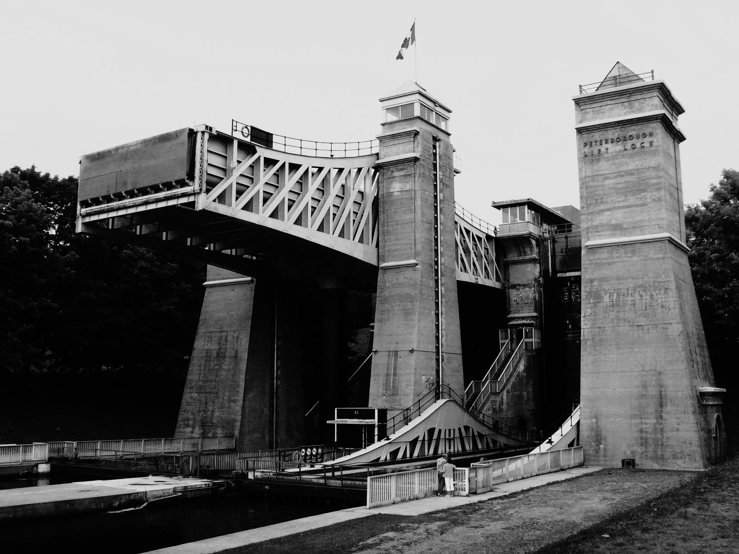
Peterborough Lift Lock [117] 1904 (completed) 1979 Peterborough
44°18′27.65″N 78°18′1.04″W / 44.3076806°N 78.3002889°WA large boat lift along the Trent-Severn Waterway designed to lift boats 19.8 metres (65 ft); it is the highest hydraulic lift lock in the world, and at the time of its construction was an engineering achievement of national and international renown 
Peterborough Petroglyphs [118] 900 to 1400 CE (ca.) 1981 Otonabee-South Monaghan
44°36′48.4″N 78°2′38.86″W / 44.613444°N 78.0441278°WAn outcrop of exposed marble inscribed with hundreds of realistic human and animal forms, as well as numerous abstract and symbolic images; one of the largest known concentrations of pre-contact petroglyphs in Canada Pic River Site [119] 1981 Pic River
48°37′34.78″N 86°17′5.66″W / 48.6263278°N 86.2849056°WA site comprising four archaeological nodes: the Pic River site, Fort Pic, the Heron Bay site, and the Duncan site, which together represent numerous Aboriginal and European occupations dating from 12000 BCE to the late 19th century Point Clark Lighthouse [120] 1859 (completed) 1966 Point Clark
44°4′22.28″N 81°45′26.37″W / 44.0728556°N 81.757325°WOne of six Imperial Towers on Lake Huron; noted for its distinctive lantern and the quality of its architecture 
Pointe au Baril [121][122] 1923 Maitland
44°38.255′N 75°36.575′W / 44.637583°N 75.609583°WThe "Iroquoise" and "Outaouaise", the last two French warships that navigated Lake Ontario, were built on this point 
Port Stanley [123] 1669 (first European contact) 1923 Port Stanley
42°39′56.99″N 81°12′43.01″W / 42.6658306°N 81.2119472°WAn important landing point for a succession of explorers and travellers of the 17th and 18th centuries, marked by a cairn commemorating events including the landing of Adrien Jolliet in 1669 (during the first descent of the Great Lakes by Europeans) and the encampment by Isaac Brock and his troops in the War of 1812 Port Talbot [124][125] 1803 (established) 1923 Port Talbot
42°38.403′N 81°21.969′W / 42.64005°N 81.36615°WFounded in 1803 by Thomas Talbot, the settlement was one of the most prosperous of its time in Upper Canada, noted for its good roads, with Talbot keeping out land speculators and securing hard-working settlers; Talbot's authoritarian control of the settlers led to his downfall at the hands of colonial authorities 
Prescott Railway Station (Grand Trunk) [126] 1855 (completed) 1973 Prescott
44°42′39.66″N 75°31′28.6″W / 44.7110167°N 75.524611°WA small, stone train station, typical of the smaller stations erected for the Grand Trunk Railway during the first construction period of the GTR line between Montreal and Brockville 
Rideau Canal [127] 1837 (completed) 1925 Ottawa to Kingston
45°25′33″N 75°41′50″W / 45.42583°N 75.69722°WBuilt for the British government by Lieutenant-Colonel John By as a defensive work in the event of war with the United States, the canal is the best preserved example of a 19th century slack water canal in North America, with most of its original structures intact 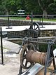
Ridout Street Complex [128] 1838 to 1870 (period of construction) 1966 London
42°59′1.27″N 81°15′17.46″W / 42.9836861°N 81.25485°WComprising three mid-19th-century residential and commercial buildings, the grouping is representative of the appearance of Ontario cities in that period and of London's early residential and commercial architecture Rosamond Woollen Mill [129] 1866 (established) 1986 Almonte
45°13′41.17″N 76°12′1.32″W / 45.2281028°N 76.2003667°WAt one time one of the largest mills in Canada, it is characteristic of late 19th-century textile mills in Canada 
Royal Flying Corps Hangars [130] 1917 (completed) 1989 Essa
44°16′8.14″N 79°53′18.45″W / 44.2689278°N 79.8884583°WEight surviving First World War hangars at CFB Borden which played a significant role in the development of military aviation in Canada Ruin of St. Raphael's Roman Catholic Church [131] 1821 (main church completed) 1996 South Glengarry
45°12′42.19″N 74°35′49.34″W / 45.2117194°N 74.5970389°WSt. Raphael’s roof, tower and interior decoration were destroyed by fire in 1970, but the ruins were preserved; one of the earliest surviving Roman Catholic monuments in English-speaking Canada 
Ruthven Park [132] 1846 (completed) 1995 Cayuga
42°58′45″N 79°52′30″W / 42.979279°N 79.875090°WAn estate with a Greek Revival villa, laid out by David Thompson; associated with the transformation of Upper Canada from a "settler" to a "settled" society Saint-Louis Mission [133] 1649 (attack) 1920 Victoria Harbour
44°43′45″N 79°46′53″W / 44.729096°N 79.781283°WA 2-hectare (4.9-acre) archaeological site, once the site of a stockaded Huron-Wendat village and nearby Jesuit mission; an Iroquois attack in 1649 led to a chain of events resulting in the abandonment of Huronia by the Huron-Wendat in 1650 
Sainte-Marie Among the Hurons Mission [134] 1639 (established) 1920 Midland
44°44′04″N 79°50′44″W / 44.734364°N 79.845420°WThe reconstructed main Jesuit mission to the Huron-Wendat; over ten years, it grew into a sizeable colony, but was abandoned in 1649 due to disease and conflict 
Sandwich First Baptist Church [135] 1851 (completed) 1999 Windsor
42°17′30.47″N 83°4′48.92″W / 42.2917972°N 83.0802556°WOne of the oldest Baptist churches surviving from this period in Ontario; representative of the churches in border settlements built to accommodate the communities created by Underground Railroad refugees 
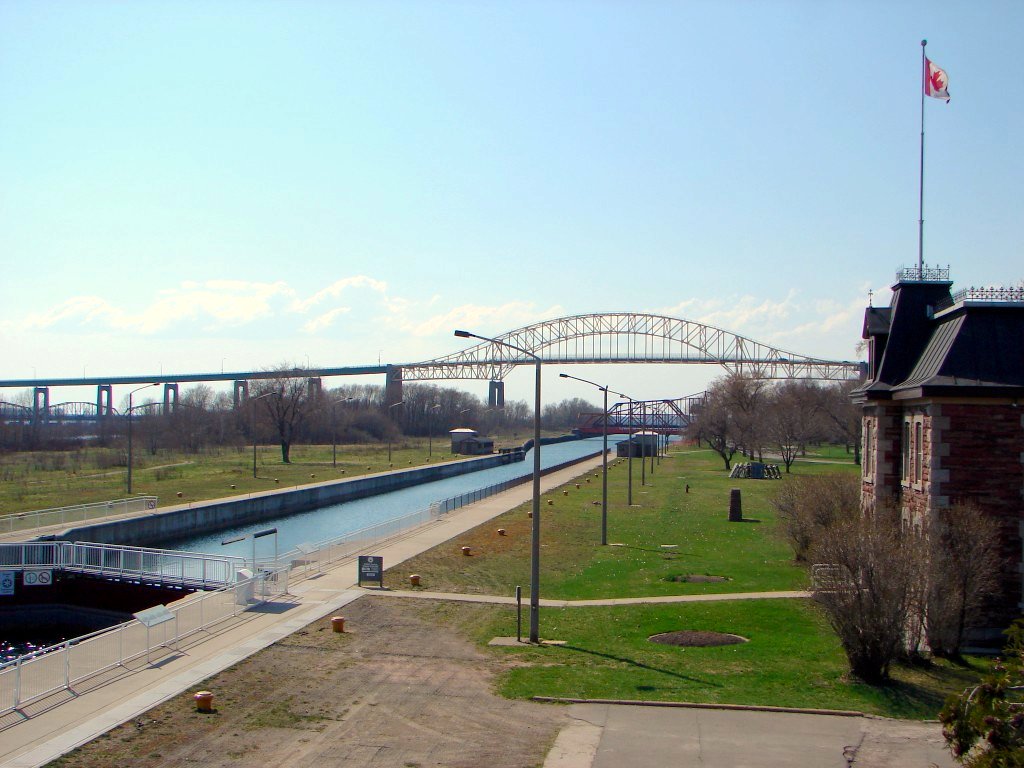
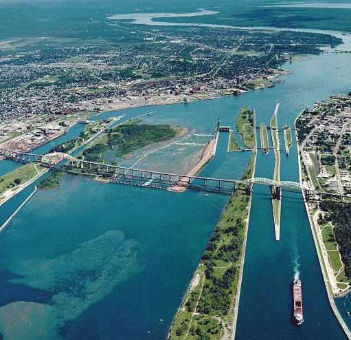
Sault Ste. Marie Canal [136] 1895 (completed) 1987 Sault Ste. Marie
46°30′46″N 84°21′05″W / 46.51278°N 84.35139°WNow operated as a recreational facility, the canal and associated works were a significant part of Canada’s national canal system at the time of their construction; the first electrically-powered lock in the world 
Serpent Mounds [137] 50 BCE to 300 CE (ca.) 1982 Keene
44°12′40″N 78°09′25″W / 44.21111°N 78.15694°WA grouping of six separate burial mounds forming a serpentine shape approximately 60 metres (200 ft) long; the only one of its kind in Canada Sharon Temple [138][139] 1831 (completed) 1990 Sharon
44°06′05″N 79°26′31″W / 44.101332°N 79.441874°WA temple built by the Children of Peace, a schismatic Quaker sect, and its design and aesthetics embody the values of the group; acquired by a local historic group in 1917, and is representative of the early heritage conservation movement in Canada 
Sheguiandah [140] 11,000 BCE (ca.) (first occupation) 1954 Manitoulin District
45°52′40.69″N 81°54′4.12″W / 45.8779694°N 81.9011444°WAn archaeological site on Manitoulin Island where successive aboriginal peoples quarried quartzite, leaving behind artifacts spanning approximately 10,000 years of occupation Sir John Johnson House [141][142] 1792 (original core completed) 1961 Williamstown
45°8′41.05″N 74°34′46.11″W / 45.1447361°N 74.579475°WA wooden house of typical 19th-century Ontario vernacular design; associated with noted Loyalist Sir John Johnson, 2nd Baronet 
Smiths Falls Bascule Bridge [143] 1913 (completed) 1983 Smiths Falls
44°53′49.97″N 76°1′37.39″W / 44.8972139°N 76.0270528°WA bascule bridge over the Rideau Canal; an early example of distinctive design in movable bridges, it is the oldest surviving structure of its type Smiths Falls Railway Station (Canadian Northern) [144] 1914 (completed) 1983 Smiths Falls
44°53′57.08″N 76°1′39.75″W / 44.8991889°N 76.0277083°WNow serving as the Smiths Falls Railway Museum, the station's distinctive turret, polygonal waiting room and substantial construction were a departure from the usual practice of building cheaply from standard plans; representative of Canadian Northern Railway's efforts to compete directly with the Canadian Pacific Railway 
Southwold Earthworks [145] 1500 (ca.)(occupation) 1923 Iona
42°40.459′N 81°21.63544′W / 42.674317°N 81.36059067°WRare and well-preserved archaeological remains of an Attawandaron fortified village 
St. Jude's Anglican Church [146] 1871 (completed) 1993 Brantford
43°08′24″N 80°15′13″W / 43.139872°N 80.253493°WA small 1871 church in the High Victorian Gothic Revival style; known for its striking interior murals, painted in 1936, influenced by the Arts and Crafts Movement and the work of William Morris St. Marys Junction Railway Station (Grand Trunk) [147] 1858 (completed) 1973 St. Marys Junction
43°16′19″N 81°07′53″W / 43.271821°N 81.131257°WA one-storey limestone building in the Italianate style which served for a time as the western terminus of the Grand Trunk Railway; representative of the Grand Trunk’s original Ontario stations, and a rare surviving stone example 
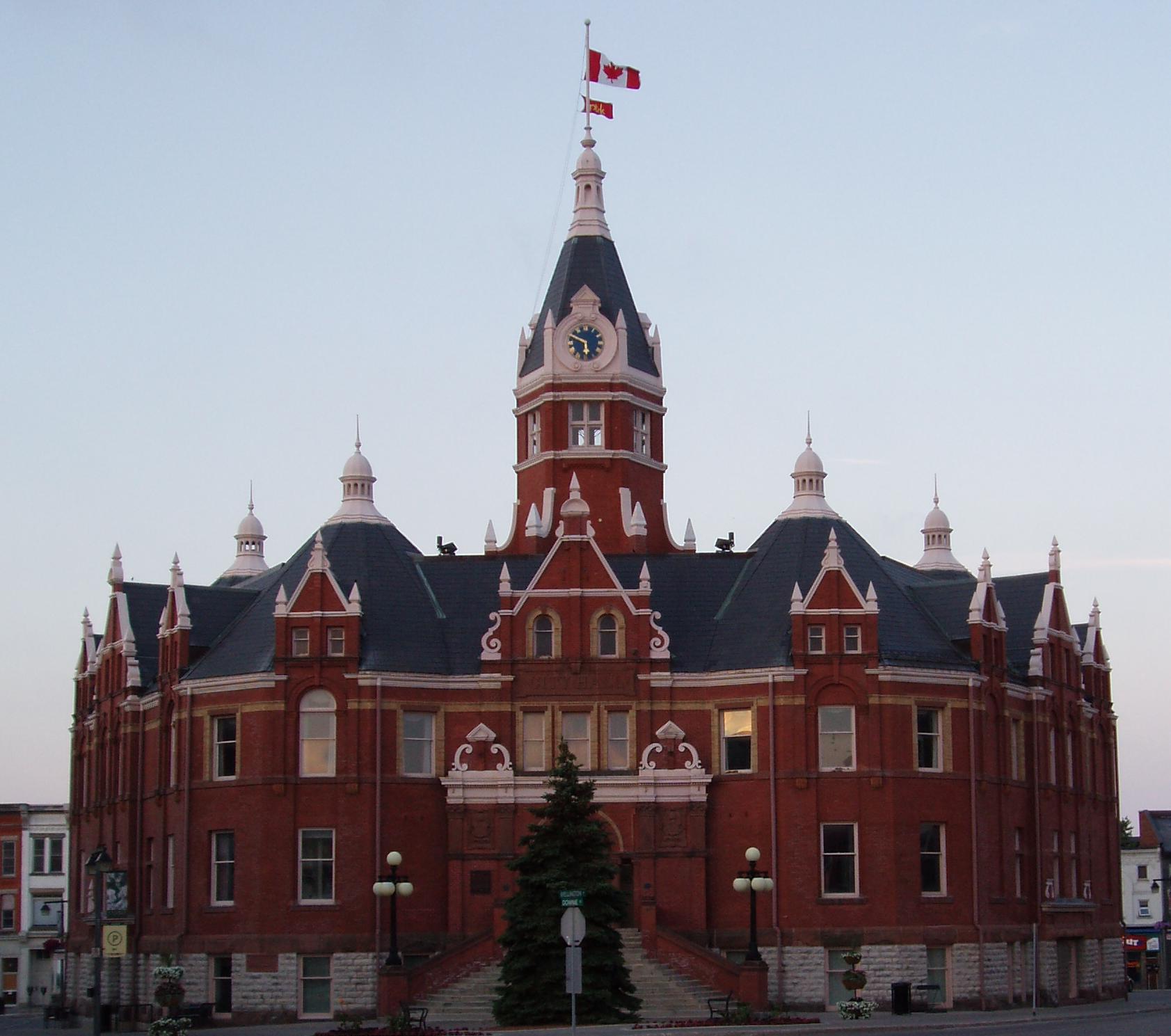
St. Thomas City Hall [148] 1899 (completed) 1984 St. Thomas
42°46′45″N 81°11′34″W / 42.779096°N 81.192723°WA well-designed late Victorian civic building with a commanding clock tower, reflective of the tremendous growth of the city at the end of the 19th century; one of the few surviving unaltered Richardsonian Romanesque town halls in Canada 
Stephen Leacock Museum / Old Brewery Bay [149] 1928 (completed) 1992 Orillia
44°36′30″N 79°23′38″W / 44.608257°N 79.393977°WA two-storey house on a four 4-hectare (9.9-acre) property on the shores of Lake Couchiching; home of and inspiration to Stephen Leacock, one of Canada's most celebrated authors and humorists 
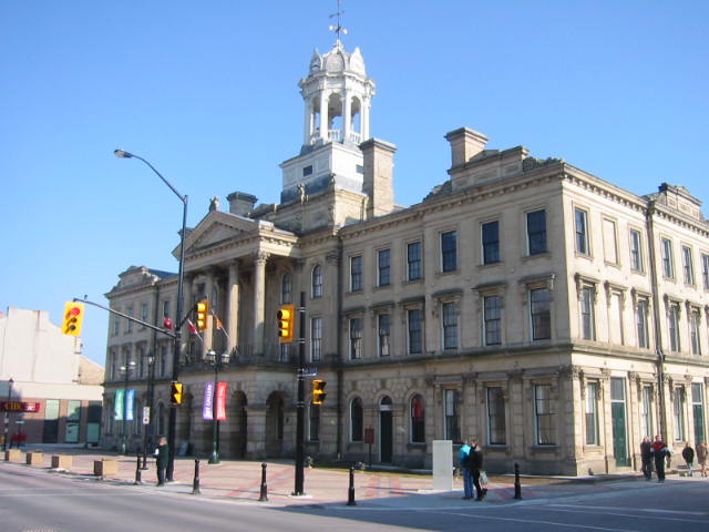
Stratford City Hall [150] 1899 (completed) 1976 Stratford
43°22′12″N 80°58′56″W / 43.369998°N 80.982188°WA monumental red brick city hall with a prominent clock tower; a noted late 19th-century Picturesque municipal building, representative of an era when growing cities sought to express their civic pride and ambition in impressive civic buildings 
Thistle Ha' Farm [151] 1852 (livestock operation began) 1973 Claremont
43°56′23″N 79°06′33″W / 43.939734°N 79.109140°WAn 80-hectare (200-acre) working farm where groundbreaking breeding of pedigree livestock in Canada occurred in the 19th century; the work undertaken here played an important role in improving stock breeding throughout the Americas Thunder Bay Tourist Pagoda [152] 1909 (completed) 1986 Thunder Bay
48°26′04″N 89°13′05″W / 48.434571°N 89.218050°WAn octagonal brick tourism bureau featuring a pagoda-shaped roof with cupola, surrounded by a verandah and with an entrance surmounted by a carved beaver; symbolic of civic boosterism and novelty architecture 
Trent–Severn Waterway [153][154] 1830 (commenced) - 1920 (completed) 1929 Trenton
44°07′15″N 77°35′29″W / 44.120826°N 77.59142°W to
Port Severn
44°48′13″N 79°43′15″W / 44.803700°N 79.720702°WA 386-kilometre (240 mi) natural and man-made waterway that links Georgian Bay to the Bay of Quinte; an important transportation route noted for the high number of surviving unmodified structures in some sections dating from the waterway's construction 
Victoria Hall / Cobourg Town Hall [155][156] 1860 (completed) 1959 Cobourg
43°57′34″N 78°10′04″W / 43.959410°N 78.167808°WA neoclassical three-storey civic building; one of the more extravagant examples of town halls constructed in Canada West after landmark municipal legislation in 1848, symbolic of the prosperity and optimism of Cobourg during the 1850s 
Victoria Hall / Petrolia Town Hall [157][158] 1889 (completed) 1975 Petrolia
42°52′52″N 82°08′49″W / 42.881198°N 82.146825°WA buff brick town hall with prominent clock tower, reflective of the time in the 1880s when Petrolia was among the wealthiest towns in Canada due to the local oil boom 
Walker Site [159] 1982 Onondaga
43°07′00″N 80°07′00″W / 43.116667°N 80.116667°WLarge Iroquoian archaeological site pertaining to the historic Attiwandaronk tribe Wellington County House of Industry and Refuge [160] 1877 (completed) 1995 Fergus
43°41′35″N 80°23′59″W / 43.693071°N 80.399773°WA former farm dominated by a two-storey Italianate-style stone building; oldest known state-supported poorhouse or almshouse in Canada, now serving as the county museum and archives 
Whitefish Island [161][162] 300 BCE (ca.) (first Aboriginal encampments) 1981 Sault Ste. Marie
46°30′40″N 84°21′14″W / 46.511°N 84.354°WA small, naturalized island that was occupied by eight successive cultures, culminating in the development of the Ojibwa nation; its location made it a focal point of pre-contact trade and settlement 
Wilberforce Red Cross Outpost [163] 1916 (completed); 1922-57 (health centre operational) 2003 Wilberforce
45°02′20″N 78°13′25″W / 45.038905°N 78.223590°WA simple frame house that served as the first outpost of the Ontario Division of the Canadian Red Cross; dedicated women provided nurse care with minimal medical backup, facilities and equipment, and the site is representative of the key role of nurses in providing health care and education in isolated areas Wintering Site [164][165] 1669–70 (event) 1919 Port Dover
42°47′41″N 80°11′22″W / 42.794624°N 80.189332°WExplorers François Dollier de Casson and René de Bréhant de Galinée and seven other Frenchmen wintered at this site - the first Europeans known to have ascended the Great Lakes to Sault Ste. Marie Wolfe Island Township Hall [166] 1859 (completed) 1984 Wolfe Island
44°11′35″N 76°26′27″W / 44.193123°N 76.440800°WA small Italianate rural town hall; an unusually sophisticated example of its type Wolseley Barracks [167] 1888 (completed) 1963 London
43°00′00″N 81°14′02″W / 43.000138°N 81.233897°WThe first purpose-built infantry training school erected by the federal government, originally used to house Company “D” of the Infantry School Corps of The Royal Canadian Regiment; an important early step in the development of a permanent military force in Canada following the withdrawal of regular British troops from Canada in 1871 Woodside [168] 1853 (completed) 1952 Kitchener
43°27′49″N 80°28′51″W / 43.463578°N 80.480722°WA one-and-a-half-storey house on a wooded estate which served as the childhood home of William Lyon Mackenzie King, the longest serving Prime Minister of Canada; the subject of many of King's writings in adult life 
See also
- History of Ontario
- Ontario Heritage Act, legislation under which heritage sites of provincial or municipal significance are designated
References
- ^ Ontario, Directory of Designations of National Historic Significance of Canada
- ^ Ontario, National Historic Sites of Canada - administered by Parks Canada
- ^ a b Directory of Designations of National Historic Significance of Canada, Parks Canada
- ^ Adelaide Hunter Hoodless Homestead. Canadian Register of Historic Places.
- ^ Homestead History, Adelaide Hunter Hoodless Homestead
- ^ Algoma Central Engine House. Canadian Register of Historic Places.
- ^ Algonquin Provincial Park. Canadian Register of Historic Places.
- ^ Amherstburg Navy Yard. Canadian Register of Historic Places.
- ^ Annandale House/Tillsonburg Museum. Canadian Register of Historic Places.
- ^ "Annandale House". Town of Tillsonburg. http://www.tillsonburg.ca/site/1251/default.aspx. Retrieved 29 July 2011.
- ^ Backhouse Grist Mill. Canadian Register of Historic Places.
- ^ Banting House. Canadian Register of Historic Places.
- ^ Barnum House. Canadian Register of Historic Places.
- ^ Battle Hill. Canadian Register of Historic Places.
- ^ Battle of Crysler's Farm. Canadian Register of Historic Places.
- ^ Battle of the Windmill. Canadian Register of Historic Places.
- ^ Beechcroft and Lakehurst Gardens, Directory of Designations of National Historic Significance of Canada
- ^ Bell Homestead. Canadian Register of Historic Places.
- ^ Belle Vue. Canadian Register of Historic Places.
- ^ Belleville Railway Station (Grand Trunk). Canadian Register of Historic Places.
- ^ "Grand Trunk Railway Belleville". Ontario's Historical Plaques. http://www.ontarioplaques.com/Plaques_GHI/Plaque_Hastings31.html. Retrieved 29 July 2011.
- ^ Bethune Memorial House. Canadian Register of Historic Places.
- ^ Bethune-Thompson House / White House. Canadian Register of Historic Places.
- ^ Billy Bishop Boyhood Home. Canadian Register of Historic Places.
- ^ Bois Blanc Island Lighthouse and Blockhouse. Canadian Register of Historic Places.
- ^ Bridge Island / Chimney Island, Directory of Designations of National Historic Significance of Canada
- ^ Chimney Island (Bridge Island), Ontario's Historical Plaques
- ^ Buxton Settlement. Canadian Register of Historic Places.
- ^ Canadian Car & Foundry. Canadian Register of Historic Places.
- ^ Canal Lake Concrete Arch Bridge. Canadian Register of Historic Places.
- ^ Carrying Place of the Bay of Quinte. Canadian Register of Historic Places.
- ^ Castle Kilbride. Canadian Register of Historic Places.
- ^ Chiefswood. Canadian Register of Historic Places.
- ^ Chiefswood, Ontario's Historical Plaques
- ^ Christ Church, Her Majesty's Chapel Royal of the Mohawk. Canadian Register of Historic Places.
- ^ Claverleigh. Canadian Register of Historic Places.
- ^ Cliff Site. Canadian Register of Historic Places.
- ^ Cobalt Mining District. Canadian Register of Historic Places.
- ^ Cox Terrace. Canadian Register of Historic Places.
- ^ "Cox Terrace 'unique and distinctive building'". Peterborough Examiner. http://www.thepeterboroughexaminer.com/ArticleDisplay.aspx?archive=true&e=715033. Retrieved 29 July 2011.
- ^ Cummins Pre-contact Site, Directory of Designations of National Historic Significance of Canada
- ^ Darlingside, Directory of Designations of National Historic Significance of Canada
- ^ Donaldson Site, Directory of Designations of National Historic Significance of Canada
- ^ Ermatinger House. Canadian Register of Historic Places.
- ^ Etharita Site, Directory of Designations of National Historic Significance of Canada
- ^ Fairfield on the Thames. Canadian Register of Historic Places.
- ^ First Commercial Oil Field. Canadian Register of Historic Places.
- ^ Forbes Textile Mill, Directory of Designations of National Historic Significance of Canada
- ^ Former Almonte Post Office. Canadian Register of Historic Places.
- ^ "Former Almonte Post Office". Ontario's Historical Plaques. http://www.ontarioplaques.com/Plaques_JKL/Plaque_Lanark28.html. Retrieved 29 July 2011.
- ^ Former Brockville Post Office. Canadian Register of Historic Places.
- ^ Former Elora Drill Shed. Canadian Register of Historic Places.
- ^ Former Galt Post Office. Canadian Register of Historic Places.
- ^ Former Port Perry Town Hall. Canadian Register of Historic Places.
- ^ Fort Malden. Canadian Register of Historic Places.
- ^ Fort Norfolk, Directory of Designations of National Historic Significance of Canada
- ^ Fort Norfolk. Canadian Register of Historic Places.
- ^ Alan L Brown. "Turkey Point". Ontario Historical Plaques. http://www.ontarioplaques.com/Plaques_MNO/Plaque_Norfolk22.html. Retrieved 13 January 2011.
- ^ Fort Sainte Marie II. Canadian Register of Historic Places.
- ^ Fort St. Joseph. Canadian Register of Historic Places.
- ^ Fort St. Pierre, Directory of Designations of National Historic Significance of Canada
- ^ Fort Wellington. Canadian Register of Historic Places.
- ^ Fort William, Directory of Designations of National Historic Significance of Canada
- ^ François Bâby House. Canadian Register of Historic Places.
- ^ Fulford Place. Canadian Register of Historic Places.
- ^ Gillies Grove and House. Canadian Register of Historic Places.
- ^ Glanmore / Phillips-Faulkner House. Canadian Register of Historic Places.
- ^ Glengarry Cairn, Directory of Designations of National Historic Significance of Canada
- ^ Glengarry House. Canadian Register of Historic Places.
- ^ Glengarry Landing. Canadian Register of Historic Places.
- ^ Guelph City Hall. Canadian Register of Historic Places.
- ^ Hamilton and Scourge. Canadian Register of Historic Places.
- ^ Her Majesty's / St. Paul's Chapel of the Mohawks. Canadian Register of Historic Places.
- ^ Hillary House. Canadian Register of Historic Places.
- ^ Homer Watson House / Doon School of Fine Arts. Canadian Register of Historic Places.
- ^ Homewood. Canadian Register of Historic Places.
- ^ Huron County Gaol. Canadian Register of Historic Places.
- ^ Inverarden House. Canadian Register of Historic Places.
- ^ Joseph Schneider Haus. Canadian Register of Historic Places.
- ^ Kay-Nah-Chi-Wah-Nung, Directory of Designations of National Historic Significance of Canada
- ^ Kay-Nah-Chi-Wah-Nung, National Register of Historic Places
- ^ "Kay-Nah-Chi-Wah-Nung". Kay-Nah-Chi-Wah-Nung: The Place of the Long Rapids. Manitou Mounds Foundation. http://www.manitoumounds.com/Kay-Nah-Chi-Wah-Nung/kncwn.html. Retrieved 9 January 2011.
- ^ Lansdowne Iron Works, Directory of Designations of National Historic Significance of Canada
- ^ Lansdowne Iron Works, Ontario Historical Plaques
- ^ Leaskdale Manse. Canadian Register of Historic Places.
- ^ Leeds and Grenville County Court House. Canadian Register of Historic Places.
- ^ Lynnwood / Campbell-Reid House. Canadian Register of Historic Places.
- ^ Macdonell-Williamson House. Canadian Register of Historic Places.
- ^ Matheson House. Canadian Register of Historic Places.
- ^ Mazinaw Pictographs. Canadian Register of Historic Places.
- ^ McCrae House. Canadian Register of Historic Places.
- ^ "McCrae House". Guelph Museums. http://guelph.ca/MuseumBlog/?page_id=78. Retrieved 13 January 2011.
- ^ McMartin House. Canadian Register of Historic Places.
- ^ Merrickville Blockhouse. Canadian Register of Historic Places.
- ^ Middleport Site, Directory of Designations of National Historic Significance of Canada
- ^ Middlesex County Court House. Canadian Register of Historic Places.
- ^ Mnjikaning Fish Weirs. Canadian Register of Historic Places.
- ^ Moose Factory Buildings. Canadian Register of Historic Places.
- ^ Nanticoke. Canadian Register of Historic Places.
- ^ Napanee Town Hall. Canadian Register of Historic Places.
- ^ Nazrey African Methodist Episcopal Church. Canadian Register of Historic Places.
- ^ Normandale Furnace, Directory of Designations of National Historic Significance of Canada
- ^ Old Hay Bay Church. Canadian Register of Historic Places.
- ^ Old Stone Church. Canadian Register of Historic Places.
- ^ Old Stone Mill. Canadian Register of Historic Places.
- ^ Old Woodstock Town Hall. Canadian Register of Historic Places.
- ^ Oro African Methodist Episcopal Church. Canadian Register of Historic Places.
- ^ Ossossane Sites, Directory of Designations of National Historic Significance of Canada
- ^ Our Lady of the Immaculate Conception. Canadian Register of Historic Places.
- ^ Oxford-on-Rideau Township Hall. Canadian Register of Historic Places.
- ^ Parkhill, Directory of Designations of National Historic Significance of Canada
- ^ Ellis, Christopher E.. "Parkhill Site". Department of Anthropology, University of Western Ontario. http://anthropology.uwo.ca/cje/Parkhill.htm. Retrieved 20 February 2011.
- ^ Parkwood. Canadian Register of Historic Places.
- ^ Penman Textile Mill, Directory of Designations of National Historic Significance of Canada
- ^ Perth Town Hall. Canadian Register of Historic Places.
- ^ Peterborough Drill Hall / Armoury. Canadian Register of Historic Places.
- ^ Peterborough Lift Lock. Canadian Register of Historic Places.
- ^ Peterborough Petroglyphs. Canadian Register of Historic Places.
- ^ Pic River Site. Canadian Register of Historic Places.
- ^ Point Clark Lighthouse. Canadian Register of Historic Places.
- ^ Pointe au Baril, Directory of Designations of National Historic Significance of Canada
- ^ Brown, Alan L. "Pointe au Baril". Ontario's Historical Plaques. http://www.ontarioplaques.com/Plaques_JKL/Plaque_Leeds61.html. Retrieved February 27, 2011.
- ^ Port Stanley. Canadian Register of Historic Places.
- ^ Port Talbot, Directory of Designations of National Historic Significance of Canada
- ^ Brown, Alan L. "Talbot Settlement". Ontario's Historical Plaques. http://www.ontarioplaques.com/Plaques_DEF/Plaque_Elgin23.html. Retrieved February 27, 2011.
- ^ Prescott Railway Station (Grand Trunk). Canadian Register of Historic Places.
- ^ Rideau Canal. Canadian Register of Historic Places.
- ^ Ridout Street Complex. Canadian Register of Historic Places.
- ^ Rosamond Woollen Mill. Canadian Register of Historic Places.
- ^ Royal Flying Corps Hangars. Canadian Register of Historic Places.
- ^ Ruin of St. Raphael's Roman Catholic Church. Canadian Register of Historic Places.
- ^ Ruthven Park. Canadian Register of Historic Places.
- ^ Saint-Louis Mission. Canadian Register of Historic Places.
- ^ Sainte-Marie Among the Hurons Mission. Canadian Register of Historic Places.
- ^ Sandwich First Baptist Church. Canadian Register of Historic Places.
- ^ Sault Ste. Marie Canal. Canadian Register of Historic Places.
- ^ Serpent Mounds. Canadian Register of Historic Places.
- ^ Sharon Temple. Canadian Register of Historic Places.
- ^ "History of the Temple". Sharon Temple: National Historic Site & Museum. Sharon Temple. http://www.sharontemple.ca/index.php?option=com_content&view=article&id=6&Itemid=14. Retrieved 29 July 2011.
- ^ Sheguiandah. Canadian Register of Historic Places.
- ^ Sir John Johnson House. Canadian Register of Historic Places.
- ^ "The Manor House". Glengarry Archives. http://www.glengarrycounty.com/manorhw.html. Retrieved 29 July 2011.
- ^ Smiths Falls Bascule Bridge. Canadian Register of Historic Places.
- ^ Smiths Falls Railway Station (Canadian Northern). Canadian Register of Historic Places.
- ^ Southwold Earthworks. Canadian Register of Historic Places.
- ^ St. Jude's Anglican Church. Canadian Register of Historic Places.
- ^ St. Marys Junction Railway Station (Grand Trunk). Canadian Register of Historic Places.
- ^ St. Thomas City Hall. Canadian Register of Historic Places.
- ^ Stephen Leacock Museum / Old Brewery Bay. Canadian Register of Historic Places.
- ^ Stratford City Hall. Canadian Register of Historic Places.
- ^ Thistle Ha' Farm. Canadian Register of Historic Places.
- ^ Thunder Bay Tourist Pagoda. Canadian Register of Historic Places.
- ^ Trent–Severn Waterway. Canadian Register of Historic Places.
- ^ "Trent-Severn Waterway National Historic Site of Canada". National Historic Sites. Parks Canada. http://www.pc.gc.ca/eng/lhn-nhs/on/trentsevern/index.aspx. Retrieved 28 July 2011.
- ^ Victoria Hall / Cobourg Town Hall. Canadian Register of Historic Places.
- ^ "Victoria Hall - Cobourg's Town Hall". Cobourg History. Cobourg Internet. http://www.cobourghistory.ca/victoria_hall.htm. Retrieved 28 July 2011.
- ^ Victoria Hall / Petrolia Town Hall. Canadian Register of Historic Places.
- ^ "Victoria Hall". Petrolia - Canada's Victorian Oil Town. Petrolia Heritage Committee. http://www.petroliaheritage.com/victoriahall.html. Retrieved 28 July 2011.
- ^ Walker Site, Directory of Designations of National Historic Significance of Canada
- ^ Wellington County House of Industry and Refuge. Canadian Register of Historic Places.
- ^ Whitefish Island. Canadian Register of Historic Places.
- ^ "Community - Whitefish Island". Batchewana First Nation. http://www.batchewana.ca/content/content.html?page=17. Retrieved 29 July 2011.
- ^ Wilberforce Red Cross Outpost. Canadian Register of Historic Places.
- ^ "Wintering Site". Directory of Designations of National Historic Significance of Canada. Parks Canada. http://www.pc.gc.ca/apps/lhn-nhs/det_E.asp?oqSID=0500&oqeName=Wintering+Site&oqfName=Site+d%27%27hivernage. Retrieved 29 July 2011.
- ^ "Wintering Site". Ontario's Historical Plaques. http://www.ontarioplaques.com/Plaques_MNO/Plaque_Norfolk20.html. Retrieved 29 July 2011.
- ^ Wolfe Island Township Hall. Canadian Register of Historic Places.
- ^ Wolseley Barracks. Canadian Register of Historic Places.
- ^ Woodside. Canadian Register of Historic Places.
 National Historic Sites of Canada by location
Provinces Alberta · British Columbia · Manitoba · New Brunswick · Newfoundland and Labrador · Nova Scotia · Ontario (Hamilton, Kingston, Niagara, Ottawa, Toronto) · Prince Edward Island · Quebec (Montreal, Quebec City) · SaskatchewanTerritories Northwest Territories · Nunavut · YukonOther countries FranceCategories:- National Historic Sites in Ontario
- Lists of National Historic Sites of Canada
- Ontario-related lists
-


Wikimedia Foundation. 2010.