- National Register of Historic Places listings in Butler County, Ohio
-
 Location of Butler County in Ohio
This is a list of the National Register of Historic Places listings in Butler County, Ohio.
This is intended to be a complete list of the properties and districts on the National Register of Historic Places in Butler County, Ohio, United States. The locations of National Register properties and districts for which the latitude and longitude coordinates are included below, may be seen in a Google map.[1]
There are 81 properties and districts listed on the National Register in the county, including 3 National Historic Landmarks. Another 3 properties were once listed but have been removed.
-
- This National Park Service list is complete through NPS recent listings posted November 10, 2011.[2]
Current listings
[3] Landmark name [4] Image Date listed Location City or town Summary 1 Dr. William S. Alexander House 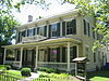
March 18, 1987 22 N. College Ave.
39°30′40″N 84°44′44″W / 39.511111°N 84.745556°WOxford 2 Anderson-Shaffer House 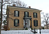
January 18, 1974 404 Ross Ave.
39°24′15″N 84°34′18″W / 39.404167°N 84.571667°WHamilton 3 Augspurger Grist Mill November 1, 1984 Wayne-Madison Rd. at Woodsdale
39°25′48″N 84°28′38″W / 39.43°N 84.477222°WSt. Clair Township 4 Augspurger Paper Company Rowhouse 1 November 1, 1984 Wayne-Madison Rd. at Woodsdale
39°26′02″N 84°28′34″W / 39.433889°N 84.476111°WSt. Clair Township 5 Augspurger Paper Company Rowhouse 2 November 1, 1984 Kennedy Rd. at Woodsdale
39°25′53″N 84°28′44″W / 39.431389°N 84.478889°WMadison Township 6 Augspurger Schoolhouse November 1, 1984 Wayne-Madison Rd. at Woodsdale
39°26′06″N 84°28′32″W / 39.435°N 84.475556°WMadison Township 7 Frederick Augspurger Farm 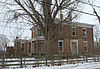
August 3, 1984 1856 Wayne-Madison Rd., south of Trenton
39°26′17″N 84°28′35″W / 39.438056°N 84.476389°WSt. Clair Township 8 John Augspurger Farm No. 1 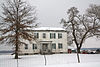
August 3, 1984 2731 Woodsdale Rd., south of Trenton
39°27′51″N 84°27′02″W / 39.464167°N 84.450556°WMadison Township 9 John Augspurger Farm No. 2 November 1, 1984 3046 Pierson Rd.
39°27′56″N 84°27′35″W / 39.465556°N 84.459722°WTrenton 10 Samuel Augspurger Farm November 1, 1984 2070 Woodsdale Rd., south of Trenton
39°26′37″N 84°27′41″W / 39.443611°N 84.461389°WMadison Township 11 Samuel Augspurger House November 1, 1984 Wayne-Madison and Kennedy Rds. at Woodsdale
39°25′57″N 84°28′36″W / 39.4325°N 84.476667°WSt. Clair Township 12 Austin-Magie Farm and Mill District December 21, 1982 Section 14 in Oxford Township
39°31′38″N 84°43′55″W / 39.527222°N 84.731944°WOxford Township 13 Beckett-Manrod House November 11, 1977 2019 Stillwell-Beckett Rd., northwest of Hamilton
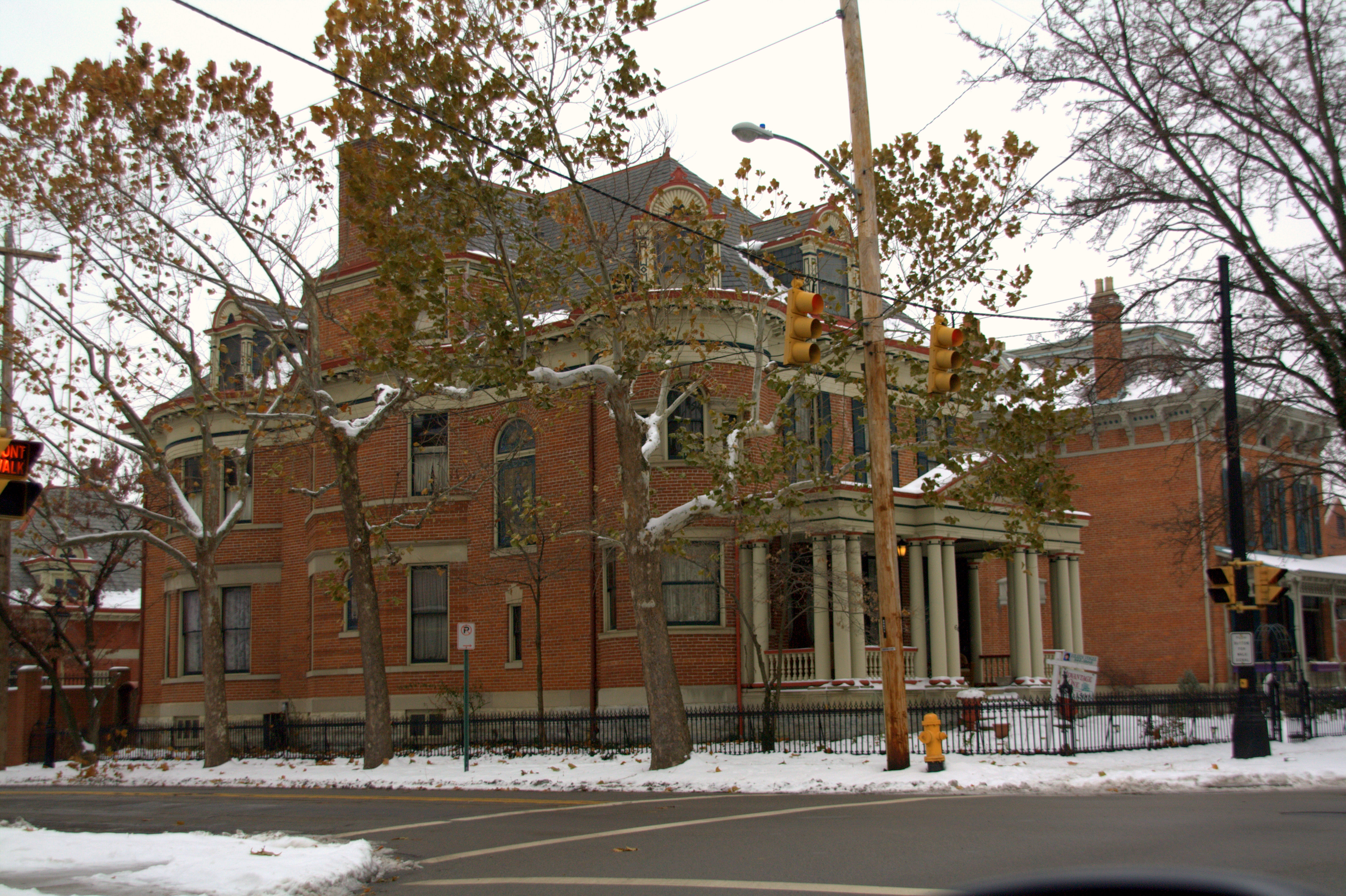
39°27′10″N 84°37′42″W / 39.452778°N 84.628333°WHanover Township 14 Benninghofen House 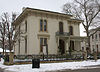
May 17, 1973 327 N. 2nd St.
39°24′14″N 84°33′37″W / 39.403889°N 84.560278°WHamilton 15 Butler County Courthouse 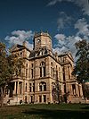
June 22, 1981 2nd and High Sts.
39°23′59″N 84°33′46″W / 39.399722°N 84.562778°WHamilton 16 Cochran Farm July 16, 1973 2900 State Route 129
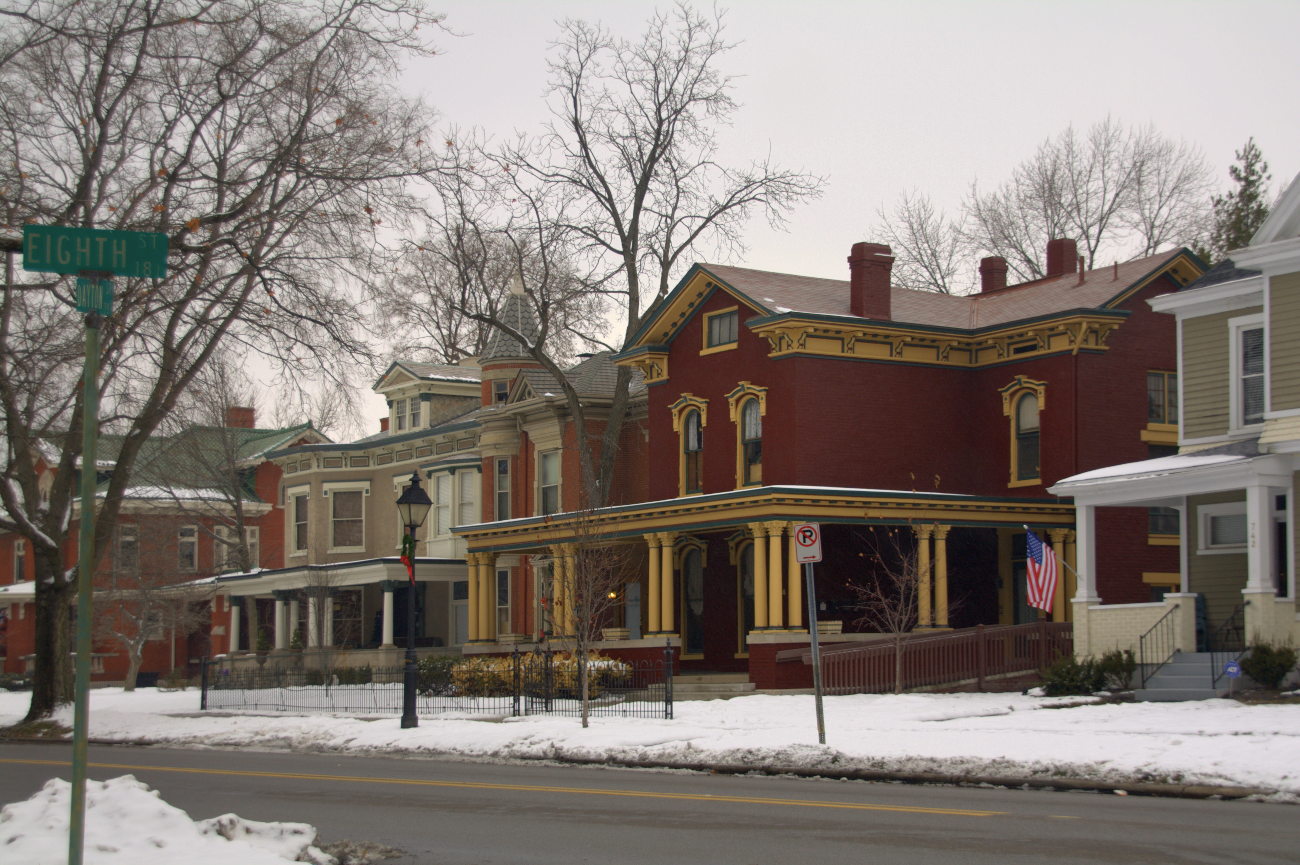
39°23′17″N 84°39′22″W / 39.388111°N 84.656°WMillville 17 Dayton-Campbell Historic District 
June 30, 1983 Primarily Dayton, High, and Campbell Ave. between 6th and 11th Sts.
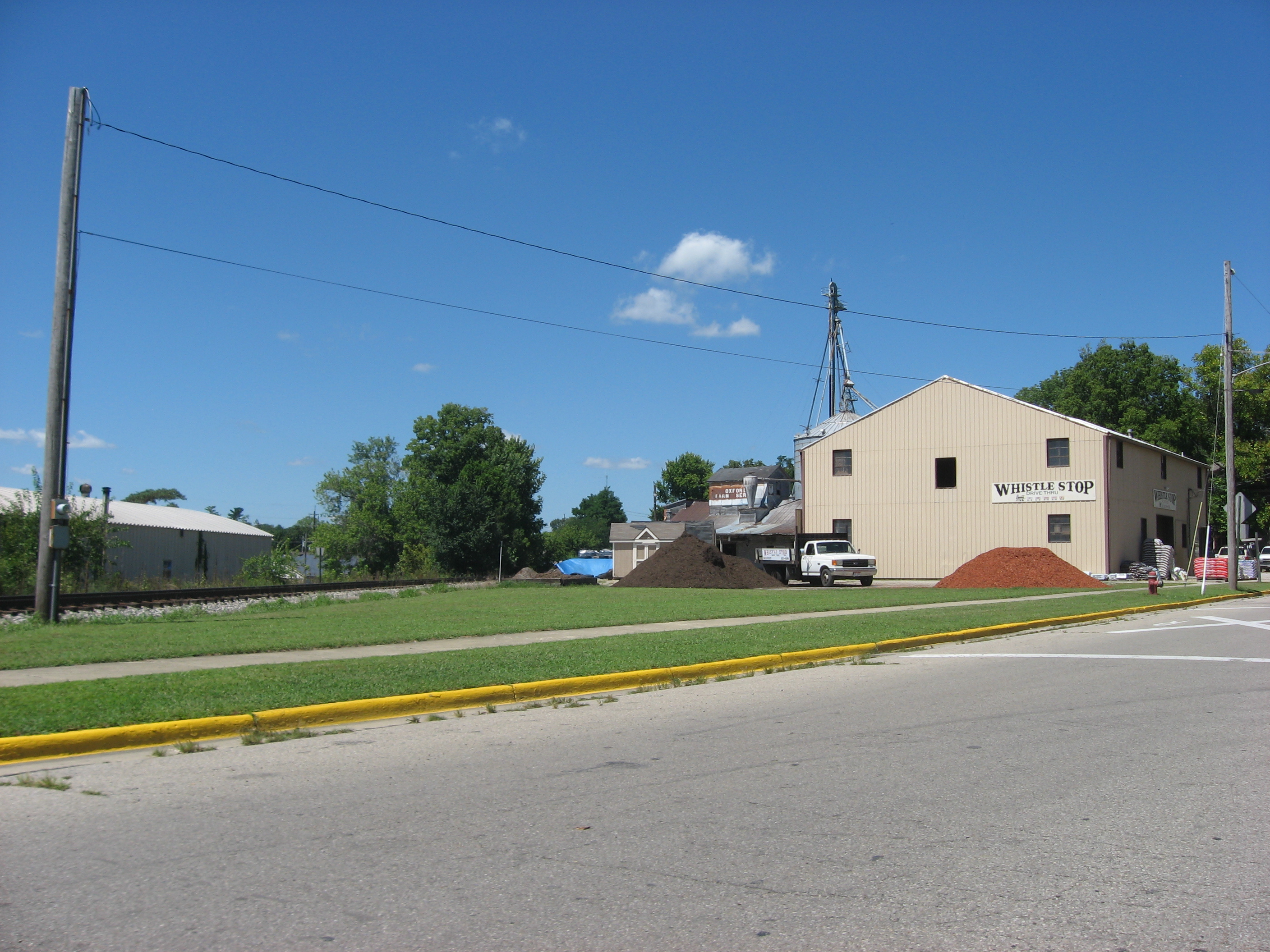
39°23′55″N 84°33′07″W / 39.398611°N 84.551944°WHamilton 18 Demoret Mound October 21, 1975 West of Ross[5] Ross Township 19 Henry P. Deuscher House February 9, 1984 2385 Woodsdale Rd., south of Trenton
39°27′02″N 84°26′47″W / 39.450556°N 84.446389°WMadison Township 20 Zachariah Price Dewitt Cabin April 13, 1973 East of Oxford on U.S. Route 73
39°30′38″N 84°43′07″W / 39.510556°N 84.718611°WOxford Township 21 Dixon-Globe Opera House-Robinson-Schwenn Building 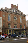
July 14, 2000 221 High St.
39°23′58″N 84°33′39″W / 39.399444°N 84.560833°WHamilton 22 Edgeton 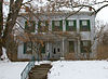
April 3, 1975 575 Harrison Ave.
39°24′21″N 84°35′11″W / 39.405833°N 84.586389°WHamilton 23 Christian Ehresman Farm August 3, 1984 900 Woodsdale Rd.
39°28′11″N 84°27′09″W / 39.469722°N 84.4525°WTrenton 24 Elliott and Stoddard Halls 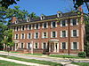
April 3, 1973 Miami University campus
39°30′31″N 84°44′07″W / 39.508611°N 84.735278°WOxford 25 Fairfield Township Works I November 5, 1971 Address restricted Fairfield Township Near Hamilton 26 Fitz Randolph-Rogers House February 8, 1978 5467 Liberty-Fairfield Rd., east of Hamilton
39°25′08″N 84°28′45″W / 39.418889°N 84.479167°WFairfield Township 27 Fortified Hill Works July 12, 1974 Western side of the Great Miami River, 3 miles (4.8 km) below Hamilton
39°21′45.75″N 84°35′33″W / 39.3627083°N 84.5925°W[6]Ross Township 28 Garver Barn August 11, 1980 1030 New London Rd., southwest of Hamilton
39°23′9.86″N 84°36′13.71″W / 39.3860722°N 84.6038083°W[7]Ross Township 29 German Village Historic District 
February 7, 1991 Roughly bounded by Vine, Dayton, Riverfront Plaza, and Martin Luther King, Jr. Boulevard
39°24′12″N 84°33′33″W / 39.403333°N 84.559167°WHamilton 30 Great Mound 
October 7, 1971 West of Middletown
39°30′55.8″N 84°28′34.5″W / 39.5155°N 84.47625°W[6]Madison Township 31 Greenwood Cemetery 
July 22, 1994 1602 Greenwood Ave.
39°24′12″N 84°32′34″W / 39.403333°N 84.542778°WHamilton 32 Hamilton Catholic High School 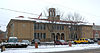
July 24, 1986 533 Dayton St.
39°24′01″N 84°33′20″W / 39.400278°N 84.555556°WHamilton 33 Hamilton Historic Civic Center 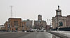
June 29, 1995 Roughly bounded by Market St., High St., Court St., and Monument Ave., including High-Main St. Bridge
39°24′04″N 84°33′53″W / 39.401111°N 84.564722°WHamilton 34 Harding-Jones Paper Company District May 29, 1975 Both sides of S. Main St. at its junction with railroad tracks in Excello
39°28′35″N 84°25′09″W / 39.476389°N 84.419167°WLemon Township 35 Herron Gymnasium 
November 29, 1979 Miami University campus
39°30′34″N 84°44′02″W / 39.509444°N 84.733889°WOxford Demolished 36 James P. Hidley Cottage August 18, 1980 1820 Oxford-Reily Rd., south of Oxford
39°26′04″N 84°45′30″W / 39.434444°N 84.758333°WReily Township 37 High Street Commercial Block March 3, 2004 228, 232, and 236 High St.
39°23′59″N 84°33′39″W / 39.399722°N 84.560833°WHamilton 38 Hogan-Borger Mound Archeological District October 21, 1975 North of Ross[5] Ross Township 39 Howe Tavern January 30, 1976 U.S. Route 27
39°34′00″N 84°48′53″W / 39.566667°N 84.814722°WCollege Corner 40 Matthew Hueston House September 16, 1977 1320 Four Mile Creek Rd., northwest of Hamilton
39°28′00″N 84°36′21″W / 39.466667°N 84.605833°WHanover Township 41 Hughes Manor March 17, 1994 5894 Hamilton-Lebanon Rd.
39°26′50″N 84°25′04″W / 39.447222°N 84.417778°WMonroe 42 Hughes School January 2, 1976 5994 Princeton Rd., east of Hamilton
39°23′12″N 84°25′13″W / 39.386667°N 84.420278°WLiberty Township 43 Hunting Lodge Farm October 20, 1982 Northeast of Oxford at 5349 Bonham Rd.
39°31′15″N 84°43′19″W / 39.520833°N 84.721944°WOxford Township 44 Christian Iutzi Farm August 3, 1984 2180 Woodsdale Rd., south of Trenton
39°26′41″N 84°27′11″W / 39.444722°N 84.453056°WMadison Township 45 John Kennel Sr. Farm August 3, 1984 5506 Kennel Rd., south of Trenton
39°26′48″N 84°28′39″W / 39.446667°N 84.4775°WSt. Clair Township 46 John Kennel Jr. Farm August 3, 1984 2251 Wayne-Madison Rd.
39°27′40″N 84°28′32″W / 39.461111°N 84.475556°WTrenton 47 Elias Kumler House 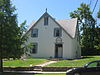
January 3, 1980 120 S. Main St.
39°30′30″N 84°44′33″W / 39.508333°N 84.7425°WOxford 48 Lane's Mill Historic Buildings 
October 3, 1980 South of Oxford at 3884 Wallace Rd.
39°28′57″N 84°41′32″W / 39.4825°N 84.692222°WMorgan Township 49 Lane-Hooven House 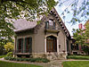
October 25, 1973 319 N. 3rd St.
39°24′13″N 84°33′34″W / 39.403611°N 84.559444°WHamilton 50 Langstroth Cottage 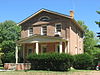
June 22, 1976 303 Patterson Ave.
39°30′23″N 84°43′49″W / 39.506389°N 84.730278°WOxford 51 Henry Maltby House 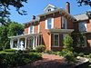
November 29, 1979 216 E. Church St
39°30′42″N 84°44′19″W / 39.511667°N 84.738611°WOxford Demolished 52 Mann Mound 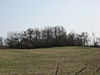
October 7, 1971 Section 12 of Wayne Township, northeast of Jacksonburg
39°33′5.4″N 84°29′42″W / 39.5515°N 84.495°W[6][8]:221Wayne Township 53 William H. McGuffey House 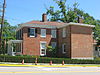
October 15, 1966 401 E. Spring St.
39°30′25″N 84°44′10″W / 39.506944°N 84.736111°WOxford 54 Miami-Erie Canal Site Historic District December 18, 1978 5171-5251 Rialto Rd., west of West Chester
39°19′29″N 84°27′07″W / 39.324722°N 84.451944°WWest Chester Township 55 Mill Office and Post Office November 1, 1984 Woodsdale Rd. in Woodsdale
39°25′57″N 84°28′32″W / 39.4325°N 84.475556°WMadison Township 56 Morgan-Hueston House 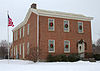
October 1, 1990 Ross Rd. between Mack Rd. and Woodridge Boulevard
39°18′42″N 84°30′22″W / 39.311667°N 84.506111°WFairfield 57 Notre Dame Academy and Notre Dame High School February 2, 2001 926 2nd St.
39°23′27″N 84°33′52″W / 39.390833°N 84.564444°WHamilton 58 Oxford Female Institute 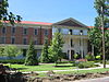
April 26, 1976 High St. and College Ave.
39°30′36″N 84°44′46″W / 39.51°N 84.746111°WOxford 59 Oxford Railroad Depot and Junction House 
February 8, 1980 S. Elm and W. Spring St.
39°30′27″N 84°44′51″W / 39.5075°N 84.7475°WOxford Depot is demolished; Junction House remains standing 60 Pugh's Mill Covered Bridge 
June 5, 1975 1 mi (1.6 km) north of Oxford off State Route 732
39°31′26″N 84°44′06″W / 39.523889°N 84.735°WOxford Township 61 Rentschler House 
April 21, 1983 643 Dayton St.
39°23′59″N 84°33′14″W / 39.399722°N 84.553889°WHamilton 62 Roberts Mound March 27, 1975 Section 36 of Reily Township, northwest of Auburn
39°23′39.3″N 84°42′40″W / 39.39425°N 84.71111°W[9][8]:201Reily Township 63 D.S. Rose Mound May 28, 1975 North of Huntsville[5] Liberty Township Demolished by the owner without a chance for archaeological excavation[10] 64 Ross Trails Adena Circle October 10, 1975 Northwest of Ross[5] Ross Township 65 Rossville Historic District 
October 6, 1975 Roughly bounded by B, E, Main, and Amberly Dr.
39°24′00″N 84°34′14″W / 39.4°N 84.570556°WHamilton 66 St. Stephen Church and Rectory 
July 29, 1982 224 Dayton St.
39°24′07″N 84°33′36″W / 39.401944°N 84.56°WHamilton 67 Peter Schrock Jr. Farm November 1, 1984 Edgewood Dr.
39°28′38″N 84°28′16″W / 39.477222°N 84.471111°WTrenton 68 John Scott Barn and Granary October 4, 2005 3681 Hamilton-New London Rd., east of Shandon
39°19′41″N 84°41′39″W / 39.328056°N 84.694167°WRoss Township 69 Shaw Farm July 24, 1974 3357 Cincinnati-Brookville Rd., west of Ross
39°18′25″N 84°40′22″W / 39.306944°N 84.672778°WRoss Township 70 Sigma Alpha Epsilon Chapter House of Miami University 
February 8, 2005 310 Tallawanda Rd.
39°30′51″N 84°44′06″W / 39.514167°N 84.735°WOxford 71 South Main Street District 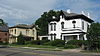
March 21, 1978 S. Main St.
39°30′45″N 84°24′33″W / 39.5125°N 84.409167°WMiddletown 72 Spread Eagle Tavern-James D. Conrey House October 24, 2003 9797 Cincinnati-Columbus Rd., north of Cincinnati
39°18′29″N 84°23′05″W / 39.308056°N 84.384722°WWest Chester Township 73 Symmes Mission Chapel June 12, 1980 5139 Pleasant Ave.
39°20′20″N 84°33′40″W / 39.338889°N 84.561111°WFairfield 74 Thomas Select School April 11, 1977 3637 Millville-Shandon Rd. at Shandon
39°19′42″N 84°42′52″W / 39.328333°N 84.714444°WMorgan Township 75 John B. Tytus House 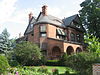
May 27, 1975 300 S. Main St.
39°30′47″N 84°23′49″W / 39.513056°N 84.396944°WMiddletown 76 Union Township Works II October 7, 1971 Address restricted West Chester Township Near Pisgah 77 Unzicker-Cook House July 24, 1974 2975 Oxford-Middletown Rd., northeast of Oxford
39°31′59″N 84°39′27″W / 39.533056°N 84.6575°WMorgan Township 78 John Vaughan House May 29, 1975 3756 Hamilton-New London Rd. at Shandon
39°19′36″N 84°42′36″W / 39.326667°N 84.71°WMorgan Township 79 Voice of America Bethany Relay Station 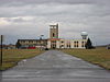
November 28, 2006 8070 Tylersville Rd., north of West Chester
39°21′18″N 84°21′24″W / 39.355°N 84.356667°WWest Chester Township 80 Western Female Seminary 
September 17, 1979 Junction of U.S. Route 27 and State Route 73, Western College, Miami University
39°30′14″N 84°43′36″W / 39.503889°N 84.726667°WOxford 81 Williamson Mound Archeological District May 29, 1975 Atop a hill in Section 24 of West Chester Township
39°22′0″N 84°23′42″W / 39.366667°N 84.395°W[11][8]:175West Chester Township Former listings
[3] Landmark name Image Date listed Location City or town Summary 1 Fisher Hall 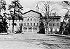
July 1, 1978 Miami University campus Oxford 2 Phillip Hughes House January 1, 1977 East of Hamilton at the junction of State Routes 4 and 747
39°25′39.2″N 84°27′0″W / 39.427556°N 84.45°WHamilton 3 Pleasant Run Mounds January 1, 1975 Address Restricted Fairfield See also
References
- ^ The latitude and longitude information provided in this table was derived originally from the National Register Information System, which has been found to be fairly accurate for about 99% of listings. For about 1% of NRIS original coordinates, experience has shown that one or both coordinates are typos or otherwise extremely far off; some corrections may have been made. A more subtle problem causes many locations to be off by up to 150 yards, depending on location in the country: most NRIS coordinates were derived from tracing out latitude and longitudes off of USGS topographical quadrant maps created under the North American Datum of 1927, which differs from the current, highly accurate WGS84 GPS system used by Google maps. Chicago is about right, but NRIS longitudes in Washington are higher by about 4.5 seconds, and are lower by about 2.0 seconds in Maine. Latitudes differ by about 1.0 second in Florida. Some locations in this table may have been corrected to current GPS standards.
- ^ "National Register of Historic Places: Weekly List Actions". National Park Service, United States Department of the Interior. Retrieved on November 10, 2011.
- ^ a b Numbers represent an ordering by significant words. Various colorings, defined here, differentiate National Historic Landmark sites and National Register of Historic Places Districts from other NRHP buildings, structures, sites or objects.
- ^ "National Register Information System". National Register of Historic Places. National Park Service. . http://nrhp.focus.nps.gov/natreg/docs/All_Data.html.
- ^ a b c d Location derived from its Federal Register notice; the NRIS lists the site as "Address Restricted"
- ^ a b c Location derived from Mills, William C. Archeological Atlas of Ohio. Columbus: Ohio State Archeological and Historical Society, 1914, page 9 and plate 9. The NRIS lists the site as "Address Restricted".
- ^ Location derived from its Ohio Historic Inventory form; the NRIS lists the site as "Address Restricted"
- ^ a b c MacLean, J. P., The Mound Builders: Being an Account of a Remarkable People that Once Inhabited the Valleys of the Ohio and Mississippi, Together with an Investigation Into the Archæology of Butler County, O. Cincinnati: Clarke, 1879.
- ^ Thomas, Cyrus. Catalogue of Prehistoric Works East of the Rocky Mountains. Washington: GPO, 1891, Plate XV.
- ^ Ohio Archaeologist 42/43 (1992), 23.
- ^ Owen, Lorrie K., ed. Dictionary of Ohio Historic Places. Vol. 1. St. Clair Shores: Somerset, 1999, 108.
National Register of Historic Places in Ohio Lists by county Adams • Allen • Ashland • Ashtabula • Athens • Auglaize • Belmont • Brown • Butler • Carroll • Champaign • Clark • Clermont • Clinton • Columbiana • Coshocton • Crawford • Cuyahoga • Darke • Defiance • Delaware • Erie • Fairfield • Fayette • Franklin • Fulton • Gallia • Geauga • Greene • Guernsey • Hamilton • Hancock • Hardin • Harrison • Henry • Highland • Hocking • Holmes • Huron • Jackson • Jefferson • Knox • Lake • Lawrence • Licking • Logan • Lorain • Lucas • Madison • Mahoning • Marion • Medina • Meigs • Mercer • Miami • Monroe • Montgomery • Morgan • Morrow • Muskingum • Noble • Ottawa • Paulding • Perry • Pickaway • Pike • Portage • Preble • Putnam • Richland • Ross • Sandusky • Scioto • Seneca • Shelby • Stark • Summit • Trumbull • Tuscarawas • Union • Van Wert • Vinton • Warren • Washington • Wayne • Williams • Wood • Wyandot
Lists by city Other lists Municipalities and communities of Butler County, Ohio Cities Fairfield‡ | Hamilton | Middletown‡ | Monroe‡ | Oxford | Sharonville‡ | Trenton

Villages College Corner‡ | Jacksonburg | Millville | New Miami | Seven Mile | Somerville
Townships CDPs Unincorporated
communitiesAlert | Bethany | Collinsville | Darrtown | Excello | Maud | Miltonville | McGonigle | Okeana | Overpeck | Poasttown | Port Union | Scipio | Shandon | Tylersville | West Middletown | Woodsdale
Footnotes ‡This populated place also has portions in an adjacent county or counties
Categories:- National Register of Historic Places in Ohio by county
- Butler County, Ohio
-


Wikimedia Foundation. 2010.