- National Register of Historic Places listings in Miami County, Ohio
-
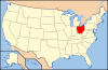
 Location of Miami County in Ohio
This is a list of the National Register of Historic Places listings in Miami County, Ohio.
This is intended to be a complete list of the properties and districts on the National Register of Historic Places in Miami County, Ohio, United States. The locations of National Register properties and districts for which the latitude and longitude coordinates are included below, may be seen in a Google map.[1]
There are 43 properties and districts listed on the National Register in the county.
-
- This National Park Service list is complete through NPS recent listings posted November 10, 2011.[2]
Current listings
[3] Landmark name [4] Image Date listed Location City or town Summary 1 African Jackson Cemetery 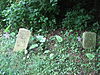
December 16, 1982 North of Piqua on Zimmerlin Rd.
40°09′25″N 84°14′07″W / 40.156944°N 84.235278°WSpring Creek Township 2 Arrowston 
February 8, 1980 1220 Park Ave.
40°09′14″N 84°15′34″W / 40.153889°N 84.259444°WPiqua 3 William Baumgardner House and Farm Buildings 
February 17, 1978 8390 National Rd., southwest of New Carlisle
39°54′22″N 84°03′35″W / 39.906111°N 84.059722°WBethel Township 4 Bradford Junction Interlocking Tower 
April 20, 1995 501 E. Main St.
40°07′52″N 84°25′29″W / 40.131111°N 84.424722°WBradford 5 Casstown Lutheran Stone Church 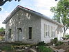
May 31, 1984 11 S. Main St.
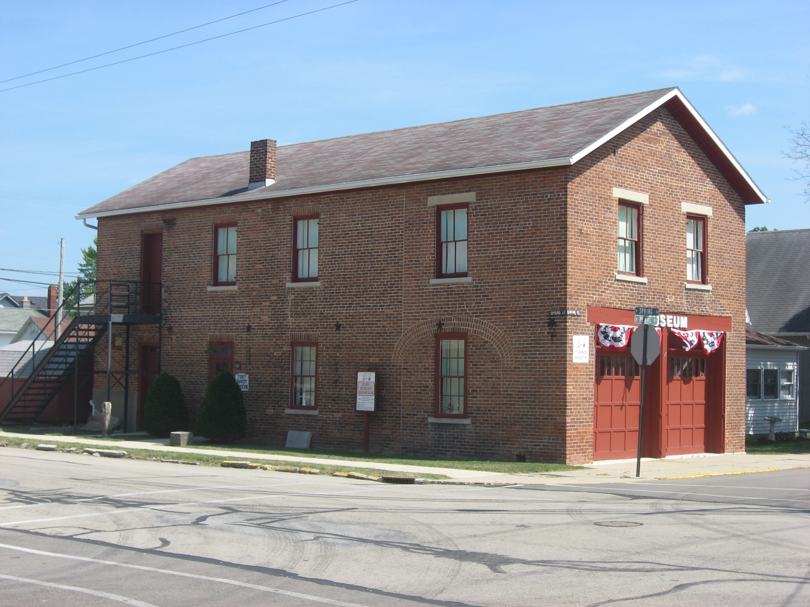
40°03′05″N 84°07′46″W / 40.051306°N 84.129583°WCasstown 6 Covington Historic Government Building 
June 22, 1981 Spring and Pearl Sts.
40°06′59″N 84°21′12″W / 40.116389°N 84.353333°WCovington 7 Robert Culbertson House 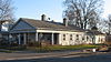
October 10, 1975 304 E. Franklin St.
40°02′13″N 84°12′05″W / 40.036944°N 84.201389°WTroy 8 Detrick Milling and Distilling Company 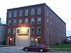
April 15, 2010 128 W. Broadway
39°57′33″N 84°10′25″W / 39.959083°N 84.173722°WTipp City 9 William K. Dunlap House 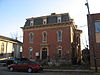
December 12, 1976 16 E. Franklin St.
40°02′17″N 84°12′13″W / 40.038056°N 84.203611°WTroy 10 John Minor Dye Stone House 
July 7, 1983 9 S. Children's Home Rd., east of Troy
40°01′49″N 84°08′06″W / 40.030278°N 84.135°WElizabeth Township 11 Eldean Covered Bridge 
February 20, 1975 North of Troy across the Great Miami River on County Road 33
40°04′40″N 84°13′00″W / 40.077778°N 84.216667°WConcord and Staunton Townships 12 Elizabeth Township Rural Historic District 
March 1, 1997 Roughly bounded by Lost Creek, the Miami and Clark County line, and Casstown Clark County and Elizabeth Bethel Rds.
40°00′45″N 84°05′53″W / 40.0125°N 84.098056°WElizabeth Township 13 First Presbyterian Church 
December 12, 1976 Franklin and Walnut Sts.
40°02′17″N 84°12′11″W / 40.038056°N 84.203056°WTroy 14 Fort Piqua Hotel 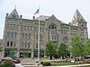
February 15, 1974 114 W. Main St.
40°08′55″N 84°14′25″W / 40.148611°N 84.240278°WPiqua 15 Mary Jane Hayner House 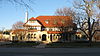
January 30, 1976 301 W. Main St.
40°02′26″N 84°12′22″W / 40.040556°N 84.206111°WTroy 16 Hobart Circle Historic District 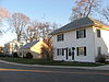
May 25, 1989 2-9 Hobart Cir. and 11 and 23 Hobart Dr.
40°02′31″N 84°12′35″W / 40.041944°N 84.209722°WTroy 17 E.A. Hobart House 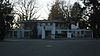
May 25, 1989 172 S. Ridge
40°02′35″N 84°13′12″W / 40.043056°N 84.22°WTroy 18 William Hobart Vacation House 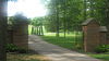
May 25, 1989 905 Polecat Rd., north of Troy
40°04′35″N 84°11′24″W / 40.076333°N 84.19°WStaunton Township 19 House at 121 South Ridge 
May 25, 1989 121 S. Ridge
40°02′41″N 84°13′03″W / 40.044722°N 84.2175°WTroy 20 House at 129 South Ridge 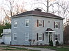
May 25, 1989 129 S. Ridge
40°02′39″N 84°13′03″W / 40.044167°N 84.2175°WTroy 21 House at 145 South Ridge 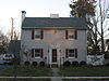
May 25, 1989 145 S. Ridge
40°02′37″N 84°13′03″W / 40.043611°N 84.2175°WTroy 22 House at 203 Penn Road 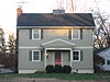
May 25, 1989 203 Penn Rd.
40°02′33″N 84°12′56″W / 40.0425°N 84.215556°WTroy 23 House at 1022 West Main Street 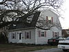
May 25, 1989 1022 W. Main St.
40°02′42″N 84°13′02″W / 40.045°N 84.217222°WTroy 24 Benjamin Iddings Log House November 21, 1976 6.5 mi (10.5 km) west of Troy
40°00′56″N 84°19′03″W / 40.015556°N 84.3175°WNewton Township 25 Lockington Locks Historical Area 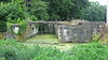
December 17, 1969 Miami and Erie Canal between Lockington and Washington Township
40°11′22″N 84°14′31″W / 40.189361°N 84.241875°WWashington Township Extends into Lockington and Washington Township in Shelby County 26 McKinley School April 22, 2005 240 S. Main St.
39°57′34″N 84°19′39″W / 39.959444°N 84.3275°WWest Milton 27 Miami County Courthouse and Power Station 
May 30, 1975 Bounded by Main, Short, Plum, and Water Sts.
40°02′27″N 84°12′18″W / 40.040833°N 84.205°WTroy 28 Old Tippecanoe Main Street Historic District 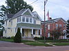
July 7, 1983 5-439 W. Main St. and 3-225 E. Main St.
39°57′40″N 84°10′02″W / 39.961111°N 84.167222°WTipp City 29 Overfield Tavern 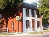
January 30, 1976 201 E. Water St.
40°02′23″N 84°12′02″W / 40.039722°N 84.200556°WTroy One of Ohio's oldest taverns, built in 1808. Now a museum. 30 Piqua High School 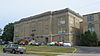
August 22, 1996 316 N. College St.
40°08′56″N 84°14′57″W / 40.148889°N 84.249167°WPiqua Built in 1914, converted to 78 senior housing units in 1995 31 Piqua Historical Area State Memorial 
April 7, 1971 State Route 66, 1 mi (1.6 km) north of Piqua
40°10′45″N 84°15′21″W / 40.179167°N 84.255833°WWashington Township 32 Piqua-Caldwell Historic District 
January 11, 1985 N. Main, Wayne, Downing, Caldwell Sts; W. Ash to Camp Sts.
40°08′59″N 84°14′22″W / 40.149722°N 84.239444°WPiqua 33 Plainview Farm 
April 18, 1985 535-545 Weddle Rd., southeast of Casstown
40°02′08″N 84°05′30″W / 40.035556°N 84.091667°WElizabeth Township 34 Pleasant Hill United Church of Christ August 22, 2002 10 W. Monument St.
40°03′07″N 84°20′43″W / 40.051944°N 84.345278°WPleasant Hill 35 York Rial House 
August 12, 1986 McFarland St., north of Piqua
40°09′23″N 84°14′12″W / 40.156389°N 84.236667°WSpring Creek Township 36 Elizabeth Sheets Saunders Farm 
November 21, 1976 4525 McCandless Rd., southeast of Casstown
40°02′16″N 84°07′18″W / 40.037778°N 84.121667°WElizabeth Township 37 Saunders Seed Company 
April 13, 2010 101 W. Broadway
40°02′16″N 84°07′18″W / 40.037778°N 84.121667°WTipp City 38 Andrew Sheets House 
February 1, 1988 6880 LaFevre Rd.
40°01′34″N 84°04′36″W / 40.026111°N 84.076667°WElizabeth Township 39 Staley Farm March 24, 1980 North of Brandt at 7095 Staley Rd.
39°57′57″N 84°04′43″W / 39.965833°N 84.078611°WBethel Township 40 Troy Public Square 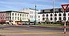
June 30, 1975 Property surrounding the junction of Main and Market Sts.
40°02′22″N 84°12′12″W / 40.039444°N 84.203333°WTroy 41 Twin Arch Stone Culvert 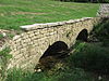
July 17, 1978 North of Troy at County Road 25A
40°05′18″N 84°13′24″W / 40.088333°N 84.223333°WConcord Township 42 Callahill and Priscilla Weddle House 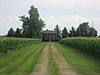
June 18, 1987 5710 LeFevre Rd., east of Troy
40°01′32″N 84°05′59″W / 40.025556°N 84.099722°WElizabeth Township 43 Judge Henry Williams House 
January 1, 1976 16 S. Cherry St.
40°02′22″N 84°12′17″W / 40.039444°N 84.204722°WTroy See also
References
- ^ The latitude and longitude information provided in this table was derived originally from the National Register Information System, which has been found to be fairly accurate for about 99% of listings. For about 1% of NRIS original coordinates, experience has shown that one or both coordinates are typos or otherwise extremely far off; some corrections may have been made. A more subtle problem causes many locations to be off by up to 150 yards, depending on location in the country: most NRIS coordinates were derived from tracing out latitude and longitudes off of USGS topographical quadrant maps created under the North American Datum of 1927, which differs from the current, highly accurate WGS84 GPS system used by Google maps. Chicago is about right, but NRIS longitudes in Washington are higher by about 4.5 seconds, and are lower by about 2.0 seconds in Maine. Latitudes differ by about 1.0 second in Florida. Some locations in this table may have been corrected to current GPS standards.
- ^ "National Register of Historic Places: Weekly List Actions". National Park Service, United States Department of the Interior. Retrieved on November 10, 2011.
- ^ Numbers represent an ordering by significant words. Various colorings, defined here, differentiate National Historic Landmark sites and National Register of Historic Places Districts from other NRHP buildings, structures, sites or objects.
- ^ "National Register Information System". National Register of Historic Places. National Park Service. . http://nrhp.focus.nps.gov/natreg/docs/All_Data.html.
National Register of Historic Places in Ohio Lists by county Adams • Allen • Ashland • Ashtabula • Athens • Auglaize • Belmont • Brown • Butler • Carroll • Champaign • Clark • Clermont • Clinton • Columbiana • Coshocton • Crawford • Cuyahoga • Darke • Defiance • Delaware • Erie • Fairfield • Fayette • Franklin • Fulton • Gallia • Geauga • Greene • Guernsey • Hamilton • Hancock • Hardin • Harrison • Henry • Highland • Hocking • Holmes • Huron • Jackson • Jefferson • Knox • Lake • Lawrence • Licking • Logan • Lorain • Lucas • Madison • Mahoning • Marion • Medina • Meigs • Mercer • Miami • Monroe • Montgomery • Morgan • Morrow • Muskingum • Noble • Ottawa • Paulding • Perry • Pickaway • Pike • Portage • Preble • Putnam • Richland • Ross • Sandusky • Scioto • Seneca • Shelby • Stark • Summit • Trumbull • Tuscarawas • Union • Van Wert • Vinton • Warren • Washington • Wayne • Williams • Wood • Wyandot
Lists by city Other lists Municipalities and communities of Miami County, Ohio Cities 
Villages Bradford‡ | Casstown | Covington | Fletcher | Laura | Ludlow Falls | Pleasant Hill | Potsdam | West Milton
Townships Bethel | Brown | Concord | Elizabeth | Lost Creek | Monroe | Newberry | Newton | Spring Creek | Staunton | Union | Washington
Unincorporated
communitiesBrandt | Conover | Phoneton | West Charleston
Footnotes ‡This populated place also has portions in an adjacent county or counties
Categories:- National Register of Historic Places in Ohio by county
- Miami County, Ohio
-


Wikimedia Foundation. 2010.