- National Register of Historic Places listings in West and Southwest Baltimore
-
National Register of Historic Places listings in the city of Baltimore, Maryland
The locations of the National Register properties and districts listed below (at least for all showing latitude and longitude coordinates below) may be seen in a Google map by clicking on "Map of all coordinates".[1]
This list covers some of the properties in the independent city of Baltimore, but not those in the county of Baltimore surrounding the city. The county actually does not include the city; the city is an independent county-equivalent.
-
- This National Park Service list is complete through NPS recent listings posted November 10, 2011.[2]
Main:List of RHPs in Baltimore
Current listings
[3] Landmark name Image Date listed Location District[4] Summary 1 Cummins Memorial Church October 31, 1979 1210 W. Lanvale St.
39°17′53″N 76°38′17″W / 39.298056°N 76.638056°WWest 2 Frederick Douglass High School 
May 18, 1989 1601 N. Calhoun St.
39°18′28″N 76°38′31″W / 39.307778°N 76.641944°WWest 3 Edmondson Avenue Historic District December 27, 2010 Winchester St., Braddish Ave. north of Edmondson Ave., Edmondson Ave. west of Braddish Ave., Franklintown Rd. north of W. Franklin St.
39°17′53″N 76°39′47″W / 39.298056°N 76.663056°WWest 4 Engine House No. 8 January 26, 1995 1027 W. Mulberry St.
39°17′36″N 76°38′09″W / 39.293333°N 76.635833°WWest 5 Franklin Square Historic District December 10, 1982 Bounded by Mulberry, N. Carey, W. Baltimore, and Monroe Sts.
39°17′29″N 76°38′36″W / 39.291389°N 76.643333°WWest 6 Franklintown Historic District November 11, 2001 5100-5201 N. Franklintown Rd., 1707-1809 N. Forest Park Ave., 5100 Hamilton Ave., and 5100 Fredwall Ave.
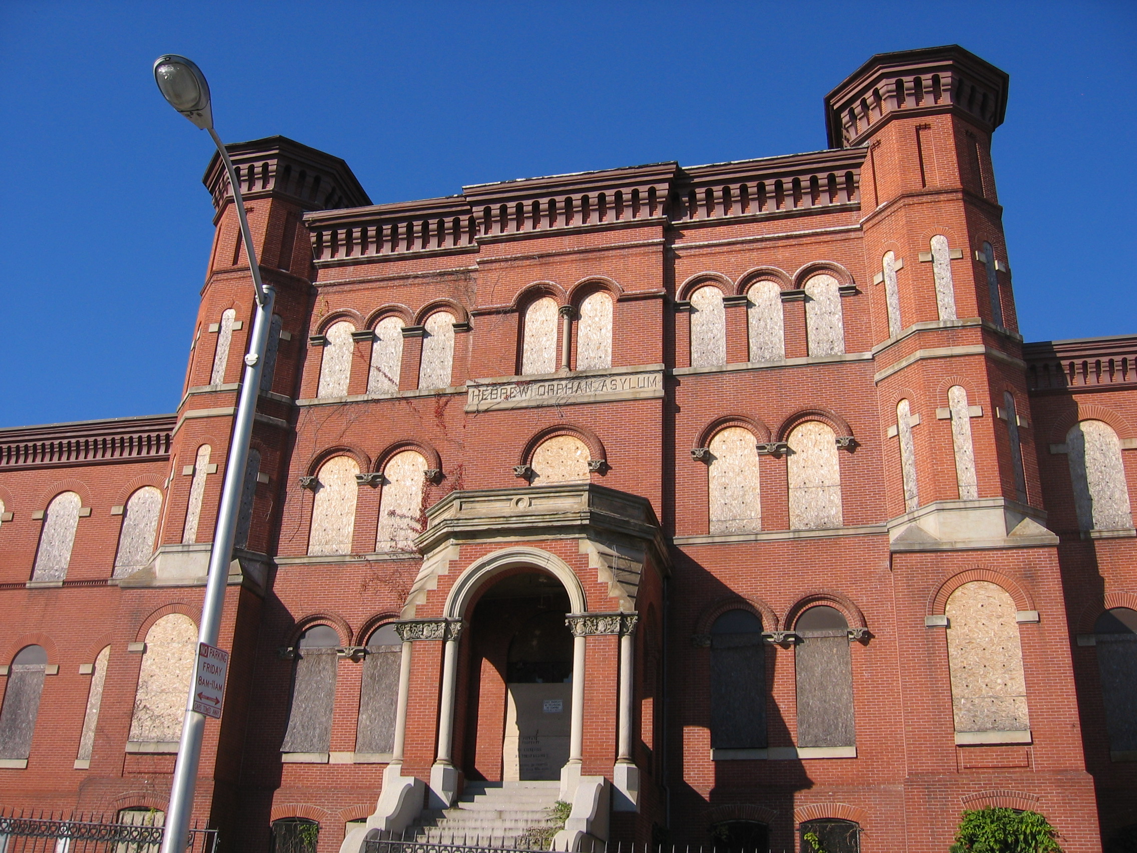
39°18′16″N 76°42′35″W / 39.304444°N 76.709722°WSouthwest 7 Hebrew Orphan Asylum 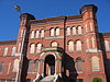
October 28, 2010 2700 Rayner Ave.
39°17′48″N 76°39′44″W / 39.296667°N 76.662222°WWest 8 Hollins-Roundhouse Historic District July 22, 2009 W. Baltimore and Schroeder Sts., south on Schroeder to Lombard; west on Lombard to Carey, south to Pratt, and east on Pratt to Hayes
39°17′20″N 76°38′02″W / 39.288764°N 76.633783°WWest 9 James Lawrence Kernan Hospital 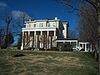
September 24, 1979 Windsor Mill Rd. and Forest Park Ave.
39°18′48″N 76°42′34″W / 39.313333°N 76.709444°WSouthwest 10 Lion Brothers Company Building December 7, 2006 875 Hollins St.
39°17′22″N 76°37′54″W / 39.289444°N 76.631667°WWest 11 Loudon Park National Cemetery June 20, 1996 3445 Frederick Ave.
39°16′49″N 76°40′31″W / 39.280278°N 76.675278°WSouthwest 12 Old West Baltimore Historic District December 23, 2004 Roughly bounded by North Ave., Dolphin St., Franklin St. and Fulton Ave.
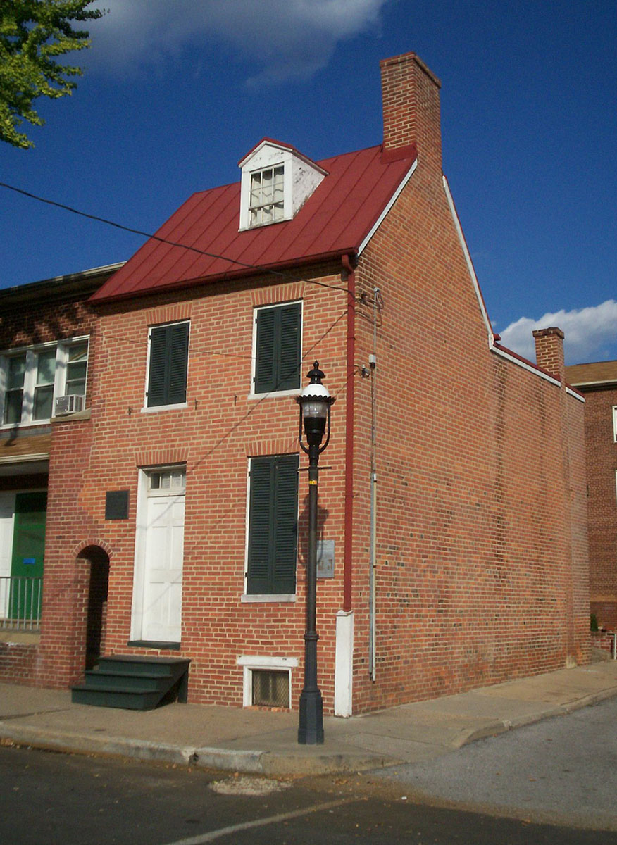
39°18′14″N 76°38′17″W / 39.303889°N 76.638056°WWest 13 Edgar Allan Poe House 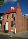
November 11, 1971 203 Amity St.
39°17′28″N 76°38′00″W / 39.291111°N 76.633333°WWest 14 Public School No. 111 September 25, 1979 N. Carrollton Ave. and Riggs Rd.
39°18′03″N 76°38′17″W / 39.300833°N 76.638056°WWest 15 St. Luke's Church March 30, 1973 217 N. Carey St.
39°17′28″N 76°38′18″W / 39.291111°N 76.638333°WWest 16 Schwartze Mansion September 12, 1985 4206 Euclid Ave.
39°16′58″N 76°41′10″W / 39.282778°N 76.686111°WSouthwest 17 Sellers Mansion 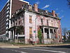
December 28, 2001 801 N. Arlington St.
39°17′53″N 76°38′10″W / 39.298056°N 76.636111°WWest 18 Shaarei Tfiloh Synagogue 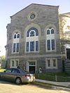
October 10, 1996 2001 Liberty Heights Ave.
39°19′11″N 76°39′04″W / 39.319722°N 76.651111°WWest 19 Weiskittel-Roehle Burial Vault May 19, 1976 Section P of Loudon Park Cemetery
39°16′45″N 76°40′47″W / 39.279167°N 76.679722°WSouthwest 20 Windsor Hills Historic District December 27, 2002 Roughly bounded by Chelsea Terrace, Windsor Mill Rd., Talbot Rd., Westchester Rd., and Woodhaven Ave.
39°18′59″N 76°41′11″W / 39.316389°N 76.686389°WWest See also
References
- ^ The latitude and longitude information provided in this table was derived originally from the National Register Information System, which has been found to be fairly accurate for about 99% of listings. For about 1% of NRIS original coordinates, experience has shown that one or both coordinates are typos or otherwise extremely far off; some corrections may have been made. A more subtle problem causes many locations to be off by up to 150 yards, depending on location in the country: most NRIS coordinates were derived from tracing out latitude and longitudes off of USGS topographical quadrant maps created under the North American Datum of 1927, which differs from the current, highly accurate WGS84 GPS system used by Google maps. Chicago is about right, but NRIS longitudes in Washington are higher by about 4.5 seconds, and are lower by about 2.0 seconds in Maine. Latitudes differ by about 1.0 second in Florida. Some locations in this table may have been corrected to current GPS standards.
- ^ "National Register of Historic Places: Weekly List Actions". National Park Service, United States Department of the Interior. Retrieved on November 10, 2011.
- ^ Numbers represent an ordering by significant words. Various colorings, defined here, differentiate National Historic Landmark sites and National Register of Historic Places Districts from other NRHP buildings, structures, sites or objects.
- ^ Official Baltimore neighborhoods, defined here
U.S. National Register of Historic Places in Maryland Lists by county Allegany • Anne Arundel • Baltimore County • Calvert • Caroline • Carroll • Cecil • Charles • Dorchester • Frederick • Garrett • Harford • Howard • Kent • Montgomery • Prince George's • Queen Anne's • Somerset • St. Mary's • Talbot • Washington • Wicomico • Worcester
Lists by city Baltimore: (Central · North and Northwest · West and Southwest · East and Northeast · South and Southeast)Other lists Categories:- National Register of Historic Places in Maryland by county
- History of Baltimore, Maryland
-


Wikimedia Foundation. 2010.