- National Register of Historic Places listings in Addison County, Vermont
-
 Location of Addison County in Vermont
This is a list of the National Register of Historic Places listings in Addison County, Vermont.
This is intended to be a complete list of the properties and districts on the National Register of Historic Places in Addison County, Vermont, United States. Latitude and longitude coordinates are provided for many National Register properties and districts; these locations may be seen together in a Google map.[1]
There are 68 properties and districts listed on the National Register in the county, including 4 National Historic Landmarks.
-
- This National Park Service list is complete through NPS recent listings posted November 10, 2011.[2]
Contents: Counties in Vermont Addison - Bennington - Caledonia - Chittenden - Essex - Franklin - Grand Isle - Lamoille - Orange - Orleans - Rutland - Washington - Windham - Windsor Current listings
[3] Landmark name [4] Image Date listed Location City or town Summary 1 Addison Baptist Church 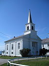
November 2, 1978 Junction of VT 22A and VT 17
44°05′19″N 73°18′10″W / 44.088664°N 73.302697°WAddison 2 Bottum Farm March 7, 2008 1423 North St.
44°08′41″N 73°09′29″W / 44.144722°N 73.158056°WNew Haven 3 Bridge 26 June 7, 2006 Town Highway 11, Morgan Horse Farm Rd., over Otter Creek
44°04′23″N 73°11′39″W / 44.073056°N 73.194167°WWeybridge 4 Bristol Downtown Historic District 
February 3, 1983 Main St.
44°07′57″N 73°04′40″W / 44.1325°N 73.077778°WBristol 5 Brooksville Advent Church November 21, 2002 1338 Dog Team Tavern Rd.
44°03′53″N 73°10′23″W / 44.064722°N 73.173056°WNew Haven 6 Cedar Swamp Covered Bridge September 10, 1974 West of West Salisbury over Otter Creek
43°55′06″N 73°10′28″W / 43.918333°N 73.174444°WWest Salisbury 7 Chimney Point Tavern March 31, 1971 VT 125
44°02′04″N 73°25′18″W / 44.034444°N 73.421667°WAddison 8 Chipman's Point December 26, 1996 Junction of VT 73A and Chipman Point Rd.
43°47′59″N 73°22′32″W / 43.799722°N 73.375556°WOrwell 9 Cornwall General Store August 6, 2005 2635 VT 30, Seth Warner Highway
43°57′47″N 73°12′34″W / 43.963056°N 73.209444°WCornwall 10 Cornwall Town Hall May 8, 1986 VT 30
43°57′41″N 73°12′52″W / 43.961389°N 73.214444°WCornwall 11 Cotton Free Library April 4, 1996 Quaker Village Rd., near the junction of Baker Ct. and Quaker Village Rd.
44°03′54″N 73°12′57″W / 44.065°N 73.215833°WWeybridge 12 Capts. Louis and Philomene Daniels House July 11, 2001 50 Macdonough Dr.
44°10′N 73°16′W / 44.17°N 73.26°WVergennes 13 District School No. 1 April 17, 1980 Lake Rd.
44°07′37″N 73°21′53″W / 44.126944°N 73.364722°WPanton 14 District Six Schoolhouse August 18, 1977 North of Shoreham on Worcester Rd.
43°55′51″N 73°17′50″W / 43.930833°N 73.297222°WShoreham 15 Dog Team Tavern November 21, 2002 1338 Dog Team Tavern Rd.
44°03′51″N 73°10′24″W / 44.064167°N 73.173333°WNew Haven Destroyed by fire in 2006[5] 16 Colonel Ephraim and Sarah Doolittle Farm January 6, 1995 1 mi (1.6 km) east of VT 22-A on Doolittle Rd.
43°56′19″N 73°18′16″W / 43.938611°N 73.304444°WShoreham 17 East Shoreham Covered Railroad Bridge June 13, 1974 Southeast of Shoreham over the Lemon Fair River
43°51′33″N 73°15′22″W / 43.859167°N 73.256111°WShoreham 18 Fenn Farm January 6, 1995 Western side of VT 116 (Case St.)
43°58′46″N 73°06′16″W / 43.979444°N 73.104444°WMiddlebury 19 Field Farm March 10, 1995 Fuller Mountain Rd.
44°13′34″N 73°11′56″W / 44.226111°N 73.198889°WFerrisburgh 20 First Congregational Church 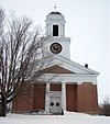
March 2, 2001 464 Main St.
43°48′15″N 73°18′03″W / 43.804167°N 73.300833°WOrwell 21 Paris and Anna Fletcher House February 12, 1999 VT 22A, north of its junction with Middle Rd.
43°59′07″N 73°18′48″W / 43.985278°N 73.313333°WBridport 22 Robert Frost Farm 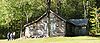
May 23, 1968 1 mi (1.6 km) north of VT 125, 3 mi (4.8 km) east of Ripton
43°58′08″N 72°59′49″W / 43.968889°N 72.996944°WRipton Homestead of author Robert Frost; now owned by Middlebury College. 23 Glen Dale 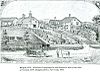
July 11, 2002 1455 Cider Mill Rd.
44°00′10″N 73°12′34″W / 44.002778°N 73.209444°WCornwall 24 Halpin Covered Bridge 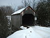
September 10, 1974 Northeast of Middlebury
44°03′00″N 73°08′28″W / 44.05°N 73.141111°WMiddlebury 25 John Hamilton Farmstead June 17, 1993 VT 125 west of the Lemon Fair River
43°59′18″N 73°16′33″W / 43.988333°N 73.275833°WBridport 26 Hand's Cove May 22, 1980 Southwest of Shoreham
43°52′02″N 73°21′56″W / 43.867222°N 73.365556°WShoreham 27 Hawley's Ferry House November 2, 1978 Northwest of Ferrisburg on Kingsland Bay
44°14′26″N 73°17′52″W / 44.240556°N 73.297778°WFerrisburg 28 The Heights December 29, 1988 South St./VT 30
44°00′18″N 73°10′54″W / 44.005°N 73.181667°WMiddlebury Also known as Thaddeus Chapman House 29 Hoag Gristmill and Knight House Complex April 22, 1980 Northwest of Starksboro on State Prison Hollow Rd.
44°14′37″N 73°04′08″W / 44.243611°N 73.068889°WStarksboro 30 House at 215 School Street December 16, 2005 215 School St.
43°53′33″N 73°18′55″W / 43.8925°N 73.315278°WShoreham 31 Lampson School December 21, 2001 44 Summer Rd.
44°05′30″N 73°06′35″W / 44.091667°N 73.109722°WNew Haven 32 Larrabee's Point Complex May 1, 1980 Southwest of Shoreham
43°51′20″N 73°22′36″W / 43.855556°N 73.376667°WShoreham 33 Leicester Meeting House July 28, 1988 U.S. Route 7 and Town Highway 1
43°51′58″N 73°06′32″W / 43.866111°N 73.108889°WLeicester 34 Middlebury Gorge Concrete Arch Bridge November 14, 1991 Vermont 125 over the Middlebury River
43°58′12″N 73°05′11″W / 43.97°N 73.086389°WMiddlebury 35 Middlebury Village Historic District November 13, 1976 U.S. Route 7; also VT 30 and VT 125
44°00′51″N 73°10′04″W / 44.014167°N 73.167778°WMiddlebury Vermont highway addresses represent a boundary increases 36 Monkton Borough Baptist Church January 5, 1989 Town Highway 1
44°13′55″N 73°08′13″W / 44.231944°N 73.136944°WMonkton 37 Monkton Town Hall 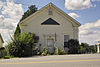
January 3, 1978 North of Monkton on Monkton Ridge Rd.
44°15′13″N 73°07′30″W / 44.253611°N 73.125°WMonkton 38 Mount Independence September 3, 1971 On Lake Champlain opposite Fort Ticonderoga, northwest of Orwell
43°49′33″N 73°23′02″W / 43.825833°N 73.383889°WOrwell Site of Fort Independence, an American Revolutionary War fortification built opposite Fort Ticonderoga. 39 New Haven Junction Depot October 19, 1978 Junction of U.S. Route 7 and VT 17
44°07′24″N 73°11′00″W / 44.123333°N 73.183333°WNew Haven 40 Old Stone Blacksmith Shop April 21, 1975 North of Cornwall on VT 30
43°58′39″N 73°12′21″W / 43.9775°N 73.205833°WCornwall 41 Orwell Site April 11, 1977 Address Restricted Orwell 42 Pulp Mill Covered Bridge September 10, 1974 Northwest of Middlebury off VT 23
44°01′29″N 73°10′41″W / 44.024722°N 73.178056°WMiddlebury 43 Ripton Community House July 3, 1973 On VT 125
43°58′30″N 73°02′14″W / 43.975°N 73.037222°WRipton 44 Rokeby 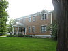
June 20, 1974 North of Ferrisburg off U.S. Route 7
44°13′21″N 73°14′17″W / 44.2225°N 73.238056°WFerrisburg Robinson family farmstead significant for its role in the Underground Railroad 45 Salisbury Congregational Church March 2, 2001 West Salisbury Rd.
43°53′49″N 73°06′10″W / 43.896944°N 73.102778°WSalisbury 46 Salisbury Fish Hatchery March 24, 1994 VT 53, southeast of its junction with Smead Rd.
43°55′29″N 73°05′47″W / 43.924722°N 73.096389°WSalisbury 47 Salisbury Town Hall November 7, 1995 West of the junction of Maple and Prospect Sts.
43°53′46″N 73°06′08″W / 43.896111°N 73.102222°WSalisbury 48 School House and Town Hall June 14, 1988 U.S. Route 7 and Town Highway 1
43°51′58″N 73°06′33″W / 43.866111°N 73.109167°WLeicester 49 Shard Villa October 30, 1989 Junction of Shard Villa and Columbus Smith Rds.
43°56′22″N 73°09′13″W / 43.939444°N 73.153611°WSalisbury 50 Shoreham Congregational Church March 2, 2001 School St.
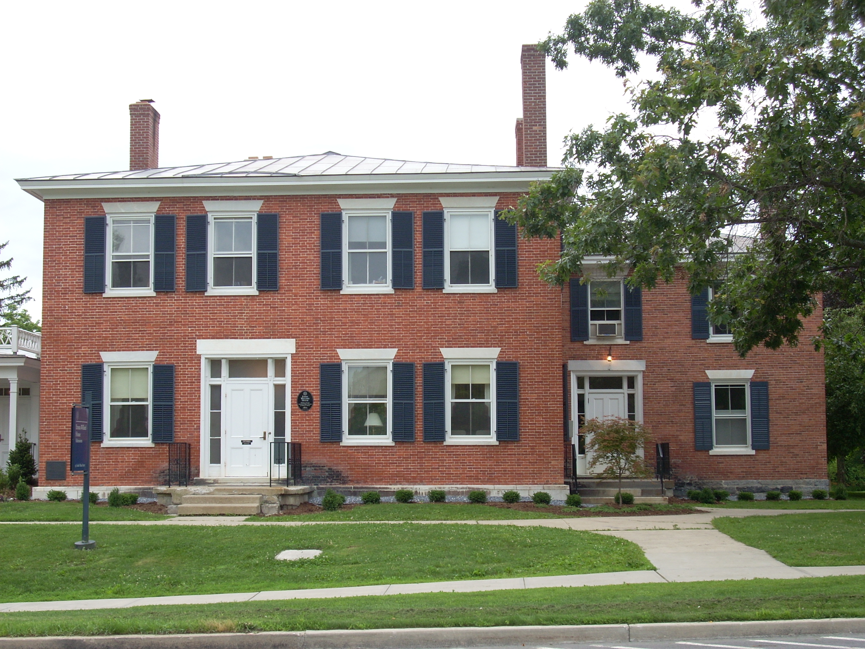
43°53′34″N 73°18′15″W / 43.892778°N 73.304167°WShoreham 51 South Starksboro Friends Meeting House and Cemetery November 7, 1985 Dan Sargent Rd.
44°10′02″N 73°00′53″W / 44.167222°N 73.014722°WStarksboro 52 Stagecoach Inn November 15, 1984 U.S. Route 7
43°51′57″N 73°06′27″W / 43.865833°N 73.1075°WLeicester 53 Starksboro Village Meeting House 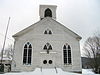
November 7, 1985 VT 116
44°13′32″N 73°03′28″W / 44.225556°N 73.057778°WStarksboro Village 54 Stone Mill April 11, 1973 Mill St.
44°01′05″N 73°10′15″W / 44.018056°N 73.170833°WMiddlebury 55 Old Stone Row September 18, 1997 Junction of S. Main St. and Old Chapel Rd.
44°00′32″N 73°10′34″W / 44.008889°N 73.176111°WMiddlebury 56 Gen. Samuel Strong House April 11, 1973 64 W. Main St.
44°09′50″N 73°15′30″W / 44.163889°N 73.258333°WVergennes 57 John Strong House May 15, 1980 Southwest of Addison VT A
44°03′17″N 73°24′43″W / 44.054722°N 73.411944°WAddison 58 Samuel Paddock Strong House August 15, 1979 82 W. Main St.
44°09′41″N 73°15′41″W / 44.161389°N 73.261389°WVergennes 59 Union Church July 20, 2000 Junction of River Rd. and East St.
44°05′33″N 73°06′34″W / 44.0925°N 73.109444°WNew Haven 60 Union Meetinghouse February 23, 1978 U.S. Route 7
44°12′22″N 73°14′45″W / 44.206111°N 73.245833°WFerrisburg 61 University of Vermont Morgan Horse Farm April 11, 1973 Mogan Horse Farm Rd., off U.S. Route 7
44°02′40″N 73°11′10″W / 44.044444°N 73.186111°WWeybridge 62 Vergennes Historic District September 3, 1976 U.S. Route 7
44°10′07″N 73°15′15″W / 44.168611°N 73.254167°WVergennes 63 Vergennes Residential Historic District May 8, 2003 S. Water St., Green St., S. Maple St., all south of Main St.
44°09′57″N 73°15′09″W / 44.165833°N 73.2525°WVergennes 64 Waybury Inn July 14, 1983 VT 125
43°58′19″N 73°05′35″W / 43.971944°N 73.093056°WEast Middlebury 65 Wesleyan Methodist Church April 12, 1996 Quaker Village Rd., near the junction of Baker Ct. and Quaker Village Rd.
44°03′53″N 73°12′57″W / 44.064722°N 73.215833°WWeybridge 66 Wilcox-Cutts House December 2, 1974 2 mi (3.2 km) south of Orwell on VT 22A
43°47′05″N 73°18′29″W / 43.784722°N 73.308056°WOrwell 67 Emma Willard House 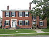
October 15, 1966 Middlebury College campus
44°00′27″N 73°10′29″W / 44.0075°N 73.174722°WMiddlebury Home of Emma Willard, pioneer in women's education in the United States 68 Witherell Farm April 1, 1993 Town Highway 74 (Witherell Rd.) west of Lakeview and St. Genevieve cemeteries
43°53′02″N 73°20′23″W / 43.883889°N 73.339722°WShoreham See also
- List of National Historic Landmarks in Vermont
- National Register of Historic Places listings in Vermont
References
- ^ The latitude and longitude information provided in this table was derived originally from the National Register Information System, which has been found to be fairly accurate for about 99% of listings. For about 1% of NRIS original coordinates, experience has shown that one or both coordinates are typos or otherwise extremely far off; some corrections may have been made. A more subtle problem causes many locations to be off by up to 150 yards, depending on location in the country: most NRIS coordinates were derived from tracing out latitude and longitudes off of USGS topographical quadrant maps created under the North American Datum of 1927, which differs from the current, highly accurate WGS84 GPS system used by Google maps. Chicago is about right, but NRIS longitudes in Washington are higher by about 4.5 seconds, and are lower by about 2.0 seconds in Maine. Latitudes differ by about 1.0 second in Florida. Some locations in this table may have been corrected to current GPS standards.
- ^ "National Register of Historic Places: Weekly List Actions". National Park Service, United States Department of the Interior. Retrieved on November 10, 2011.
- ^ Numbers represent an ordering by significant words. Various colorings, defined here, differentiate National Historic Landmark sites and National Register of Historic Places Districts from other NRHP buildings, structures, sites or objects.
- ^ "National Register Information System". National Register of Historic Places. National Park Service. . http://nrhp.focus.nps.gov/natreg/docs/All_Data.html.
- ^ http://www.dogteamcatering.com/index.htm
U.S. National Register of Historic Places Topics Lists by states Alabama • Alaska • Arizona • Arkansas • California • Colorado • Connecticut • Delaware • Florida • Georgia • Hawaii • Idaho • Illinois • Indiana • Iowa • Kansas • Kentucky • Louisiana • Maine • Maryland • Massachusetts • Michigan • Minnesota • Mississippi • Missouri • Montana • Nebraska • Nevada • New Hampshire • New Jersey • New Mexico • New York • North Carolina • North Dakota • Ohio • Oklahoma • Oregon • Pennsylvania • Rhode Island • South Carolina • South Dakota • Tennessee • Texas • Utah • Vermont • Virginia • Washington • West Virginia • Wisconsin • WyomingLists by territories Lists by associated states Other Municipalities and communities of Addison County, Vermont City 
Towns CDP Other
communitiesChimney Point | Satans Kingdom
Categories:- National Register of Historic Places in Vermont by county
- Addison County, Vermont
-


Wikimedia Foundation. 2010.