- National Register of Historic Places listings in Atlantic County, New Jersey
-
List of the National Register of Historic Places listings in Atlantic County, New Jersey
Contents: Counties in New Jersey Atlantic - Bergen - Burlington - Camden - Cape May - Cumberland - Essex - Gloucester - Hudson - Hunterdon - Mercer - Middlesex - Monmouth - Morris - Ocean - Passaic - Salem - Somerset - Sussex - Union - Warren This is intended to be a complete list of properties and districts listed on the National Register of Historic Places in Atlantic County, New Jersey. The locations of National Register properties and districts (at least for all showing latitude and longitude coordinates below) may be seen in a Google map by clicking on "Map of all coordinates".[1]
-
- This National Park Service list is complete through NPS recent listings posted November 10, 2011.[2]
[3] Landmark name [4] Image Date listed Location City or town Summary 1 Absecon Lighthouse 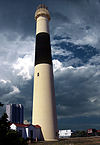
January 25, 1971 Vermont and Pacific Aves.
39°21′58″N 74°24′51″W / 39.366111°N 74.414167°WAtlantic City 2 Atlantic City Convention Hall 
February 27, 1987 Georgia and Mississippi Aves. and the Boardwalk
39°21′17″N 74°26′20″W / 39.354722°N 74.438889°WAtlantic City 3 Capt. Francis Babcock House July 28, 1999 324 S. Shore Rd.
39°25′10″N 74°30′01″W / 39.419444°N 74.500278°WAbsecon City 4 Barclay Court 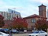
June 22, 1988 9-11 S. Pennsylvania Ave.
39°21′48″N 74°25′24″W / 39.363333°N 74.423333°WAtlantic City Demolished[5] 5 Bay Front Historic District March 22, 1989 Roughly bounded by Decatur Ave., Egg Harbor Bay, George Ave., and Shore Rd.
39°18′41″N 74°35′41″W / 39.311389°N 74.594722°WSomers Point 6 Belcoville Post Office 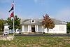
March 14, 2008 1201 Madden Ave.
39°26′20″N 74°44′00″W / 39.438889°N 74.733333°WWeymouth Township 7 Bethlehem Loading Company Mays Landing Plant Archeological Historic District July 12, 2006 Address Restricted Estell Manor 8 William L. Black House August 26, 1993 458 Bellevue Ave.
39°38′24″N 74°47′56″W / 39.64°N 74.798889°WHammonton 9 Amanda Blake Store January 15, 1979 104 Main St.
39°31′09″N 74°29′29″W / 39.519167°N 74.491389°WPort Republic 10 Church of the Ascension 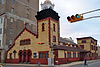
July 24, 1986 1601 Pacific Ave.
39°21′35″N 74°25′47″W / 39.359586°N 74.429584°WAtlantic City 11 Church of the Redeemer 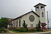
September 10, 1992 Jct. of 20th and Atlantic Aves.
39°18′34″N 74°31′51″W / 39.309444°N 74.530833°WLongport 12 John Doughty House March 5, 2002 40 North Shore Rd.
39°25′28″N 74°29′56″W / 39.424483°N 74.498956°WAbsecon City 13 Egg Harbor Commercial Bank 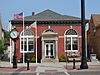
August 28, 2007 134 Philadelphia Ave.
39°31′46″N 74°38′48″W / 39.529444°N 74.646667°WEgg Harbor City 14 Estellville Glassworks Historic District November 21, 1991 Roughly bounded by Estell Manor Park, Stevens Cr. and NJ 50
39°23′43″N 74°44′52″W / 39.395278°N 74.747778°WEstell Manor City 15 Great Egg Coast Guard Station 
October 31, 2005 2301 Atlantic Ave.
39°18′42″N 74°31′41″W / 39.311761°N 74.527939°WLongport 16 Head of the River Church March 7, 1979 NJ 49
39°18′38″N 74°49′19″W / 39.310556°N 74.821944°WEstell Manor 17 Holmhurst Hotel January 18, 1978 121 S. Pennsylvania Ave.
39°21′41″N 74°25′23″W / 39.361389°N 74.423056°WAtlantic City Demolished, March 1985.[5] Now a parking lot. 18 Jacobus Evangelical Lutheran Church 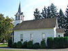
June 9, 1988 Mays Landing Rd. and NJ 54
39°36′25″N 74°50′49″W / 39.606944°N 74.846944°WFolsom Borough 19 Capt. John Jeffries Burial Marker June 14, 1984 Palestine Bible Church Cemetery, NJ 559
39°20′55″N 74°39′42″W / 39.348611°N 74.661667°WSomers Point 20 Linwood Borough School No. 1 December 20, 1984 16 W. Poplar Ave.
39°21′03″N 74°34′04″W / 39.350833°N 74.567778°WLinwood 21 Linwood Historic District July 13, 1989 Roughly Shore Rd. from Royal Ave. to Sterling Ave.
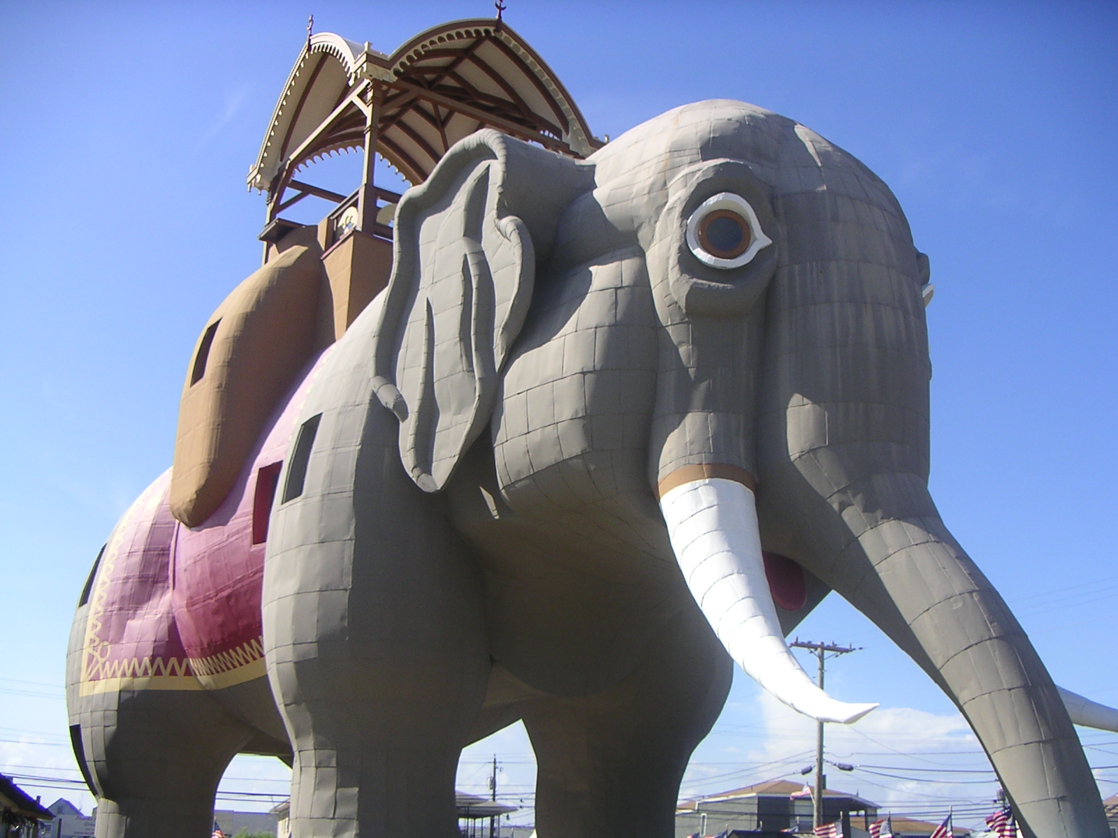
39°20′27″N 74°34′30″W / 39.340833°N 74.575°WLinwood 22 Lucy, the Margate Elephant 
August 12, 1971 Decatur and Atlantic Aves.
39°19′15″N 74°30′42″W / 39.320775°N 74.511597°WMargate City 23 Madison Hotel 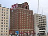
December 20, 1984 123 S. Illinois Ave.
39°21′28″N 74°25′49″W / 39.357778°N 74.430278°WAtlantic City 24 Marven Gardens Historic District 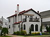
September 13, 1990 Bounded by Ventnor, Fredericksburg, Winchester and Brunswick Aves.
39°20′00″N 74°29′43″W / 39.333333°N 74.495278°WMargate City 25 Mays Landing Historic District 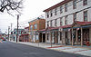
August 23, 1990 Jct. US 40, NJ 50; roughly bounded by Lake Lenape and Great Egg Harbor
39°27′06″N 74°43′51″W / 39.451667°N 74.730833°WMays Landing 26 Mays Landing Presbyterian Church 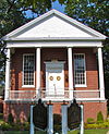
April 20, 1982 Main St. and Cape May Ave.
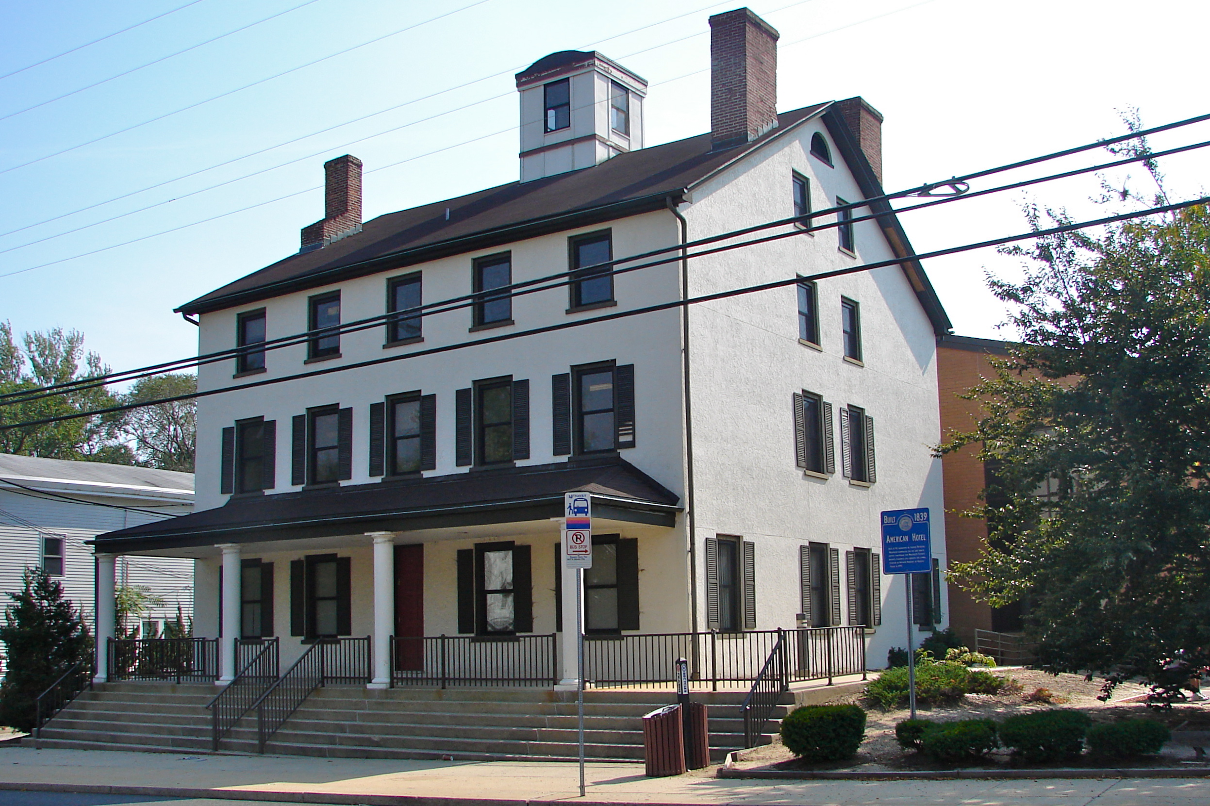
39°27′09″N 74°43′40″W / 39.4525°N 74.727778°WMays Landing 27 Morton Hotel 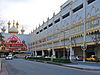
July 15, 1977 150 S. Virginia Ave.
39°21′34″N 74°25′14″W / 39.359444°N 74.420556°WAtlantic City Demolished,[5] now occupied by Trump Taj Mahal 28 Neutral Water Health Resort Sanitarium March 20, 1991 Jct. of Claudius St. and London Ave.
39°32′08″N 74°38′30″W / 39.535556°N 74.641667°WEgg Harbor City 29 Dr. Jonathan Pitney House August 14, 1998 57 N. Shore Rd.
39°25′31″N 74°29′55″W / 39.425231°N 74.498728°WAbsecon City 30 Pleasant Mills March 3, 1995 Elwood-Pleasant Mills Rd., E side
39°38′13″N 74°39′39″W / 39.636944°N 74.660833°WMullica Township 31 Port Republic Historic District May 16, 1991 Roughly bounded by Mill St., Clark's Landing Rd., Adams Ave., Port Republic-Smithville Rd. and Riverside Dr.
39°31′15″N 74°29′35″W / 39.520833°N 74.493056°WPort Republic 32 Samuel Richards Hotel 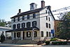
August 31, 1979 106 E. Main St
39°27′04″N 74°43′31″W / 39.451111°N 74.725278°WMays Landing 33 Jeremiah II or Edward Risley House May 31, 1991 8 Virginia Ave.
39°22′32″N 74°32′22″W / 39.375556°N 74.539444°WNorthfield 34 Risley School May 4, 2011 134 Cape May Ave.
39°22′37″N 74°49′29″W / 39.376944°N 74.824722°WEstell Manor 35 Santa Rita Apartments June 14, 1991 66 South Carolina Ave.
39°21′40″N 74°25′35″W / 39.361111°N 74.426389°WAtlantic City 36 Segal Building 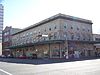
February 9, 1984 1200 Atlantic Ave.
39°21′46″N 74°25′35″W / 39.362778°N 74.426389°WAtlantic City 37 Shelburne Hotel 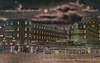
May 19, 1978 Michigan Ave. and the Boardwalk
39°21′21″N 74°26′03″W / 39.355833°N 74.434167°WAtlantic City Demolished[5] 38 Smithville Apothecary June 9, 1978 Off Moss Mill Rd.
39°29′47″N 74°27′49″W / 39.496389°N 74.463611°WSmithville 39 Somers Mansion December 18, 1970 Shore Rd. and Somers Point Circle
39°18′33″N 74°35′55″W / 39.309167°N 74.598611°WSomers Point 40 St. Nicholas of Tolentine Church 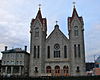
February 2, 2001 1409 Pacific Ave.
39°21′38″N 74°25′41″W / 39.360556°N 74.428056°WAtlantic City 41 John Stafford Historic District 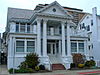
June 9, 1988 Roughly bounded by Atlantic Ave., Vassar Ave., Boardwalk, and Austin Ave.
39°20′35″N 74°28′01″W / 39.343056°N 74.466944°WVentnor City 42 Ventnor City Hall 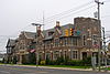
October 10, 1996 6201 Atlantic Ave.
39°20′15″N 74°28′49″W / 39.3375°N 74.480278°WVentnor City 43 WEYMOUTH (schooner) April 25, 1985 Address Restricted Hamilton Township 44 Weymouth Road Bridge June 21, 2001 Weymouth Rd.
39°31′07″N 74°46′45″W / 39.518611°N 74.779167°WHamilton Township 45 World War I Memorial 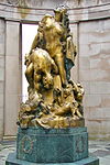
August 28, 1981 O'Donnell Pkwy., S. Albany and Ventnor Aves.
39°21′05″N 74°27′19″W / 39.351389°N 74.455278°WAtlantic City References
- ^ The latitude and longitude information provided in this table was derived originally from the National Register Information System, which has been found to be fairly accurate for about 99% of listings. For about 1% of NRIS original coordinates, experience has shown that one or both coordinates are typos or otherwise extremely far off; some corrections may have been made. A more subtle problem causes many locations to be off by up to 150 yards, depending on location in the country: most NRIS coordinates were derived from tracing out latitude and longitudes off of USGS topographical quadrant maps created under the North American Datum of 1927, which differs from the current, highly accurate WGS84 GPS system used by Google maps. Chicago is about right, but NRIS longitudes in Washington are higher by about 4.5 seconds, and are lower by about 2.0 seconds in Maine. Latitudes differ by about 1.0 second in Florida. Some locations in this table may have been corrected to current GPS standards.
- ^ "National Register of Historic Places: Weekly List Actions". National Park Service, United States Department of the Interior. Retrieved on November 10, 2011.
- ^ Numbers represent an ordering by significant words. Various colorings, defined here, differentiate National Historic Landmark sites and National Register of Historic Places Districts from other NRHP buildings, structures, sites or objects.
- ^ "National Register Information System". National Register of Historic Places. National Park Service. . http://nrhp.focus.nps.gov/natreg/docs/All_Data.html.
- ^ a b c d NJ DEP Historic Preservation Office
U.S. National Register of Historic Places Topics Lists by states Alabama • Alaska • Arizona • Arkansas • California • Colorado • Connecticut • Delaware • Florida • Georgia • Hawaii • Idaho • Illinois • Indiana • Iowa • Kansas • Kentucky • Louisiana • Maine • Maryland • Massachusetts • Michigan • Minnesota • Mississippi • Missouri • Montana • Nebraska • Nevada • New Hampshire • New Jersey • New Mexico • New York • North Carolina • North Dakota • Ohio • Oklahoma • Oregon • Pennsylvania • Rhode Island • South Carolina • South Dakota • Tennessee • Texas • Utah • Vermont • Virginia • Washington • West Virginia • Wisconsin • WyomingLists by territories Lists by associated states Other  State of New Jersey
Topics Regions - Atlantic Coastal Plain
- Central Jersey
- Delaware River Region
- Delaware Valley
- Gateway Region
- Gold Coast
- Highlands
- Jersey Shore
- Meadowlands
- New York metro area
- North Hudson
- North Jersey
- Pascack Valley
- Piedmont
- Pine Barrens
- Raritan Bayshore
- Ridge-and-Valley Appalachians
- Southern Shore Region
- Skylands Region
- South Jersey
- Tri‑State Region
- West Hudson
Counties Major cities Categories:- National Register of Historic Places in New Jersey
- Atlantic County, New Jersey
-


Wikimedia Foundation. 2010.