- National Register of Historic Places listings in Augusta County, Virginia
-
This list includes properties and districts listed on the National Register of Historic Places in Augusta County, Virginia. Click the "Map of all coordinates" link to the right to view a Google map of all properties and districts with latitude and longitude coordinates in the table below.[1]
-
- This National Park Service list is complete through NPS recent listings posted November 10, 2011.[2]
[3] Landmark name [4] Image Date listed Location City or town Summary 1 James Alexander House September 16, 1982 N of Spottswood on VA 671
37°57′52″N 79°12′12″W / 37.964444°N 79.203333°WSpottswood 2 Archeological Site No. AU-154 December 13, 1985 Address Restricted Luray 3 Augusta County Training School June 19, 1986 VA 693
38°08′49″N 79°07′55″W / 38.146944°N 79.131944°WCedar Green 4 Augusta Military Academy 
February 10, 1983 N of Staunton on U.S. 11
38°14′12″N 78°58′39″W / 38.236667°N 78.9775°WFort Defiance 5 Augusta Stone Church 
May 9, 1973 U.S. 11
38°14′18″N 78°58′26″W / 38.238333°N 78.973889°WFort Defiance 6 Bare House and Mill November 21, 2002 157 Wilda Rd.
38°01′36″N 79°05′40″W / 38.026617°N 79.094511°WStuarts Draft 7 Bethel Green August 26, 1982 Rte. 701
38°02′31″N 79°10′34″W / 38.041944°N 79.176111°WGreenville 8 Blackrock Springs Site December 13, 1985 Address Restricted Luray 9 Chapel Hill November 16, 1978 E of Mint Spring on VA 654
38°04′01″N 79°04′23″W / 38.066944°N 79.073056°WMint Spring 10 Clover Mount September 16, 1982 W of Greenvile on VA 674
37°59′58″N 79°12′26″W / 37.999444°N 79.207222°WGreenville 11 Coiner House March 30, 1978 NW of Crimora off VA 865
38°10′02″N 78°51′48″W / 38.167222°N 78.863333°WCrimora 12 Craigsville School February 27, 1985 Railroad Ave.
38°04′46″N 79°22′48″W / 38.079444°N 79.38°WCraigsville 13 Crimora School February 27, 1985 VA 612
38°09′17″N 78°51′10″W / 38.154722°N 78.852778°WCrimora 14 Deerfield School June 19, 1986 VA 600
38°11′40″N 79°24′22″W / 38.194444°N 79.406111°WDeerfield 15 Estaline Schoolhouse February 27, 1985 VA 601
38°03′45″N 79°21′27″W / 38.0625°N 79.3575°WEstaline Valley 16 Folly October 25, 1973 S of Staunton on U.S. 11
38°05′21″N 79°06′05″W / 38.089167°N 79.101389°WStaunton 17 Glebe Burying Ground October 1, 1985 S of Swoope on VA 876
38°06′33″N 79°13′20″W / 38.109167°N 79.222222°WSwoope 18 Glebe Schoolhouse February 27, 1985 VA 876
38°06′36″N 79°13′17″W / 38.11°N 79.221389°WSummerdean 19 Hanger Mill November 8, 1991 Jct. of VA 801 and US 250
38°13′10″N 79°08′09″W / 38.219444°N 79.135833°WChurchville 20 Harnsberger Octagonal Barn July 8, 1982 VA 256 and VA 865
38°15′44″N 78°51′53″W / 38.262222°N 78.864722°WGrottoes 21 Harper House February 1, 2006 3029 Stuarts Draft Hwy.
38°02′24″N 79°01′10″W / 38.04°N 79.019444°WStuarts Draft 22 Intervale February 14, 1985 VA 720
38°11′51″N 79°11′21″W / 38.1975°N 79.189167°WSwoope 23 Long Glade Farm January 22, 1996 VA 607, S of jct. with VA 741
38°16′58″N 79°04′14″W / 38.282778°N 79.070556°WMount Solon 24 Maple Front Farm August 16, 2010 439 Cale Spring Rd.
38°03′33″N 79°14′26″W / 38.059167°N 79.240556°WMiddlebrook vicinity 25 Middlebrook High School February 27, 1985 VA 670
38°03′00″N 79°12′48″W / 38.05°N 79.213333°WMiddlebrook 26 Middlebrook Historic District February 10, 1983 Jct. VA 252 and 876
38°03′07″N 79°12′53″W / 38.051944°N 79.214722°WMiddlebrook 27 Middlebrook School February 27, 1985 VA 670
38°03′00″N 79°12′48″W / 38.05°N 79.213333°WMiddlebrook 28 A. J. Miller House July 8, 1982 VA 639
38°01′25″N 79°13′57″W / 38.023611°N 79.2325°WMiddlebrook 29 Hannah Miller House May 24, 1979 N of Mossy Creek off VA 747
38°21′33″N 79°01′48″W / 38.359167°N 79.03°WMossy Creek 30 Henry Miller House May 23, 1979 E of Mossy Creek on VA 42
38°21′26″N 79°01′41″W / 38.357222°N 79.028056°WMossy Creek 31 Henry Mish Barn February 10, 1983 N of Middlebrook on VA 876
38°03′53″N 79°13′25″W / 38.064722°N 79.223611°WMiddlebrook 32 Moffett's Creek Schoolhouse February 27, 1985 VA 681
38°00′08″N 79°18′28″W / 38.002222°N 79.307778°WNewport 33 Mount Pleasant October 30, 1989 879 Middle River Rd.
38°14′39″N 79°05′24″W / 38.244167°N 79.09°WStaunton 34 Mt. Meridian Schoolhouse February 27, 1985 VA 865
38°15′34″N 78°51′39″W / 38.259444°N 78.860833°WMt. Meridian 35 Mt. Sidney Historic District October 30, 1998 Lee Highway, Mt. Sidney School Ln.,Pottery Shop Ln.
38°15′22″N 78°57′36″W / 38.256111°N 78.96°WMt. Sidney 36 Mt. Sidney School February 27, 1985 VA 11
38°15′21″N 78°57′44″W / 38.255833°N 78.962222°WMt. Sidney 37 Mt. Torry Furnace February 25, 1974 SW of Waynesboro on VA 664 in the George Washington National Forest
37°56′43″N 78°57′53″W / 37.945278°N 78.964722°WSherando 38 Mt. Zion Schoolhouse February 27, 1985 VA 747
38°20′12″N 79°07′37″W / 38.336667°N 79.126944°WMount Solon 39 New Hope High School February 27, 1985 VA 608
38°12′04″N 78°54′14″W / 38.201111°N 78.903889°WNew Hope 40 North River High School February 27, 1985 VA 42
38°18′54″N 79°04′46″W / 38.315°N 79.079444°WMoscow 41 Old Providence Stone Church December 5, 1972 Jct. of VA 613 and VA 620
37°57′40″N 79°13′36″W / 37.961111°N 79.226667°WSpottswood 42 Paine Run Rockshelter December 13, 1985 Address Restricted Luray 43 Lewis Shuey House February 10, 1983 S of Swoope on VA 713
38°07′05″N 79°13′38″W / 38.118056°N 79.227222°WSwoope 44 Skyline Drive Historic District April 28, 1997 Shenandoah National Park, from the N entrance station at Front Royal to the S entrance station at Rockfish Gap
38°32′54″N 78°27′38″W / 38.548333°N 78.460556°WLuray 45 Sugar Loaf Farm 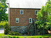
July 9, 1991 W of jct. of VA 695 and VA 710
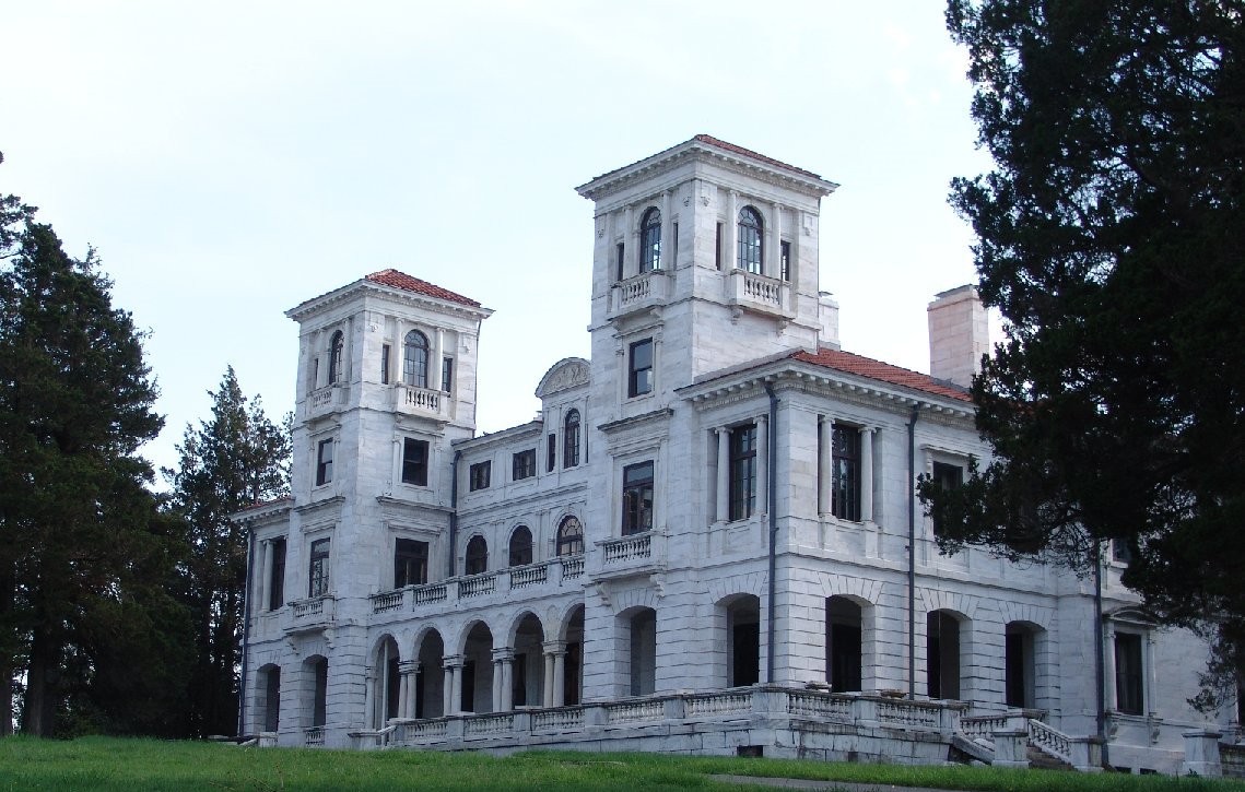
38°06′10″N 79°10′40″W / 38.102778°N 79.177778°WStaunton 46 Swannanoa 
October 1, 1969 S of jct. of VA 610 and U.S. 250
38°01′41″N 78°52′08″W / 38.028056°N 78.868889°WWaynesboro 47 Tinkling Spring Presbyterian Church April 11, 1973 VA 608, 1 mi. S of jct. with VA 636 and VA 631
38°05′06″N 78°58′59″W / 38.085°N 78.983056°WFishersville 48 Valley Railroad Stone Bridge 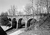
November 19, 1974 S of Jolivue off VA 654
38°05′21″N 79°04′40″W / 38.089167°N 79.077778°WJolivue 49 Verona School February 27, 1985 VA 11
38°12′13″N 79°00′27″W / 38.203611°N 79.0075°WVerona 50 Walker's Creek Schoolhouse February 27, 1985 VA 602
38°00′57″N 79°19′54″W / 38.015833°N 79.331667°WNewport 51 West View Schoolhouse February 27, 1985 VA 774 and 773
38°16′02″N 78°54′42″W / 38.267222°N 78.911667°WWeyers Cave 52 Weyers Cave School February 27, 1985 VA 276
38°17′17″N 78°54′33″W / 38.288056°N 78.909167°WWeyers Cave See also
- National Register of Historic Places listings in Virginia
- National Register of Historic Places listings in Staunton, Virginia
- National Register of Historic Places listings in Waynesboro, Virginia
- List of National Historic Landmarks in Virginia
References
- ^ The latitude and longitude information provided in this table was derived originally from the National Register Information System, which has been found to be fairly accurate for about 99% of listings. For about 1% of NRIS original coordinates, experience has shown that one or both coordinates are typos or otherwise extremely far off; some corrections may have been made. A more subtle problem causes many locations to be off by up to 150 yards, depending on location in the country: most NRIS coordinates were derived from tracing out latitude and longitudes off of USGS topographical quadrant maps created under North American Datum of 1927, which differs from the current, highly accurate GPS system used by Google maps. Chicago is about right, but NRIS longitudes in Washington are higher by about 4.5 seconds, and are lower by about 2.0 seconds in Maine. Latitudes differ by about 1.0 second in Florida. Some locations in this table may have been corrected to current GPS standards.
- ^ "National Register of Historic Places: Weekly List Actions". National Park Service, United States Department of the Interior. Retrieved on November 10, 2011.
- ^ Numbers represent an ordering by significant words. Various colorings, defined here, differentiate National Historic Landmark sites and National Register of Historic Places Districts from other NRHP buildings, structures, sites or objects.
- ^ "National Register Information System". National Register of Historic Places. National Park Service. . http://nrhp.focus.nps.gov/natreg/docs/All_Data.html.
U.S. National Register of Historic Places Topics Lists by states Alabama • Alaska • Arizona • Arkansas • California • Colorado • Connecticut • Delaware • Florida • Georgia • Hawaii • Idaho • Illinois • Indiana • Iowa • Kansas • Kentucky • Louisiana • Maine • Maryland • Massachusetts • Michigan • Minnesota • Mississippi • Missouri • Montana • Nebraska • Nevada • New Hampshire • New Jersey • New Mexico • New York • North Carolina • North Dakota • Ohio • Oklahoma • Oregon • Pennsylvania • Rhode Island • South Carolina • South Dakota • Tennessee • Texas • Utah • Vermont • Virginia • Washington • West Virginia • Wisconsin • WyomingLists by territories Lists by associated states Other  Category:National Register of Historic Places •
  Portal:National Register of Historic Places
Municipalities and communities of Augusta County, Virginia County seat: Staunton Towns 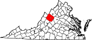
CDPs Augusta Springs | Churchville | Crimora | Deerfield | Dooms | Fishersville | Greenville | Harriston | Jolivue | Lyndhurst | Middlebrook | Mount Sidney | New Hope | Sherando | Stuarts Draft | Verona | Weyers Cave
Unincorporated
communitiesBuffalo Gap | Centerville | Ferrol | Fort Defiance | Ladd | Lone Fountain | Mount Solon | Newport | Spring Hill | Steeles Tavern
Footnotes ‡This populated place also has portions in an adjacent county or counties
Categories:- Augusta County, Virginia
- National Register of Historic Places in Virginia
- Virginia-related lists
-


Wikimedia Foundation. 2010.