- National Register of Historic Places listings in Bamberg County, South Carolina
-
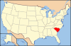
 Location of Bamberg County in South Carolina
This is a list of the National Register of Historic Places listings in Bamberg County, South Carolina.
This is intended to be a complete list of the properties and districts on the National Register of Historic Places in Bamberg County, South Carolina, United States. The locations of National Register properties and districts for which the latitude and longitude coordinates are included below, may be seen in a Google map.[1]
There are 12 properties and districts listed on the National Register in the county, including 1 National Historic Landmark.
-
- This National Park Service list is complete through NPS recent listings posted November 10, 2011.[2]
Current listings
[3] Landmark name [4] Image Date listed Location City or town Summary 1 American Telephone and Telegraph Company Building July 8, 1999 124 N. Palmetto Ave.
33°19′36″N 81°08′31″W / 33.326667°N 81.141944°WDenmark 2 Bamberg City Hall September 28, 2005 3069 Main Highway
33°17′47″N 81°02′07″W / 33.296389°N 81.035278°WBamberg 3 Bamberg Historic District May 19, 1983 E. Railroad Ave. and 2nd, Midway, Elm, Cannon, N. Carlisle, and Church Sts. Bamberg 4 Bamberg Post Office May 22, 2007 11955 Heritage Highway Bamberg 5 Gen. Francis Marion Bamberg House June 29, 1976 N. Railroad Ave. and N. Carlisle St.
33°17′50″N 81°02′57″W / 33.297222°N 81.049167°WBamberg 6 Cal Smoak Site January 6, 1986 Address Restricted Bamberg 7 Copeland House October 18, 1991 Secondary Road 389, 0.3 miles south of its junction with South Carolina Highway 64
33°05′43″N 81°02′47″W / 33.095278°N 81.046389°WEhrhardt 8 Denmark High School March 29, 2001 N. Palmetto Ave.
33°19′42″N 81°08′26″W / 33.328333°N 81.140556°WDenmark 9 Mizpah Methodist Church December 13, 2000 Junction of U.S. Route 301 and S-5-31 Olar 10 Rivers Bridge State Park February 23, 1972 6 miles southwest of Ehrhardt Ehrhardt 11 Voorhees College Historic District January 21, 1982 Voorhees College campus Denmark 12 Woodlands 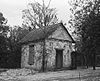
November 11, 1971 3 miles south of Bamberg on South Carolina Highway 78 Bamberg See also
- List of National Historic Landmarks in South Carolina
- National Register of Historic Places listings in South Carolina
References
- ^ The latitude and longitude information provided in this table was derived originally from the National Register Information System, which has been found to be fairly accurate for about 99% of listings. For about 1% of NRIS original coordinates, experience has shown that one or both coordinates are typos or otherwise extremely far off; some corrections may have been made. A more subtle problem causes many locations to be off by up to 150 yards, depending on location in the country: most NRIS coordinates were derived from tracing out latitude and longitudes off of USGS topographical quadrant maps created under the North American Datum of 1927, which differs from the current, highly accurate WGS84 GPS system used by Google maps. Chicago is about right, but NRIS longitudes in Washington are higher by about 4.5 seconds, and are lower by about 2.0 seconds in Maine. Latitudes differ by about 1.0 second in Florida. Some locations in this table may have been corrected to current GPS standards.
- ^ "National Register of Historic Places: Weekly List Actions". National Park Service, United States Department of the Interior. Retrieved on November 10, 2011.
- ^ Numbers represent an ordering by significant words. Various colorings, defined here, differentiate National Historic Landmark sites and National Register of Historic Places Districts from other NRHP buildings, structures, sites or objects.
- ^ "National Register Information System". National Register of Historic Places. National Park Service. . http://nrhp.focus.nps.gov/natreg/docs/All_Data.html.
U.S. National Register of Historic Places in South Carolina Lists by county Abbeville • Aiken • Allendale • Anderson • Bamberg • Barnwell • Beaufort • Berkeley • Calhoun • Charleston • Cherokee • Chester • Chesterfield • Clarendon • Colleton • Darlington • Dillon • Dorchester • Edgefield • Fairfield • Florence • Georgetown • Greenville • Greenwood • Hampton • Horry • Jasper • Kershaw • Lancaster • Laurens • Lee • Lexington • Marion • Marlboro • McCormick • Newberry • Oconee • Orangeburg • Pickens • Richland • Saluda • Spartanburg • Sumter • Union • Williamsburg • York
Lists by city Other lists Municipalities and communities of Bamberg County, South Carolina Cities 
Towns Categories:- Bamberg County, South Carolina
- National Register of Historic Places in South Carolina by county
- Buildings and structures in Bamberg County, South Carolina
-


Wikimedia Foundation. 2010.