- National Register of Historic Places listings in Bartholomew County, Indiana
-
 Location of Bartholomew County in Indiana
This is a list of the National Register of Historic Places listings in Bartholomew County, Indiana.
This is intended to be a complete list of the properties and districts on the National Register of Historic Places in Bartholomew County, Indiana, United States. Latitude and longitude coordinates are provided for many National Register properties and districts; these locations may be seen together in a Google map.[1]
There are 21 properties and districts listed on the National Register in the county, including 6 National Historic Landmarks.
-
- This National Park Service list is complete through NPS recent listings posted November 10, 2011.[2]
Current listings
[3] Landmark name [4] Image Date listed Location City or town Summary 1 David Aikens House June 6, 2001 2325 Jonesville Rd.
39°10′27″N 85°55′48″W / 39.174167°N 85.93°WColumbus 2 Bartholomew County Courthouse 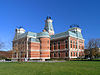
November 15, 1979 3rd and Washington Sts.
39°12′04″N 85°55′17″W / 39.201111°N 85.921389°WColumbus 3 Columbus City Hall 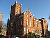
November 15, 1979 5th and Franklin Sts.
39°12′11″N 85°55′13″W / 39.203056°N 85.920278°WColumbus 4 Columbus Historic District 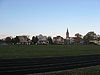
December 10, 1982 Roughly bounded by the former Pennsylvania railroad tracks, Chestnut, 34th, Washington, and Franklin Sts.
39°12′23″N 85°55′04″W / 39.206389°N 85.917778°WColumbus 5 Elnora Daugherty Farm June 4, 1992 5541 E. 500S
39°07′39″N 85°51′43″W / 39.1275°N 85.861944°WColumbus 6 First Baptist Church 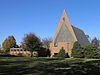
May 16, 2000 3300 Fairlawn Dr.
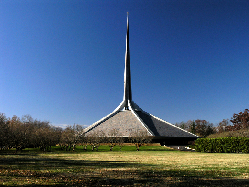
39°14′01″N 85°52′20″W / 39.233611°N 85.872222°WColumbus Designed by Harry Weese 7 First Christian Church 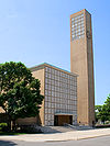
January 3, 2001 531 5th St.
39°12′11″N 85°55′08″W / 39.203056°N 85.918889°WColumbus Designed by Eliel Saarinen 8 William R. Gant Farm September 22, 2000 5890 S. 175 St.
39°09′02″N 85°53′04″W / 39.150556°N 85.884444°WColumbus 9 Haw Creek Leather Company 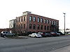
December 17, 1998 Junction of Washington and 1st Sts.
39°11′57″N 85°55′17″W / 39.199167°N 85.921389°WColumbus 10 D.W. Heagy Farm August 14, 1998 3005 W. 200S
39°10′14″N 85°57′23″W / 39.170556°N 85.956389°WColumbus 11 Hope Historic District 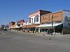
December 19, 1991 Roughly bounded by Haw Creek, Grand St., Walnut St., and South St.
39°18′04″N 85°46′13″W / 39.301111°N 85.770278°WHope 12 Irwin Union Bank and Trust 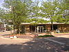
May 16, 2000 500 Washington St.
39°12′13″N 85°55′17″W / 39.203611°N 85.921389°WColumbus 13 James Marr House and Farm 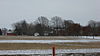
October 23, 1980 Northeast of Columbus on Marr Rd.
39°15′22″N 85°52′50″W / 39.256111°N 85.880556°WColumbus 14 Mabel McDowell Elementary School 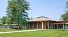
January 3, 2001 2700 McKinley Ave.
39°12′07″N 85°53′31″W / 39.201944°N 85.891944°WColumbus 15 McEwen-Samuels-Marr House 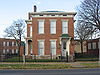
May 22, 1978 524 3rd St.
39°12′06″N 85°55′08″W / 39.201667°N 85.918889°WColumbus 16 McKinley School 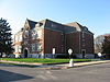
August 25, 1988 17th St. and Home Ave.
39°12′57″N 85°54′44″W / 39.215833°N 85.912222°WColumbus 17 Miller House 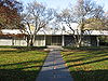
May 16, 2000 2760 Highland Way
39°13′38″N 85°55′23″W / 39.22722°N 85.92306°W[5]Columbus Designed by Eero Saarinen 18 New Hope Bridge 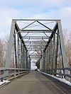
September 9, 1999 County Road 400N over the Flat Rock River
39°15′34″N 85°55′19″W / 39.259444°N 85.921944°WColumbus 19 Newsom-Marr Farm March 20, 2002 4950 S. 150E
39°09′17″N 85°53′02″W / 39.154722°N 85.883889°WColumbus 20 North Christian Church 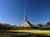
May 16, 2000 850 Tipton Ln.
39°13′46″N 85°54′53″W / 39.229444°N 85.914722°WColumbus 21 Pugh Ford Bridge 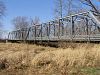
September 9, 1999 County Road 900N over the Flat Rock River
39°20′01″N 85°52′16″W / 39.333611°N 85.871111°WTaylorsville See also
- List of National Historic Landmarks in Indiana
- National Register of Historic Places listings in Indiana
References
- ^ The latitude and longitude information provided in this table was derived originally from the National Register Information System, which has been found to be fairly accurate for about 99% of listings. For about 1% of NRIS original coordinates, experience has shown that one or both coordinates are typos or otherwise extremely far off; some corrections may have been made. A more subtle problem causes many locations to be off by up to 150 yards, depending on location in the country: most NRIS coordinates were derived from tracing out latitude and longitudes off of USGS topographical quadrant maps created under the North American Datum of 1927, which differs from the current, highly accurate WGS84 GPS system used by Google maps. Chicago is about right, but NRIS longitudes in Washington are higher by about 4.5 seconds, and are lower by about 2.0 seconds in Maine. Latitudes differ by about 1.0 second in Florida. Some locations in this table may have been corrected to current GPS standards.
- ^ "National Register of Historic Places: Weekly List Actions". National Park Service, United States Department of the Interior. Retrieved on November 10, 2011.
- ^ Numbers represent an ordering by significant words. Various colorings, defined here, differentiate National Historic Landmark sites and National Register of Historic Places Districts from other NRHP buildings, structures, sites or objects.
- ^ "National Register Information System". National Register of Historic Places. National Park Service. . http://nrhp.focus.nps.gov/natreg/docs/All_Data.html.
- ^ Location derived from this IUPUI website; the NRIS lists the site as "Address Restricted"
U.S. National Register of Historic Places Topics Lists by states Alabama • Alaska • Arizona • Arkansas • California • Colorado • Connecticut • Delaware • Florida • Georgia • Hawaii • Idaho • Illinois • Indiana • Iowa • Kansas • Kentucky • Louisiana • Maine • Maryland • Massachusetts • Michigan • Minnesota • Mississippi • Missouri • Montana • Nebraska • Nevada • New Hampshire • New Jersey • New Mexico • New York • North Carolina • North Dakota • Ohio • Oklahoma • Oregon • Pennsylvania • Rhode Island • South Carolina • South Dakota • Tennessee • Texas • Utah • Vermont • Virginia • Washington • West Virginia • Wisconsin • WyomingLists by territories Lists by associated states Other Municipalities and communities of Bartholomew County, Indiana City 
Towns Clifford | Edinburgh‡ | Elizabethtown | Hartsville | Hope | Jonesville
Townships Unincorporated
communitiesAzalia | Bethel Village | Burnsville | Corn Brook | Everroad Park | Flat Rock Park | Garden City | Grammer | Grandview Lake | Jewell Village | Lowell | Mount Healthy | Newbern | North Gate | North Ogilville | North Park | Northcliff | Nortonburg | Ogilville | Old Saint Louis | Petersville | Pleasant View Village | Riverview Acres | Rosstown | Rugby | Saint Louis Crossing | Stony Lonesome | Taylorsville | Twin Crest | Walesboro | Waymansville | Waynesville
Footnotes ‡This populated place also has portions in an adjacent county or counties
Categories:- National Register of Historic Places in Bartholomew County, Indiana
- National Register of Historic Places in Indiana by county
-


Wikimedia Foundation. 2010.