- National Register of Historic Places listings in Burleigh County, North Dakota
-
 Location of Burleigh County in North Dakota
This is a list of the National Register of Historic Places listings in Burleigh County, North Dakota. It is intended to be a complete list of the properties and districts on the National Register of Historic Places in Burleigh County, North Dakota, United States. The locations of National Register properties and districts for which the latitude and longitude coordinates are included below, may be seen in a Google map.[1]
There are 22 properties and districts listed on the National Register in the county, including 1 National Historic Landmark. Two other sites that were once listed on the Register have been removed.
Contents: Counties in North Dakota Adams | Barnes | Benson | Billings | Bottineau | Bowman | Burke | Burleigh | Cass | Cavalier | Dickey | Divide | Dunn | Eddy | Emmons | Foster | Golden Valley | Grand Forks | Grant | Griggs | Hettinger | Kidder | La Moure | Logan | McHenry | McIntosh | McKenzie | McLean | Mercer | Morton | Mountrail | Nelson | Oliver | Pembina | Pierce | Ramsey | Ransom | Renville | Richland | Rolette | Sargent | Sheridan | Sioux | Slope | Stark | Steele | Stutsman | Towner | Traill | Walsh | Ward | Wells | Williams -
- This National Park Service list is complete through NPS recent listings posted November 10, 2011.[2]
Listings county-wide
[3] Landmark name Image Date listed Location City or town Summary 1 Bismarck Cathedral Area Historic District May 8, 1980 Roughly bounded by Hannifan and N. 1st Sts. and Aves. C and A, W.; also roughly along N. 1st, N. Mandan, N. Washington, and N. Raymond Sts., and Aves. C, D, and E, W.
46°48′37″N 100°47′36″W / 46.810278°N 100.793333°WBismarck Second set of addresses represents a boundary increase; Boundary Increase II (listed 3/31/2010): 104, 106, 112, 115, 116, 120 E Ave B & 523 N 1st St (Remove 316, 320 W Ave A & 510 N Washington St) 2 Bismarck Civic Auditorium June 7, 1976 201 N. 6th St.
46°48′24″N 100°46′56″W / 46.806667°N 100.782222°WBismarck 3 Bismarck Tribune Building October 22, 1982 22 N. 4th St.
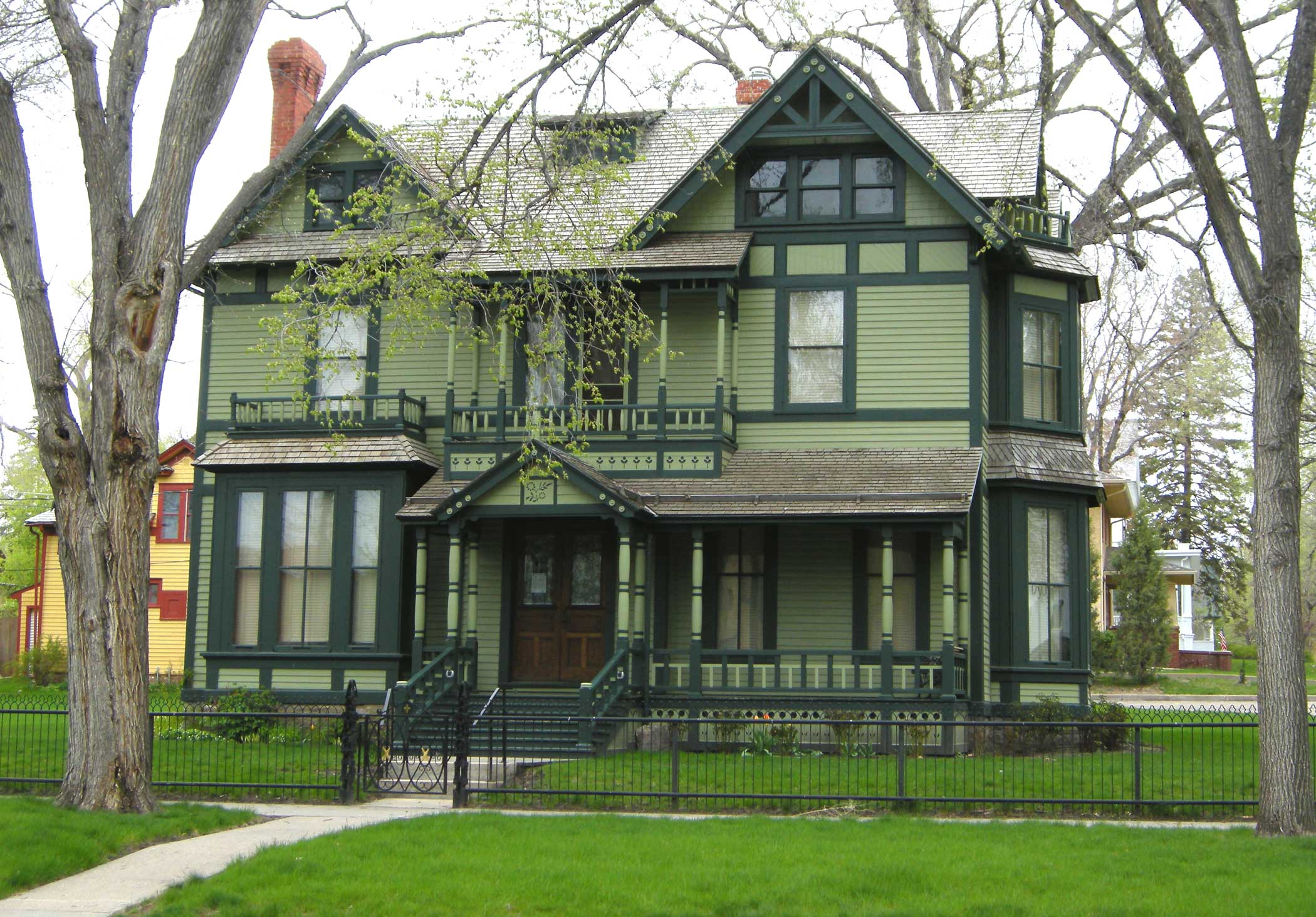
46°48′26″N 100°47′10″W / 46.807222°N 100.786111°WBismarck 4 Dr. Albert M. and Evelyn M. Brandt House August 16, 2000 323 E. Ave. B
46°48′01″N 100°47′09″W / 46.800278°N 100.785833°WBismarck 5 Burleigh County Courthouse 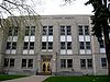
November 14, 1985 E. Thayer Ave.
46°48′28″N 100°47′01″W / 46.807778°N 100.783611°WBismarck 6 Camp Hancock Site February 23, 1972 101 Main Ave.
46°48′19″N 100°47′30″W / 46.805278°N 100.791667°WBismarck 7 Chief Looking's Village site (32BL3) November 21, 1978 Eastern edge of Pioneer Park
46°49′49″N 100°49′46″W / 46.830278°N 100.829444°WBismarck 8 Depression Era Work Relief Construction Features at Menoken State Historic Site December 7, 2010 171st St. and 32nd Ave. NE; 1.7 miles north of Menoken
46°50′29″N 100°31′07″W / 46.841389°N 100.518611°WBismarck vicinity Federal Relief Construction in North Dakota, 1931-1943, MPS 9 Double Ditch Earth Lodge Village Site (32BL8) January 29, 1979 Address Restricted Bismarck 10 Downtown Bismarck Historic District October 28, 2001 Roughly bounded by Broadway and Thayer Aves., 5th St., Burlington and Santa Fe railroad line, and Washington and 2nd Sts.
46°48′12″N 100°47′23″W / 46.803333°N 100.789722°WBismarck 11 Former North Dakota Executive Mansion 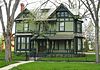
April 16, 1975 320 Ave. B, E.
46°48′40″N 100°47′10″W / 46.811111°N 100.786111°WBismarck 12 Fred and Gladys Grady House July 21, 2006 414 E. Ave. F
46°48′56″N 100°47′05″W / 46.815556°N 100.784722°WBismarck 13 Oliver and Gertrude Lundquist House July 21, 2006 622 W. Thayer St.
46°48′29″N 100°48′00″W / 46.808056°N 100.8°WBismarck 14 Menoken Indian Village Site 
October 15, 1966 171 St. at 32nd Ave., NE.[4] Menoken 15 Northern Pacific Railway Depot 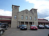
September 19, 1977 407 E. Main Ave.
46°48′18″N 100°47′07″W / 46.805°N 100.785278°WBismarck 16 Patterson Hotel 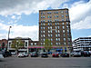
December 8, 1976 422 E. Main Ave.
46°48′21″N 100°47′05″W / 46.805833°N 100.784722°WBismarck 17 E. G. Patterson Building 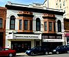
October 22, 1982 412-414 Main St.
46°48′20″N 100°47′05″W / 46.805556°N 100.784722°WBismarck 18 Soo Hotel May 9, 1983 112-114 5th St., N.
46°48′21″N 100°47′05″W / 46.805833°N 100.784722°WBismarck 19 Towne-Williams House April 14, 1975 722 7th St., N.
46°48′45″N 100°46′53″W / 46.8125°N 100.781389°WBismarck 20 U.S. Post Office and Courthouse 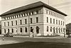
June 23, 1976 304 E. Broadway
46°48′25″N 100°47′13″W / 46.806944°N 100.786944°WBismarck 21 Van Horn Hotel May 10, 1984 114 N. 3rd St.
46°48′22″N 100°47′16″W / 46.806111°N 100.787778°WBismarck 22 Webb Brothers Block October 13, 1983 317 E. Main Ave.
46°48′19″N 100°47′11″W / 46.805278°N 100.786389°WBismarck Former listings
[3] Landmark name Image Date listed Location City or town Summary 1 Liberty Memorial Bridge 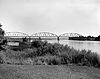
Listed March 11, 1997
Removed March 25, 2009Interstate 94 business loop, across the Missouri River
46°48′28″N 100°49′21″W / 46.80778°N 100.8225°WBismarck Demolished in October 2008. 2 Yegen House and Pioneer Grocery Listed October 5, 1977
Removed February 1, 2011808-810 E. Main Ave.
46°48′20″N 100°46′44″W / 46.80556°N 100.77889°WBismarck See also
- List of National Historic Landmarks in North Dakota
- National Register of Historic Places listings in North Dakota
References
- ^ The latitude and longitude information provided in this table was derived originally from the National Register Information System, which has been found to be fairly accurate for about 99% of listings. For about 1% of NRIS original coordinates, experience has shown that one or both coordinates are typos or otherwise extremely far off; some corrections may have been made. A more subtle problem causes many locations to be off by up to 150 yards, depending on location in the country: most NRIS coordinates were derived from tracing out latitude and longitudes off of USGS topographical quadrant maps created under the North American Datum of 1927, which differs from the current, highly accurate WGS84 GPS system used by Google maps. Chicago is about right, but NRIS longitudes in Washington are higher by about 4.5 seconds, and are lower by about 2.0 seconds in Maine. Latitudes differ by about 1.0 second in Florida. Some locations in this table may have been corrected to current GPS standards.
- ^ "National Register of Historic Places: Weekly List Actions". National Park Service, United States Department of the Interior. Retrieved on November 10, 2011.
- ^ Numbers represent an ordering by significant words. Various colorings, defined here, differentiate National Historic Landmark sites and National Register of Historic Places Districts from other NRHP buildings, structures, sites or objects.
- ^ This location is derived from this National Park service website; the NRIS lists it as "Address Restricted"
U.S. National Register of Historic Places Topics Lists by states Alabama • Alaska • Arizona • Arkansas • California • Colorado • Connecticut • Delaware • Florida • Georgia • Hawaii • Idaho • Illinois • Indiana • Iowa • Kansas • Kentucky • Louisiana • Maine • Maryland • Massachusetts • Michigan • Minnesota • Mississippi • Missouri • Montana • Nebraska • Nevada • New Hampshire • New Jersey • New Mexico • New York • North Carolina • North Dakota • Ohio • Oklahoma • Oregon • Pennsylvania • Rhode Island • South Carolina • South Dakota • Tennessee • Texas • Utah • Vermont • Virginia • Washington • West Virginia • Wisconsin • WyomingLists by territories Lists by associated states Other Municipalities and communities of Burleigh County, North Dakota Cities 
Townships Apple Creek | Boyd | Canfield | Christiania | Clear Lake | Crofte | Cromwell | Driscoll | Ecklund | Estherville | Florence Lake | Francis | Ghylin | Gibbs | Glenview | Grass Lake | Harriet-Lien | Hay Creek | Hazel Grove | Logan | Long Lake | McKenzie | Menoken | Missouri | Morton | Naughton | Painted Woods | Richmond | Rock Hill | Schrunk | Sibley Butte | Steiber | Sterling | Taft | Telfer | Thelma | Trygg | Wild Rose | Wilson | Wing
CDPs Unorganized
territoriesBurnt Creek-Riverview | Lincoln-Fort Rice | Lyman | Phoenix
Unincorporated
communitiesFootnotes ‡This populated place also has portions in an adjacent county or counties
Categories:- National Register of Historic Places in North Dakota by county
- Burleigh County, North Dakota
-


Wikimedia Foundation. 2010.