- National Register of Historic Places listings in Butler County, Pennsylvania
-
 Location of Butler County in Pennsylvania
This is a list of the National Register of Historic Places listings in Butler County, Pennsylvania.
This is intended to be a complete list of the properties and districts on the National Register of Historic Places in Butler County, Pennsylvania, United States. The locations of National Register properties and districts for which the latitude and longitude coordinates are included below, may be seen in a Google map.[1]
There are 10 properties and districts listed on the National Register in the county. One site is further designated as a National Historic Landmark District.
-
- This National Park Service list is complete through NPS recent listings posted November 10, 2011.[2]
Current listings
[3] Landmark name Image Date listed Location City or town Summary 1 Butler Armory 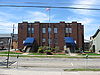
July 12, 1991 216 North Washington Street
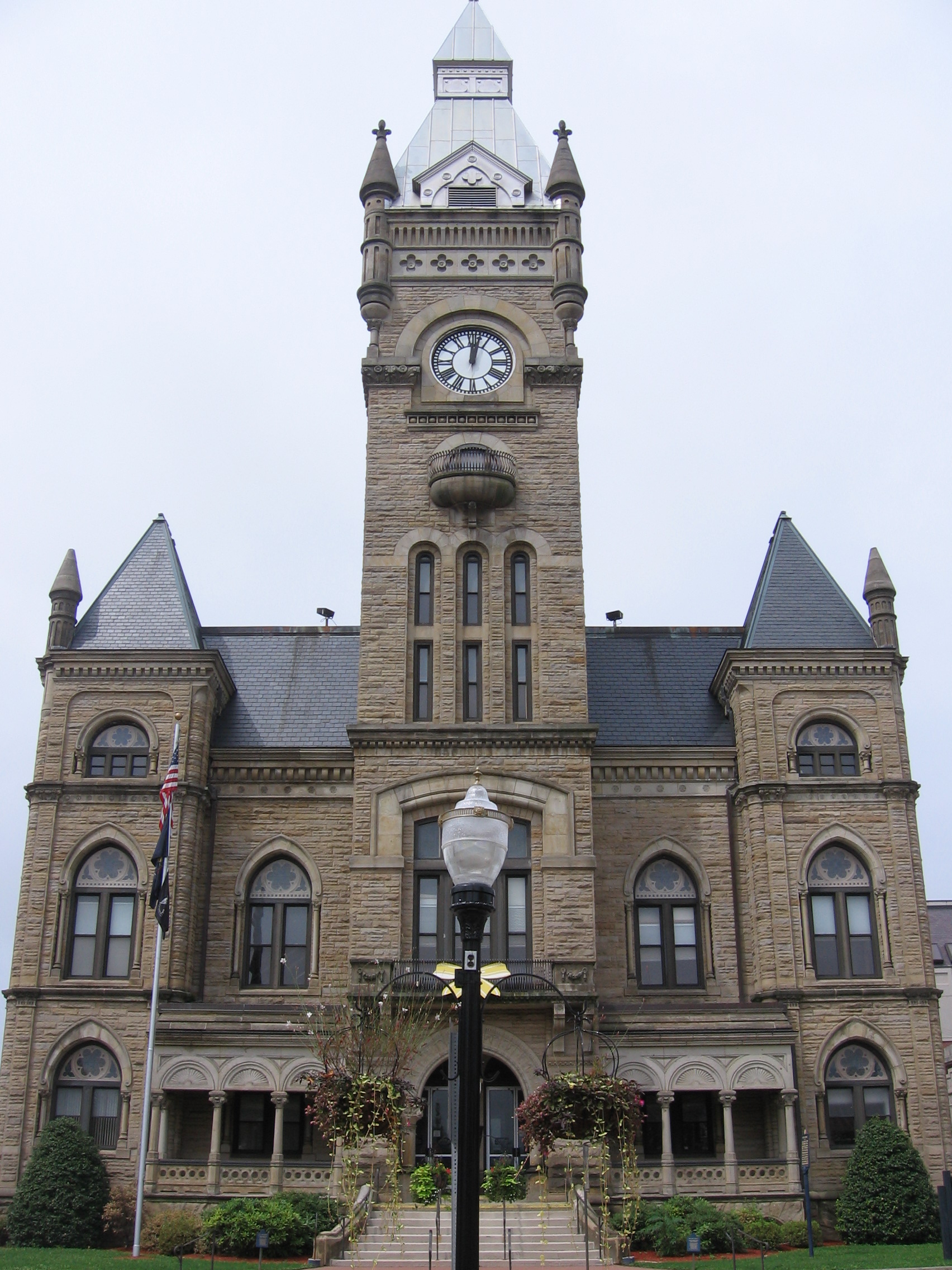
40°51′47″N 79°53′50″W / 40.863056°N 79.897222°WButler 2 Butler County Courthouse 
September 15, 1977 South Main and Diamond Streets
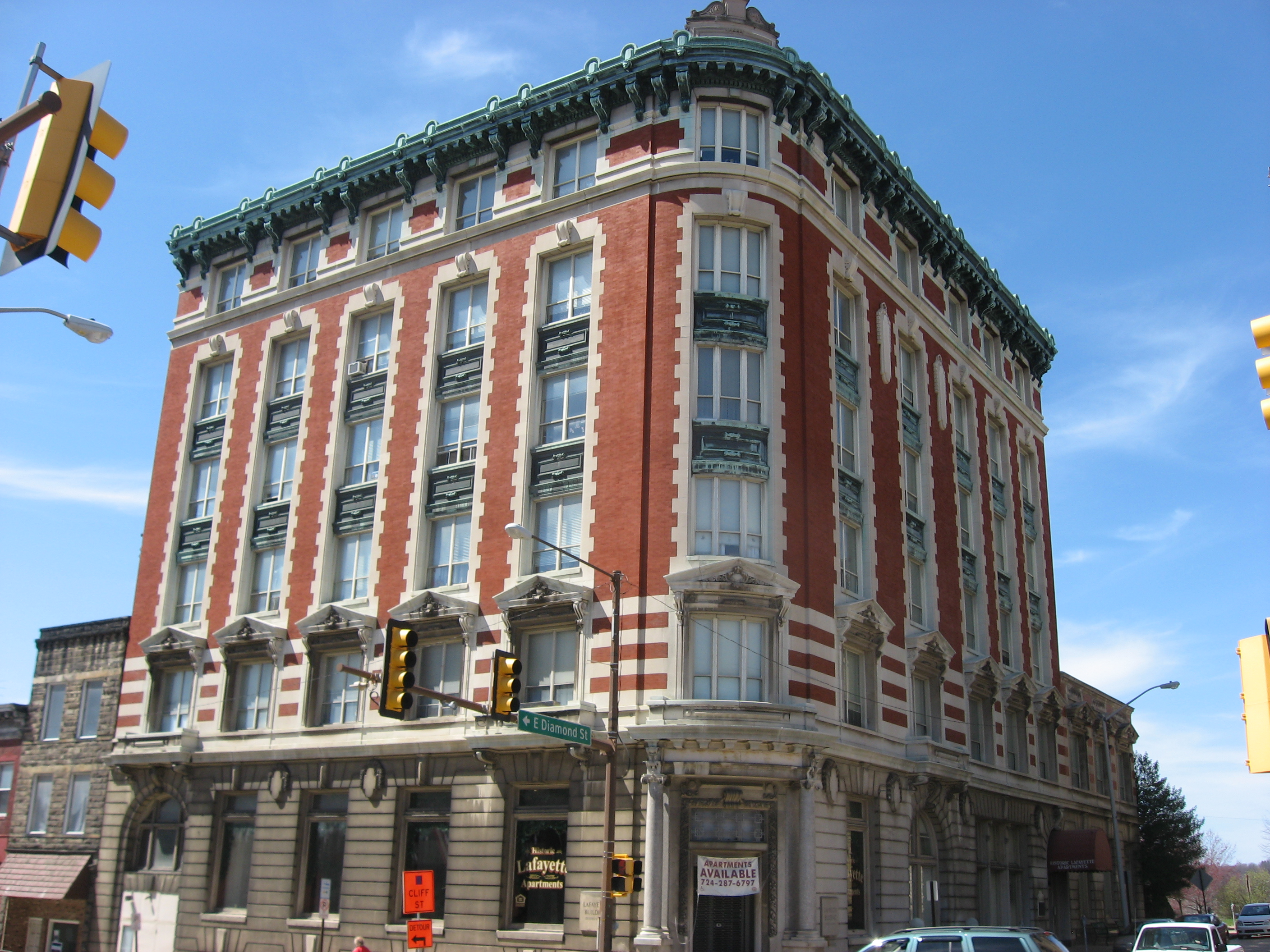
40°51′30″N 79°53′46″W / 40.858333°N 79.896111°WButler 3 Butler County National Bank 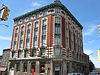
November 7, 1995 302 South Main Street
40°51′29″N 79°53′43″W / 40.858056°N 79.895278°WButler 4 Butler Historic District 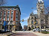
May 29, 2003 Roughly bounded by North Church Street, Walnut Street, Franklin Street, and Wayne Street
40°51′39″N 79°53′40″W / 40.860833°N 79.894444°WButler 5 Elm Court 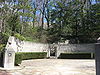
December 6, 1979 Between Polk and Elm Streets
40°52′07″N 79°53′31″W / 40.868611°N 79.891944°WButler 6 Harmony Historic District 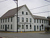
March 21, 1973 PA 68
40°48′11″N 80°07′42″W / 40.803056°N 80.128333°WHarmony 7 Sen. Walter Lowrie House 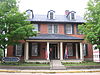
May 1, 1979 West Diamond and South Jackson Streets
40°51′30″N 79°53′47″W / 40.858333°N 79.896389°WButler 8 Passavant House 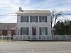
April 11, 1977 243 South Main Street
40°47′35″N 80°08′13″W / 40.793056°N 80.136944°WZelienople 9 John Roebling House 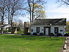
November 13, 1976 Rebecca and Main Streets
40°45′03″N 79°48′39″W / 40.750833°N 79.810833°WSaxonburg Home of John Roebling 10 Saxonburg Historic District 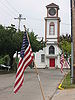
February 14, 2003 Portions of East and West Main, North and South Rebecca, North and South Isabella, Pittsburgh, Butler, and State Streets
40°45′00″N 79°49′08″W / 40.75°N 79.818889°WSaxonburg See also
- List of National Historic Landmarks in Pennsylvania
- National Register of Historic Places listings in Pennsylvania
- List of Pennsylvania state historical markers in Butler County
References
- ^ The latitude and longitude information provided in this table was derived originally from the National Register Information System, which has been found to be fairly accurate for about 99% of listings. For about 1% of NRIS original coordinates, experience has shown that one or both coordinates are typos or otherwise extremely far off; some corrections may have been made. A more subtle problem causes many locations to be off by up to 150 yards, depending on location in the country: most NRIS coordinates were derived from tracing out latitude and longitudes off of USGS topographical quadrant maps created under North American Datum of 1927, which differs from the current, highly accurate GPS system used by Google maps. Chicago is about right, but NRIS longitudes in Washington are higher by about 4.5 seconds, and are lower by about 2.0 seconds in Maine. Latitudes differ by about 1.0 second in Florida. Some locations in this table may have been corrected to current GPS standards.
- ^ "National Register of Historic Places: Weekly List Actions". National Park Service, United States Department of the Interior. Retrieved on November 10, 2011.
- ^ Numbers represent an ordering by significant words. Various colorings, defined here, differentiate National Historic Landmark sites and National Register of Historic Places Districts from other NRHP buildings, structures, sites or objects.
National Register of Historic Places in Butler County, Pennsylvania National Historic Landmark District 
Historic districts Butler Historic District | Saxonburg Historic District
Other properties Butler Armory | Butler County Courthouse | Butler County National Bank | Elm Court | Sen. Walter Lowrie House | Passavant House | John Roebling House
See also: National Register of Historic Places listings in Butler County, Pennsylvania and List of National Historic Landmarks in Pennsylvania Municipalities and communities of Butler County, Pennsylvania County seat: Butler City 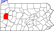
Boroughs Bruin | Callery | Cherry Valley | Chicora | Connoquenessing | East Butler | Eau Claire | Evans City | Fairview | Harmony | Harrisville | Karns City | Mars | Petrolia | Portersville | Prospect | Saxonburg | Seven Fields | Slippery Rock | Valencia | West Liberty | West Sunbury | Zelienople
Townships Adams | Allegheny | Brady | Buffalo | Butler | Center | Cherry | Clay | Clearfield | Clinton | Concord | Connoquenessing | Cranberry | Donegal | Fairview | Forward | Franklin | Jackson | Jefferson | Lancaster | Marion | Mercer | Middlesex | Muddy Creek | Oakland | Parker | Penn | Slippery Rock | Summit | Venango | Washington | Winfield | Worth
CDPs Fernway | Fox Run | Homeacre-Lyndora | Meadowood | Meridian | Nixon | Oak Hills | Shanor-Northvue
Unincorporated
communitiesFootnotes ‡This populated place also has portions in an adjacent county or counties
Categories:- National Register of Historic Places in Pennsylvania by county
- Butler County, Pennsylvania
-


Wikimedia Foundation. 2010.