- National Register of Historic Places listings in Carbon County, Montana
-
 Location of Carbon County in Montana
This is a list of the National Register of Historic Places listings in Carbon County, Montana. It is intended to be a complete list of the properties and districts on the National Register of Historic Places in Carbon County, Montana, United States. The locations of National Register properties and districts for which the latitude and longitude coordinates are included below, may be seen in a Google map.[1]
There are 59 properties and districts listed on the National Register in the county.
-
- This National Park Service list is complete through NPS recent listings posted November 10, 2011.[2]
Listings county-wide
[3] Landmark name Image Date listed Location City or town Summary 1 Bad Pass Trail 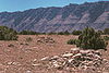
October 29, 1975 East of Warren along the Big Horn River in the Bighorn Canyon National Recreation Area
45°03′07″N 108°15′44″W / 45.051944°N 108.262222°WWarren 2 Baker and Lovering Store May 2, 1986 Main St.
45°29′06″N 108°58′10″W / 45.485°N 108.969444°WJoliet 3 Baldwin Building January 28, 1993 Junction of W. River St. and Harley Ave.
45°23′31″N 108°54′25″W / 45.391944°N 108.906944°WFromberg 4 Bearcreek Bank March 31, 2004 Main and 2nd Sts.
45°09′40″N 109°09′30″W / 45.161111°N 109.158333°WBearcreek 5 Bearcreek Cemetery January 18, 2011 1 mile west of Bearcreek
45°09′30″N 109°08′21″W / 45.158333°N 109.139167°WBearcreek 6 Dr. Theodore J. Benson House January 28, 1993 10 N. Montana
45°23′33″N 108°54′32″W / 45.3925°N 108.908889°WFromberg 7 John Blewett House January 28, 1993 2411 E. River St.
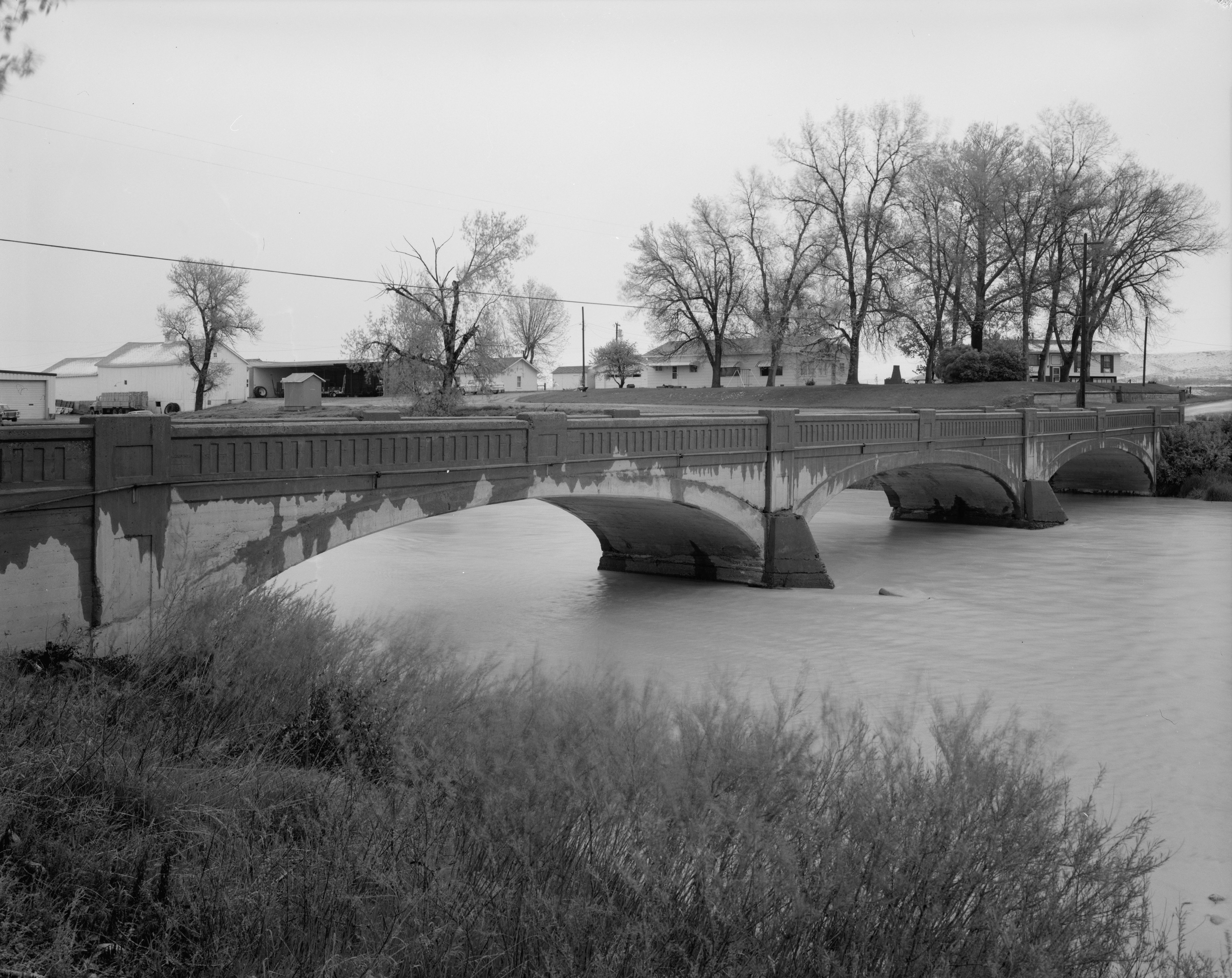
45°23′30″N 108°54′05″W / 45.391667°N 108.901389°WFromberg 8 Bluewater Creek Bridge April 28, 2011 Milepost 8 on Bluewater Creek Rd.
45°22′10″N 108°52′56″W / 45.369444°N 108.882222°WFromberg vicinity Reinforced Concrete Bridges in Montana, 1900-1958 MPS 9 Bridger Coal Company House September 15, 1987 307 W. Broadway
45°17′46″N 108°55′00″W / 45.296111°N 108.916667°WBridger 10 Bridger Opera House September 15, 1987 E. Broadway
45°17′44″N 108°54′39″W / 45.295556°N 108.910833°WBridger 11 Frank Brooder House January 28, 1993 303 North St.
45°23′38″N 108°54′37″W / 45.393889°N 108.910278°WFromberg 12 Calvary Episcopal Church October 23, 1986 9 N. Villard Ave.
45°11′16″N 109°14′56″W / 45.187778°N 109.248889°WRed Lodge 13 Camp Senia Historic District April 14, 1988 Custer National Forest
45°10′15″N 109°28′34″W / 45.170833°N 109.476111°WRed Lodge 14 Cedarvale 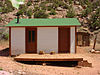
August 19, 1975 Present town of Hillsboro and its environs in the Bighorn Canyon National Recreation Area
45°05′53″N 108°13′26″W / 45.098056°N 108.223889°WHillsboro 15 Corey House July 21, 1987 106 N. E St.
45°17′46″N 108°54′21″W / 45.296111°N 108.905833°WBridger 16 Demijohn Flat Archeological District November 20, 1974 Address Restricted Bridger 17 Ewing-Snell Ranch 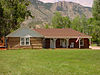
May 12, 1977 South of Dryhead
45°05′02″N 108°15′49″W / 45.083889°N 108.263611°WDryhead 18 Fire Hall May 2, 1986 Main St.
45°29′05″N 108°58′10″W / 45.484722°N 108.969444°WJoliet 19 Forsman House July 21, 1987 406 E. Carbon Ave.
45°17′35″N 108°54′29″W / 45.293056°N 108.908056°WBridger 20 Fromberg Concrete Arch Bridge 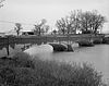
January 28, 1993 River St. over the Clarks Fork of the Yellowstone River
45°23′31″N 108°53′39″W / 45.391944°N 108.894167°WFromberg 21 Fromberg High School January 28, 1993 Kids Ct.
45°23′35″N 108°54′41″W / 45.393056°N 108.911389°WFromberg 22 Fromberg Methodist-Episcopal Church January 28, 1993 Junction of N. Montana Ave. and School St.
45°23′34″N 108°54′32″W / 45.392778°N 108.908889°WFromberg 23 Fromberg Opera House January 28, 1993 Junction of Harley Ave. and C St.
45°23′35″N 108°54′24″W / 45.393056°N 108.906667°WFromberg 24 Gebo Barn June 1, 2005 2.5 miles south of Fromberg on River Rd.
45°21′15″N 108°54′19″W / 45.354167°N 108.905278°WFromberg 25 Gebo Cemetery April 8, 1993 County road linking Gebo and Fromberg
45°24′12″N 108°55′23″W / 45.403333°N 108.923056°WFromberg 26 Henry Gebo House July 21, 1987 East of Bridger
45°18′10″N 109°09′15″W / 45.302778°N 109.154167°WBridger 27 John Gibson House January 28, 1993 219 W. River St.
45°23′31″N 108°54′36″W / 45.391944°N 108.91°WFromberg 28 Glidden House July 21, 1987 112 N. E St.
45°17′47″N 108°54′22″W / 45.296389°N 108.906111°WBridger 29 Glidden Mercantile September 15, 1987 102 N. Main
45°17′46″N 108°54′49″W / 45.296111°N 108.913611°WBridger 30 Samuel Greenblatt House January 28, 1993 215 W. River St.
45°23′31″N 108°54′34″W / 45.391944°N 108.909444°WFromberg 31 Heatherington Boarding House September 15, 1987 209 E. Broadway
45°17′46″N 108°54′41″W / 45.296111°N 108.911389°WBridger 32 Hi Bug Historic District July 23, 1986 Roughly bounded by W. 3rd St., N. Villard Ave., W. 8th St., and N. Word Ave.
45°11′35″N 109°14′58″W / 45.193056°N 109.249444°WRed Lodge 33 Raymond Hough House September 15, 1987 312 S. 2nd
45°17′35″N 108°54′54″W / 45.293056°N 108.915°WBridger 34 House on Railroad Avenue May 2, 1986 Railroad Ave.
45°29′10″N 108°58′12″W / 45.486111°N 108.97°WJoliet 35 IOOF Hall and Fromberg Co-operative Mercantile Building January 28, 1993 123 W. River St.
45°23′31″N 108°54′31″W / 45.391944°N 108.908611°WFromberg 36 Joliet Bridge May 2, 1986 Carries Main St. over Rock Creek
45°29′14″N 108°58′32″W / 45.487222°N 108.975556°WJoliet 37 Joliet High School May 2, 1986 Main St.
45°29′15″N 108°58′23″W / 45.4875°N 108.973056°WJoliet 38 Joliet Residential Historic District May 2, 1986 Roughly bounded by the Northern Pacific railroad line and U.S. Route 12, State St., Carbon Ave., and 2nd St.
45°29′04″N 108°58′11″W / 45.484444°N 108.969722°WJoliet 39 Kent Dairy Round Barn April 7, 1995 Along U.S. Route 212, 2 miles north of Red Lodge
45°13′09″N 109°14′29″W / 45.219167°N 109.241389°WRed Lodge 40 Kero Farmstead Historic District August 16, 2007 223 W. Bench Rd.
45°17′32″N 109°13′05″W / 45.292222°N 109.218056°WRoberts 41 Caroline Lockhart Ranch 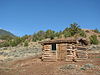
November 3, 1989 Davis Creek, 70 miles south of Hardin
45°08′17″N 108°14′24″W / 45.138056°N 108.24°WDead Hill 42 Dr. Carl Marcus House September 15, 1987 210 S. 2nd
45°17′41″N 108°54′54″W / 45.294722°N 108.915°WBridger 43 Tracy McCall House January 28, 1993 110 N. Montana Ave.
45°23′36″N 108°54′32″W / 45.393333°N 108.908889°WFromberg 44 Methodist Episcopal Church and Parsonage September 15, 1987 220 W. Broadway
45°17′45″N 108°54′58″W / 45.295833°N 108.916111°WBridger 45 Northern Pacific Railroad Depot-Fromberg January 28, 1993 Junction of U.S. Route 310 and River St.
45°23′31″N 108°54′20″W / 45.391944°N 108.905556°WFromberg 46 Nutting Rental September 15, 1987 Carbon Ave.
45°17′39″N 108°54′55″W / 45.294167°N 108.915278°WBridger 47 Petroglyph Canyon November 20, 1975 Address Restricted Warren 48 Pretty Creek Archeological Site January 17, 1975 Address Restricted Hardin 49 Francis Rahrer House January 28, 1993 309 School St.
45°23′36″N 108°54′40″W / 45.393333°N 108.911111°WFromberg 50 Red Lodge Brewing Company-Red Lodge Canning Company September 5, 2007 904 N. Bonner St.
45°11′46″N 109°14′40″W / 45.196111°N 109.244444°WRed Lodge 51 Red Lodge Commercial Historic District 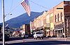
April 14, 1983 Roughly Broadway from 8th to 13th Sts.; also S. Broadway between 8th and 15th Sts.
45°11′32″N 109°14′48″W / 45.192222°N 109.246667°WRed Lodge Second set of boundaries represents a boundary increase, added on August 28, 1986 52 Red Lodge Communal Mausoleum March 21, 2011 Montana Highway 78 Red Lodge vicinity 53 Rock Creek State Bank May 2, 1986 Main St.
45°29′04″N 108°58′12″W / 45.484444°N 108.97°WJoliet 54 T.W. Smith House May 2, 1986 Front St.
45°29′20″N 108°57′46″W / 45.488889°N 108.962778°WJoliet 55 Smith Mine Historic District September 30, 2009 Montana Highway 308
45°09′25″N 109°10′58″W / 45.156981°N 109.182892°WBearcreek 56 Southern Hotel May 2, 1986 Main St.
45°29′05″N 108°58′09″W / 45.484722°N 108.969167°WJoliet 57 Hester E. Suydam Boarding House January 28, 1993 209 W. River St.
45°23′31″N 108°54′33″W / 45.391944°N 108.909167°WFromberg 58 Warila Boarding House and Sauna October 24, 1985 20 N. Haggin
45°11′16″N 109°14′38″W / 45.187778°N 109.243889°WRed Lodge 59 Wool Warehouse July 21, 1987 E. Bridger
45°17′44″N 108°54′32″W / 45.295556°N 108.908889°WBridger See also
- List of National Historic Landmarks in Montana
- National Register of Historic Places listings in Montana
References
- ^ The latitude and longitude information provided in this table was derived originally from the National Register Information System, which has been found to be fairly accurate for about 99% of listings. For about 1% of NRIS original coordinates, experience has shown that one or both coordinates are typos or otherwise extremely far off; some corrections may have been made. A more subtle problem causes many locations to be off by up to 150 yards, depending on location in the country: most NRIS coordinates were derived from tracing out latitude and longitudes off of USGS topographical quadrant maps created under the North American Datum of 1927, which differs from the current, highly accurate WGS84 GPS system used by Google maps. Chicago is about right, but NRIS longitudes in Washington are higher by about 4.5 seconds, and are lower by about 2.0 seconds in Maine. Latitudes differ by about 1.0 second in Florida. Some locations in this table may have been corrected to current GPS standards.
- ^ "National Register of Historic Places: Weekly List Actions". National Park Service, United States Department of the Interior. Retrieved on November 10, 2011.
- ^ Numbers represent an ordering by significant words. Various colorings, defined here, differentiate National Historic Landmark sites and National Register of Historic Places Districts from other NRHP buildings, structures, sites or objects.
U.S. National Register of Historic Places Topics Lists by states Alabama • Alaska • Arizona • Arkansas • California • Colorado • Connecticut • Delaware • Florida • Georgia • Hawaii • Idaho • Illinois • Indiana • Iowa • Kansas • Kentucky • Louisiana • Maine • Maryland • Massachusetts • Michigan • Minnesota • Mississippi • Missouri • Montana • Nebraska • Nevada • New Hampshire • New Jersey • New Mexico • New York • North Carolina • North Dakota • Ohio • Oklahoma • Oregon • Pennsylvania • Rhode Island • South Carolina • South Dakota • Tennessee • Texas • Utah • Vermont • Virginia • Washington • West Virginia • Wisconsin • WyomingLists by territories Lists by associated states Other Municipalities and communities of Carbon County, Montana City 
Towns CDP Unincorporated
communitiesCategories:- National Register of Historic Places in Montana by county
- Carbon County, Montana
-


Wikimedia Foundation. 2010.