- National Register of Historic Places listings in Carroll County, Arkansas
-
 Location of Carroll County in Arkansas
This is a list of the National Register of Historic Places listings in Carroll County, Arkansas.
This is intended to be a complete list of the properties and districts on the National Register of Historic Places in Carroll County, Arkansas, United States. The locations of National Register properties and districts for which the latitude and longitude coordinates are included below, may be seen in a Google map.[1]
There are 26 properties and districts listed on the National Register in the county. Another property was once listed but has been removed.
Contents: Counties in Arkansas Arkansas - Ashley - Baxter - Benton - Boone - Bradley - Calhoun - Carroll - Chicot - Clark - Clay - Cleburne - Cleveland - Columbia - Conway - Craighead - Crawford - Crittenden - Cross - Dallas - Desha - Drew - Faulkner - Franklin - Fulton - Garland - Grant - Greene - Hempstead - Hot Spring - Howard - Independence - Izard - Jackson - Jefferson - Johnson - Lafayette - Lawrence - Lee - Lincoln - Little River - Logan - Lonoke - Madison - Marion - Miller - Mississippi - Monroe - Montgomery - Nevada - Newton - Ouachita - Perry - Phillips - Pike - Poinsett - Polk - Pope - Prairie - Pulaski (Little Rock) - Randolph - St. Francis - Saline - Scott - Searcy - Sebastian - Sevier - Sharp - Stone - Union - Van Buren - Washington - White - Woodruff - Yell
-
- This National Park Service list is complete through NPS recent listings posted November 10, 2011.[2]
Current listings
[3] Landmark name [4] Image Date listed Location City or town Summary 1 Beaver Bridge 
April 9, 1990 Highway 187, over the White River
36°28′15″N 93°46′06″W / 36.470833°N 93.768333°WBeaver 2 Berryville Agriculture Building September 10, 1992 South of Freeman Ave., east of Linda St., north of W. College Ave., and west of Ferguson St.
36°22′07″N 93°34′33″W / 36.368611°N 93.575833°WBerryville 3 Berryville Gymnasium September 10, 1992 South of Freeman Ave., east of Linda St., north of W. College Ave., and west of Ferguson St.
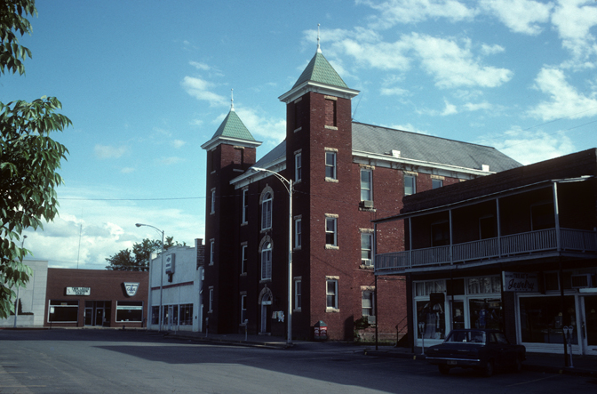
36°22′08″N 93°34′33″W / 36.368889°N 93.575833°WBerryville 4 Berryville Post Office August 14, 1998 101 E. Madison Ave.
36°21′52″N 93°33′56″W / 36.364444°N 93.565556°WBerryville 5 Blue Spring Shelter December 20, 2002 Address Restricted Eureka Springs 6 Carroll County Courthouse, Eastern District 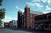
August 27, 1976 Public Sq.
36°21′51″N 93°34′04″W / 36.364167°N 93.567778°WBerryville 7 Carroll County Poor Farm Cemetery May 24, 2006 Address Restricted Pleasant Valley 8 James C. Chaney House November 20, 1989 Highway 68
36°11′15″N 93°24′03″W / 36.1875°N 93.400833°WOsage 9 Concord School House March 9, 2009 805 County Road 309
36°23′13″N 93°40′57″W / 36.386842°N 93.682375°WEureka Springs 10 W.D. Crawford House November 20, 1992 East of County Road 27, about 1 mile north of its junction with County Road 98
36°23′00″N 93°29′48″W / 36.383333°N 93.496667°WCisco 11 Dog Branch School September 8, 1992 South of U.S. Route 412, approximately 3 miles east of Osage
36°12′12″N 93°21′28″W / 36.203333°N 93.357778°WOsage 12 Eureka Springs Historic District 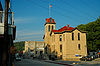
December 18, 1970 Most of Eureka Springs and its environs; also S. Main
36°24′06″N 93°44′18″W / 36.401667°N 93.738333°WEureka Springs South Main represents a boundary increase of January 29, 1979 13 Green Forest Water Tower May 22, 2007 Southeast of the junction of S. Springfield St. and E. 2nd St.
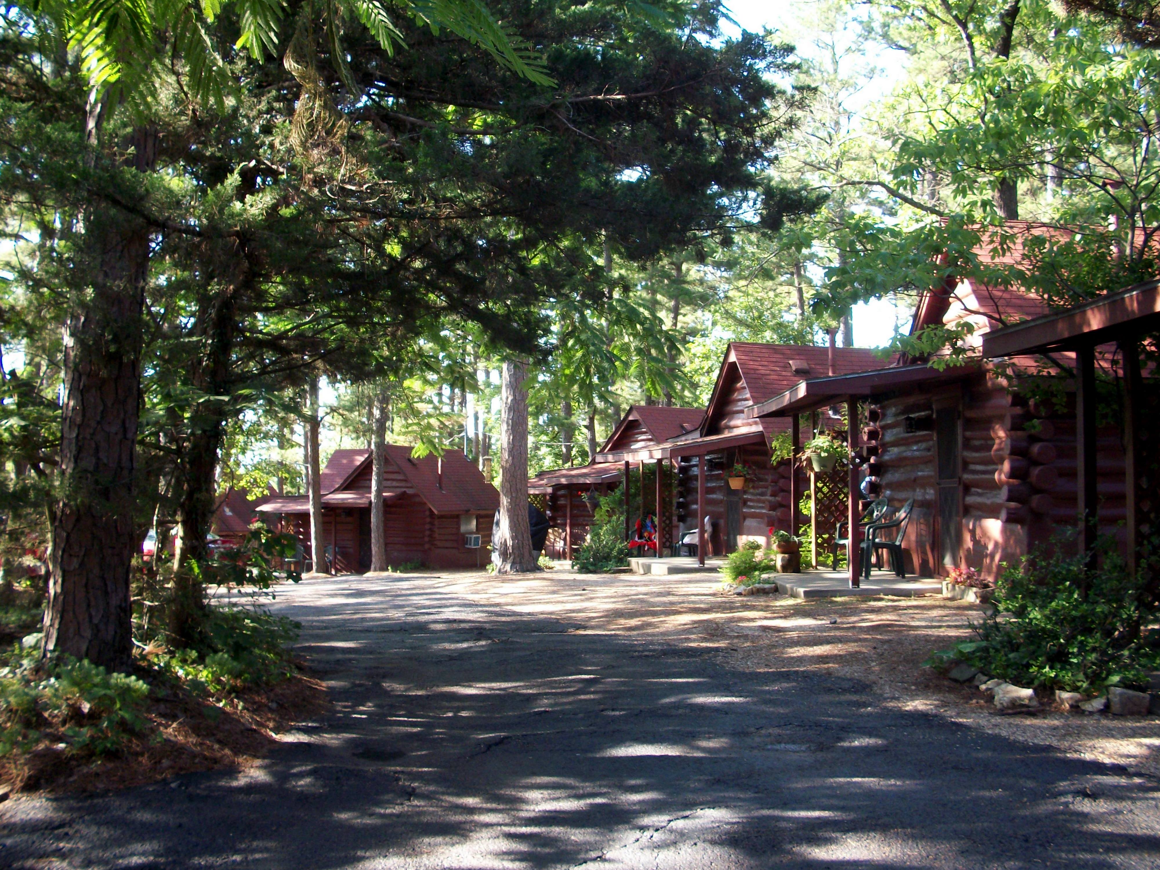
36°20′11″N 93°26′08″W / 36.336389°N 93.435556°WGreen Forest 14 Lake Leatherwood Park Historic District November 24, 1998 Between U.S. Route 62 and Highway 23 at Leatherwood Lake
36°26′07″N 93°45′37″W / 36.435278°N 93.760278°WEureka Springs 15 Lake Leatherwood Recreational Facilities August 12, 1992 End of County Road 61
36°26′04″N 93°45′34″W / 36.434444°N 93.759444°WEureka Springs 16 Mo-Ark Baptist Academy September 27, 1996 South of the western terminus of Park St.
36°29′52″N 93°23′57″W / 36.497778°N 93.399167°WBlue Eye 17 Mulladay Hollow Bridge 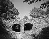
April 6, 1990 County Road 61, over Mulladay Hollow Creek
36°26′06″N 93°45′56″W / 36.435°N 93.765556°WEureka Springs 18 Old U.S. 62, Busch Segment September 25, 2008 County Roads 107, 109, and 173
36°26′55″N 93°49′47″W / 36.448631°N 93.829678°WBusch 19 Quigley's Castle May 30, 2003 274 Quigley's Castle Rd.
36°20′46″N 93°45′21″W / 36.346111°N 93.755833°WEureka Springs 20 Sanitarium Lake Bridges Historic District January 19, 2010 County Road 317, approximately 0.5 miles south of Greenwood Hollow Rd.
36°22′30″N 93°44′02″W / 36.375128°N 93.733958°WEureka Springs 21 Stamps Store September 5, 1990 Old Highway 68 near its junction with Highway 68
36°10′58″N 93°24′16″W / 36.182778°N 93.404444°WOsage 22 Tall Pines Motor Inn 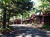
January 15, 1999 U.S. Route 62
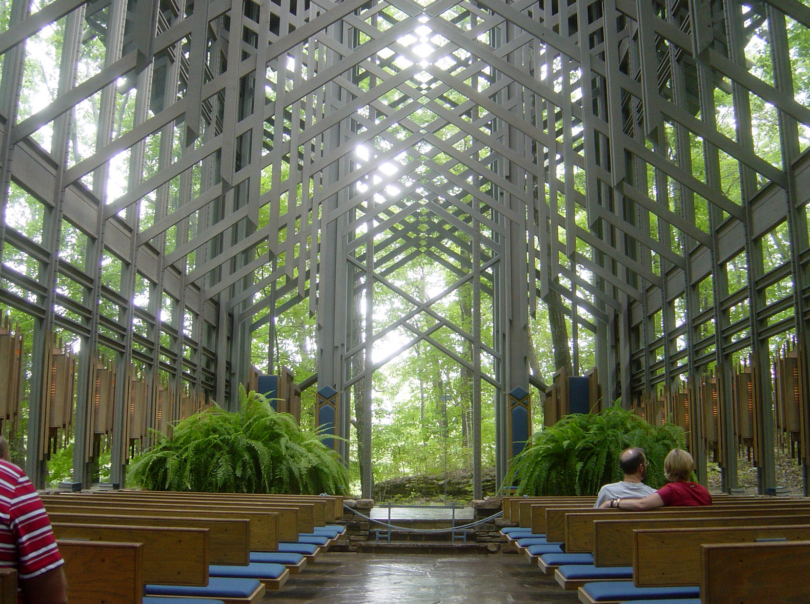
36°24′18″N 93°45′08″W / 36.405°N 93.752222°WEureka Springs 23 Thorncrown Chapel 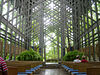
April 28, 2000 US 62, 0.5 miles west of Eureka Springs
36°25′01″N 93°46′13″W / 36.416944°N 93.770278°WEureka Springs 24 U.S. 62 White River Bridge 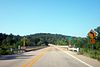
January 24, 2008 U.S. Route 62, approximately ¼ mile south of County Road 212
36°27′04″N 93°49′24″W / 36.451111°N 93.823333°WEureka Springs 25 Winona Church and School June 5, 1991 Rockhouse Rd.
36°19′58″N 93°40′54″W / 36.332778°N 93.681667°WWinona Springs 26 Yell Masonic Lodge Hall November 1, 1984 Off Highway 68
36°15′47″N 93°19′18″W / 36.263056°N 93.321667°WCarrollton Former listing
Landmark name Image Dates Location City or Town Summary 1 James C. Chaney House September 20, 2006 (delisted) Osage See also
- List of National Historic Landmarks in Arkansas
- National Register of Historic Places listings in Arkansas
References
- ^ The latitude and longitude information provided in this table was derived originally from the National Register Information System, which has been found to be fairly accurate for about 99% of listings. For about 1% of NRIS original coordinates, experience has shown that one or both coordinates are typos or otherwise extremely far off; some corrections may have been made. A more subtle problem causes many locations to be off by up to 150 yards, depending on location in the country: most NRIS coordinates were derived from tracing out latitude and longitudes off of USGS topographical quadrant maps created under North American Datum of 1927, which differs from the current, highly accurate GPS system used by Google maps. Chicago is about right, but NRIS longitudes in Washington are higher by about 4.5 seconds, and are lower by about 2.0 seconds in Maine. Latitudes differ by about 1.0 second in Florida. Some locations in this table may have been corrected to current GPS standards.
- ^ "National Register of Historic Places: Weekly List Actions". National Park Service, United States Department of the Interior. Retrieved on November 10, 2011.
- ^ Numbers represent an ordering by significant words. Various colorings, defined here, differentiate National Historic Landmark sites and National Register of Historic Places Districts from other NRHP buildings, structures, sites or objects.
- ^ "National Register Information System". National Register of Historic Places. National Park Service. . http://nrhp.focus.nps.gov/natreg/docs/All_Data.html.
U.S. National Register of Historic Places Topics Lists by states Alabama • Alaska • Arizona • Arkansas • California • Colorado • Connecticut • Delaware • Florida • Georgia • Hawaii • Idaho • Illinois • Indiana • Iowa • Kansas • Kentucky • Louisiana • Maine • Maryland • Massachusetts • Michigan • Minnesota • Mississippi • Missouri • Montana • Nebraska • Nevada • New Hampshire • New Jersey • New Mexico • New York • North Carolina • North Dakota • Ohio • Oklahoma • Oregon • Pennsylvania • Rhode Island • South Carolina • South Dakota • Tennessee • Texas • Utah • Vermont • Virginia • Washington • West Virginia • Wisconsin • WyomingLists by territories Lists by associated states Other  Category:National Register of Historic Places •
  Portal:National Register of Historic Places
Municipalities and communities of Carroll County, Arkansas County seats: Berryville and Eureka Springs Cities 
Towns CDP Holiday Island
Unincorporated
communityFootnotes ‡This populated place also has portions in an adjacent county or counties
Categories:- Carroll County, Arkansas
- National Register of Historic Places in Arkansas by county
-


Wikimedia Foundation. 2010.