- National Register of Historic Places listings in Carver County, Minnesota
-
This is a complete List of Registered Historic Places in Carver County, Minnesota. The list includes 33 entries on the National Register of Historic Places.
Carver County is a county located in the southeastern part of the U.S. state of Minnesota, bounded on the north by Wright County, the northeast by Hennepin County, the southeast by the Minnesota River (Scott County), the southwest by Sibley County, and the west by McLeod County. Chaska is the county seat.
-
- This National Park Service list is complete through NPS recent listings posted November 10, 2011.[1]
[2] Landmark name [3] Image Date listed Location City or town Summary 1 Emile Amblard Guest House 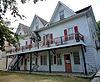
January 4, 1980 32-36 N. Vine St.
44°51′04″N 93°47′20″W / 44.851111°N 93.788889°WWaconia 2 Brinkhaus Saloon Livery Barn 
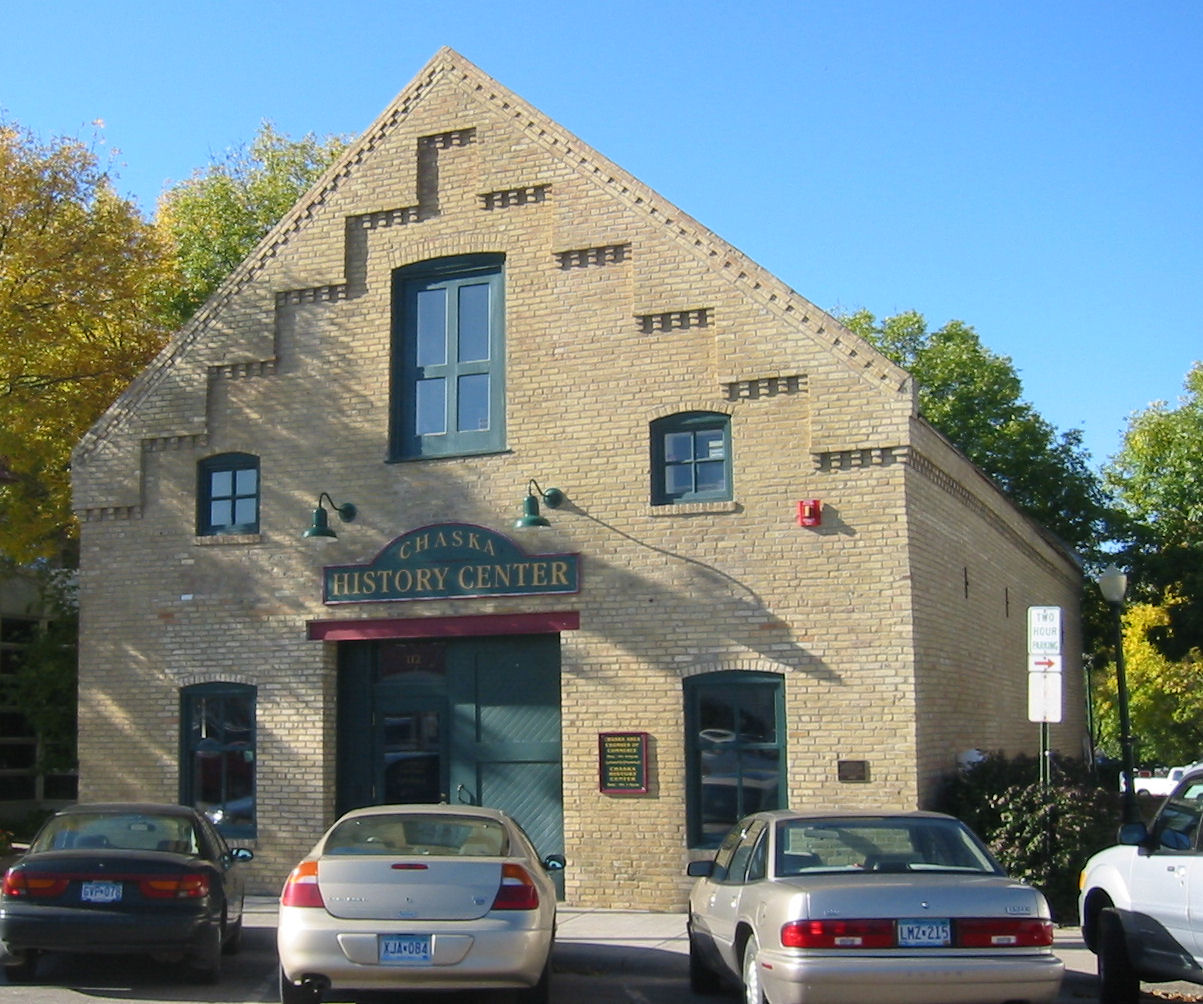
January 4, 1980 112 W. 4th St.
44°47′14″N 93°36′02″W / 44.787222°N 93.600556°WChaska 3 Carver Historic District 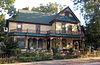
January 4, 1980 Roughly bounded by Lime, 1st, Walnut, and 6th Sts.
44°45′46″N 93°37′34″W / 44.762778°N 93.626111°WCarver 4 Chaska Historical Marker July 6, 2010 County Highway 61 near Edgehill Rd.
44°46′58″N 93°36′43″W / 44.782778°N 93.611944°WChaska 5 Church of St. Hubertus-Catholic 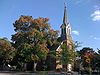
March 19, 1982 Great Plains Boulevard and W. 78th St.
44°51′42″N 93°31′49″W / 44.861667°N 93.530278°WChanhassen 6 Coney Island of the West 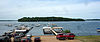
August 11, 1976 Lake Waconia off Minnesota Highway 5
44°51′40″N 93°47′01″W / 44.861111°N 93.783611°WWaconia 7 Frederick E. DuToit House 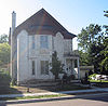
January 4, 1980 121 Hickory St.
44°47′02″N 93°36′21″W / 44.783889°N 93.605833°WChaska 8 Eder-Baer House 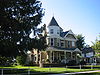
January 4, 1980 105 Elm St.
44°47′01″N 93°36′16″W / 44.783611°N 93.604444°WChaska 9 Frederick Greiner House 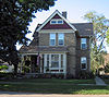
January 4, 1980 319 E. 3rd St.
44°47′14″N 93°35′48″W / 44.787222°N 93.596667°WChaska 10 Wendelin Grimm Farmstead 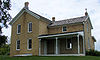
December 30, 1974 Off County Highway 11 in Carver Park Reserve
44°53′15″N 93°43′08″W / 44.8875°N 93.718889°WVictoria 11 Philip Guettler House 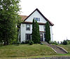
January 4, 1980 Adams and Mill Sts.
44°46′08″N 93°46′45″W / 44.768889°N 93.779167°WCologne 12 Jacob Hebeisen Hardware Store January 4, 1980 Railroad and Maria Sts.
44°43′59″N 93°58′03″W / 44.733056°N 93.9675°WHamburg 13 Jacob Hebeisen House January 4, 1980 Off County Highway 50
44°43′46″N 93°58′14″W / 44.729444°N 93.970556°WHamburg 14 Albertine and Fred Heck House 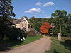
December 27, 2000 8941 Audobon Rd.
44°50′34″N 93°33′53″W / 44.842778°N 93.564722°WChanhassen 15 Herald Block 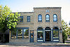
January 4, 1980 123 W. 2nd St.
44°47′05″N 93°36′05″W / 44.784722°N 93.601389°WChaska 16 King Oscar's Settlement 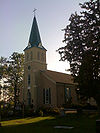
January 4, 1980 County Highway 40
44°43′44″N 93°40′26″W / 44.728889°N 93.673889°WCarver 17 John Knotz House 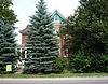
January 4, 1980 Paul and Mill Sts.
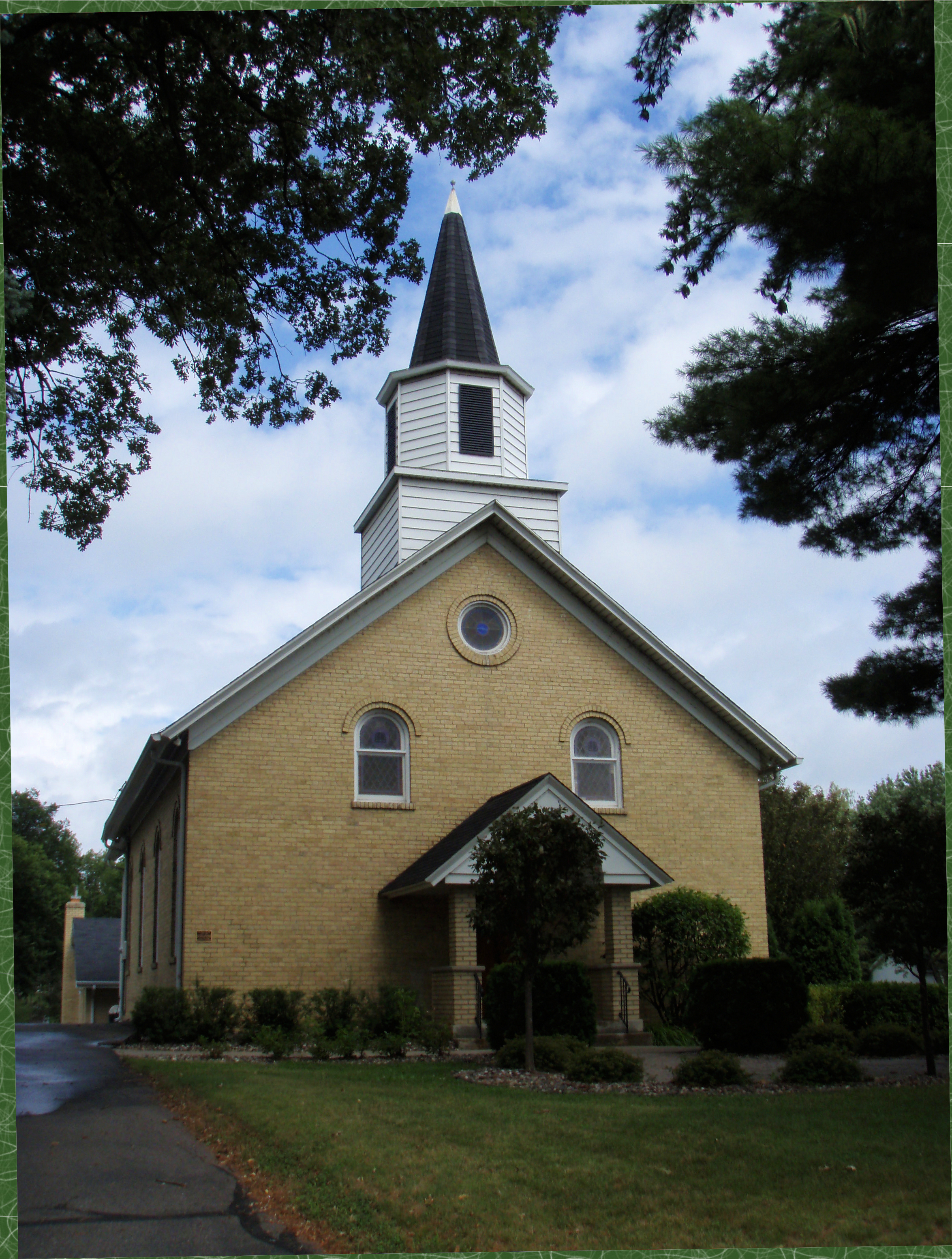
44°46′05″N 93°46′51″W / 44.768056°N 93.780833°WCologne 18 Laketown Moravian Brethren's Church 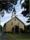
January 4, 1980 County Highway 11
44°52′08″N 93°40′38″W / 44.868889°N 93.677222°WVictoria 19 E. H. Lewis House 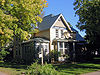
January 4, 1980 321 W. 2nd St.
44°47′03″N 93°36′15″W / 44.784167°N 93.604167°WChaska 20 Charles Maiser House 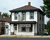
January 4, 1980 16 W. Main St.
44°51′03″N 93°47′09″W / 44.850833°N 93.785833°WWaconia 21 Mock Cigar Factory and House 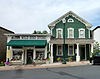
January 4, 1980 48 W. Main St.
44°51′03″N 93°47′11″W / 44.850833°N 93.786389°WWaconia 22 Paul Mohrbacher House 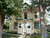
January 4, 1980 102 Paul Ave., S.
44°46′11″N 93°46′51″W / 44.769722°N 93.780833°WCologne 23 Norwood Methodist Episcopal Church 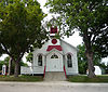
January 4, 1980 Hill and Union Sts.
44°46′12″N 93°55′39″W / 44.77°N 93.9275°WNorwood Young America 24 Andrew Peterson Farmstead 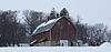
October 11, 1979 Northeast of Waconia on Minnesota Highway 5
44°51′50″N 93°43′30″W / 44.863889°N 93.725°WWaconia 25 Johann Schimmelpfennig Farmstead January 4, 1980 Off U.S. Route 212
44°46′39″N 93°52′39″W / 44.7775°N 93.8775°WNorwood Young America 26 Simons Building and Livery Barn 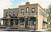
January 4, 1980 123 W. 3rd St.
44°47′09″N 93°36′06″W / 44.785833°N 93.601667°WChaska 27 Waconia City Hall 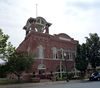
May 9, 1983 9 W. 1st St.
44°50′57″N 93°47′11″W / 44.849167°N 93.786389°WWaconia 28 Walnut Street Historic District 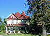
January 4, 1980 Roughly around Walnut, 2nd, Chestnut, and 6th Sts.
44°47′12″N 93°35′58″W / 44.786667°N 93.599444°WChaska 29 West Main Street Houses 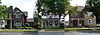
January 4, 1980 417, 429, and 453 W. Main St.
44°51′02″N 93°47′34″W / 44.850556°N 93.792778°WWaconia 30 West Union 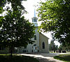
January 4, 1980 County Highway 50
44°42′58″N 93°46′08″W / 44.716111°N 93.768889°WCologne 31 Winter Saloon 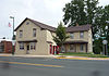
January 4, 1980 Elm and Hazel Sts.
44°46′02″N 93°55′39″W / 44.767222°N 93.9275°WNorwood Young America 32 Young America City Hall 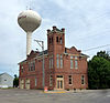
January 4, 1980 102 2nd Ave., S.
44°46′54″N 93°54′45″W / 44.781667°N 93.9125°WNorwood Young America 33 Zoar Moravian Church 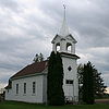
January 4, 1980 County Highway 10 near Waconia
44°49′07″N 93°43′50″W / 44.818611°N 93.730556°WChaska Property overview See also
References
- ^ "National Register of Historic Places: Weekly List Actions". National Park Service, United States Department of the Interior. Retrieved on November 10, 2011.
- ^ Numbers represent an ordering by significant words. Various colorings, defined here, differentiate National Historic Landmark sites and National Register of Historic Places Districts from other NRHP buildings, structures, sites or objects.
- ^ "National Register Information System". National Register of Historic Places. National Park Service. . http://nrhp.focus.nps.gov/natreg/docs/All_Data.html.
Nord, Mary Ann (2003). The National Register of Historic Places in Minnesota. Minnesota Historical Society. ISBN 0-87351-448-3.
External links
- A list of the above sites, with street addresses and other information, is available at Carver County, MN listing of National Register of Historic Places.com, a private site serving up NRHP information.
U.S. National Register of Historic Places Topics Lists by states Alabama • Alaska • Arizona • Arkansas • California • Colorado • Connecticut • Delaware • Florida • Georgia • Hawaii • Idaho • Illinois • Indiana • Iowa • Kansas • Kentucky • Louisiana • Maine • Maryland • Massachusetts • Michigan • Minnesota • Mississippi • Missouri • Montana • Nebraska • Nevada • New Hampshire • New Jersey • New Mexico • New York • North Carolina • North Dakota • Ohio • Oklahoma • Oregon • Pennsylvania • Rhode Island • South Carolina • South Dakota • Tennessee • Texas • Utah • Vermont • Virginia • Washington • West Virginia • Wisconsin • WyomingLists by territories Lists by associated states Other Categories:- Carver County, Minnesota
- National Register of Historic Places in Minnesota by county
- Buildings and structures in Carver County, Minnesota
-


Wikimedia Foundation. 2010.