- National Register of Historic Places listings in Cass County, North Dakota
-
 Location of Cass County in North Dakota
This is a list of the National Register of Historic Places listings in Cass County, North Dakota.
This is intended to be a complete list of the properties and districts on the National Register of Historic Places in Cass County, North Dakota, United States. The locations of National Register properties and districts for which the latitude and longitude coordinates are included below, may be seen in a Google map.[1]
Multiple resource areas in the county which have been studied include the North Side Fargo area, covered in a study in 1986.[2]
There are 33 properties and districts listed on the National Register in the county. Another property was once listed but has been removed.
Contents: Counties in North Dakota Adams | Barnes | Benson | Billings | Bottineau | Bowman | Burke | Burleigh | Cass | Cavalier | Dickey | Divide | Dunn | Eddy | Emmons | Foster | Golden Valley | Grand Forks | Grant | Griggs | Hettinger | Kidder | La Moure | Logan | McHenry | McIntosh | McKenzie | McLean | Mercer | Morton | Mountrail | Nelson | Oliver | Pembina | Pierce | Ramsey | Ransom | Renville | Richland | Rolette | Sargent | Sheridan | Sioux | Slope | Stark | Steele | Stutsman | Towner | Traill | Walsh | Ward | Wells | Williams -
- This National Park Service list is complete through NPS recent listings posted November 10, 2011.[3]
Current listings
[4] Landmark name [5] Image Date listed Location City or town Summary 1 1916 Buffalo High School May 10, 2001 303 Pearl St., N.
46°55′16″N 97°32′59″W / 46.921111°N 97.549722°WBuffalo 2 Barrington Apartments July 27, 1989 219 12th St., S.
46°52′19″N 96°47′51″W / 46.871944°N 96.7975°WFargo 3 Burlington Northern Depot August 29, 1977 Woodard Ave.
47°00′17″N 97°13′09″W / 47.004722°N 97.219167°WAmenia 4 Cass County Court House, Jail, and Sheriff's House 
December 22, 1983 S. 9th St. between S. 2nd and 3rd Aves.
46°52′19″N 96°47′35″W / 46.871944°N 96.793056°WFargo 5 Casselton Commercial Historic District October 28, 1982 Roughly bounded by Front and 1st St. between 6th and 8th Aves.
46°54′03″N 97°12′38″W / 46.900833°N 97.210556°WCasselton 6 DeLendrecie's Department Store 
October 22, 1979 620-624 Main St.
46°52′27″N 96°47′20″W / 46.874167°N 96.788889°WFargo 7 Dibley House November 25, 1980 331 8th Ave., S.
46°51′59″N 96°47′01″W / 46.866389°N 96.783611°WFargo 8 Downtown Fargo District October 13, 1983 Roughly Roberts St. from S. 1st Ave. to 5th Ave. N., and Main Ave.
46°52′41″N 96°47′24″W / 46.878056°N 96.79°WFargo 9 Fargo City Detention Hospital April 7, 1987 57 11th Ave., N.
46°53′21″N 96°46′37″W / 46.889167°N 96.776944°WFargo 10 Fargo Oak Grove Residential Historic District October 13, 2011 North & South Terrace Aves., east of Elm St., N.
46°53′00″N 96°46′34″W / 46.883333°N 96.776111°WFargo 11 Fargo South Residential District September 19, 1983 Roughly bounded by 5th and 17th Aves. S., 7th and 9th Sts. S.
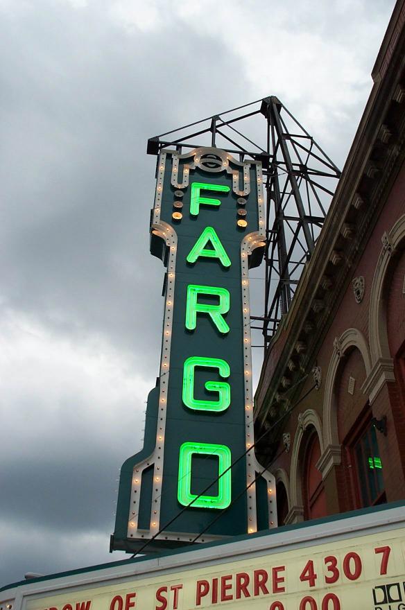
46°51′43″N 96°47′30″W / 46.861944°N 96.791667°WFargo 12 Fargo Theatre Building 
October 21, 1982 314 Broadway
46°52′45″N 96°47′16″W / 46.879167°N 96.787778°WFargo 13 Grand Lodge of North Dakota, Ancient Order of United Workmen 
August 24, 1979 112-114 N. Roberts St.
46°52′40″N 96°47′23″W / 46.877778°N 96.789722°WFargo 14 Great Northern Freight Warehouse November 21, 1990 420 N. 7th St.
46°52′52″N 96°47′28″W / 46.881111°N 96.791111°WFargo 15 James Holes House April 7, 1987 1230 Fifth St., N.
46°53′29″N 96°47′10″W / 46.891389°N 96.786111°WFargo 16 Knerr Block, Floyd Block, McHench Building and Webster and Cole Building May 12, 1983 13, 15, 17-19, and 21-23 8th St., S.
46°52′26″N 96°47′27″W / 46.873889°N 96.790833°WFargo 17 Lewis House October 18, 1979 1002 3rd Ave., S.
46°52′17″N 96°47′46″W / 46.871389°N 96.796111°WFargo 18 Robert Lindemann House September 2, 1994 1.5 miles east and 2.75 miles north of Enderlin
46°40′08″N 97°34′32″W / 46.668889°N 97.575556°WEnderlin 19 Masonic Block August 3, 1979 11 S. 8th St.
46°51′55″N 96°47′29″W / 46.865278°N 96.791389°WFargo 20 North Dakota State University District 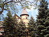
October 6, 1986 Roughly bounded by N. University Dr., 12th Ave., N., Service Dr., and Campus Ave.
46°53′34″N 96°48′00″W / 46.892778°N 96.8°WFargo 21 North Side Fargo Builder's Residential Historic District April 7, 1987 Roughly bounded by Benjamin Franklin School area and Golf Course, 1st St., 12th Ave., N, and 4th St.
46°53′33″N 96°47′00″W / 46.8925°N 96.783333°WFargo 22 North Side Fargo High Style Residential Historic District April 7, 1987 Roughly bounded by 12th Ave. N, 4th St., 11th Ave., N, and 7th St.
46°53′22″N 96°47′11″W / 46.889444°N 96.786389°WFargo 23 Northern Pacific Railway Depot February 13, 1975 701 Main Ave.
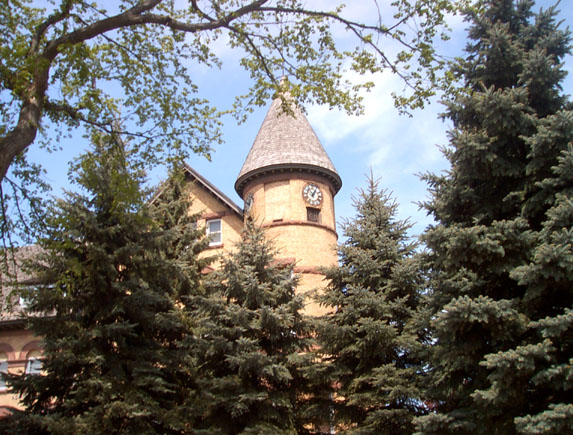
46°52′29″N 96°47′21″W / 46.874722°N 96.789167°WFargo 24 Old Stone Church March 29, 1996 206 N. Wilcox Ave.
46°55′18″N 97°33′03″W / 46.921667°N 97.550833°WBuffalo 25 Pence Automobile Company Warehouse 
January 7, 1994 301 N. P Ave.
46°52′34″N 96°46′57″W / 46.876111°N 96.7825°WFargo 26 Powers Hotel May 12, 1983 400 Broadway
46°52′48″N 96°47′16″W / 46.88°N 96.787778°WFargo 27 Research Plot 2 October 8, 1991 Near the junction of Centennial Ave. and 18th St., N. on the North Dakota State University campus
46°53′39″N 96°48′31″W / 46.894167°N 96.808611°WFargo 28 Research Plot 30 October 8, 1991 Near the junction of Centennial Ave. and 18th St., N. on the North Dakota State University campus
46°53′39″N 96°48′39″W / 46.894167°N 96.810833°WFargo 29 Shea Site July 25, 1996 Address Restricted Embden 30 Sprunk Site (32CS04478) January 9, 2007 Address Restricted Enderlin 31 St. Stephen's Episcopal Church 
December 3, 1992 Southeastern corner of the junction of 3rd Ave. and 5th St.
46°54′10″N 97°12′34″W / 46.902778°N 97.209444°WCasselton 32 Union Storage & Transfer Cold Storage Warehouse and Armour Creamery Building February 9, 2007 1026-1032 Northern Pacific Ave. and 1034-1102 Northern Pacific Ave.
46°52′36″N 96°47′43″W / 46.876667°N 96.795278°WFargo 33 Watts Free Library May 31, 1990 101 3rd St., N.
46°39′12″N 97°14′45″W / 46.653333°N 97.245833°WLeonard Former listing
[4] Landmark name Image Date listed Location City or town Summary 1 Cole Hotel October 21, 2009 401-407 Northern Pacific Ave.
46°52′34″N 96°47′3″W / 46.87611°N 96.78417°WFargo Listed May 9, 1983 Determined eligible
At least one property was determined eligible but was not finally listed on the National Register, due to owner objection.
Landmark name Image Date Location City or Town Summary 1 Elliot-Powers House and Garage April 7, 1987 702-704 Broadway Fargo See also
- List of National Historic Landmarks in North Dakota
- National Register of Historic Places listings in North Dakota
References
- ^ The latitude and longitude information provided in this table was derived originally from the National Register Information System, which has been found to be fairly accurate for about 99% of listings. For about 1% of NRIS original coordinates, experience has shown that one or both coordinates are typos or otherwise extremely far off; some corrections may have been made. A more subtle problem causes many locations to be off by up to 150 yards, depending on location in the country: most NRIS coordinates were derived from tracing out latitude and longitudes off of USGS topographical quadrant maps created under North American Datum of 1927, which differs from the current, highly accurate GPS system used by Google maps. Chicago is about right, but NRIS longitudes in Washington are higher by about 4.5 seconds, and are lower by about 2.0 seconds in Maine. Latitudes differ by about 1.0 second in Florida. Some locations in this table may have been corrected to current GPS standards.
- ^ Mark T. Fiege, Jack Crowley, and Fredric L. Quivik (October, 1986). "National Register of Historic Places Multiple Property Submission: Historic Resources of North Side Fargo". National Park Service. http://pdfhost.focus.nps.gov/docs/NRHP/Text/64000478.pdf.
- ^ "National Register of Historic Places: Weekly List Actions". National Park Service, United States Department of the Interior. Retrieved on November 10, 2011.
- ^ a b Numbers represent an ordering by significant words. Various colorings, defined here, differentiate National Historic Landmark sites and National Register of Historic Places Districts from other NRHP buildings, structures, sites or objects.
- ^ "National Register Information System". National Register of Historic Places. National Park Service. . http://nrhp.focus.nps.gov/natreg/docs/All_Data.html.
U.S. National Register of Historic Places Topics Lists by states Alabama • Alaska • Arizona • Arkansas • California • Colorado • Connecticut • Delaware • Florida • Georgia • Hawaii • Idaho • Illinois • Indiana • Iowa • Kansas • Kentucky • Louisiana • Maine • Maryland • Massachusetts • Michigan • Minnesota • Mississippi • Missouri • Montana • Nebraska • Nevada • New Hampshire • New Jersey • New Mexico • New York • North Carolina • North Dakota • Ohio • Oklahoma • Oregon • Pennsylvania • Rhode Island • South Carolina • South Dakota • Tennessee • Texas • Utah • Vermont • Virginia • Washington • West Virginia • Wisconsin • WyomingLists by territories Lists by associated states Other  Category:National Register of Historic Places •
  Portal:National Register of Historic Places
Municipalities and communities of Cass County, North Dakota County seat: Fargo Cities Alice | Amenia | Argusville | Arthur | Ayr | Briarwood | Buffalo | Casselton | Davenport | Enderlin‡ | Fargo | Frontier | Gardner | Grandin‡ | Harwood | Horace | Hunter | Kindred | Leonard | Mapleton | North River | Oxbow | Page | Prairie Rose | Reile's Acres | Tower City‡ | West Fargo

Townships Addison | Amenia | Arthur | Ayr | Barnes | Bell | Berlin | Buffalo | Casselton | Chaffee | Clifton | Cornell | Davenport | Dows | Durbin | Eldred | Empire | Erie | Everest | Fargo | Gardner | Gill | Gunkel | Harmony | Harwood | Highland | Hill | Howes | Hunter | Kinyon | Lake | Leonard | Maple River | Mapleton | Noble | Normanna | Page | Pleasant | Pontiac | Raymond | Reed | Rich | Rochester | Rush River | Stanley | Tower | Walburg | Warren | Watson | Wheatland | Wiser
CDPs Unincorporated
communitiesFootnotes ‡This populated place also has portions in an adjacent county or counties
Categories:- National Register of Historic Places in North Dakota by county
- Cass County, North Dakota
-


Wikimedia Foundation. 2010.