- National Register of Historic Places listings in Charleston County, South Carolina
-
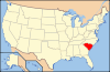
 Location of Charleston County in South Carolina
This is a list of the National Register of Historic Places listings in Charleston County, South Carolina.
This is intended to be a complete list of the properties and districts on the National Register of Historic Places in Charleston County, South Carolina, United States. The locations of National Register properties and districts for which the latitude and longitude coordinates are included below, may be seen in a Google map.[1]
There are 184 properties and districts listed on the National Register in the county, including 43 National Historic Landmarks. The city of Charleston is the location of 90 of these properties and districts, including 34 of the National Historic Landmarks; they are listed separately, while the 96 properties and districts in the remaining parts of the county, including 9 National Historic Landmarks, are listed here. Another 3 properties in Charleston County outside of Charleston were once listed but have been removed. Three properties and districts — the Ashley River Historic District, Ashley River Road, and the Secessionville Historic District — are split between the city and the other parts of the county, and are thus included on both lists.
-
- This National Park Service list is complete through NPS recent listings posted November 10, 2011.[2]
Current listings
[3] Landmark name[4] Image Date listed Location City or Town Summary 1 Ashley Hall Plantation 
June 5, 1975 Address Restricted West Ashley 2 Ashley River Historic District 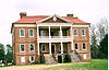
September 12, 1994 Roughly along the Ashley River from just east of South Carolina Highway 165 to the Seaboard Coast Line Railroad bridge
32°53′58″N 80°7′0″W / 32.89944°N 80.116667°WCharleston, North Charleston Extends into Charleston and Dorchester County 3 Ashley River Road November 21, 1983 South Carolina Highway 61 between Church Creek and South Carolina Highway 165
32°53′43″N 80°8′8″W / 32.89528°N 80.13556°WSummerville Extends into Charleston and Dorchester County 4 Atlanticville Historic District September 6, 2007 Middle St., Jasper Boulevard, and Myrtle Ave. between Stations 22½ and 26
32°45′55″N 79°49′57″W / 32.76528°N 79.8325°WSullivan's Island 5 Auld Mound October 15, 1970 Address Restricted Mount Pleasant 6 Alexander Bache U.S. Coast Survey Line October 5, 2007 8377 State Cabin Rd.
32°30′20″N 80°18′37″W / 32.50556°N 80.31028°WEdisto Island 7 Bailey's Store November 28, 1986 On Store Creek at the junction of South Carolina Highway 174 and Point of Pines Rd.
32°33′35″N 80°16′47″W / 32.55972°N 80.27972°WEdisto Island 8 Barnwell House November 25, 1980 South of Charleston
32°41′54″N 80°24′22″W / 32.69833°N 80.40611°WAdams Run 9 Bass Pond Site April 24, 1979 Address Restricted Kiawah Island 10 Battery Gadsden 
June 25, 1974 2017 Ion Ave.
32°45′36″N 79°50′23″W / 32.76°N 79.83972°WSullivan's Island Now houses the Edgar Allan Poe Branch of the Charleston County Library 11 Battery Thomson 
June 25, 1974 2013 Ion Ave.
32°45′33″N 79°50′28″W / 32.75917°N 79.84111°WSullivan's Island 12 Bethel African Methodist Episcopal Church 
June 22, 2004 369 Drayton St.
33°5′21.476″N 79°27′25.578″W / 33.08929889°N 79.457105°WMcClellanville 13 Bleak Hall Plantation Outbuildings March 7, 1973 4 miles southeast of Edisto Island off South Carolina Highway 174
32°33′10″N 80°14′5″W / 32.55278°N 80.23472°WEdisto Island 14 Brick House Ruin 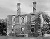
April 15, 1970 South of Edisto Island
32°36′5″N 80°19′32″W / 32.60139°N 80.32556°WEdisto Island 15 Brooklands Plantation 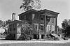
May 5, 1987 Off Laurel Hill Rd. on Scanawah Island
32°34′19″N 80°21′19″W / 32.57194°N 80.35528°WEdisto Island 16 Buzzard's Island Site October 15, 1970 Address Restricted Mount Pleasant 17 Cape Romain Lighthouses 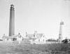
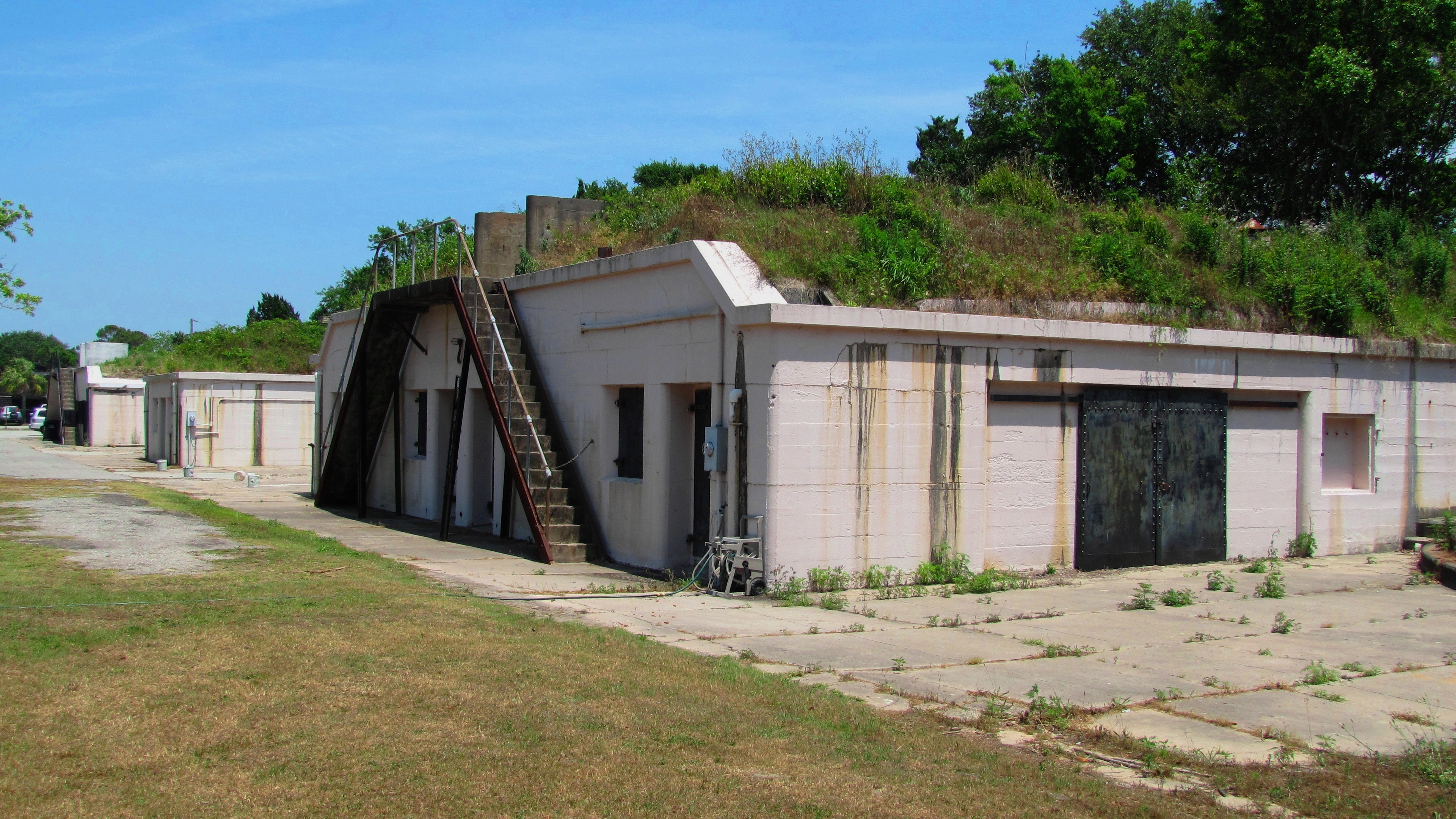
November 12, 1981 Southeast of McClellanville on Lighthouse Island
33°1′6″N 79°22′27″W / 33.01833°N 79.37417°WMcClellanville 18 Cassina Point 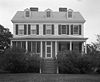
November 28, 1986 Cassina Point Rd.
32°35′29″N 80°15′3″W / 32.59139°N 80.25083°WEdisto Island 19 Charleston Naval Hospital Historic District 
October 22, 2010 Portions of Avenue A, Avenue B, Avenue D, 2nd Street, 4th Street, Hayter Street, North Hobson Street, McMillan Avenue, Machinists Street, Pierside Street, Pipefitters Street, Roe Avenue, Shipfitters Way, and Truxtun Avenue
32°51′51″N 79°58′2″W / 32.86417°N 79.96722°W[5]North Charleston 20 Charleston Navy Yard Historic District 
August 9, 2006 Roughly bounded by 1st St., Hobson Ave., Ave. D, 4th and 5th Sts., and the drydocks between 1st and 13th Sts.
32°51′43″N 79°57′46″W / 32.86194°N 79.96278°WNorth Charleston 21 Charleston Navy Yard Officers' Quarters Historic District March 2, 2007 Turnbull Ave., Everglades Dr., Navy Way, and portions of Hobson Ave. and Blackstop Dr.
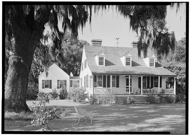
32°52′8″N 79°58′9″W / 32.86889°N 79.96917°WNorth Charleston 22 Christ Church 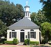
November 27, 1972 2304 Highway 17N[6]
32°50′38″N 79°48′50″W / 32.84389°N 79.81389°WMount Pleasant 23 Cook's Old Field Cemetery May 9, 2003 0.5 miles north of Rifle Range Rd.
32°50′20″N 79°48′13″W / 32.83889°N 79.80361°WMount Pleasant 24 Crawford's Plantation House June 8, 1993 8202 Oyster Factory Rd.
32°32′15″N 80°18′16″W / 32.5375°N 80.30444°WEdisto Island 25 Edisto Island Baptist Church April 1, 1982 North of Edisto Island, on South Carolina Highway 174
32°34′21″N 80°17′4″W / 32.5725°N 80.28444°WEdisto Island 26 Edisto Island Presbyterian Church 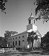
June 24, 1971 1.9 miles north of Edisto Island on South Carolina Highway 174
32°34′44″N 80°17′49″W / 32.57889°N 80.29694°WEdisto Island 27 Fairfield Plantation 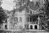
July 25, 1974 North of McClellanville
33°10′58″N 79°24′18″W / 33.18278°N 79.405°WMcClellanville 28 Fig Island Site October 15, 1970 Address Restricted Edisto Island 29 Folly North Site-38CH1213 October 2, 2003 Address Restricted Folly Beach 30 Fort Johnson/Powder Magazine 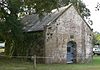
September 14, 1972 East end of Ft. Johnson Road, in South Carolina Department of Natural Resources compound
32°45′8″N 79°53′55″W / 32.75222°N 79.89861°WJames Island 31 Fort Moultrie Quartermaster and Support Facilities Historic District 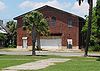
September 6, 2007 Middle St. and Thompson Ave., between Stations 14 and 16.5
32°45′35″N 79°51′11″W / 32.75972°N 79.85306°WSullivan's Island 32 Fort Palmetto August 11, 1982 Christ Church Parish
32°49′23″N 79°45′56″W / 32.82306°N 79.76556°WHamlin Sound 33 Fort Pemberton Site November 21, 1978 Shoreline of the Stono River on the northwestern corner of James Island
32°45′35″N 80°0′3″W / 32.75972°N 80.00083°W[7]James Island 34 Frogmore May 5, 1987 South of Pine Landing Rd. near the intersection of South Carolina Highway 174 and Laurel Hill Rd.
32°35′16″N 80°21′21″W / 32.58778°N 80.35583°WEdisto Island 35 Paul Grimball House Ruins November 28, 1986 Address Restricted Edisto Island 36 Grove Plantation August 25, 1978 Southwest of Adams Run off South Carolina Highway 174
32°39′54″N 80°23′37″W / 32.665°N 80.39361°WAdams Run 37 H.L. HUNLEY (submarine) 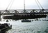
December 29, 1978 East of Charleston
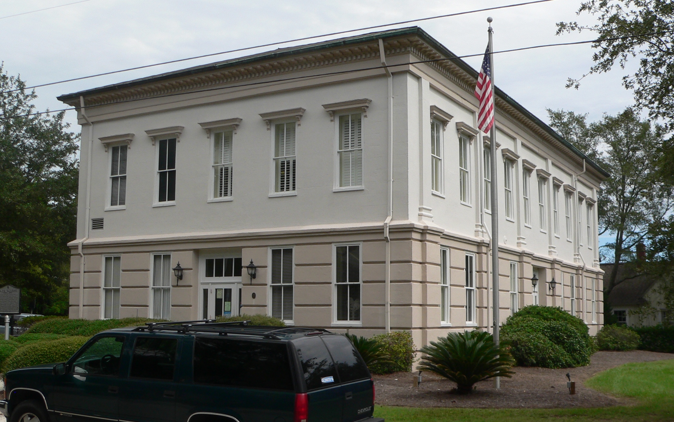
32°44′0″N 79°46′0″W / 32.733333°N 79.766667°WNorth Charleston 38 Hampton Plantation 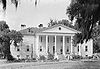
April 15, 1970 8 miles north of McClellanville
33°12′1″N 79°26′9″W / 33.20028°N 79.43583°WMcClellanville 39 Hanckel Mound October 15, 1970 Address Restricted Rockville 40 Harrietta Plantation 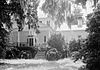
September 18, 1975 5 miles east of McClellanville off U.S. Route 17
33°10′10″N 79°23′37″W / 33.16944°N 79.39361°WMcClellanville 41 Horse Island November 10, 1970 Address Restricted Rockville 42 Hutchinson House May 5, 1987 Northern side of Point of Pines Rd.
32°34′11″N 80°15′25″W / 32.56972°N 80.25694°WEdisto Island 43 John's Island Presbyterian Church November 3, 1975 10 miles west of Charleston on South Carolina Highway 20
32°41′12″N 80°4′56″W / 32.68667°N 80.08222°WJohns Island 44 King Cemetery June 13, 2000 1.1 miles northeast of the junction of U.S. Route 17 and S-19-38
32°46′10″N 80°22′51″W / 32.76944°N 80.38083°WAdams Run 45 Lighthouse Point Shell Ring (38CH12) October 14, 1990 Address Restricted James Island 46 Long Point Plantation (38CH321) March 20, 1986 Address Restricted Mount Pleasant 47 Lucas Family Cemetery 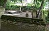
May 18, 1998 Ellen Dr.
32°47′45″N 79°52′18″W / 32.79583°N 79.87167°WMount Pleasant 48 Magnolia Plantation and Gardens 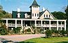
December 11, 1972 10 miles northwest of Charleston on South Carolina Highway 61
32°52′29″N 80°5′21″W / 32.87472°N 80.08917°WWest Ashley 49 Marshlands Plantation House 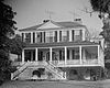
March 30, 1973 Northern side of Fort Sumter Dr.
32°45′1″N 79°54′3″W / 32.75028°N 79.90083°WJames Island 50 McClellanville Historic District March 23, 1982 Pinckney, Lofton, Charlotte, Church, Water, Oak, Venning, Legare, Morrison, and Scotia Sts.
33°5′6″N 79°27′43″W / 33.085°N 79.46194°WMcClellanville 51 Middleton's Plantation May 6, 1971 3.5 miles north of Edisto Island off South Carolina Highway 174
32°33′25″N 80°19′48″W / 32.55694°N 80.33°WEdisto Island Not to be confused with Middleton Place in nearby Dorchester County 51 Moultrieville Historic District 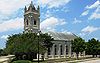
September 6, 2007 Middle St. and Osceola Ave., between stations 11 and 12
32°45′39″N 79°51′33″W / 32.76083°N 79.85917°WSullivan's Island Includes several late-19th and early-20th century beach houses and the Stella Maris Catholic Church 53 Mount Pleasant Historic District 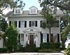
March 30, 1973 Bounded by Charleston Harbor, Shem Creek, Royall Ave., and McCants Dr.
32°47′10″N 79°52′33″W / 32.78611°N 79.87583°WMount Pleasant 54 Moving Star Hall June 17, 1982 River Rd.
32°40′55″N 80°1′33″W / 32.68194°N 80.02583°WJohns Island 55 Oak Island 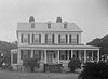
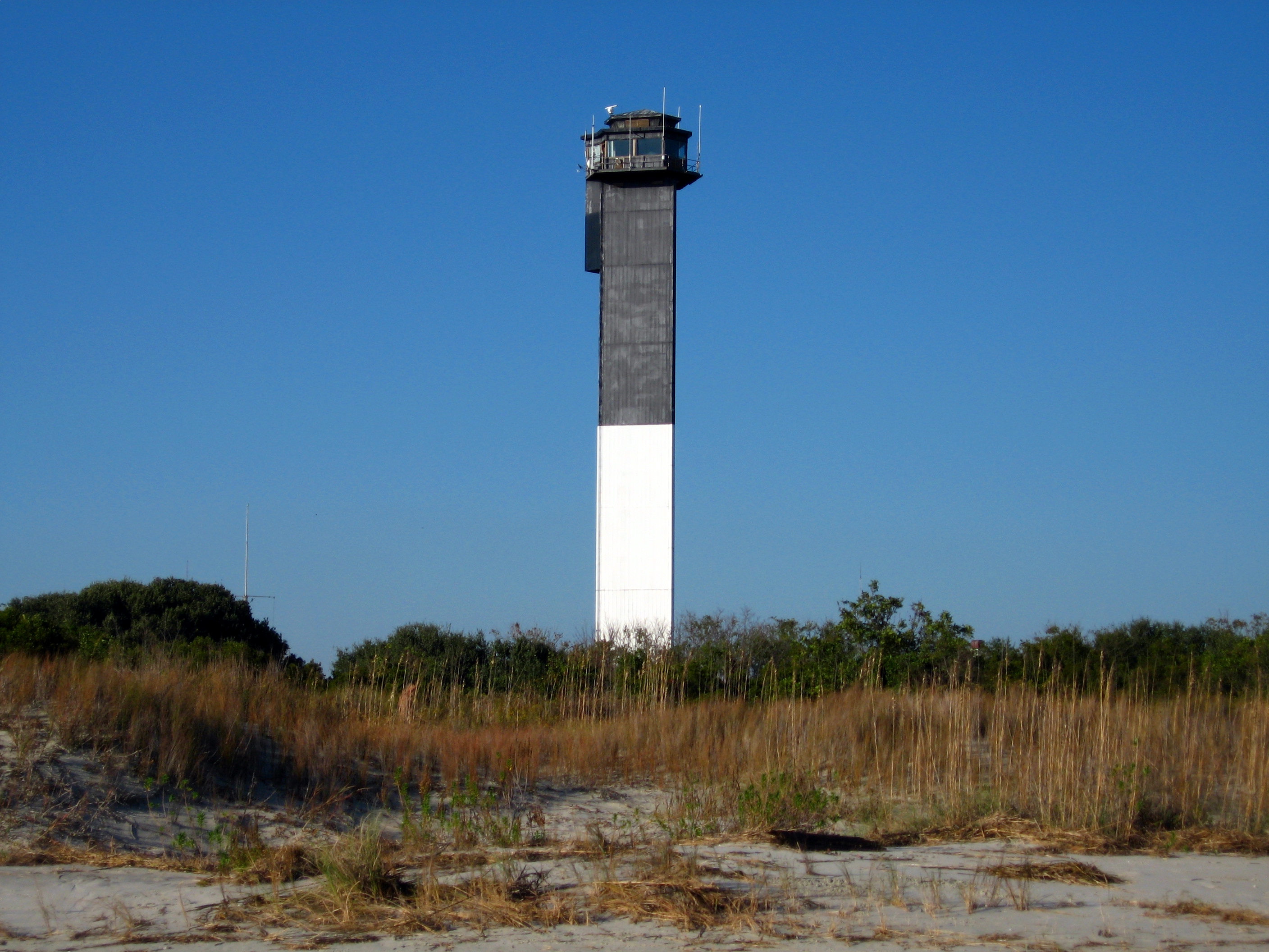
November 28, 1986 1 mile off Oak Island Rd. on Westbank Creek
32°35′39″N 80°15′5″W / 32.59417°N 80.25139°WEdisto Island 56 Oakland Plantation House 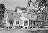
July 13, 1977 7 miles north of Charleston Harbor on U.S. Route 17
32°51′59″N 79°45′18″W / 32.86639°N 79.755°WMount Pleasant 57 Old Berkeley County Courthouse 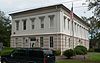
May 6, 1971 331 King St.
32°47′6″N 79°51′50″W / 32.785°N 79.86389°WMount Pleasant 58 Old House Plantation May 14, 1971 Northeast of Edisto Island via South Carolina Highway 174; also 0.5 miles east of the junction of South Carolina Highway 174 and Oak Island Rd., then right on a dirt road
32°34′49″N 80°15′37″W / 32.58028°N 80.26028°WEdisto Island Second address represents a boundary increase of May 5, 1987 59 Dr. John B. Patrick House 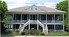
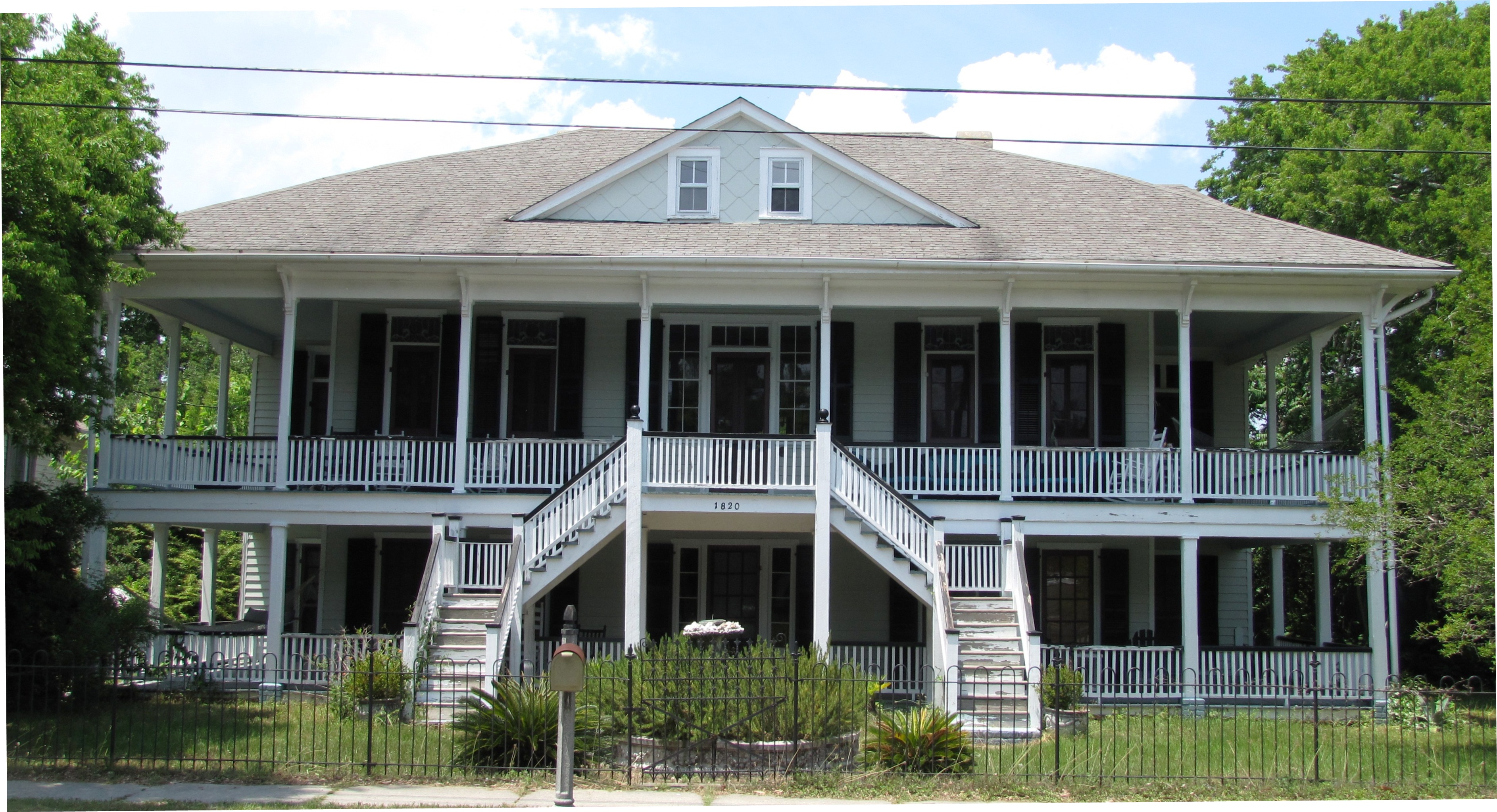
February 9, 1995 1820 Middle St.
32°45′35″N 79°50′36″W / 32.75972°N 79.84333°WSullivan's Island 60 Peter's Point Plantation June 19, 1973 Southwest of Edisto Island off South Carolina Highway 174 on County Road 764
32°32′18″N 80°20′39″W / 32.53833°N 80.34417°WEdisto Island 61 Point of Pines Plantation Slave Cabin November 28, 1986 Point of Pines Rd.
32°34′39″N 80°14′25″W / 32.5775°N 80.24028°WEdisto Island 62 Presbyterian Manse May 14, 1971 Northwest of Edisto Island off South Carolina Highway 174
32°34′4″N 80°18′34″W / 32.56778°N 80.30944°WEdisto Island 63 Paul Pritchard Shipyard September 17, 1974 Address Restricted Mount Pleasant 64 The Progressive Club October 24, 2007 3377 River Rd.
32°40′37″N 80°2′26″W / 32.67694°N 80.04056°WJohns Island 65 Prospect Hill November 28, 1986 Off Laurel Hill Rd.
32°34′54″N 80°23′4″W / 32.58167°N 80.38444°WEdisto Island 66 Remley Point Cemetery 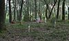
May 30, 2002 0.2 miles northeast of the junction of 3rd and 4th Aves. Mount Pleasant 67 Rockville Historic District June 13, 1972 Town of Rockville on the northern bank of Bohicket Creek
32°36′18″N 80°11′35″W / 32.605°N 80.19306°WRockville 68 St. James Episcopal Church, Santee 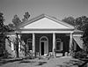
April 15, 1970 17 miles south of Georgetown on the Santee River
33°10′19″N 79°27′56″W / 33.17194°N 79.46556°WGeorgetown 69 John Seabrook Plantation Bridge October 9, 1974 Northwest of Rockville off South Carolina Highway 700
32°37′38″N 80°12′37″W / 32.62722°N 80.21028°WRockville 70 William Seabrook House 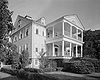
May 6, 1971 North of Edisto Island off South Carolina Highway 174
32°36′6″N 80°16′53″W / 32.60167°N 80.28139°WEdisto Island 71 Seashore Farmers' Lodge No. 767 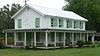
October 3, 2007 Northeastern corner of the junction of Sol Legare and Old Sol Legare Rds.
32°40′54″N 79°58′2″W / 32.68167°N 79.96722°WJames Island 72 Seaside School June 17, 1994 1097 South Carolina Highway 174
32°32′51″N 80°16′54″W / 32.5475°N 80.28167°WEdisto Island 73 Secessionville Historic District 
October 1, 1979 North of Folly Beach
32°42′18″N 79°56′35″W / 32.705°N 79.94306°WFolly Beach Extends into Charleston 74 Sewee Mound 
October 15, 1970 Salt Pond Road (FS Road 243)[8]
Awendaw 75 Slave Street, Smokehouse, and Allee, Boone Hall Plantation 
July 14, 1983 North of Mt. Pleasant off U.S. Route 17; also Long Point Rd. west of its junction with U.S. Routes 17/701
32°51′29″N 79°49′23″W / 32.85806°N 79.82306°WMount Pleasant Second location represents a boundary increase of January 21, 1994, the Boone Hall Plantation House and Historic Landscape 76 Snee Farm-Charles Pinckney National Historic Site 
April 13, 1973 6 miles west of Mt. Pleasant at 1254 Long Point Rd.
32°50′46″N 79°49′29″W / 32.84611°N 79.82472°WMount Pleasant 77 Stono River Slave Rebellion Site May 30, 1974 Off U.S. Route 17 on the western bank of the Wallace River
32°47′14″N 80°8′44″W / 32.78722°N 80.14556°WRantowles 78 Sullivan's Island Historic District 
September 6, 2007 Middle St., I'on Ave., and Central Ave. between Stations 17 and 18½
32°45′33″N 79°50′45″W / 32.75917°N 79.84583°WSullivan's Island 79 Summit Plantation House 
July 28, 1983 Off County Road 390
32°41′37″N 80°17′10″W / 32.69361°N 80.28611°WAdams Run 80 Sunnyside 
November 28, 1986 Off the northern side of Peter's Point Rd.; also north of the junction of Peters Point and Creekwood Rd.
32°33′57″N 80°17′50″W / 32.56583°N 80.29722°WEdisto Island A plantation on Edisto Island. Second location represents a boundary increase, the Sunnyside Plantation Foreman's House 81 Towles Farmstead January 21, 1994 4595 and 4611 Towles Rd.
32°43′14″N 80°11′6″W / 32.72056°N 80.185°WMeggett 82 Hephzibah Jenkins Townsend's Tabby Oven Ruins May 5, 1987 Address Restricted Edisto Island 83 Trinity Episcopal Church May 14, 1971 About 1.2 miles north of Edisto Island on South Carolina Highway 174
32°34′10″N 80°17′1″W / 32.56944°N 80.28361°WEdisto Island 84 U.S. Coast Guard Historic District 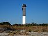
June 19, 1973 Ion Ave. between Station 18 and Station 18½
32°45′27″N 79°50′33″W / 32.7575°N 79.8425°WSullivan's Island 85 Unnamed Battery No. 1 August 11, 1982 Clark's Point
32°43′15″N 79°56′7″W / 32.72083°N 79.93528°WJames Island 86 Unnamed Battery No. 2 August 11, 1982 Clark's Point
32°43′15″N 79°56′14″W / 32.72083°N 79.93722°WJames Island 87 USS CLAMAGORE (SS-343) 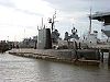
June 29, 1989 Patriot's Point
32°47′23″N 79°54′28″W / 32.78972°N 79.90778°WMount Pleasant 88 USS LAFFEY 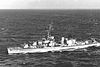
April 12, 1983 West of Mt. Pleasant on the eastern side of Charleston Harbor
32°47′23″N 79°54′28″W / 32.78972°N 79.90778°WMount Pleasant 89 USS YORKTOWN (CV-10) 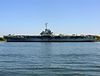
November 10, 1982 West of Mt. Pleasant on the eastern side of Charleston Harbor
32°47′26″N 79°54′31″W / 32.79056°N 79.90861°WMount Pleasant 90 Arnoldus Vander Horst House October 25, 1973 25 miles southwest of Charleston on Kiawah Island
32°37′0″N 80°4′24″W / 32.616667°N 80.07333°WKiawah Island 91 The Wedge 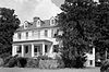
November 25, 1980 Northeast of McClellanville
33°10′17″N 79°23′57″W / 33.17139°N 79.39917°WMcClellanville 92 Wescott Road November 28, 1986 West of South Carolina Highway 174
32°33′39″N 80°16′51″W / 32.56083°N 80.28083°WEdisto Island 93 Wilkinson-Boineau House January 21, 1999 5185 South Carolina Highway 174
32°43′10″N 80°20′57″W / 32.71944°N 80.34917°WAdams Run 94 Willtown Bluff January 8, 1974 Southwest of Adams Run at the end of County Road 55 on the banks of the S. Edisto River
32°40′54″N 80°24′54″W / 32.68167°N 80.415°WAdams Run 95 Windsor Plantation July 23, 1974 East of South Carolina Highway 174 near Little Edisto
32°35′58″N 80°20′41″W / 32.59944°N 80.34472°WEdisto Island Former listings
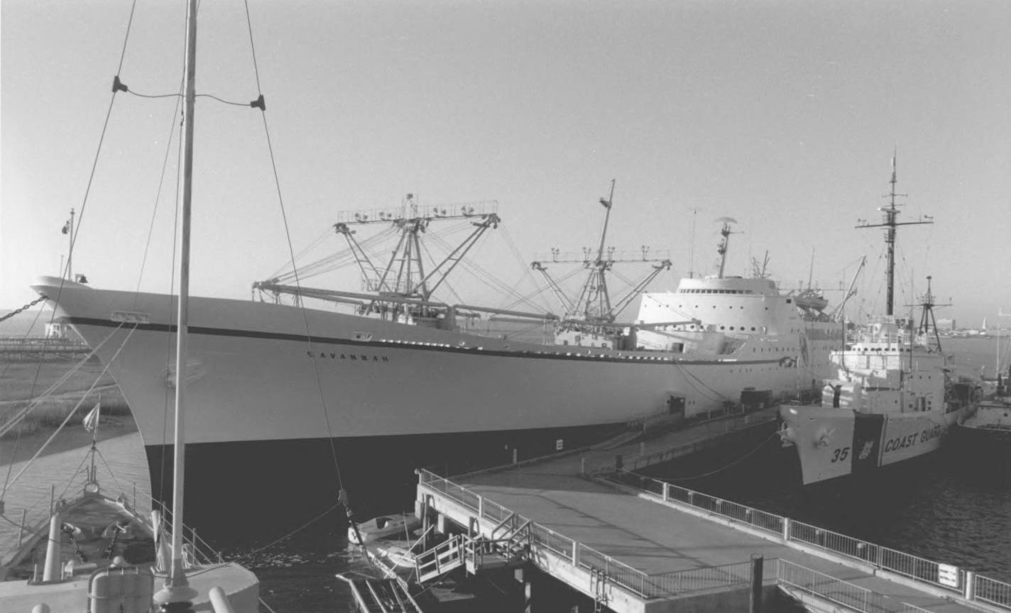
Landmark name Image Dates Location City or Town Summary 1 Laurel Hill March 15, 2000 (delisted) McClellanville Destroyed by Hurricane Hugo 2 NS Savannah 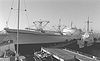
December 8, 2005 (delisted) Partiot's Points Mount Pleasant Moved to Newport News, Virginia 3 USCGC Ingham 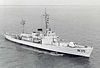
April 27, 1992 40 Patriots Point Rd.
32°47′18″N 79°54′31″W / 32.78833°N 79.90861°WMount Pleasant Moved to Florida 4 Williams Graded School August 21, 1980 (delisted) Pinckney St. Lincolnville Burned See also
- List of National Historic Landmarks in South Carolina
- National Register of Historic Places listings in South Carolina
References
- ^ The latitude and longitude information provided in this table was derived originally from the National Register Information System, which has been found to be fairly accurate for about 99% of listings. For about 1% of NRIS original coordinates, experience has shown that one or both coordinates are typos or otherwise extremely far off; some corrections may have been made. A more subtle problem causes many locations to be off by up to 150 yards, depending on location in the country: most NRIS coordinates were derived from tracing out latitude and longitudes off of USGS topographical quadrant maps created under the North American Datum of 1927, which differs from the current, highly accurate WGS84 GPS system used by Google maps. Chicago is about right, but NRIS longitudes in Washington are higher by about 4.5 seconds, and are lower by about 2.0 seconds in Maine. Latitudes differ by about 1.0 second in Florida. Some locations in this table may have been corrected to current GPS standards.
- ^ "National Register of Historic Places: Weekly List Actions". National Park Service, United States Department of the Interior. Retrieved on November 10, 2011.
- ^ Numbers represent an ordering by significant words. Various colorings, defined here, differentiate National Historic Landmark sites and National Register of Historic Places Districts from other NRHP buildings, structures, sites or objects.
- ^ "National Register Information System". National Register of Historic Places. National Park Service. 2009-03-13. http://nrhp.focus.nps.gov/natreg/docs/All_Data.html.
- ^ "Charleston Charleston Naval Hospital Historic District National Register of Historic Places Registration Form". South Carolina Department of Archives and History. February 14, 2006. http://www.nationalregister.sc.gov/charleston/S10817710175/S10817710175.pdf. Retrieved October 31, 2010.
- ^ "Contact Us". Christ Church--Mount Pleasant website. Retrieved 2011-09-10.
- ^ Location derived from its GNIS feature record; the NRIS lists the site as "Address Restricted"
- ^ "Sewee Shell Mound Interpretive Trail". U.S. Forest Service. Retrieved 2011-09-07.
U.S. National Register of Historic Places in South Carolina Lists by county Abbeville • Aiken • Allendale • Anderson • Bamberg • Barnwell • Beaufort • Berkeley • Calhoun • Charleston • Cherokee • Chester • Chesterfield • Clarendon • Colleton • Darlington • Dillon • Dorchester • Edgefield • Fairfield • Florence • Georgetown • Greenville • Greenwood • Hampton • Horry • Jasper • Kershaw • Lancaster • Laurens • Lee • Lexington • Marion • Marlboro • McCormick • Newberry • Oconee • Orangeburg • Pickens • Richland • Saluda • Spartanburg • Sumter • Union • Williamsburg • York
Lists by city Other lists Municipalities and communities of Charleston County, South Carolina Cities 
Towns Awendaw | Hollywood | James Island | Kiawah Island | Lincolnville‡ | McClellanville | Meggett | Mount Pleasant | Ravenel | Rockville | Seabrook Island | Sullivan's Island | Summerville‡
CDP Unincorporated
communityFootnotes ‡This populated place also has portions in an adjacent county or counties
Categories:- National Register of Historic Places in Charleston County, South Carolina
-


Wikimedia Foundation. 2010.