- National Register of Historic Places listings in Chittenden County, Vermont
-
 Location of Chittenden County in Vermont
This is a list of the National Register of Historic Places listings in Chittenden County, Vermont.
This is intended to be a complete list of the properties and districts on the National Register of Historic Places in Chittenden County, Vermont, United States. Latitude and longitude coordinates are provided for many National Register properties and districts; these locations may be seen together in a Google map.[1]
There are 97 properties and districts listed on the National Register in the county, including 3 National Historic Landmarks.
-
- This National Park Service list is complete through NPS recent listings posted November 10, 2011.[2]
Contents: Counties in Vermont Addison - Bennington - Caledonia - Chittenden - Essex - Franklin - Grand Isle - Lamoille - Orange - Orleans - Rutland - Washington - Windham - Windsor Current listings
[3] Site name[4] Image Date listed Location City or Town Summary 1 Ethan Allen Homestead 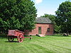
July 24, 1986 Off Van Patten Parkway
44°30′28.91″N 73°13′47.86″W / 44.5080306°N 73.2299611°WBurlington 2 Martin M. Bates Farmstead November 21, 1991 Huntington Rd. north of Huntington
44°21′57″N 72°59′48″W / 44.36583°N 72.99667°WRichmond 3 Battery Street Historic District 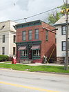
November 2, 1977 Roughly bounded by Lake Champlain and Main, Maple, and St. Pauls Sts. (both sides); also roughly bounded by Brown's Court and King, Adams, and Union Sts.
44°28′29″N 73°13′5″W / 44.47472°N 73.21806°WBurlington Second set of boundaries represents a boundary increase 4 Wilson Alwyn "Snowflake" Bentley House July 3, 1980 Southeast of Jericho on Nashville Rd.
44°27′1″N 72°55′57″W / 44.45028°N 72.9325°WJericho 5 Buell Street-Bradley Street Historic District November 13, 1995 2-71 Bradley St., 24-125 Buell St., 16-75 Orchard Terr., 9-96 S. Union St., 11-87 Hungerford Terr.
44°28′45″N 73°12′31″W / 44.47917°N 73.20861°WBurlington 6 Burlington Bay Horse Ferry December 15, 1993 In Burlington Bay, between Lone Rock Point and the Burlington breakwater
44°29′7.2″N 73°14′34.8″W / 44.485333°N 73.243°W[5]Burlington Shipwreck of a horse-powered ferry 7 Burlington Breakwater 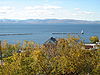
June 6, 2003 Burlington Harbor
44°28′32″N 73°13′33″W / 44.47556°N 73.22583°WBurlington Built to calm the waters of Lake Champlain against Burlington harbor. 8 Burlington Montgomery Ward Building 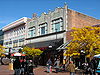
May 30, 1991 52-54 Church St.
44°28′44″N 73°12′46″W / 44.47889°N 73.21278°WBurlington 9 Burlington Traction Company 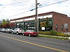
October 7, 2004 662 Riverside Ave. and 321-343 N. Winooski Ave.
44°29′29″N 73°12′22″W / 44.49139°N 73.20611°WBurlington First housing streetcars, then buses, now several small businesses. 10 Roswell Butler House November 8, 2001 6 Carmichael St.
44°30′34″N 73°5′5″W / 44.50944°N 73.08472°WEssex 11 Carnegie Building of the Fletcher Free Library 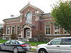
August 18, 1976 College St. and S. Winooski Ave.
44°28′37″N 73°12′39″W / 44.47694°N 73.21083°WBurlington 12 Champlain School 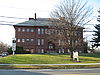
December 10, 1982 809 Pine St.
44°27′25″N 73°12′55″W / 44.45694°N 73.21528°WBurlington Former elementary school, now apartments (with addition in rear) 13 Charlotte Center Historic District 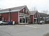
July 19, 1984 Church Hill and Hinesburg Rds.
44°18′52″N 73°14′23″W / 44.31444°N 73.23972°WCharlotte 14 Chittenden County Courthouse 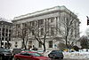
April 11, 1973 180 Church St.
44°28′2″N 73°12′44″W / 44.46722°N 73.21222°WBurlington 15 Giles Chittenden Farmstead October 29, 1993 Governor Chittenden Rd., northeast of Williston village center
44°26′59″N 73°2′43″W / 44.44972°N 73.04528°WWilliston 16 Martin Chittenden House January 9, 1978 West of Jericho on Vermont Route 117
44°27′28″N 73°1′13″W / 44.45778°N 73.02028°WJericho 17 Church Street Historic District 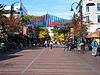
July 29, 2010 Generally the Church St. corridor, along with flanking blocks of Bank, Cherry, College, and Main Sts.
44°28′40″N 73°12′45″W / 44.47778°N 73.2125°WBurlington 18 City Hall Park Historic District 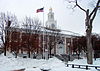
June 9, 1983 Church, College, Main, and St. Paul Sts.
44°28′35″N 73°12′49″W / 44.47639°N 73.21361°WBurlington 19 Downtown Essex Junction Commercial Historic District 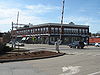
November 1, 2004 3-17 and 8-12 Main St., 2-28 Railroad Ave., and 2 Railroad St.
44°29′36″N 73°6′35″W / 44.49333°N 73.10972°WEssex Junction 20 Ethan Allen Engine company No. 4 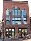
April 16, 1971 Church St.
44°28′40″N 73°12′50″W / 44.47778°N 73.21389°WBurlington 21 First Baptist Church 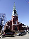
March 2, 2001 81 St. Paul St.
44°29′3″N 73°13′24″W / 44.48417°N 73.22333°WBurlington 22 First Methodist Church of Burlington 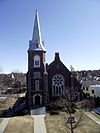
October 5, 1978 S. Winooski Ave.
44°28′33″N 73°12′40″W / 44.47583°N 73.21111°WBurlington 23 Follett House 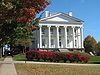
October 30, 1972 63 College St.
44°28′36″N 73°13′4″W / 44.47667°N 73.21778°WBurlington 24 Fort Ethan Allen Historic District 
September 14, 1995 Junction of Vermont Route 15 and Barnes Rd.
44°30′19″N 73°8′56″W / 44.50528°N 73.14889°WColchester and Essex 25 Galusha House October 10, 1978 South of Jericho
44°30′9″N 72°59′38″W / 44.5025°N 72.99389°WJericho 26 Burlington 27 Grassemount 
April 11, 1973 411 Main St.
44°28′36″N 73°12′13″W / 44.47667°N 73.20361°WBurlington 28 Gray Rocks December 27, 1996 U.S. Route 2, near its junction with U.S. Route 89
44°24′5″N 72°58′29″W / 44.40139°N 72.97472°WRichmond 29 Head of Church Street Historic District 
July 15, 1974 Pearl and Church Sts.
44°28′51″N 73°12′48″W / 44.48083°N 73.21333°WBurlington 30 Holmes Creek Covered Bridge 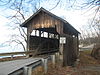
September 6, 1974 Northwest of Charlotte over Holmes Creek
44°19′59″N 73°17′40″W / 44.33306°N 73.29444°WCharlotte 31 House at 44 Front Street October 16, 2008 42-44 Front St.
44°28′59.53″N 73°13′13.29″W / 44.4832028°N 73.2203583°WBurlington 32 Honey Hollow Camp December 29, 1994 2 mi (3.2 km) south of Vermont Route 2, along Honey Hollow Rd.
44°21′2″N 72°55′6″W / 44.35056°N 72.91833°WBolton 33 Howard Mortuary Chapel 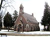
October 21, 1999 455 North Ave.
44°29′36″N 73°13′49″W / 44.49333°N 73.23028°WBurlington 34 Huntington Lower Village Church August 23, 1984 Huntington Lower Village Church
44°19′35″N 72°59′21″W / 44.32639°N 72.98917°WHuntington 35 Jericho Center Historic District May 26, 1983 Brown's Trace, Bolger Hill and Varney Rds.
44°28′13″N 72°58′20″W / 44.47028°N 72.97222°WJericho 36 Jericho Village Historic District November 5, 1992 Vermont Route 15, Plains Rd., Mill St., and Old Pump Rd.
44°30′19″N 72°59′45″W / 44.50528°N 72.99583°WJericho 37 Dan Johnson Farmstead November 4, 1993 Junction of U.S. Route 2 and Johnson Ln.
44°25′50″N 73°3′22″W / 44.43056°N 73.05611°WWilliston 38 Jonesville Academy 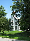
November 2, 1982 South of Jonesville at Cochran and Waterbury Rds.
44°22′53″N 72°56′20″W / 44.38139°N 72.93889°WJonesville 39 Martin L. Kelsey House 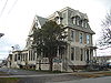
February 24, 1983 43 Elmwood Ave
44°28′52″N 73°12′52″W / 44.48111°N 73.21444°WBurlington 40 LeFarriere House August 8, 2008 171-173 Intervale Ave.
44°29′32.4312″N 73°11′43.9908″W / 44.492342°N 73.195553°WBurlington 41 Lakeside Development 
April 12, 1982 Lakeside, Central, Conger, Wright, and Harrison Aves.
44°27′35″N 73°13′15″W / 44.45972°N 73.22083°WBurlington 42 Main Street-College Street Historic District October 13, 1988 Roughly bounded by College, S. Williams and Main Sts., and S. Winooski Ave.
44°28′44″N 73°12′22″W / 44.47889°N 73.20611°WBurlington 43 McNeil Homestead June 17, 1982 Lake Champlain off Vermont Route F-5
44°18′12″N 73°18′5″W / 44.30333°N 73.30139°WCharlotte 44 Methodist Episcopal Church of Winooski 
March 2, 2001 24 W Allen St.
44°29′28″N 73°11′16″W / 44.49111°N 73.18778°WWinooski 45 Mintzer House August 8, 2008 175-177 Intervale Ave.
44°29′25.71″N 73°12′36.8274″W / 44.490475°N 73.210229833°WBurlington 46 Moquin's Bakery 
June 27, 1997 78 Rose St.
44°29′13″N 73°13′0″W / 44.48694°N 73.216667°WBurlington 47 Moran Municipal Generation Station 
December 17, 2010 475 Lake St.
44°28′53″N 73°13′24″W / 44.48139°N 73.22333°WBurlington 48 Mount Philo State Park 
November 29, 2001 5425 Mount Philo Rd.
44°16′40″N 73°12′40″W / 44.27778°N 73.21111°WCharlotte 49 Murray-Isham Farm December 7, 1992 741 Oak Hill Rd. (Town Highway 1)
44°23′34″N 73°5′47″W / 44.39278°N 73.09639°WWilliston 50 Normand House August 8, 2008 163-165, 165 rear Intervale Ave.
44°29′24.7158″N 73°12′37.677″W / 44.490198833°N 73.21046583°WBurlington 51 North Street Historic District 
December 21, 2001 Roughly along North St., from North Ave. to N. Winooski Ave.
44°29′3″N 73°13′1″W / 44.48417°N 73.21694°WBurlington 52 Burlington 53 Old Ohavi Zedek Synagogue 
January 31, 1978 Archibald and Hyde Sts.
44°29′18″N 73°12′26″W / 44.48833°N 73.20722°WBurlington 54 Old Red Mill and Mill House 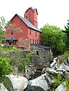
July 31, 1972 Vermont Route 15
44°30′17″N 73°0′0″W / 44.50472°N 73°WJericho 55 Old Stone House 
May 8, 1973 73 E. Allen St.
44°29′29.112″N 73°11′0.168″W / 44.49142°N 73.18338°WWinooski 56 Charles R. Palmer House August 30, 2005 201 and 203 N. Willard St.
44°29′21″N 73°12′15″W / 44.48917°N 73.20417°WBurlington 57 Pearl Street Historic District November 1, 1984 Roughly 184 to 415 Pearl St., Orchard Terr., and Winooski Ave.
44°28′50″N 73°12′29″W / 44.48056°N 73.20806°WBurlington 58 Cicero Goddard Peck House November 10, 2010 18 Mechanicsville Rd.
44°19′55″N 73°6′36″W / 44.33194°N 73.11°WHinesburg 59 Colchester 60 Porter Screen Company 
November 15, 1979 110 E. Spring St.
44°19′51″N 73°11′13″W / 44.33083°N 73.18694°WWinooski 61 Preston-Lafreniere Farm February 5, 1999 Junction of Duxbury Rd. and Honey Hollow Rd.
44°22′29″N 72°54′33″W / 44.37472°N 72.90917°WBolton 62 Proctor Maple Research Farm September 13, 1999 UVM Rd.
44°31′37″N 72°51′57″W / 44.52694°N 72.86583°WUnderhill 63 Quinlan's Covered Bridge 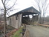
September 10, 1974 South of East Charlotte over Lewis Creek
44°16′35″N 73°11′4″W / 44.27639°N 73.18444°WEast Charlotte 64 Redstone Historic District 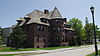
November 14, 1991 S. Prospect St.
44°28′12″N 73°11′54″W / 44.47°N 73.19833°WBurlington 65 Remington-Williamson Farm November 19, 2001 4282 Main Rd.
44°18′0″N 72°58′14″W / 44.3°N 72.97056°WHuntington 66 Richmond Congregational Church March 29, 2001 Junction of Bridge and Church St.
44°24′14″N 72°59′46″W / 44.40389°N 72.99611°WRichmond 67 Richmond Underwear Company Building 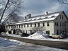
May 7, 1992 Millet St.
44°24′23.6″N 72°59′37.6″W / 44.406556°N 72.993778°WRichmond 68 John B. Robarge Duplex August 6, 2005 58-60 N. Champlain St.
44°29′3″N 73°13′2″W / 44.48417°N 73.21722°WBurlington 69 Daniel Webster Robinson House April 22, 1982 384 and 388 Main St.
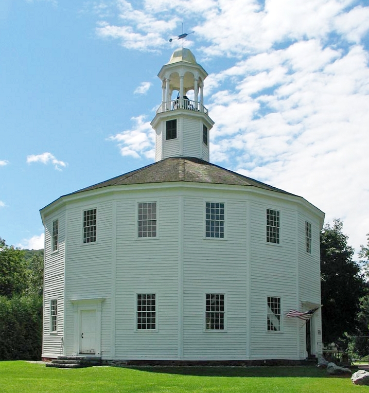
44°28′35″N 73°12′15″W / 44.47639°N 73.20417°WBurlington 70 Round Church 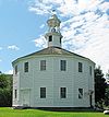
June 20, 1974 Bridge St. and Cochran Rd.
44°23′56″N 72°59′58″W / 44.39889°N 72.99944°WRichmond Built in 1812-1813, a rare, well-preserved example of a sixteen-sided meetinghouse 71 Lucy Ruggles House 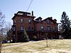
December 16, 2005 262 S. Prospect St.
44°28′30″N 73°12′0″W / 44.475°N 73.2°WBurlington 72 Saltus Grocery Store 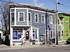
November 19, 2001 299-301 N. Winooski Ave.
44°29′18″N 73°12′28″W / 44.48833°N 73.20778°WBurlington 73 Sand Bar State Park February 14, 2002 1215 U.S. Route 2
44°37′37″N 73°14′27″W / 44.62694°N 73.24083°WMilton 74 Sequin Covered Bridge 
September 6, 1974 Southeast of East Charlotte over Lewis Creek
44°17′20″N 73°9′3″W / 44.28889°N 73.15083°WEast Charlotte 75 Shelburne Farms 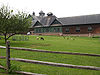
August 11, 1980 Off U.S. Route 7
44°23′37″N 73°14′53″W / 44.39361°N 73.24806°WShelburne Created in 1886 by Dr. William Seward Webb and Eliza Osgood Vanderbilt-Webb as a model agricultural estate. 76 Shelburne Village Historic District 
July 27, 1990 Area north and south of the junction of U.S. Route 7, Harbor Rd. and Falls Rd., including the area south and east of the LaPlatte River and U.S. Route 7
44°22′51″N 73°13′36″W / 44.38083°N 73.22667°WShelburne 77 South Union Street Historic District October 31, 1988 S. Union St. between Howard and Main
44°28′16″N 73°12′30″W / 44.47111°N 73.20833°WBurlington 78 South Willard Street Historic District November 3, 1988 S. Willard St.
44°28′21″N 73°12′23″W / 44.4725°N 73.20639°WBurlington 79 Sutton Farm October 7, 2004 1592 Dorset St.
44°20′20″N 73°10′14″W / 44.338829°N 73.170662°WShelburne 80 Tavern on Mutton Hill December 10, 1982 Church Hill Rd.
44°19′30″N 73°14′15″W / 44.325°N 73.2375°WCharlotte 81 TICONDEROGA 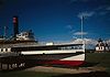
October 15, 1966 Shelburne Museum
44°22′37″N 73°13′53″W / 44.37694°N 73.23139°WShelburne 220-foot (67 m) steamboat built in Shelburne, Vermont in 1906. 82 Lee Tracy House December 22, 1983 U.S. Route 7
44°22′54″N 73°13′42″W / 44.38167°N 73.22833°WShelburne 83 U.S. Post Office and Customshouse 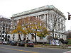
November 21, 1972 Southeastern corner of Main and Church Sts.
44°28′33″N 73°12′44″W / 44.47583°N 73.21222°WBurlington 84 Underhill State Park June 21, 2002 352 Mountain Rd.
44°31′34″N 72°49′58″W / 44.52611°N 72.83278°WUnderhill 85 University Green Historic District 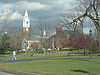
April 14, 1975 University of Vermont campus
44°28′39″N 73°12′2″W / 44.4775°N 73.20056°WBurlington 86 Edward Wells House 
October 3, 1979 61 Summit St.
44°28′28″N 73°12′11″W / 44.47444°N 73.20306°WBurlington 87 Wells-Jackson Carriage House Complex 
December 10, 1982 192-194 Jackson Court and 370 Maple St.
44°28′30″N 73°12′17″W / 44.475°N 73.20472°WBurlington 88 Wells-Richardson District 
March 5, 1979 Main, Pine, College, and St. Paul Sts.
44°28′35″N 73°12′54″W / 44.47639°N 73.215°WBurlington 89 West Milton Bridge September 8, 1992 Town Highway 40 over the Lamoille River
44°37′56″N 73°10′18″W / 44.63222°N 73.17167°WMilton 90 M. S. Whitcomb Farm September 30, 1993 U.S. Route 2
44°23′29″N 72°56′24″W / 44.39139°N 72.94°WRichmond 91 Williston Congregational Church May 17, 1973 Center of Williston Village on Vermont Route 2
44°26′20″N 73°4′23″W / 44.43889°N 73.07306°WWilliston 92 Williston Village Historic District December 19, 1979 U.S. Route 2; also U.S. Route 2 over Allen Brook
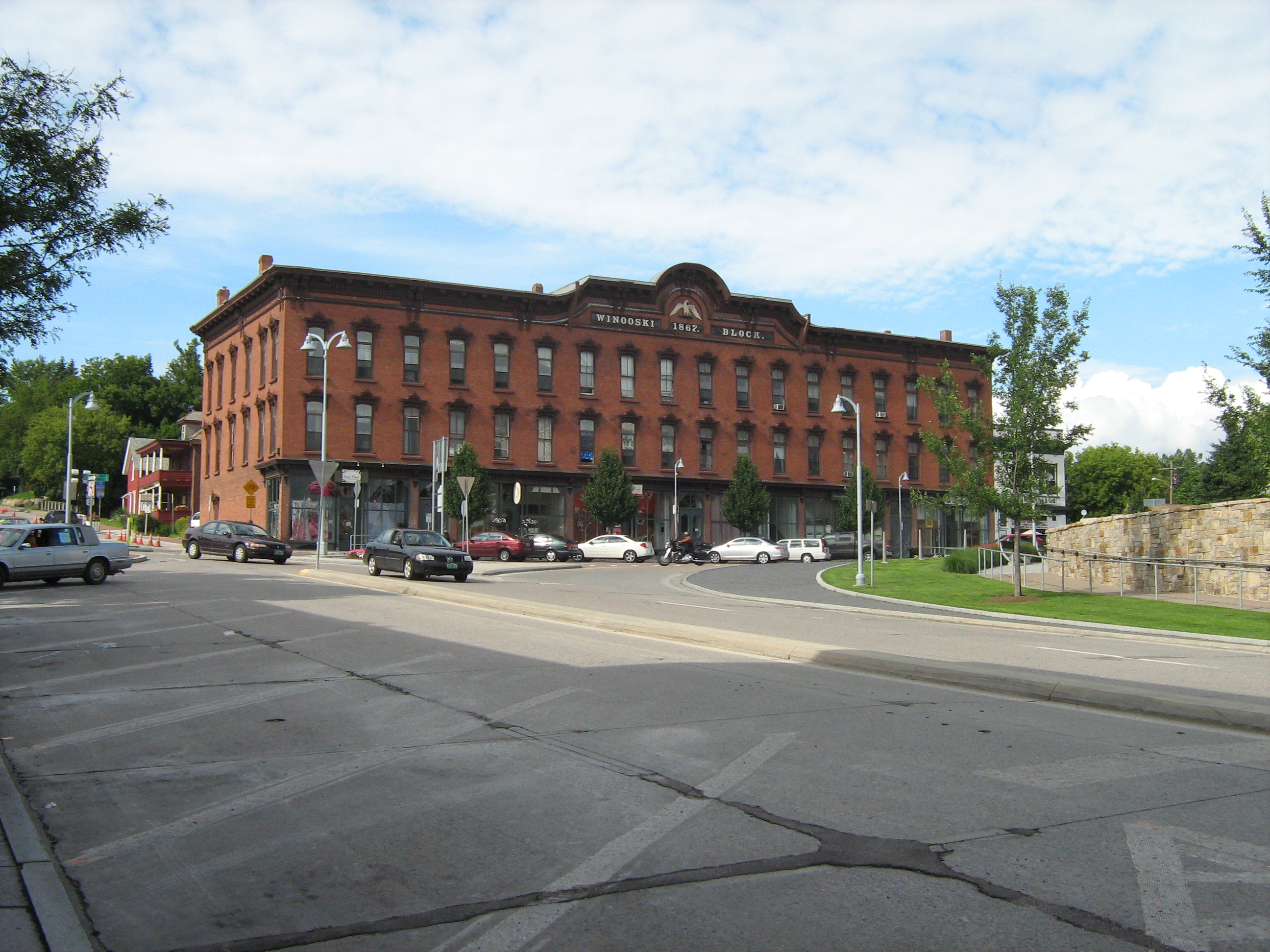
44°26′16″N 73°4′14″W / 44.43778°N 73.07056°WWilliston Allen Brook location represents a boundary increase 93 Winooski Archeological Site January 5, 1978 Address Restricted Winooski 94 Winooski Block 
November 20, 1974 E. Allen and Main Sts.
44°29′30″N 73°11′11″W / 44.49167°N 73.18639°WWinooski 95 Winooski Falls Mill District 
February 9, 1979 Northern bank of the Winooski River to Center and Canal Sts., southern bank to Bartlet St.; also 485-497 Colchester Ave., 5-21 Mill St., and 8-32 Barrett St.; also 110 W. Canal St.
44°29′20″N 73°11′15″W / 44.48889°N 73.1875°WWinooski Range of street addresses represents a boundary increase; 110 Canal represents a second boundary increase 96 Winooski River Bridge 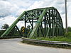
May 30, 1990 US Route 2 over the Winooski River
44°25′24″N 73°1′1″W / 44.42333°N 73.01694°WRichmond 97 Winterbotham Estate 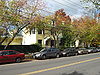
May 12, 1975 163 S. Willard St.
44°28′33″N 73°12′22″W / 44.47583°N 73.20611°WBurlington See also
- List of National Historic Landmarks in Vermont
- National Register of Historic Places listings in Vermont
References
- ^ The latitude and longitude information provided in this table was derived originally from the National Register Information System, which has been found to be fairly accurate for about 99% of listings. For about 1% of NRIS original coordinates, experience has shown that one or both coordinates are typos or otherwise extremely far off; some corrections may have been made. A more subtle problem causes many locations to be off by up to 150 yards, depending on location in the country: most NRIS coordinates were derived from tracing out latitude and longitudes off of USGS topographical quadrant maps created under the North American Datum of 1927, which differs from the current, highly accurate WGS84 GPS system used by Google maps. Chicago is about right, but NRIS longitudes in Washington are higher by about 4.5 seconds, and are lower by about 2.0 seconds in Maine. Latitudes differ by about 1.0 second in Florida. Some locations in this table may have been corrected to current GPS standards.
- ^ "National Register of Historic Places: Weekly List Actions". National Park Service, United States Department of the Interior. Retrieved on November 10, 2011.
- ^ Numbers represent an ordering by significant words. Various colorings, defined here, differentiate National Historic Landmark sites, a [[National Historic Site (United States)|]], and several National Register of Historic Places Districts from other NRHP buildings, structures, sites or objects.
- ^ "National Register Information System". National Register of Historic Places. National Park Service. 2008-04-24. http://nrhp.focus.nps.gov/natreg/docs/All_Data.html.
- ^ Location derived from this Lake Champlain Maritime Museum webpage; the NRIS lists the site as "Address Restricted"
U.S. National Register of Historic Places Topics Lists by states Alabama • Alaska • Arizona • Arkansas • California • Colorado • Connecticut • Delaware • Florida • Georgia • Hawaii • Idaho • Illinois • Indiana • Iowa • Kansas • Kentucky • Louisiana • Maine • Maryland • Massachusetts • Michigan • Minnesota • Mississippi • Missouri • Montana • Nebraska • Nevada • New Hampshire • New Jersey • New Mexico • New York • North Carolina • North Dakota • Ohio • Oklahoma • Oregon • Pennsylvania • Rhode Island • South Carolina • South Dakota • Tennessee • Texas • Utah • Vermont • Virginia • Washington • West Virginia • Wisconsin • WyomingLists by territories Lists by associated states Other Municipalities and communities of Chittenden County, Vermont Cities 
Towns Bolton | Charlotte | Colchester | Essex | Hinesburg | Huntington | Jericho | Milton | Richmond | Shelburne | St. George | Underhill | Westford | Williston
Villages Gore CDP Unincorporated
communityCategories:- National Register of Historic Places in Vermont by county
- Chittenden County, Vermont
-


Wikimedia Foundation. 2010.