- National Register of Historic Places listings in Choctaw County, Oklahoma
-
 Location of Choctaw County in Oklahoma
This is a list of the National Register of Historic Places listings in Choctaw County, Oklahoma.
This is intended to be a complete list of the properties and districts on the National Register of Historic Places in Choctaw County, Oklahoma, United States. The locations of National Register properties and districts for which the latitude and longitude coordinates are included below, may be seen in a Google map.[1]
There are 13 properties and districts listed on the National Register in the county.
-
- This National Park Service list is complete through NPS recent listings posted November 10, 2011.[2]
Current listings
[3] Landmark name [4] Image Date listed Location City or town Summary 1 District Choctaw Chief's House June 21, 1971 1.5 miles northeast of Swink
34°01′23″N 95°10′54″W / 34.023056°N 95.181667°WSwink Built for the Appuckshunubbe District Chief, the 1830 Treaty of Dancing Rabbit Creek provided for its construction. This house at Swink is the only house still on its original site in existence from that era. Maintained by the Swink Historical Preservation Association, it is open by appointment. (2011) 2 Doaksville Site May 29, 1975 Address Restricted Fort Towson 3 Everidge Cabin and Cemetery March 31, 1982 Off the railroad line
33°56′34″N 95°21′19″W / 33.942778°N 95.355278°WHugo 4 Fort Towson September 29, 1970 1 miles northeast of Fort Towson
34°01′34″N 95°15′08″W / 34.026111°N 95.252222°WFort Towson 5 Hugo Armory September 8, 1988 Jefferson and 3rd Sts.
34°00′30″N 95°30′36″W / 34.008333°N 95.51°WHugo 6 Hugo Frisco Railroad Depot June 6, 1980 N. A and Jackson Sts.
34°00′43″N 95°30′53″W / 34.011944°N 95.514722°WHugo 7 Hugo Historic District November 12, 1980 U.S. Routes 70 and 271
34°00′39″N 95°30′46″W / 34.010867°N 95.512864°WHugo 8 Choctaw County Public Library September 8, 1988 703 E. Jackson St. Hugo, Oklahoma 74743 Built in 2004 with a Donlad W. Reynolds Foundation grant,it is a Southeastern Public Library System of Oklahoma Branch. 9 Rose Hill Plantation March 15, 2010 Address Restricted Hugo 10 Speer School September 8, 1988 Off U.S. Route 271 east on a county road
34°06′49″N 95°32′54″W / 34.113611°N 95.548333°WHugo 11 Spencer Academy May 21, 1975 10 miles north of Fort Towson
34°08′51″N 95°21′37″W / 34.1475°N 95.360278°WFort Towson 12 Spencerville School Campus September 8, 1988 South of Spencerville
34°08′31″N 95°22′13″W / 34.141944°N 95.370278°WSpencerville 13 Willie W. Wilson House April 20, 1982 Northeastern corner of the junction of Cincinnati Ave. and Main St.
34°01′15″N 95°15′55″W / 34.02087°N 95.26541°WFort Towson See also
- List of National Historic Landmarks in Oklahoma
- National Register of Historic Places listings in Oklahoma
References
- ^ The latitude and longitude information provided in this table was derived originally from the National Register Information System, which has been found to be fairly accurate for about 99% of listings. For about 1% of NRIS original coordinates, experience has shown that one or both coordinates are typos or otherwise extremely far off; some corrections may have been made. A more subtle problem causes many locations to be off by up to 150 yards, depending on location in the country: most NRIS coordinates were derived from tracing out latitude and longitudes off of USGS topographical quadrant maps created under the North American Datum of 1927, which differs from the current, highly accurate WGS84 GPS system used by Google maps. Chicago is about right, but NRIS longitudes in Washington are higher by about 4.5 seconds, and are lower by about 2.0 seconds in Maine. Latitudes differ by about 1.0 second in Florida. Some locations in this table may have been corrected to current GPS standards.
- ^ "National Register of Historic Places: Weekly List Actions". National Park Service, United States Department of the Interior. Retrieved on November 10, 2011.
- ^ Numbers represent an ordering by significant words. Various colorings, defined here, differentiate National Historic Landmark sites and National Register of Historic Places Districts from other NRHP buildings, structures, sites or objects.
- ^ "National Register Information System". National Register of Historic Places. National Park Service. . http://nrhp.focus.nps.gov/natreg/docs/All_Data.html.
U.S. National Register of Historic Places Topics Lists by states Alabama • Alaska • Arizona • Arkansas • California • Colorado • Connecticut • Delaware • Florida • Georgia • Hawaii • Idaho • Illinois • Indiana • Iowa • Kansas • Kentucky • Louisiana • Maine • Maryland • Massachusetts • Michigan • Minnesota • Mississippi • Missouri • Montana • Nebraska • Nevada • New Hampshire • New Jersey • New Mexico • New York • North Carolina • North Dakota • Ohio • Oklahoma • Oregon • Pennsylvania • Rhode Island • South Carolina • South Dakota • Tennessee • Texas • Utah • Vermont • Virginia • Washington • West Virginia • Wisconsin • WyomingLists by territories Lists by associated states Other Municipalities and communities of Choctaw County, Oklahoma City 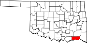
Towns Boswell | Fort Towson | Sawyer | Soper
Unincorporated
communitiesCategories:- Choctaw County, Oklahoma
- National Register of Historic Places in Oklahoma by county
- Buildings and structures in Choctaw County, Oklahoma
-

Wikimedia Foundation. 2010.