- National Register of Historic Places listings in Columbus, Ohio
-
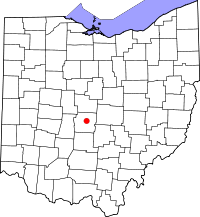 Location of Columbus in Ohio
This is a list of the National Register of Historic Places listings in Columbus, Ohio.
This is intended to be a complete list of the properties and districts on the National Register of Historic Places in Columbus, Ohio, United States. Latitude and longitude coordinates are provided for many National Register properties and districts; these locations may be seen together in a Google map.[1]
There are 308 properties and districts listed on the National Register in Franklin County, including 3 National Historic Landmarks. The city of Columbus is the location of 142 of these properties and districts, including all of the National Historic Landmarks; they are listed here, while the remaining 166 properties and districts are listed separately.
-
- This National Park Service list is complete through NPS recent listings posted November 10, 2011.[2]
Current listings
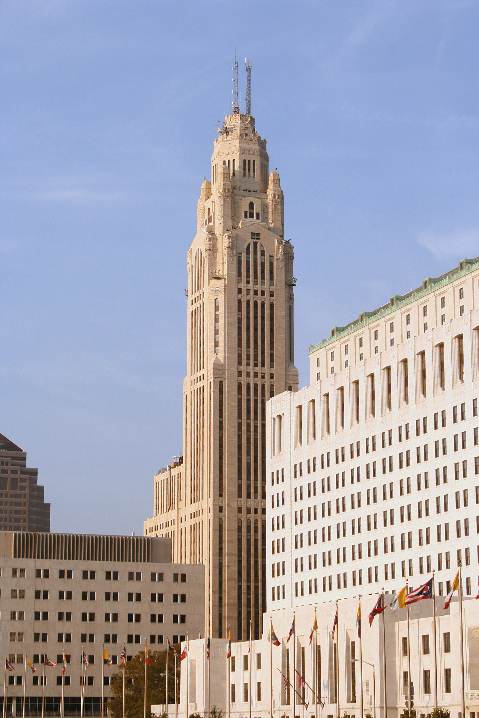
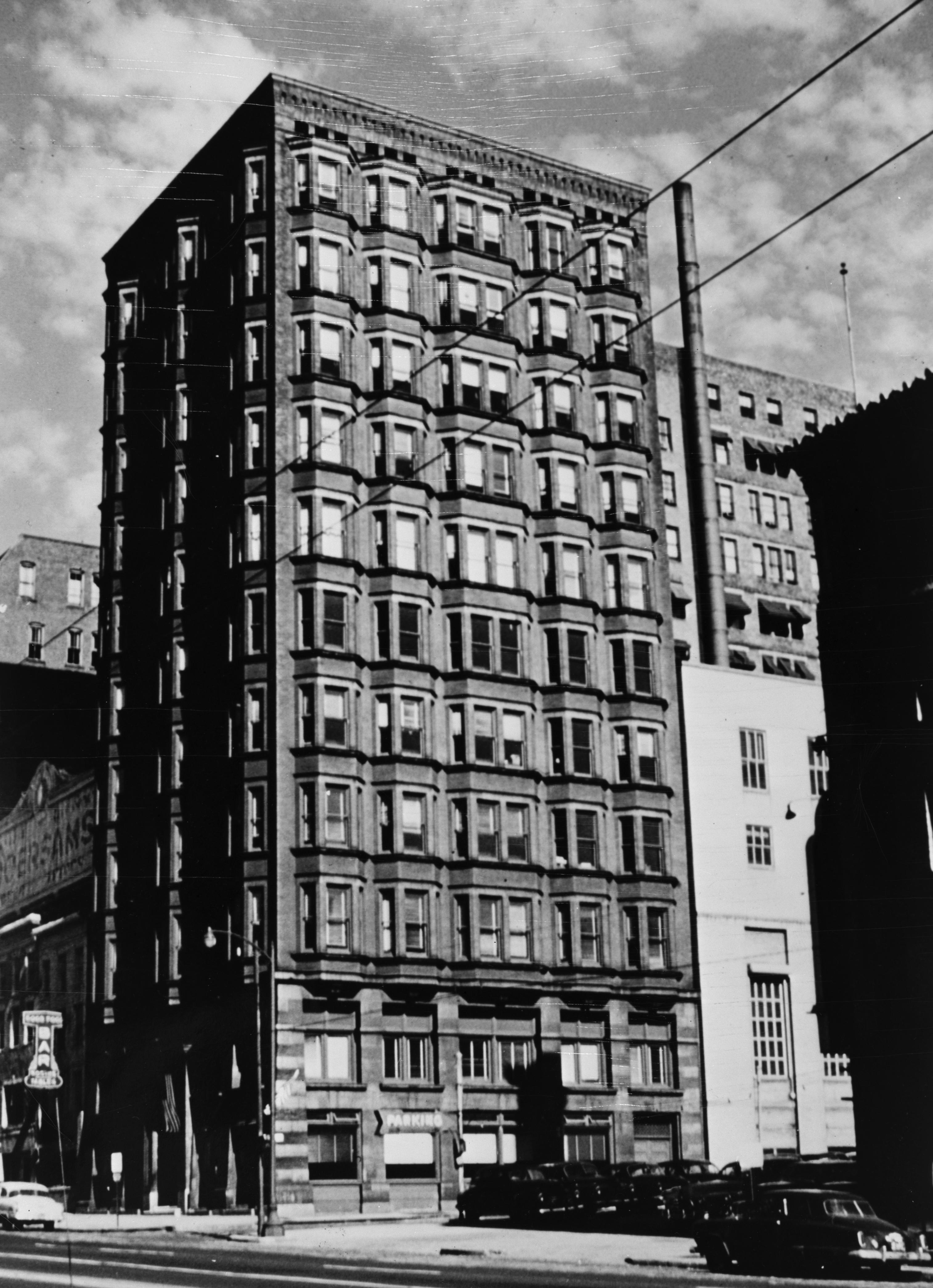
[3] Landmark name[4] Image Date listed Location Summary 1 American Insurance Union Citadel 
March 21, 1975 50 W. Broad St.
39°57′44″N 83°0′7″W / 39.96222°N 83.00194°WNow known as the LeVeque Tower 2 Athletic Club of Columbus September 29, 2011 136 E. Broad St.
39°57′46″N 82°59′49″W / 39.96278°N 82.99694°W3 Berry Brothers Bolt Works 
February 19, 1988 350 E. 1st Ave.
39°58′50″N 82°59′42″W / 39.98056°N 82.995°W4 Richard Berry, Jr., House 
July 27, 2005 324 E. North Broadway
40°1′54″N 83°0′24″W / 40.03167°N 83.00667°W5 Born Capital Brewery Bottling Works 
June 18, 2009 570 S. Front St.
39°57′0.66″N 82°59′59.52″W / 39.9501833°N 82.9998667°W6 Bradford Shoe Company Building 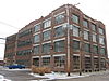
July 22, 1994 232 Neilston
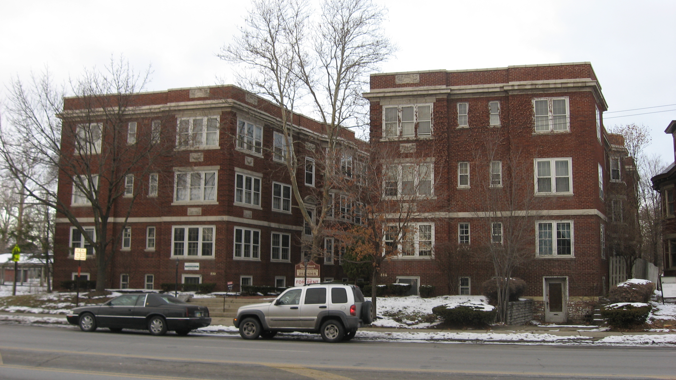
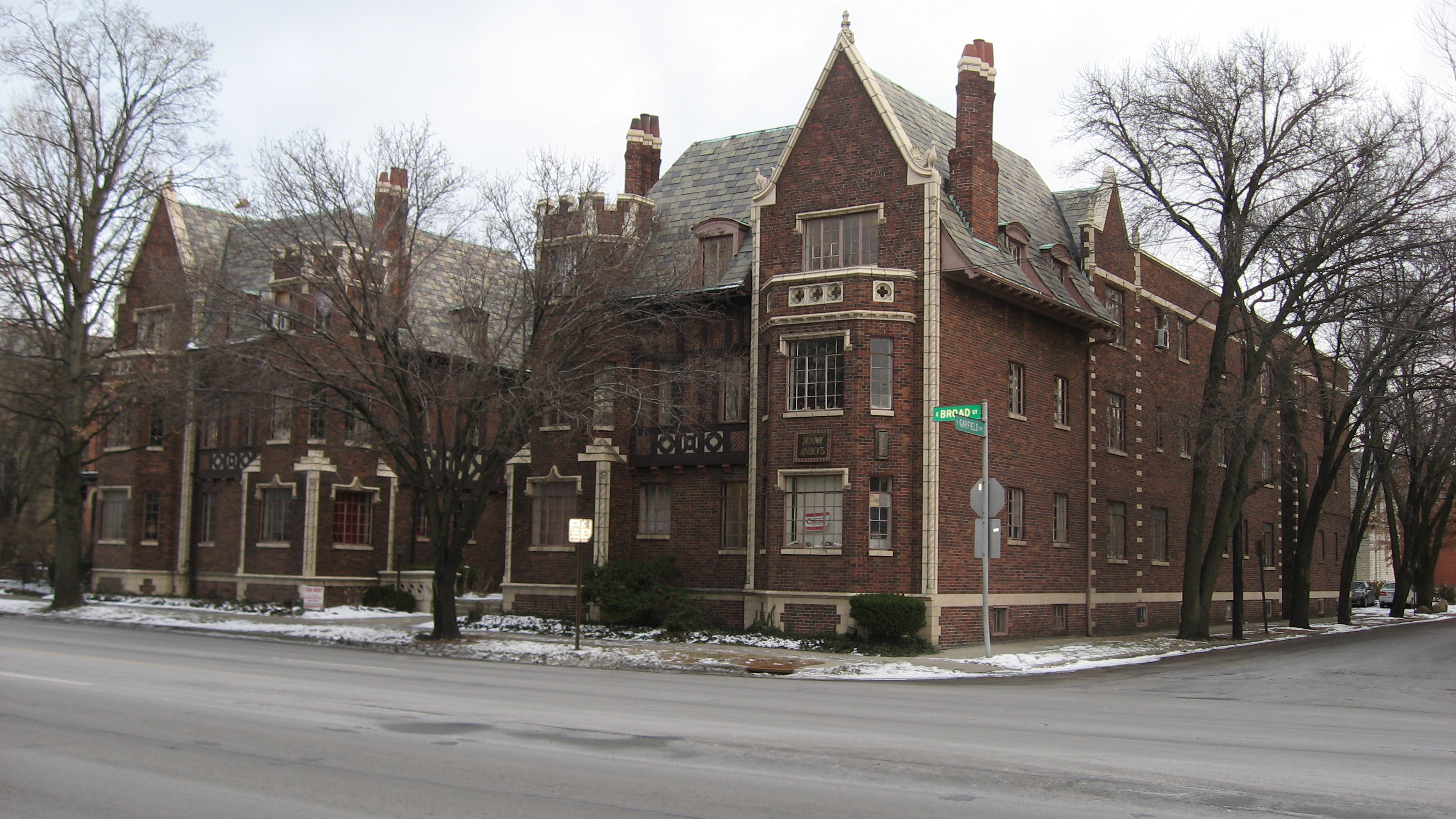
39°58′4″N 82°59′41″W / 39.96778°N 82.99472°W7 Broad Street Apartments 
December 16, 1986 880-886 E. Broad St.
39°57′54″N 82°58′38″W / 39.965°N 82.97722°W8 Broad Street Christian Church 
December 16, 1986 1051 E. Broad St.
39°57′54″N 82°58′22″W / 39.965°N 82.97278°W9 Broad Street United Methodist Church 
November 26, 1980 501 E. Broad St.
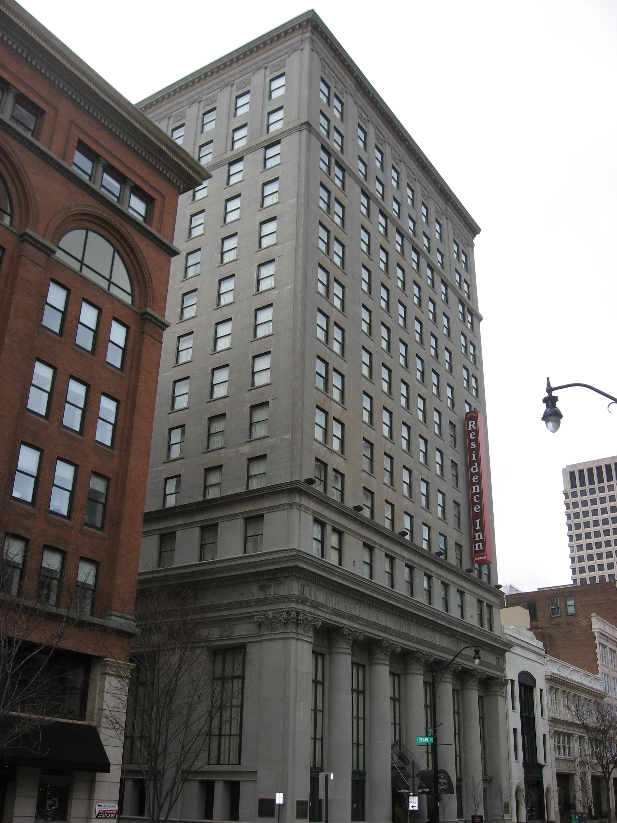
39°57′48″N 82°59′15″W / 39.96333°N 82.9875°W10 Buckeye State Building and Loan Company Building 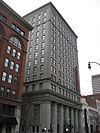
October 13, 2004 36-42 E. Gay St.
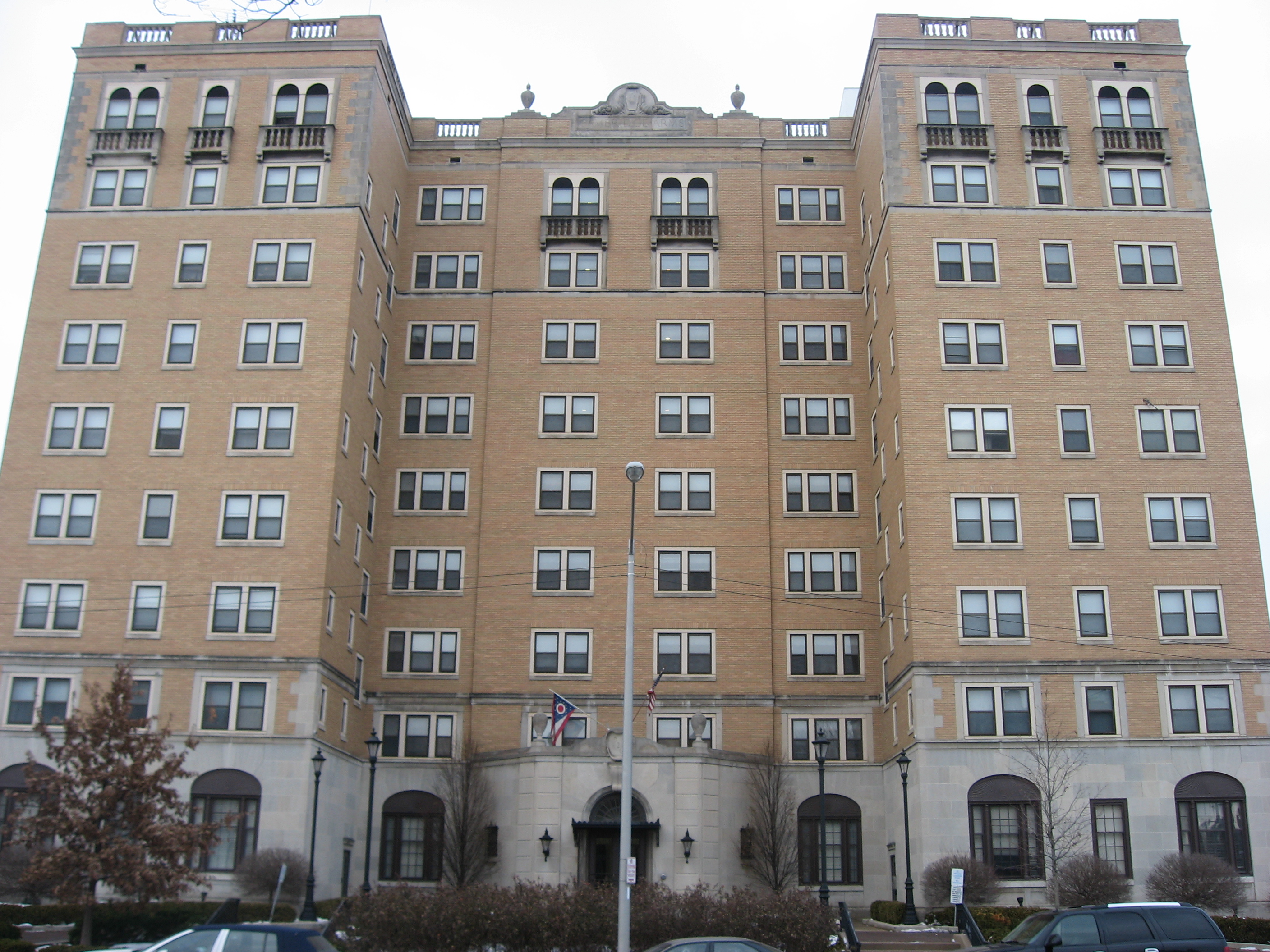
39°57′50.4″N 83°0′0″W / 39.964°N 83°W11 Cambridge Arms 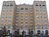
December 18, 2003 926 E. Broad St.
39°57′55″N 82°58′34″W / 39.96528°N 82.97611°W12 Camp Chase Site 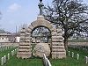
April 11, 1973 2900 Sullivant Ave.
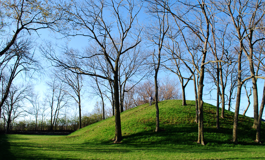
39°56′38″N 83°4′33″W / 39.94389°N 83.07583°W13 Campbell Mound 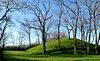
November 10, 1970 McKinley Ave.
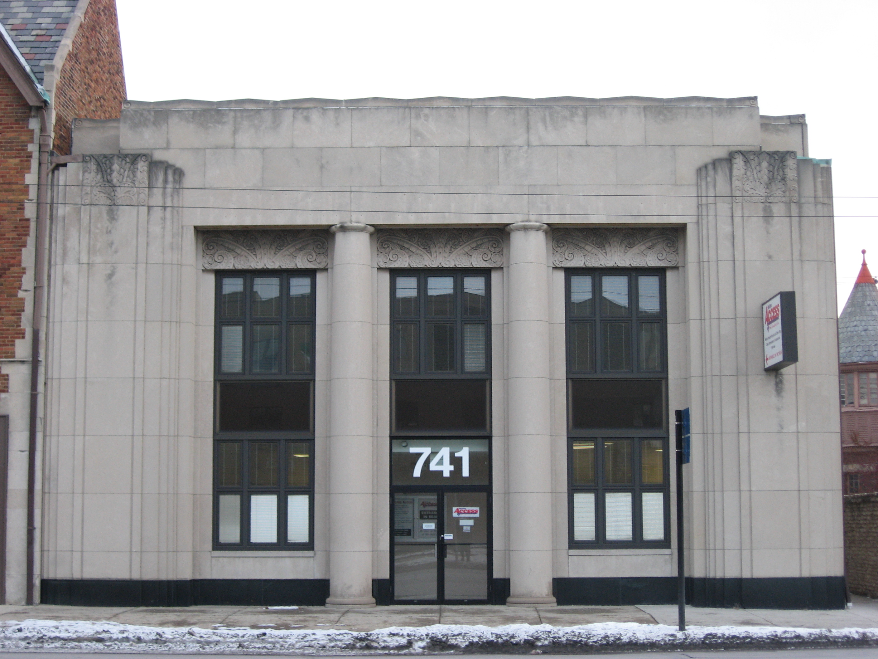
39°59′24″N 83°4′51″W / 39.99°N 83.08083°W14 Central Assurance Company 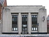
December 19, 1986 741 E. Broad St.
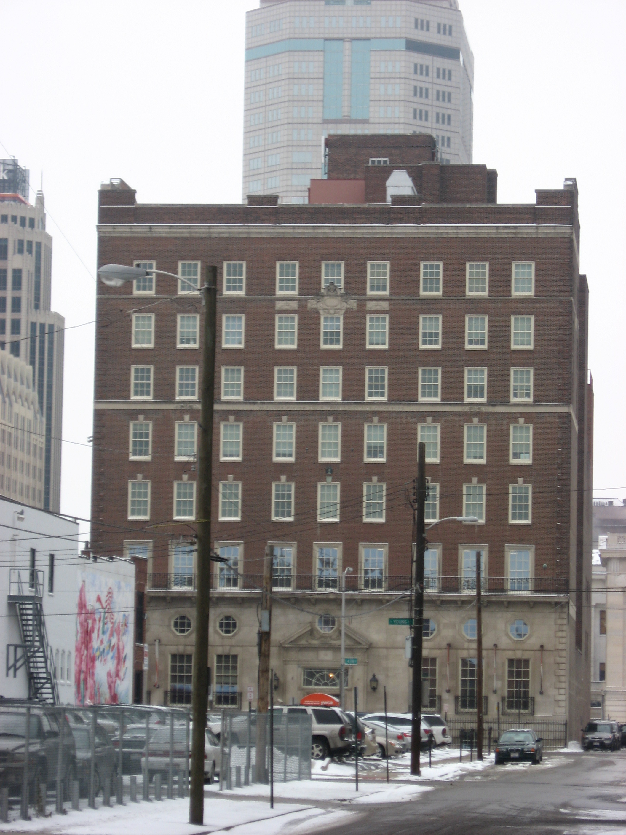
39°57′51″N 82°58′52″W / 39.96417°N 82.98111°W15 Central Building of the Columbus Young Men's Christian Association 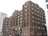
May 6, 1993 40 W. Long St.
39°57′54″N 83°0′9″W / 39.965°N 83.0025°W16 Central High School March 7, 1985 75 S. Washington Boulevard
39°57′34″N 83°0′27″W / 39.95944°N 83.0075°W17 Central Ohio Lunatic Asylum April 24, 1986 1960 W. Broad St.
39°57′10″N 83°2′44″W / 39.95278°N 83.04556°W18 Coe Mound July 18, 1974 West of High Street[5] 19 Truman and Sylvia Bull Coe House 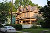
May 10, 2006 75 E. Lakeview Ave.
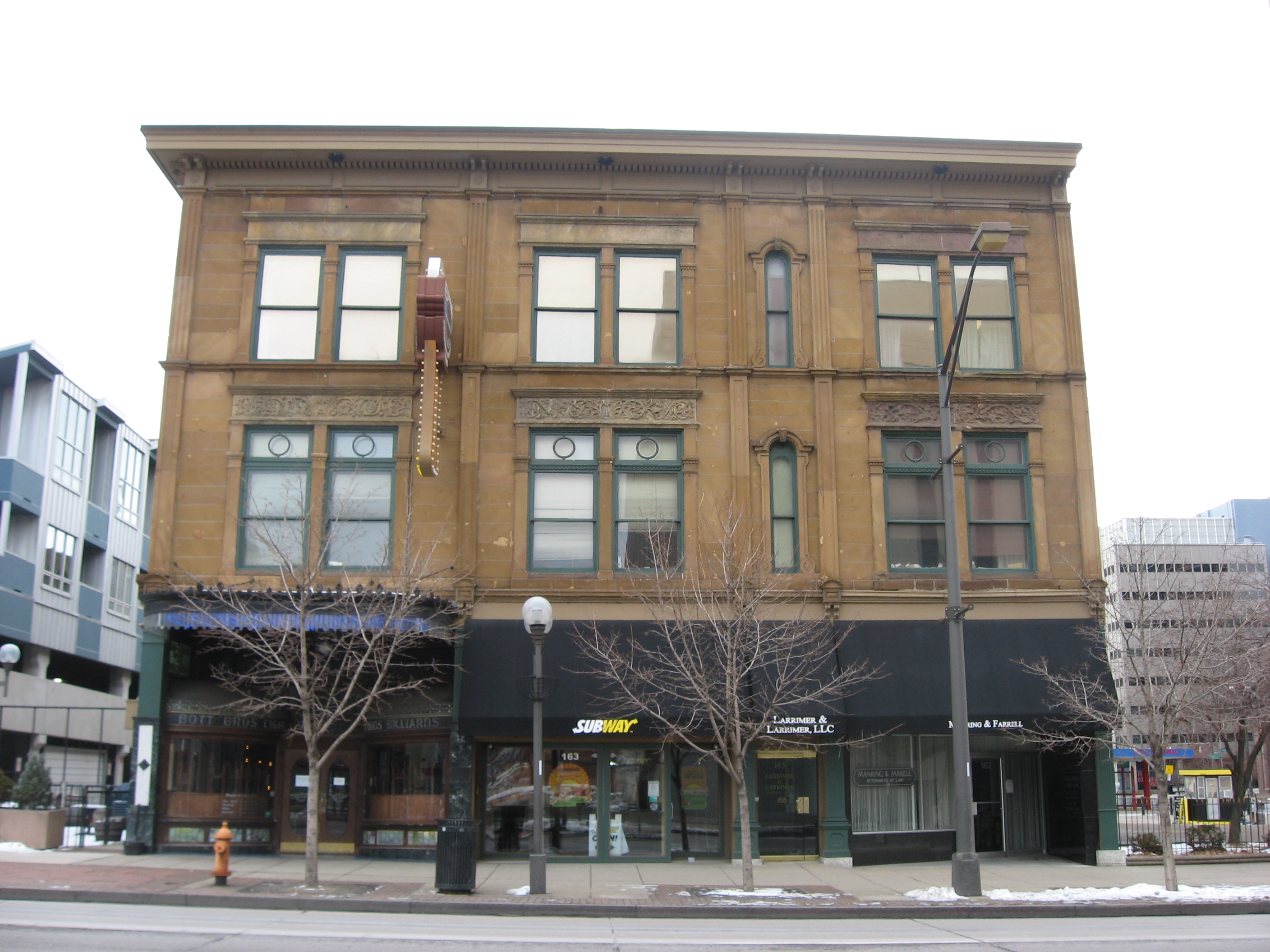
40°1′37″N 83°0′43″W / 40.02694°N 83.01194°W20 Columbia Building 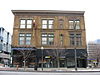
August 12, 1983 161-167 N. High St.
39°57′57″N 83°0′6″W / 39.96583°N 83.00167°W21 Columbus Country Club Mound February 15, 1974 4831 E. Broad St.
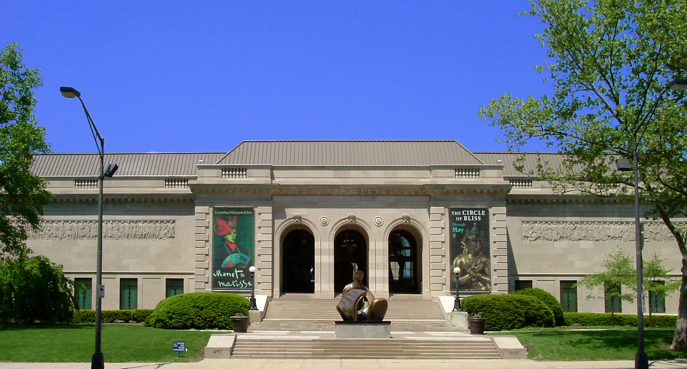
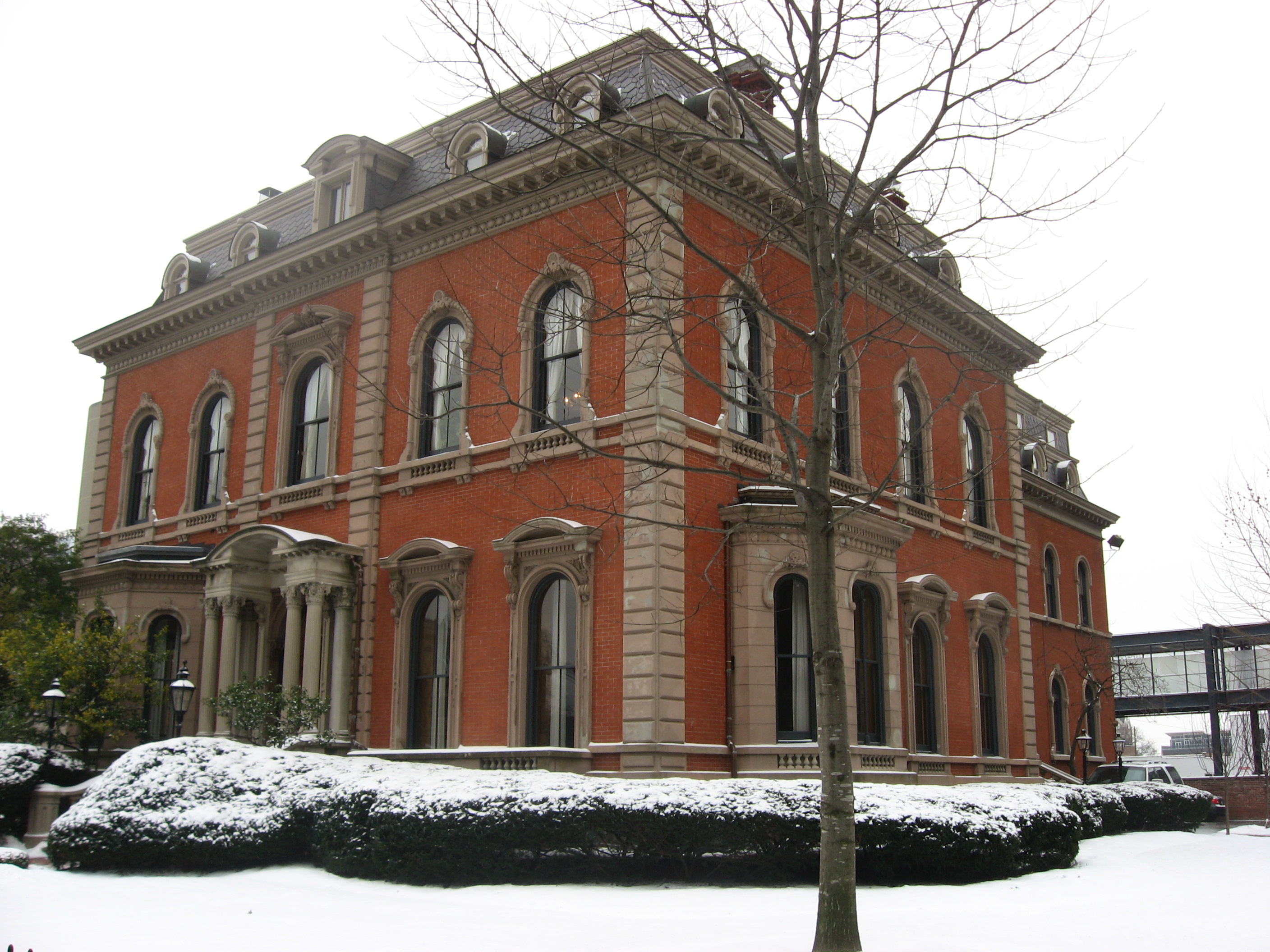
39°58′9″N 82°51′41″W / 39.96917°N 82.86139°W[5]22 Columbus Gallery of Fine Arts 
March 19, 1992 480 E. Broad St.
39°57′51″N 82°59′16″W / 39.96417°N 82.98778°W23 Columbus Near East Side District May 19, 1978 Roughly bounded by Parsons Ave., Broad and Main Sts., and the railroad tracks; also 43-125 Parsons Ave., including 684 Oak St. and 690 Franklin Ave.
39°57′43″N 82°57′53″W / 39.96194°N 82.96472°WSecond set of addresses represents a boundary increase of December 9, 1983, the Columbus Near East Side Historic District-Parsons Avenue 24 Columbus Savings and Trust Building 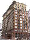
September 15, 1977 8 E. Long St.
39°57′55″N 83°0′3″W / 39.96528°N 83.00083°W25 Columbus Transfer Company Warehouse February 24, 1983 55 Nationwide Boulevard
39°58′7″N 83°0′4″W / 39.96861°N 83.00111°W26 Anson Davis House July 7, 1975 4900 Hayden Run Rd.
40°3′54″N 83°7′30″W / 40.065°N 83.125°W27 Anson Davis Springhouse April 11, 1979 4900 Hayden Run Rd.
40°3′54″N 83°7′30″W / 40.065°N 83.125°W28 Elam Drake House April 6, 1978 2738 Ole Country Lane
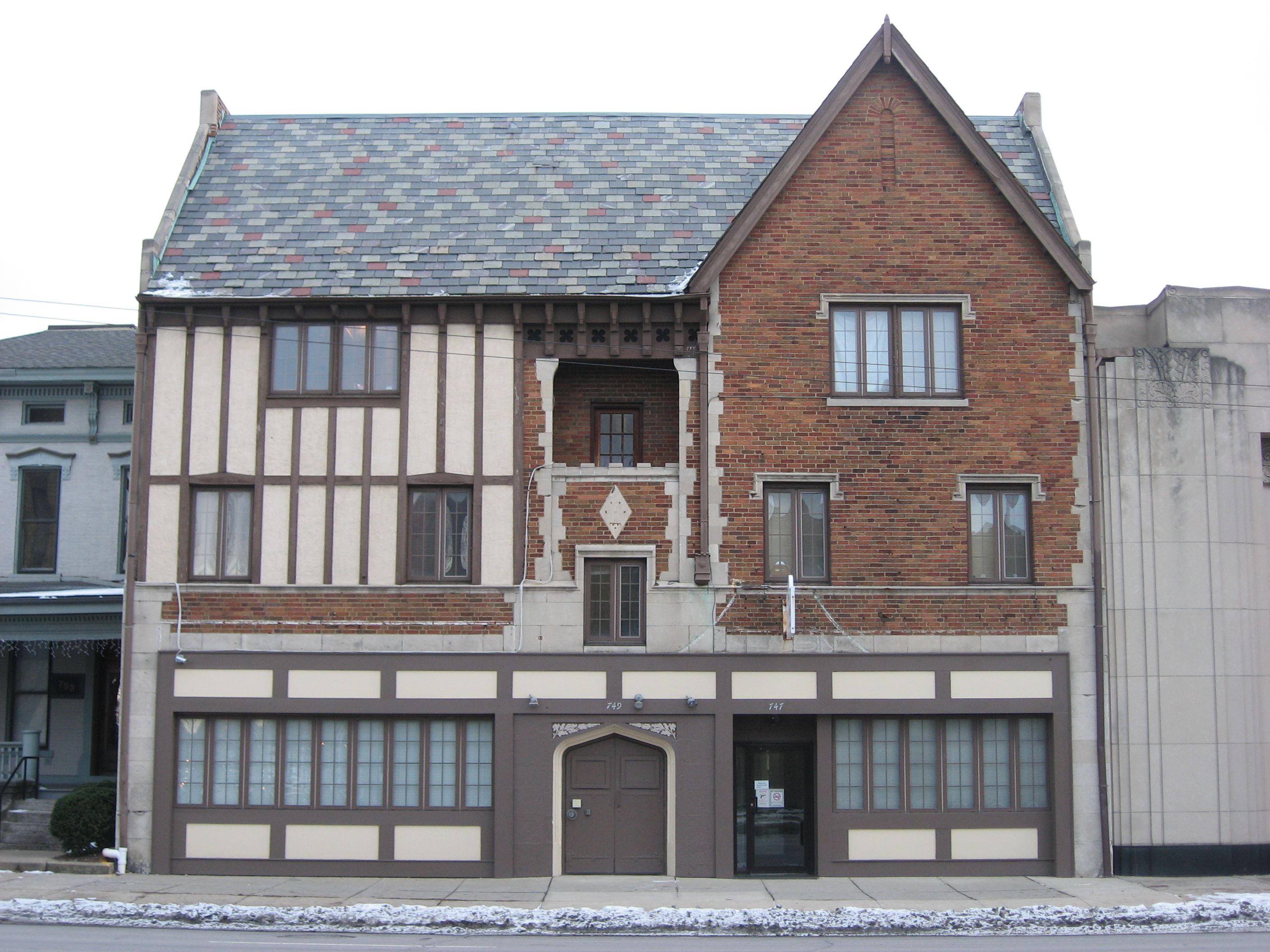
40°0′15″N 82°55′15″W / 40.00417°N 82.92083°W29 East Broad Street Commercial Building 
December 16, 1986 747, 749, and 751 E. Broad St.
39°57′51″N 82°58′51″W / 39.96417°N 82.98083°W30 East Broad Street Historic District 
March 17, 1987 Along E. Broad St. between Monypenny and Ohio Aves.
39°58′1″N 82°57′39″W / 39.96694°N 82.96083°W31 East Broad Street Presbyterian Church 
March 17, 1987 760 E. Broad St.
39°57′53″N 82°58′48″W / 39.96472°N 82.98°W32 East North Broadway Historic District July 8, 2010 E. North Broadway roughly between Broadway Place and N. Broadway Lane
40°1′53″N 83°0′25″W / 40.03139°N 83.00694°W33 East Town Street Historic District July 30, 1976 Roughly bounded by Grant and Franklin Aves., Lester Dr., and E. Rich St.
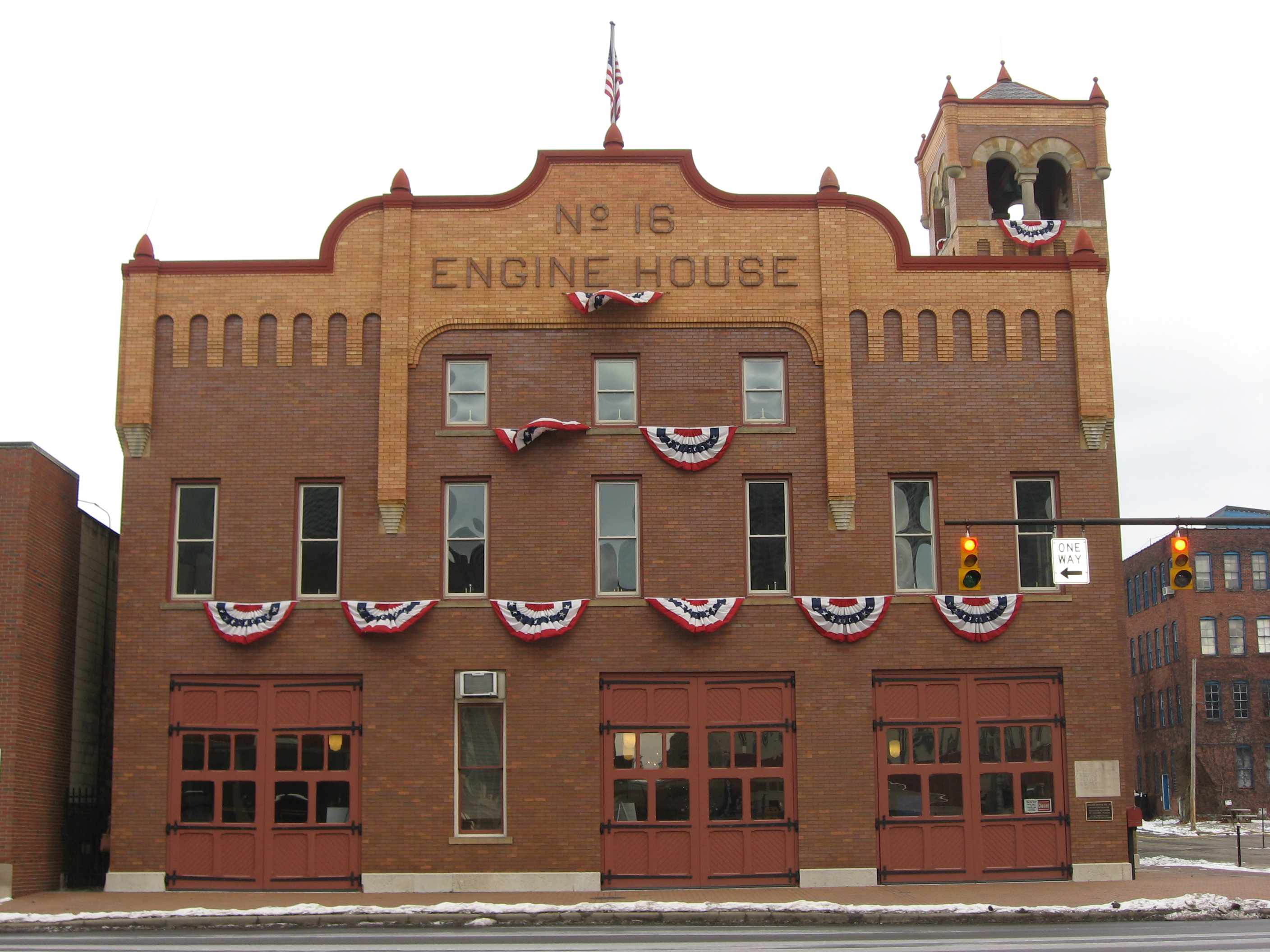
39°57′34″N 82°59′16″W / 39.95944°N 82.98778°W34 Engine House No. 16 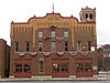
May 11, 1995 260 N. 4th St.
39°58′6″N 82°59′49″W / 39.96833°N 82.99694°W35 Felton School May 31, 1984 Leonard Ave. at N. Monroe St.
39°58′32″N 82°58′42″W / 39.97556°N 82.97833°W36 Fifth Avenue and North High Historic District April 19, 1990 N. High St. roughly between 4th Ave. and Clark Pl.
39°59′13″N 83°0′18″W / 39.98694°N 83.005°W37 Fort Hayes January 26, 1970 Columbus Ave. and Interstate 71
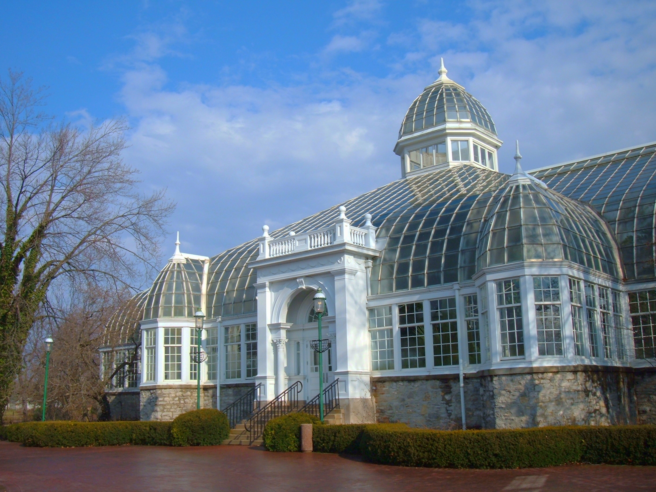
39°58′26″N 82°59′18″W / 39.97389°N 82.98833°W38 Franklin Park Conservatory 
January 18, 1974 1547 E. Broad St.
39°57′57″N 82°57′2″W / 39.96583°N 82.95056°W39 Franklinton Apartments at Broad and Hawkes April 22, 2005 949-957 W. Broad St., 13-23 Hawkes Ave.
39°57′32″N 83°1′34″W / 39.95889°N 83.02611°W40 Franklinton Apartments at State and May April 22, 2005 494-504 State St., 74-82 S. May Ave.
39°57′31″N 83°0′50″W / 39.95861°N 83.01389°W41 Franklinton Post Office March 20, 1973 72 S. Gift St.
39°57′34″N 83°0′56″W / 39.95944°N 83.01556°W42 Garfield-Broad Apartments 
December 16, 1986 775 E. Broad St.
39°57′53″N 82°58′41″W / 39.96472°N 82.97806°W43 German Village 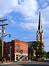
December 30, 1974 Roughly bounded by Livingston Ave., Pear Alley, Nursery Lane, Blackberry Alley, and Lathrop St.; also Briggs between E. Beck and Sycamore, S. 9th between E. Blenkner and Sycamore
39°56′45″N 82°59′34″W / 39.94583°N 82.99278°WSecond set of boundaries represents a boundary increase of November 28, 1980 44 Glen Echo Historic District October 24, 1997 Roughly bounded by Glen Echo Ravine, the former Big Four railroad tracks, Indianola Ave., and Hudson St.
40°1′1″N 82°59′59″W / 40.01694°N 82.99972°W45 Great Southern Hotel and Theatre 
December 2, 1982 S. High and E. Main Sts.
39°57′21″N 82°59′57″W / 39.95583°N 82.99917°W46 Griswold Memorial Young Women's Christian Association 
July 22, 1993 65 S. 4th St.
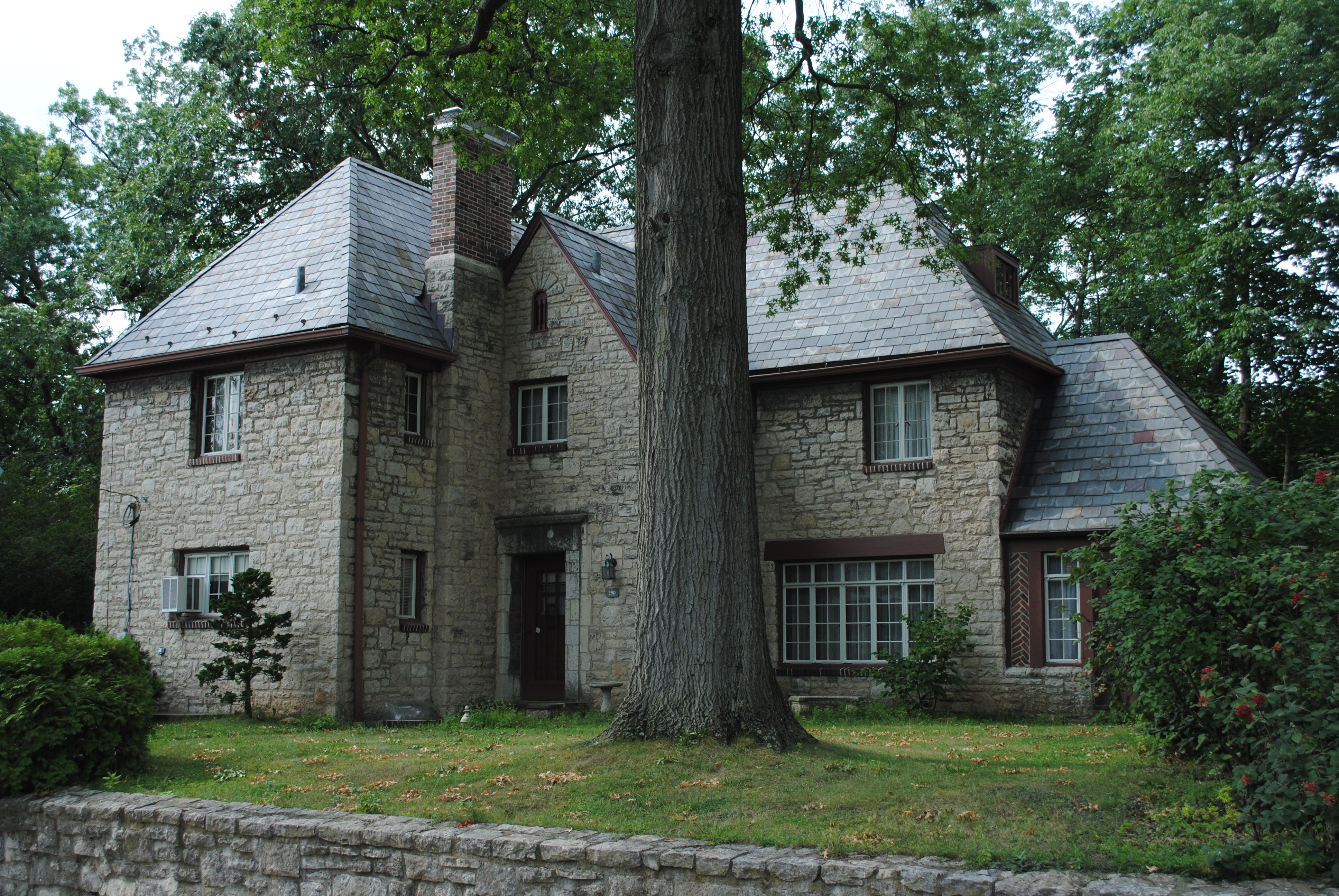
39°57′39″N 82°59′47″W / 39.96083°N 82.99639°W47 Gilbert H. Hamilton House 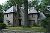
December 16, 1992 290 Cliffside Dr.
40°1′7″N 82°59′38″W / 40.01861°N 82.99389°W48 Hamilton Park Historic District 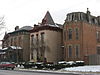
July 28, 1983 Broad and Long Sts.
39°57′57″N 82°58′53″W / 39.96583°N 82.98139°W49 Hanna House 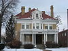
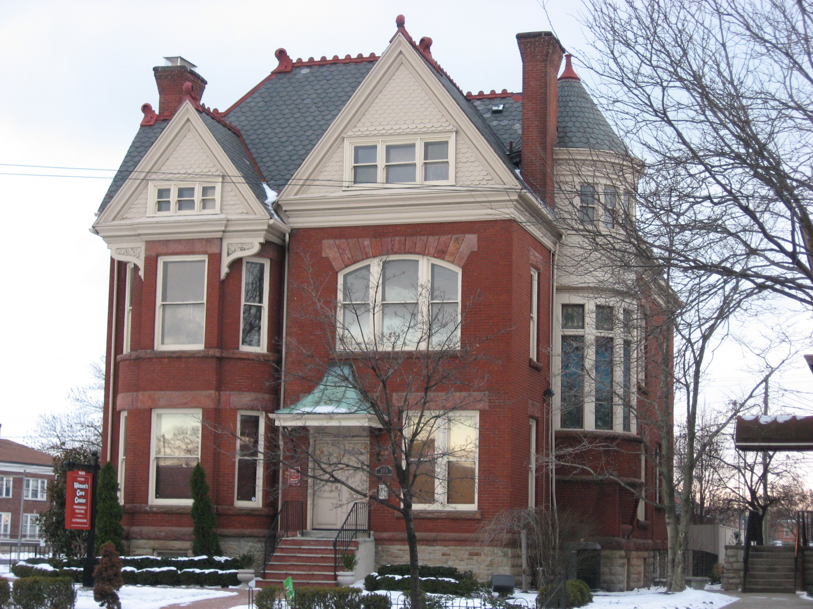
April 19, 1979 1021 E. Broad St.
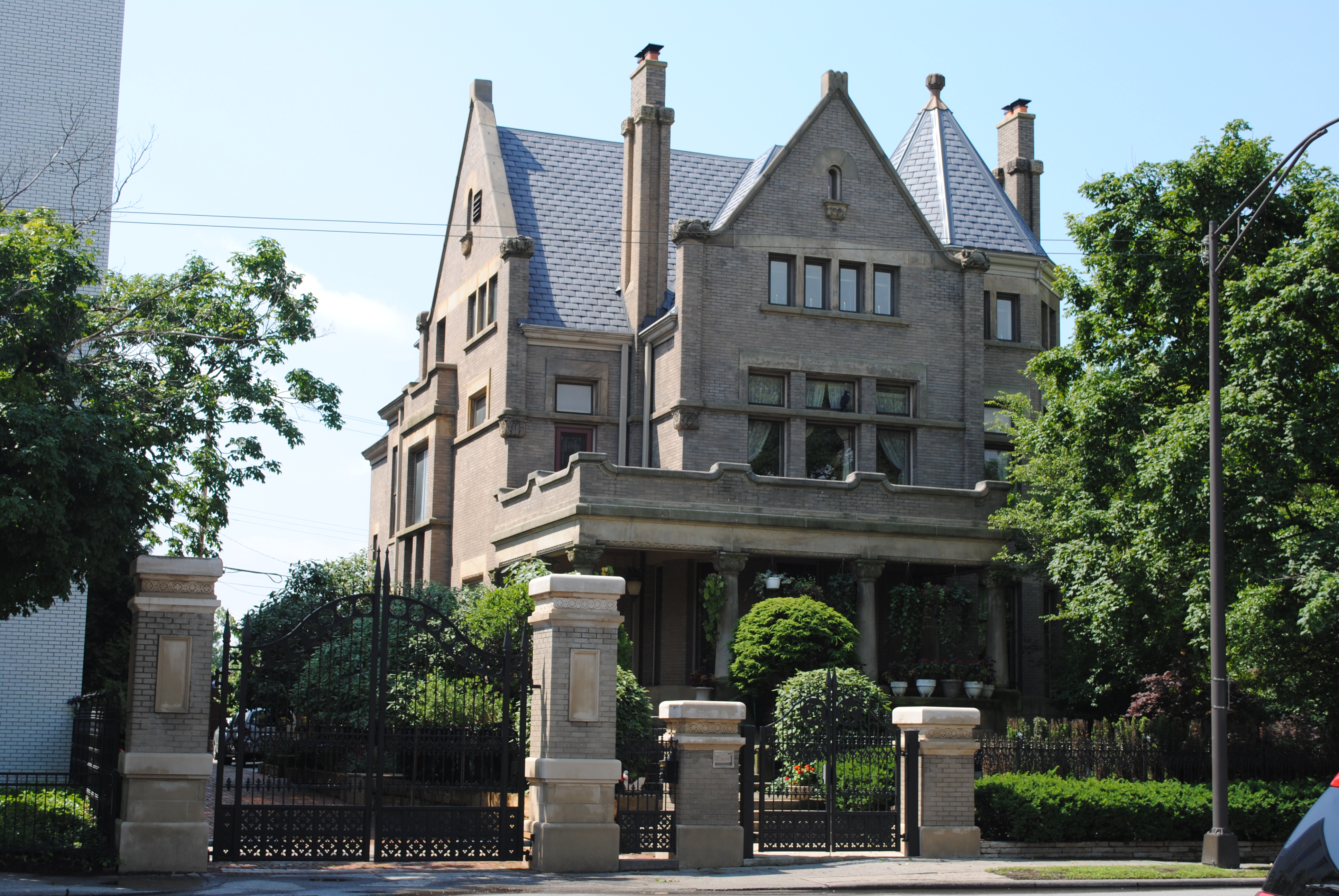
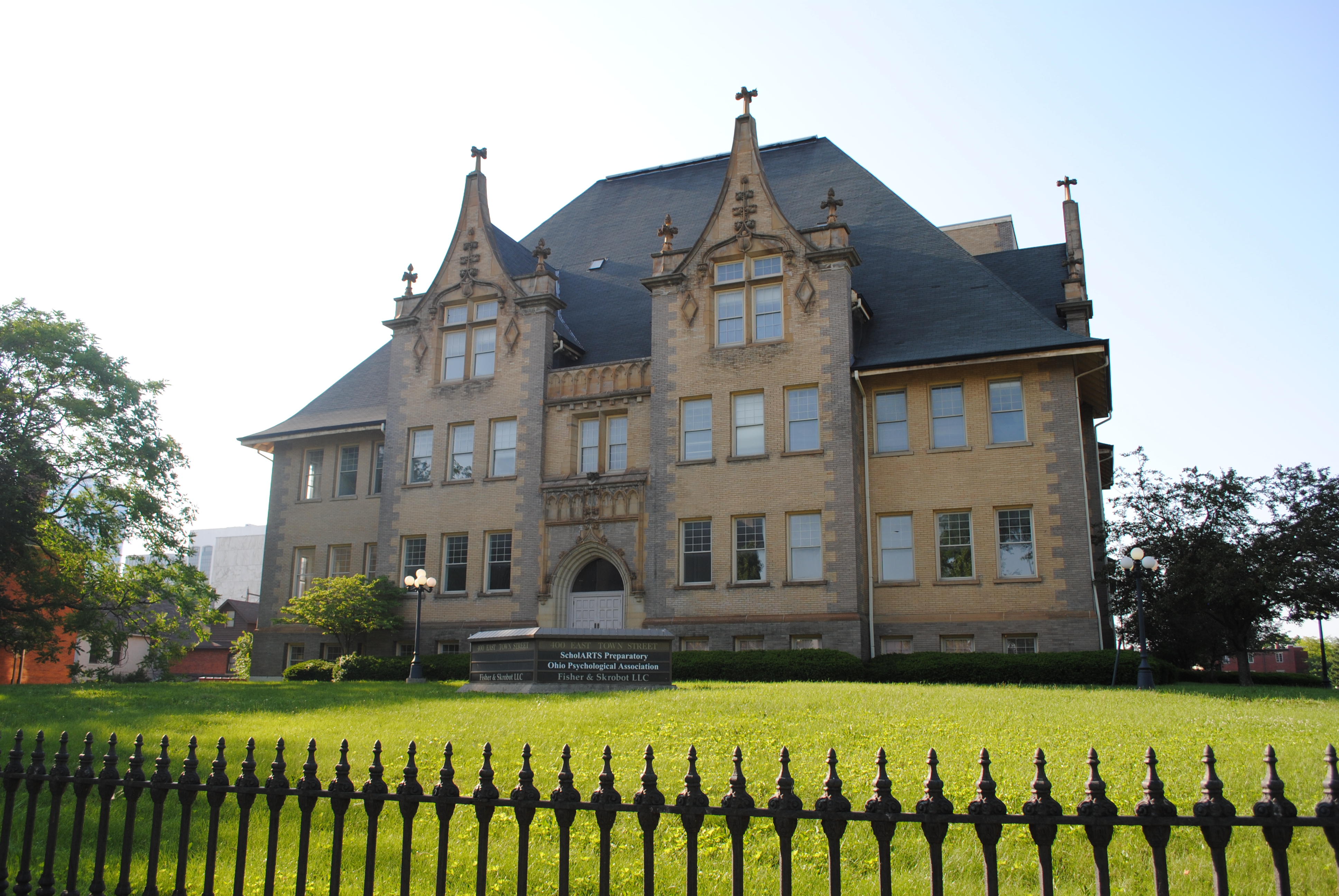
39°57′54″N 82°58′24.25″W / 39.965°N 82.9734028°W50 Gen. William Henry Harrison Headquarters December 15, 1972 570 W. Broad St.
39°57′38″N 83°0′58″W / 39.96056°N 83.01611°W51 Hartley Mound 
July 15, 1974 Between Gibbstone Dr. and Edelmarr Ln., east of Wilson Rd.
39°58′54.84″N 83°06′07.98″W / 39.9819°N 83.1022167°W[6]52 Hartman Stock Farm Historic District October 9, 1974 South of downtown Columbus on U.S. Route 23
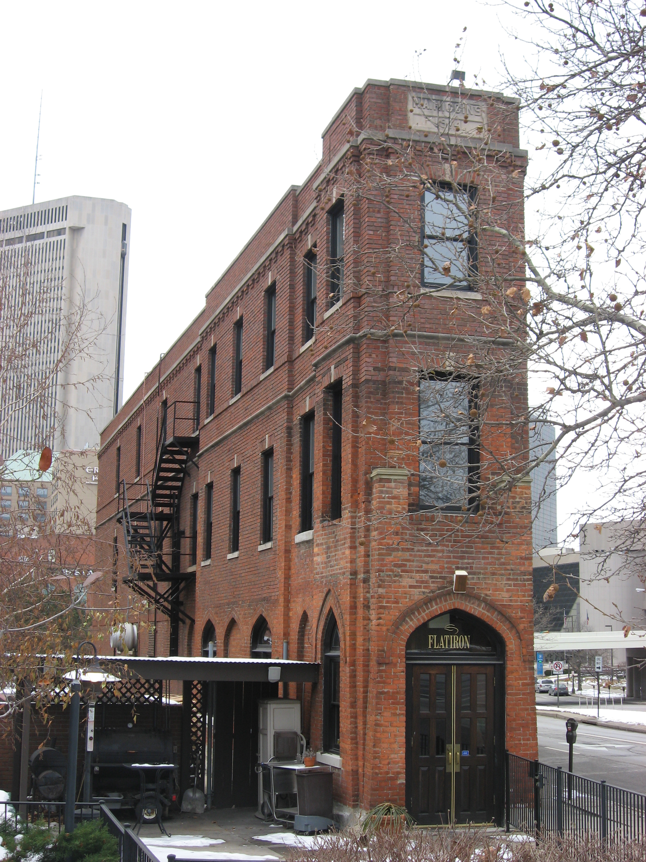
39°51′30″N 82°59′53″W / 39.85833°N 82.99806°W53 Hayden Building 
June 11, 2009 20 E. Broad St.
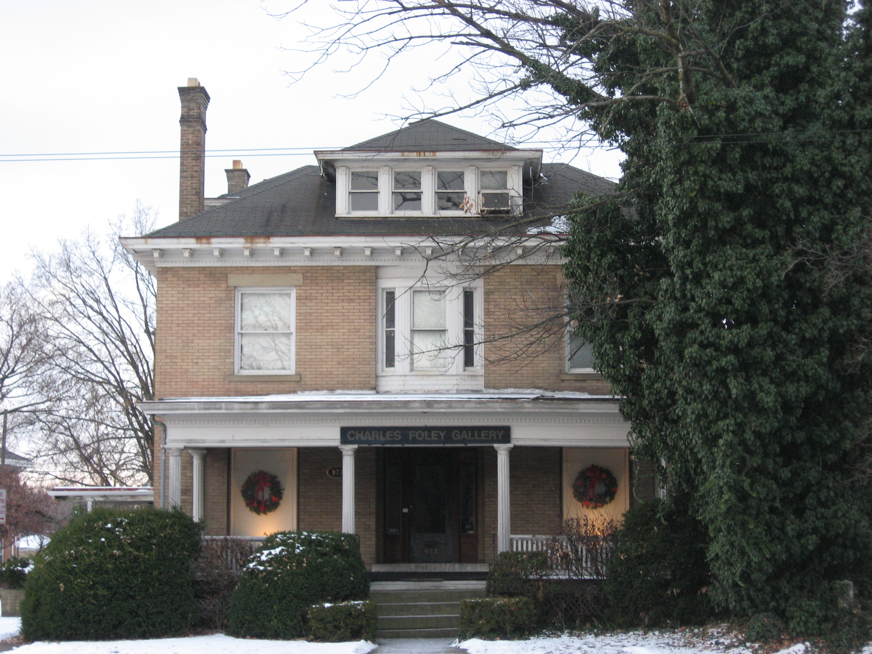
39°57′45.21″N 82°59′59.82″W / 39.9625583°N 82.99995°W54 Heyne-Zimmerman House 
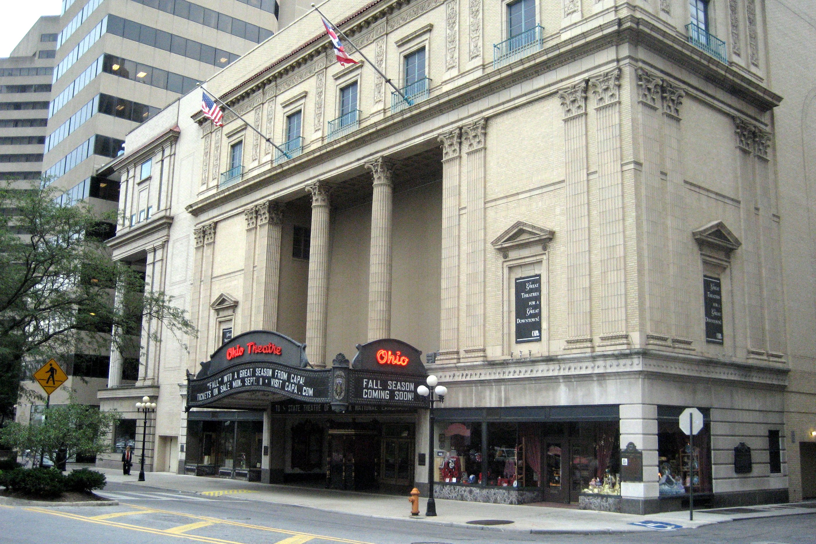
March 17, 1987 973 E. Broad St.
39°57′53″N 82°58′28″W / 39.96472°N 82.97444°W55 H.A. Higgins Building 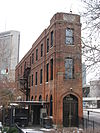
August 27, 1979 129 E. Naghten St
39°58′7″N 82°59′53″W / 39.96861°N 82.99806°W56 Holy Cross Church, Rectory and School 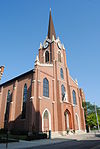
April 26, 1979 212 S. 5th St.
39°57′29″N 82°59′35″W / 39.95806°N 82.99306°W57 House at 753 East Broad Street 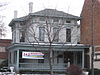
December 17, 1986 753 E. Broad St.
39°57′51″N 82°58′50″W / 39.96417°N 82.98056°W58 Indianola Junior High School 
June 30, 1980 420 E. 19th Ave.
40°0′13″N 82°59′27″W / 40.00361°N 82.99083°W59 Iuka Ravine Historic District May 8, 1986 Roughly bounded by E. Lane and E. Northwood., N. 4th, 20th and E. 19th, and Indianola Aves.
40°0′18″N 83°0′6″W / 40.005°N 83.00167°W60 Felix A. Jacobs House 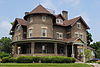
December 19, 1986 1421 Hamlet St.
39°59′40″N 83°0′2″W / 39.99444°N 83.00056°W61 Jaeger Machine Company Office Building June 16, 1983 550 W. Spring St.
39°57′56″N 83°1′2″W / 39.96556°N 83.01722°W62 Jefferson Avenue Historic District 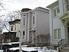
December 2, 1982 Roughly bounded by Interstate 71, E. Broad, 11th, and Long Sts.
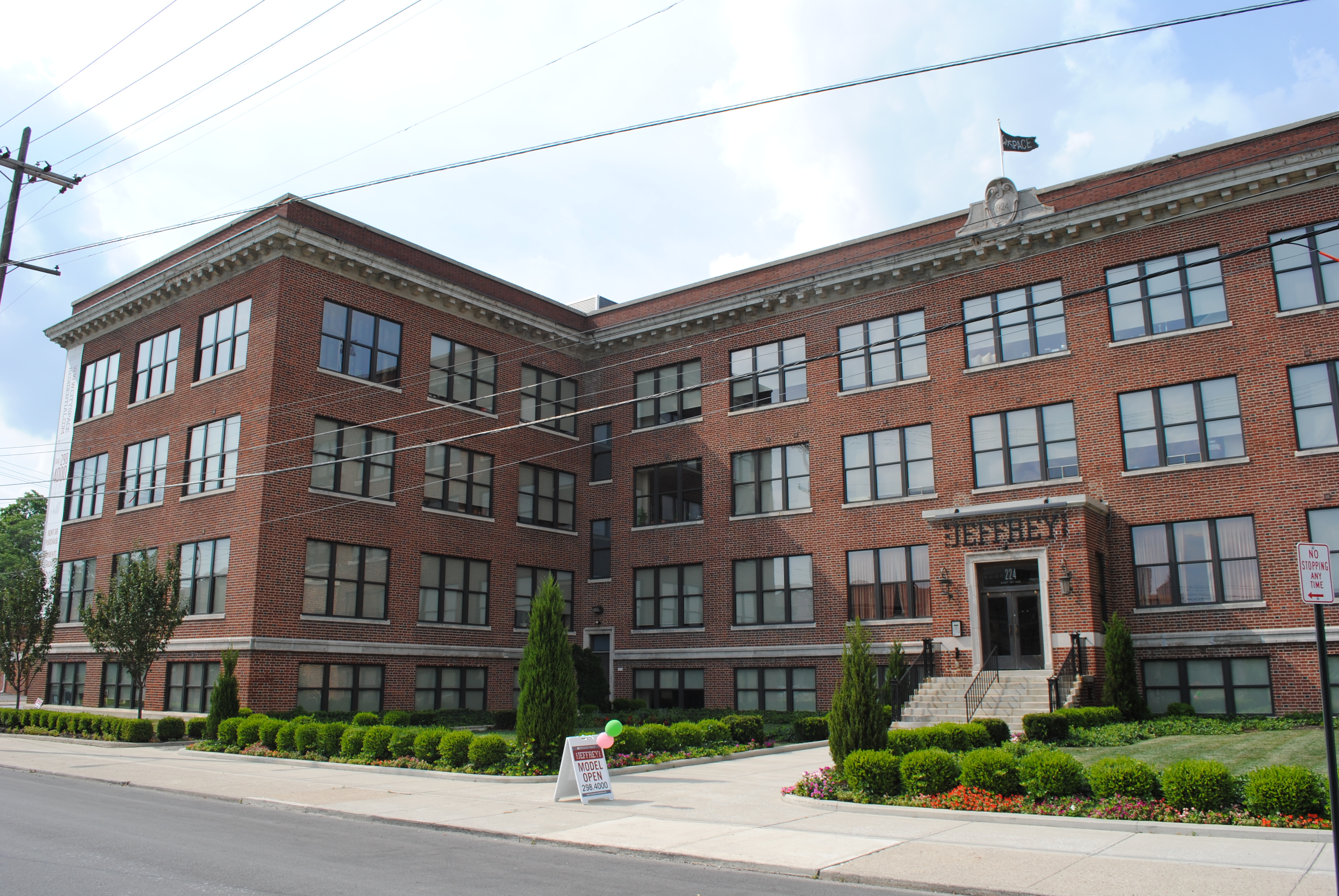
39°57′56″N 82°59′6″W / 39.96556°N 82.985°W63 Jeffrey Manufacturing Company Office Building 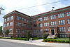
April 12, 2001 224 E. 1st Ave., 883 and 895 N. 6th St.
39°58′51″N 82°59′52″W / 39.98083°N 82.99778°W64 Johnson-Campbell House 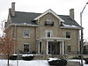
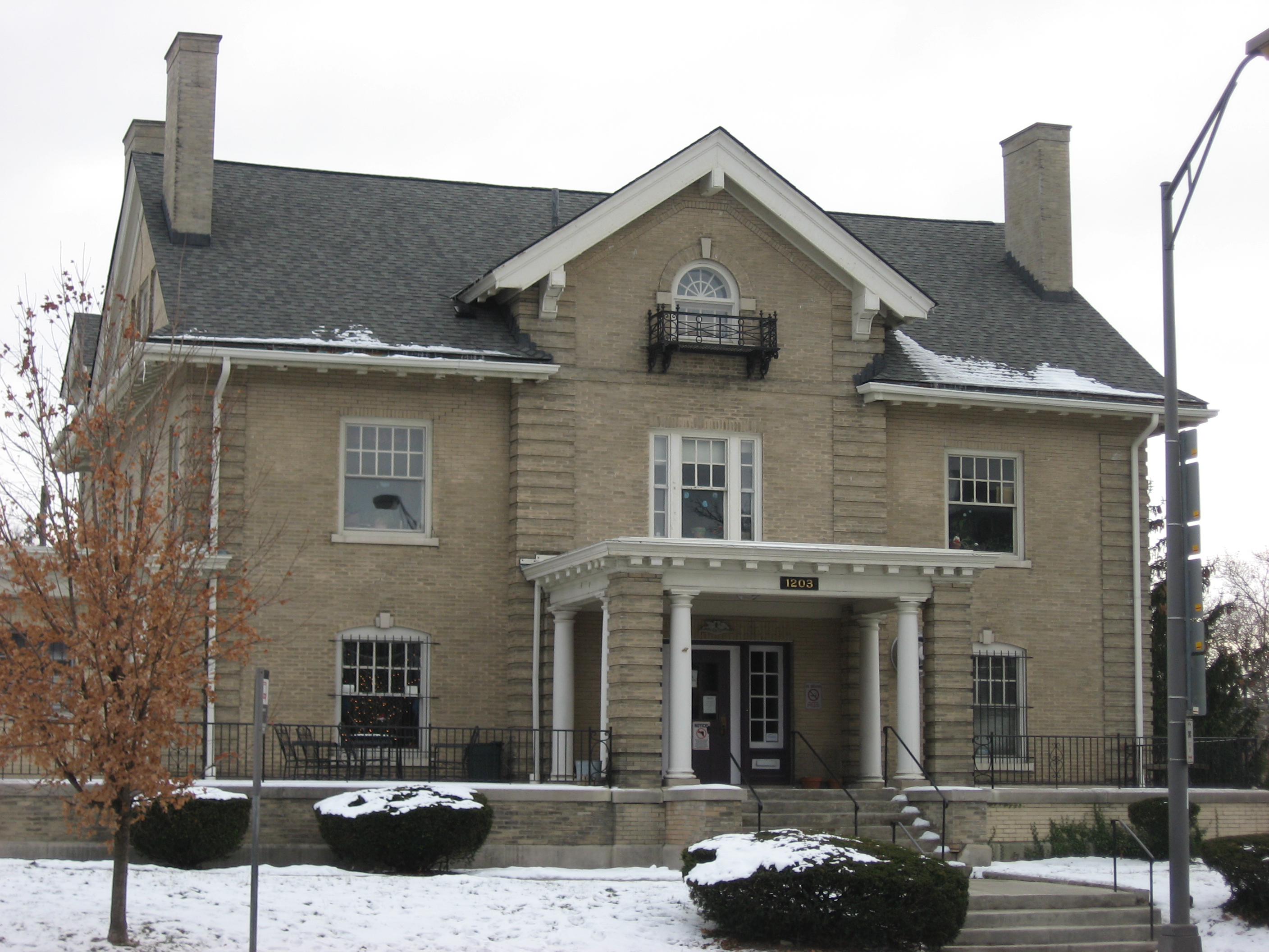
December 17, 1986 1203 E. Broad St.
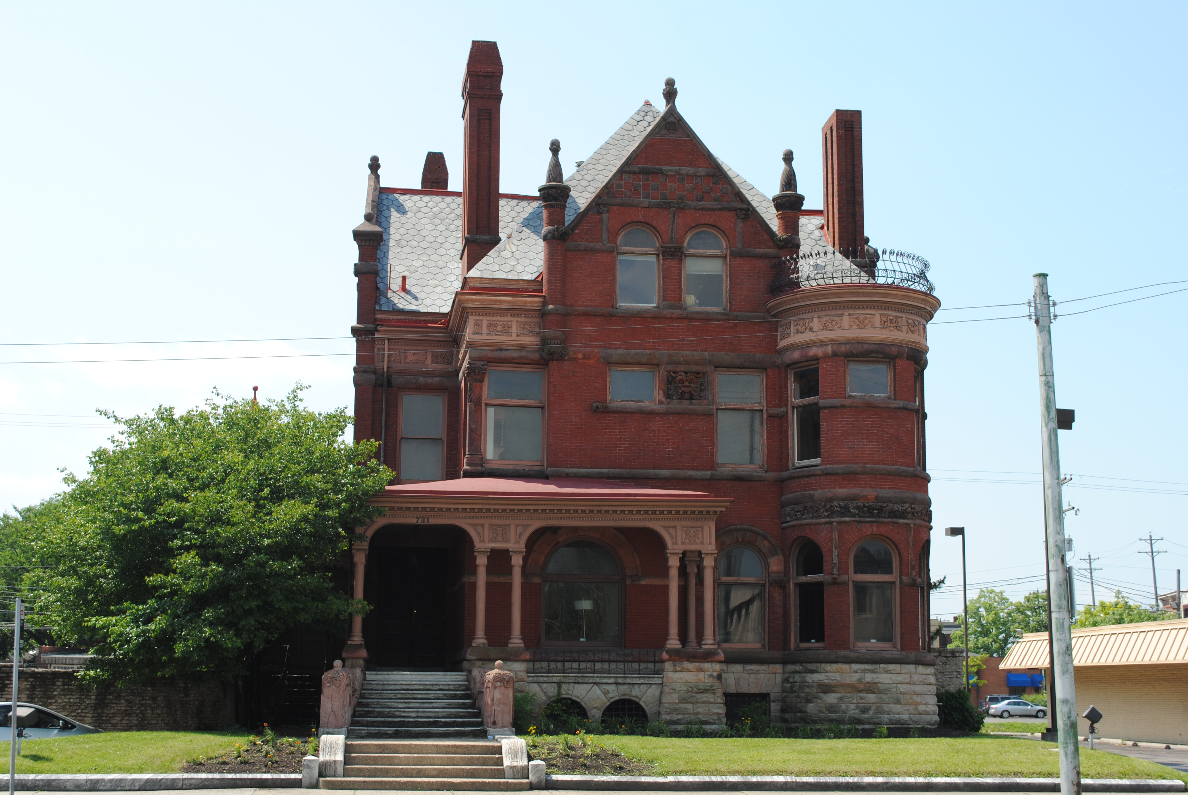
39°57′56″N 82°58′7″W / 39.96556°N 82.96861°W65 W.H. Jones Mansion 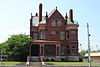
October 2, 1978 731 E. Broad St.
39°57′51″N 82°58′51″W / 39.96417°N 82.98083°W66 Joseph-Cherrington House 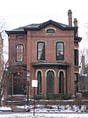
December 17, 1986 785 E. Broad St.
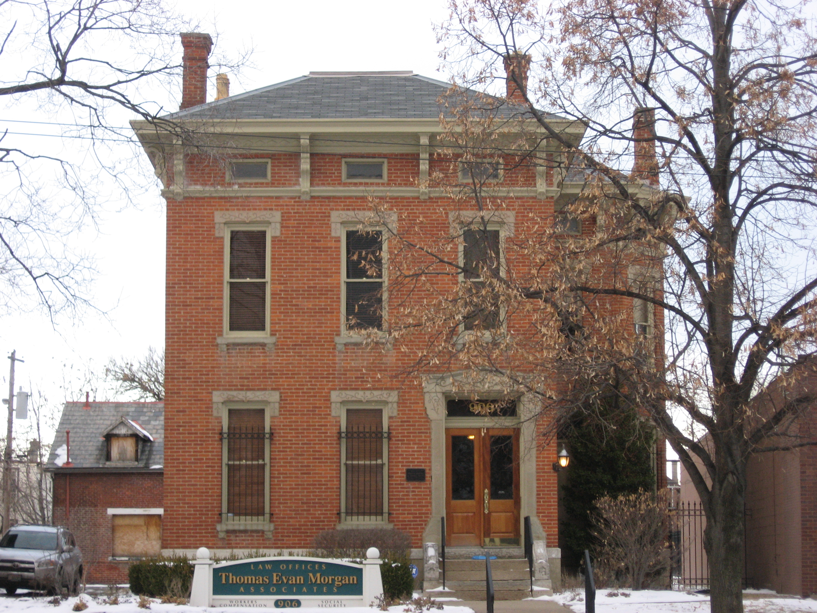
39°57′51″N 82°58′47″W / 39.96417°N 82.97972°W67 Linus B. Kauffman House 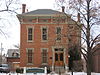
December 17, 1986 906 E. Broad St.
39°57′54″N 82°58′36″W / 39.965°N 82.97667°W68 Frank J. Kaufman House 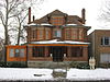
December 17, 1986 1231 E. Broad St.
39°57′57″N 82°58′5″W / 39.96583°N 82.96806°W69 Krumm House September 30, 1982 975-979 S. High St.
39°56′31″N 82°59′58″W / 39.94194°N 82.99944°W70 Samuel Landes House May 8, 1987 590 Hibbs Rd.
39°50′9″N 83°0′48″W / 39.83583°N 83.01333°W71 Soloman Levy House 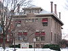
December 17, 1986 929 E. Broad St.
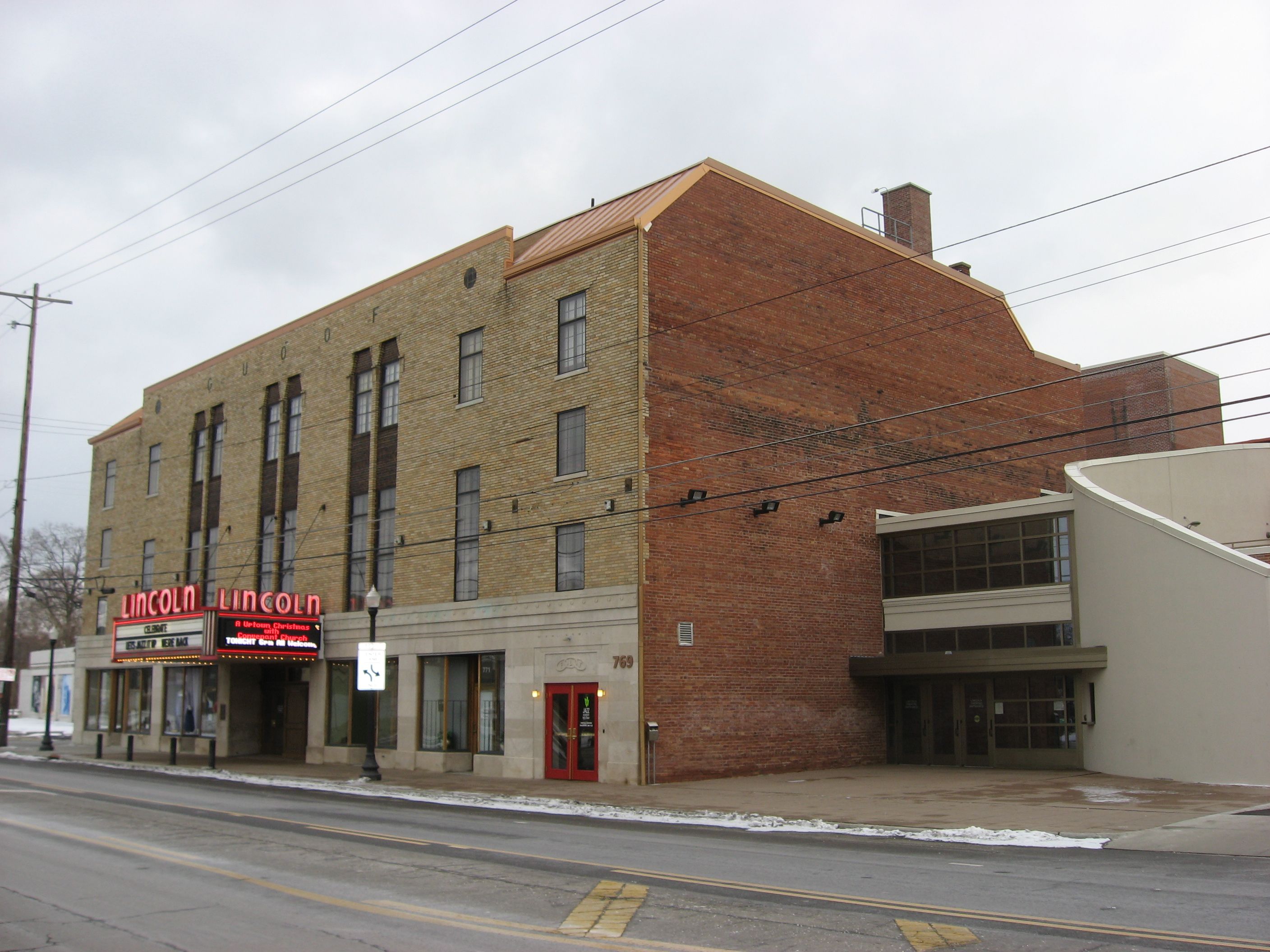
39°57′52″N 82°58′34″W / 39.96444°N 82.97611°W72 Lincoln Theatre 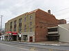
October 8, 1992 77 E. Long St.
39°58′1″N 82°58′52″W / 39.96694°N 82.98111°W73 Long and Third Commercial Building 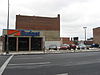
July 1, 1982 104-114 E. Long St.
39°57′55″N 82°59′58″W / 39.96528°N 82.99944°W74 Carrie Lovejoy House 
December 17, 1986 807 E. Broad St.
39°57′51″N 82°58′45″W / 39.96417°N 82.97917°W75 Masonic Temple 
February 27, 1997 34 N. 4th St.
39°57′49″N 82°59′48″W / 39.96361°N 82.99667°W76 McDannald Homestead February 17, 1978 Northeast of downtown Columbus at 5847 Sunbury Rd.
40°4′39″N 82°53′50″W / 40.0775°N 82.89722°WDemolished in 1994[7] 77 Frederick A. Miller House-Broad Gables August 8, 1985 2065 Barton Pl. and 140 Park Dr.
39°57′55″N 82°56′41″W / 39.96528°N 82.94472°W78 C.E. Morris House 
December 17, 1986 875 E. Broad St.
39°57′53″N 82°58′38″W / 39.96472°N 82.97722°W79 Near Northside Historic District June 4, 1980 Off State Route 315
39°59′5″N 83°0′45″W / 39.98472°N 83.0125°W80 New Hayden Building 
June 11, 2009 16 E. Broad St.
39°57′45.14″N 83°0′0.65″W / 39.9625389°N 83.0001806°W81 New Indianola Historic District April 30, 1985 Roughly bounded by Chittenden and Grant Aves., 5th St., 7th Ave., and 4th St.
39°59′35″N 82°59′52″W / 39.99306°N 82.99778°W82 Jonathan Noble House 
December 3, 1975 5030 Westerville Rd. (State Route 3)
40°4′29″N 82°55′42″W / 40.07472°N 82.92833°W83 North Columbus Commercial Historic District October 14, 2010 Roughly centered on N. High St. between Hudson and Dodridge
40°0′56″N 83°0′42″W / 40.01556°N 83.01167°W84 North High School 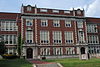
July 2, 1987 100 Arcadia Ave.
40°1′5″N 83°0′31″W / 40.01806°N 83.00861°W85 North Market Historic District December 30, 1982 Roughly bounded by W. Goodale, Park, High, Front and Vine Sts.
39°58′18″N 83°0′13″W / 39.97167°N 83.00361°W86 Ohio Asylum for the Blind 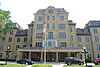
July 26, 1973 240 Parsons Ave.
39°57′33″N 82°58′52″W / 39.95917°N 82.98111°W87 Ohio Farm Bureau Federation Offices 
March 13, 1987 620 and 630 E. Broad St.
39°57′51″N 82°59′4″W / 39.96417°N 82.98444°W88 Ohio Institution for the Education of the Deaf and Dumb 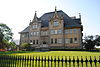
October 25, 1984 408 E. Town St.
39°57′38″N 82°59′20″W / 39.96056°N 82.98889°W89 Ohio Moline Plow Company Building June 10, 1999 343 Front St.
39°58′9″N 83°0′15″W / 39.96917°N 83.00417°W90 Ohio National Bank November 26, 1980 167 S. High St.
39°57′30″N 82°59′59″W / 39.95833°N 82.99972°W91 Ohio Stadium 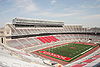
March 22, 1974 404 W. 17th Ave.
40°0′5.9″N 83°1′11.1″W / 40.001639°N 83.01975°W92 Ohio State Arsenal 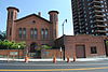
July 18, 1974 139 W. Main St.
39°57′19″N 83°0′11″W / 39.95528°N 83.00306°W93 Ohio State Office Building 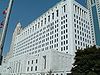
December 18, 1990 65 S. Front St.
39°57′37″N 82°59′55″W / 39.96028°N 82.99861°W94 Ohio Statehouse 
July 31, 1972 Southeastern corner of High and Broad Sts.
39°57′40″N 83°0′0″W / 39.96111°N 83°W95 Ohio Theatre 
April 11, 1973 39 E. State St.
39°57′35″N 82°59′58″W / 39.95972°N 82.99944°W96 Old Beechwold Historic District September 22, 1987 Roughly bounded by W. Jeffrey Pl., N. High, River Park Dr., and Olentangy Boulevard
40°3′37″N 83°1′24″W / 40.06028°N 83.02333°W97 Old Governor's Mansion 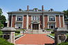
June 5, 1972 1234 E. Broad St.
39°57′59″N 82°57′23″W / 39.96639°N 82.95639°W98 Old North End Historic District August 30, 1996 Roughly bounded by Interstate 670, Pearl St., E. 2nd Ave., and N. 4th St.; also roughly bounded by W. 1st and E. 2nd Ave., N. Pearl St., E. 5th Ave., Summit St., and Beacon Alley
39°58′44″N 83°0′3″W / 39.97889°N 83.00083°WSecond set of boundaries represents a boundary increase of June 10, 1999 99 Old Ohio Union April 20, 1979 154 W. 12th Ave.
39°59′49″N 83°0′42″W / 39.99694°N 83.01167°W100 Old Port Columbus Airport Control Tower 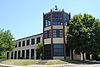
July 26, 1979 420 E. 5th Ave.
39°59′13″N 82°52′19″W / 39.98694°N 82.87194°W101 Orton Memorial Laboratory 
November 25, 1983 1445 Summit St.
39°59′32″N 83°0′7″W / 39.99222°N 83.00194°W102 Elijah Pierce Properties 
August 3, 1983 534 E. Long St. and 142-44 N. Everett Alley
39°58′0″N 82°59′12″W / 39.966667°N 82.98667°W103 Plaza Hotel 
December 20, 1984 736-740 E. Long St.
39°58′2″N 82°58′54″W / 39.96722°N 82.98167°W104 Frederick Prentiss House 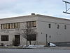
December 17, 1986 706 E. Broad St.
39°57′52″N 82°58′53″W / 39.96444°N 82.98139°W105 Prentiss-Tulford House 
December 17, 1986 1074 E. Broad St.
39°57′56″N 82°58′21″W / 39.96556°N 82.9725°W106 Pythian Temple and James Pythian Theater 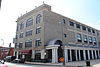
November 25, 1983 861-867 Mt. Vernon Ave.
39°58′16″N 82°58′44″W / 39.97111°N 82.97889°W107 Rankin Building 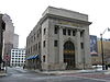
March 10, 1982 22 W. Gay St.
39°57′49″N 83°0′5″W / 39.96361°N 83.00139°W108 Capt. Edward V. Rickenbacker House 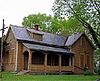
May 11, 1976 1334 E. Livingston Ave.
39°56′58″N 82°57′44″W / 39.94944°N 82.96222°W109 St. Clair Hospital 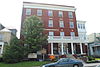
April 12, 2001 338-344 and 346 St. Clair Ave.
39°58′18″N 82°58′51″W / 39.97167°N 82.98083°W110 Saint Paul's Episcopal Church 
December 17, 1986 787 E. Broad St.
39°57′51.3″N 82°58′46″W / 39.96425°N 82.97944°W111 Schlee Brewery Historic District March 28, 1988 526, 543, 560, and rear 526 S. Front St., and the northeastern corner of Beck St. and Wall Alley
39°56′59″N 83°0′0″W / 39.94972°N 83°W112 Schlee-Kemmler Building December 2, 1982 328 S. High St.
39°57′21″N 83°0′12″W / 39.95583°N 83.00333°W113 Erwin W. Schueller House 
December 17, 1986 904 E. Broad St.
39°57′54″N 82°58′37″W / 39.965°N 82.97694°W114 Scofield-Sanor House 
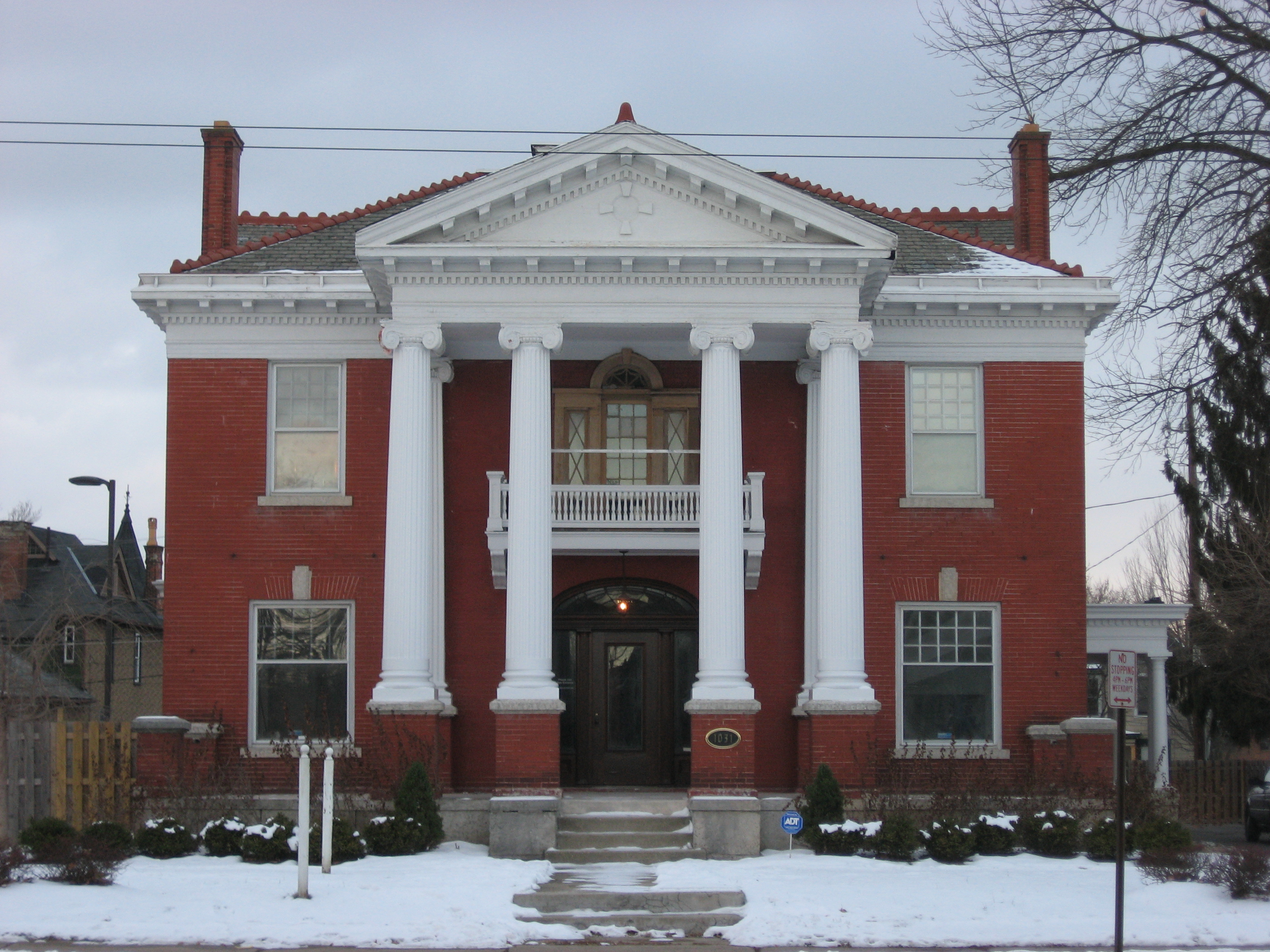
December 17, 1986 1031 E. Broad St.
39°57′54″N 82°58′23″W / 39.965°N 82.97306°W115 Second Presbyterian Church 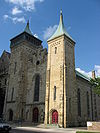
January 11, 1983 132 S. 3rd St.
39°57′34″N 82°59′50″W / 39.95944°N 82.99722°WNow known as Central Presbyterian Church 116 Benjamin Sells Barn No. 1 April 11, 1979 4586 Hayden Run Rd.
40°4′5″N 83°6′56″W / 40.06806°N 83.11556°W117 Benjamin Sells Barn No. 2 April 11, 1979 4586 Hayden Run Rd.
40°4′5″N 83°6′56″W / 40.06806°N 83.11556°W118 Benjamin Sells House July 30, 1975 4586 Hayden Run Rd.
40°4′5″N 83°6′56″W / 40.06806°N 83.11556°W119 Benjamin Sells Wash House April 11, 1979 4586 Hayden Run Rd.
40°4′5″N 83°6′56″W / 40.06806°N 83.11556°W120 Seneca Hotel 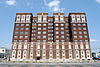
December 29, 1983 361 E. Broad St.
39°57′46″N 82°59′27″W / 39.96278°N 82.99083°W121 Sharp-Page House 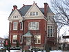
December 17, 1986 935 E. Broad St.
39°57′53.1″N 82°58′32.34″W / 39.96475°N 82.97565°W122 Shedd-Dunn House 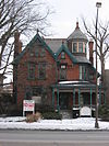
December 17, 1986 965 E. Broad St.
39°57′54″N 82°58′28″W / 39.965°N 82.97444°W123 Shiloh Baptist Church 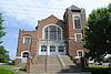
December 4, 2004 720 Mt. Vernon Ave.
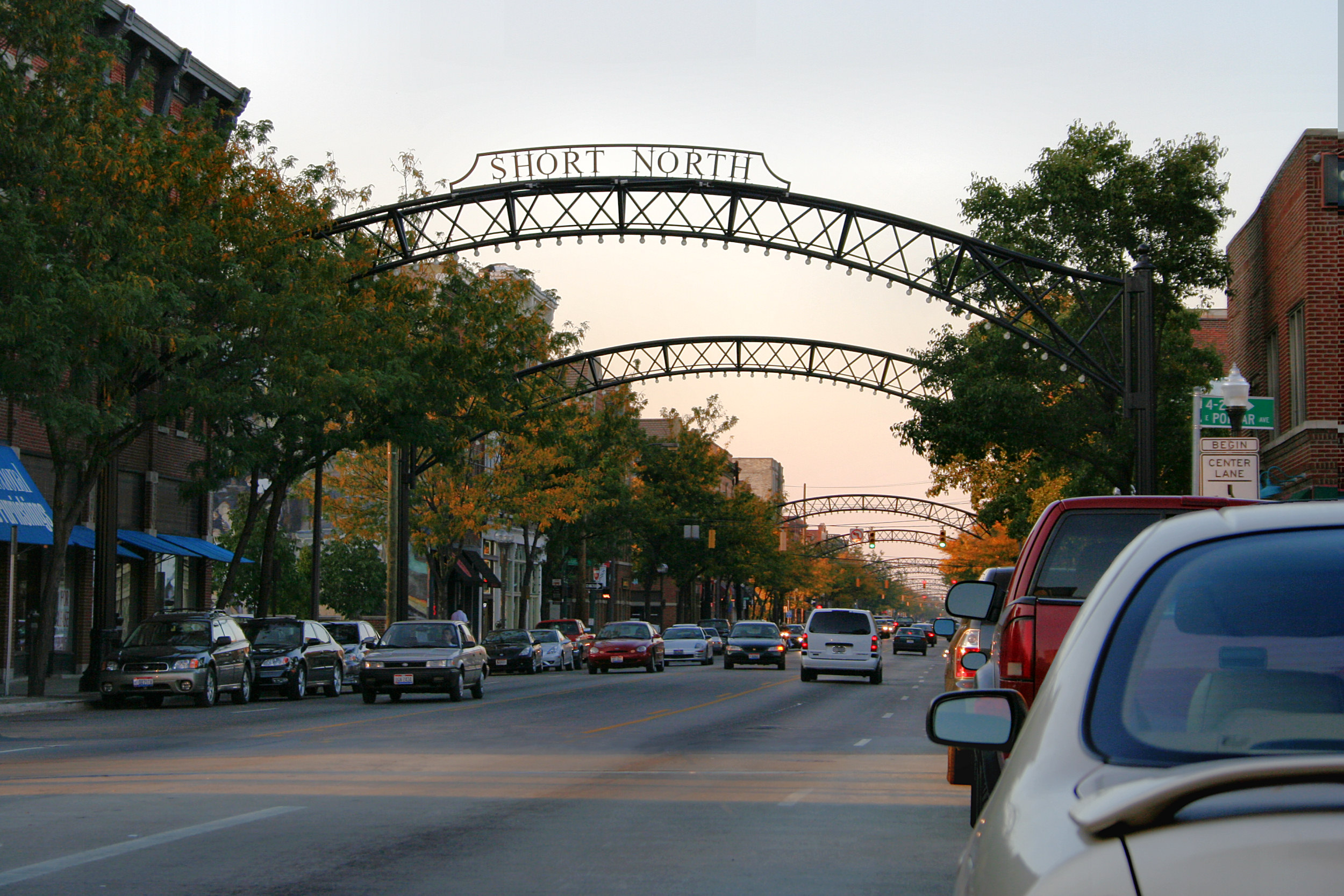
39°58′13″N 82°58′55″W / 39.97028°N 82.98194°W124 Short North Historic District 
April 19, 1990 N. High St. roughly between Poplar St. and Cedar Ave.
39°58′34″N 83°0′12″W / 39.97611°N 83.00333°W125 Benjamin Smith House 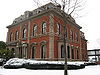
June 4, 1973 181 E. Broad St.
39°57′44.8″N 82°59′45.2″W / 39.962444°N 82.995889°W126 South High Street Commercial Grouping December 29, 1983 Bounded by Pearl, Mound, Main, and High Sts.
39°57′20″N 82°59′56″W / 39.95556°N 82.99889°W127 Stoddart Block 
March 17, 1994 260 S. 4th St.
39°57′27″N 82°59′42″W / 39.9575°N 82.995°W128 Lucas Sullivant Building March 20, 1973 714 W. Gay St.
39°57′39″N 83°1′11″W / 39.96083°N 83.01972°W129 Third Avenue and North High Historic District April 19, 1990 N. High St. in the vicinity of 2nd and 3rd
39°58′59″N 83°0′17″W / 39.98306°N 83.00472°W130 James Thurber House 
November 8, 1979 77 Jefferson Ave.
39°57′58″N 82°59′6″W / 39.96611°N 82.985°W131 Toledo and Ohio Central Railroad Station June 18, 1973 379 W. Broad St.
39°57′38″N 83°0′37″W / 39.96056°N 83.01028°W132 Tosheff's Restaurant and Hotel March 2, 2001 1943-1953 Parsons Ave.
39°55′23″N 82°59′4″W / 39.92306°N 82.98444°W133 Trinity Episcopal Church 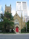
November 13, 1976 125 E. Broad St.
39°57′44″N 82°59′52″W / 39.96222°N 82.99778°W134 Trinity German Evangelical Lutheran Church 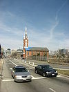
October 10, 1985 404 S. 3rd St.
39°57′15″N 82°59′47″W / 39.95417°N 82.99639°W135 U.S. Post Office and Courthouse 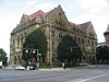
April 11, 1973 121 E. State St.
39°57′36″N 82°59′50″W / 39.96°N 82.99722°W136 University, Hayes and Orton Halls 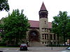
July 16, 1970 The Oval on the Ohio State University campus
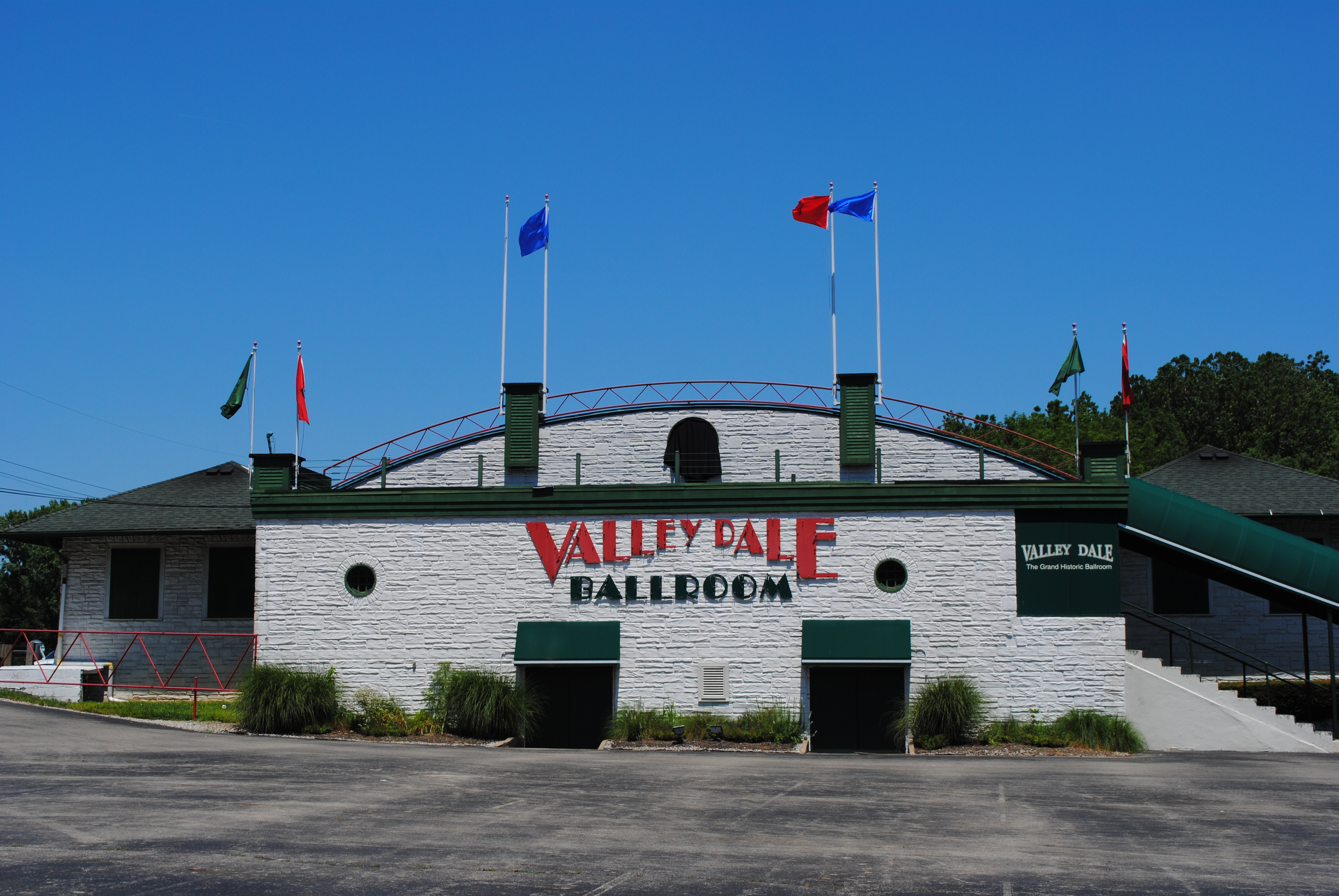
40°0′5″N 83°0′52″W / 40.00139°N 83.01444°W137 Valley Dale Ballroom 
December 17, 1982 1590 Sunbury Rd.
40°0′8″N 82°56′14″W / 40.00222°N 82.93722°W138 Welsbach Building 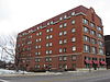
November 27, 1984 116-118 E. Chestnut St.
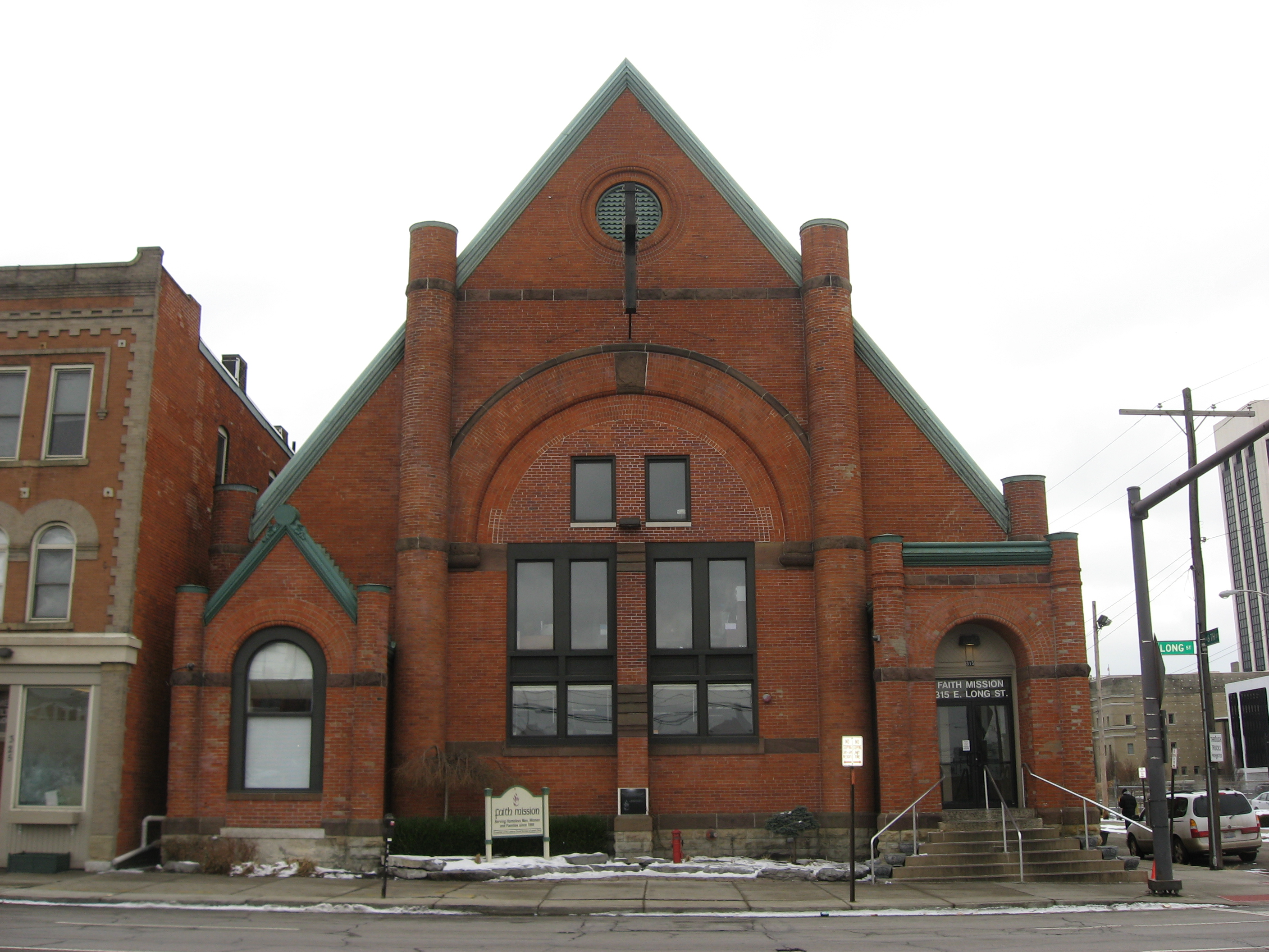
39°58′6″N 82°59′55″W / 39.96833°N 82.99861°W139 Welsh Presbyterian Church 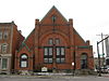
November 24, 1980 315 E. Long St.
39°57′56″N 82°59′33″W / 39.96556°N 82.9925°W140 Westminster Church 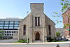
September 24, 2001 77 S. 6th St.
39°57′41″N 82°59′35″W / 39.96139°N 82.99306°W141 Wyandotte Building 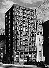
February 23, 1972 21 W. Broad St.
39°57′43.2″N 83°0′4.8″W / 39.962°N 83.001333°W142 York Lodge No. 563 July 19, 1984 1276 N. High St.
39°59′18″N 83°0′19″W / 39.98833°N 83.00528°WSee also
References
- ^ The latitude and longitude information provided in this table was derived originally from the National Register Information System, which has been found to be fairly accurate for about 99% of listings. For about 1% of NRIS original coordinates, experience has shown that one or both coordinates are typos or otherwise extremely far off; some corrections may have been made. A more subtle problem causes many locations to be off by up to 150 yards, depending on location in the country: most NRIS coordinates were derived from tracing out latitude and longitudes off of USGS topographical quadrant maps created under North American Datum of 1927, which differs from the current, highly accurate GPS system used by Google maps. Chicago is about right, but NRIS longitudes in Washington are higher by about 4.5 seconds, and are lower by about 2.0 seconds in Maine. Latitudes differ by about 1.0 second in Florida. Some locations in this table may have been corrected to current GPS standards.
- ^ "National Register of Historic Places: Weekly List Actions". National Park Service, United States Department of the Interior. Retrieved on November 10, 2011.
- ^ Numbers represent an ordering by significant words. Various colorings, defined here, differentiate National Historic Landmark sites and National Register of Historic Places Districts from other NRHP buildings, structures, sites or objects.
- ^ "National Register Information System". National Register of Historic Places. National Park Service. 2008-04-24. http://nrhp.focus.nps.gov/natreg/docs/All_Data.html.
- ^ a b Location derived from its Federal Register notice; the NRIS lists the site as "Address Restricted"
- ^ Location derived from Hartley Mound and Camp Archaeological Site 33-FR-71. Columbus Metropolitan Library, 2010. Accessed 2011-07-10. The NRIS lists the site as "Address Restricted".
- ^ "Marker #7-25 McDannald Pioneer Homestead". Remarkable Ohio. Ohio Historical Society. http://www.remarkableohio.org/HistoricalMarker.aspx?historicalMarkerId=97. Retrieved May 29, 2011.
Columbus, Ohio General 
Neighborhoods Arena District · Argyle Park · Berwick · The Bottoms · Brewery District · Briggsdale · Cherry Creek · Clintonville · Discovery District, Columbus, Ohio · Downtown · Driving Park · East Broad Street · Eastside · Flytown · Forest Park · Franklinton · Georgian Heights · German Village · Glen Echo · Harrison West · High Five (Columbus) · Hilltop · Holly Hill · Italian Village · King-Lincoln Bronzeville · Lincoln Village · Linden · Mount Vernon · Murray Hill · Near East Side · Northwood Park · Old North Columbus · Old Oaks · Olde Towne East · Olentangy · Riverbend · San Margherita · Short North · South End · University District · Victorian Village · WestgateSuburbs Amlin · Bexley · Blacklick · Brice · Canal Winchester · Delaware · Dublin · Gahanna · Grandview Heights · Grove City · Groveport · Harrisburg · Hilliard · Lewis Center · Lockbourne · Marble Cliff · Marysville · Minerva Park · New Albany · New Rome · Obetz · Pataskala · Pickerington · Powell · Reynoldsburg · Riverlea · Shawnee Hills · Unionville Center · Upper Arlington · Urbancrest · Valleyview · Westerville · Whitehall · WorthingtonCounties Attractions Columbus Commons · Beulah Park Racetrack · Columbus Crew Stadium · Columbus Metropolitan Library · Columbus Museum of Art · Columbus Zoo and Aquarium · COSI · Franklin Park Conservatory · Goodale Park · Greater Columbus Convention Center · Huntington Park (stadium) · Jerome Schottenstein Center · LeVeque Tower · Lifestyle Communities Pavilion · Lincoln Theatre · Marble Cliff Quarry Co. · Nationwide Arena · Newport Music Hall · North Market · Ohio Historical Center · Ohio Stadium · Ohio Statehouse · Ohio Theatre · Olentangy Indian Caverns · One Nationwide Plaza · Palace Theatre · Rhodes State Office Tower · Santa Maria replica ship · Southern Theatre · Wexner Center for the Arts · Zoombezi BayColleges and universities Media Buckeye TV · Columbus Alive · The Columbus Dispatch · ONN · WCMH 4 · WSYX 6 · WBNS 10 · WTTE 28 · WOSU 34 · WSFJ 51 · WWHO 53Transportation Airports Major streets and highways Shopping malls Categories:- National Register of Historic Places in Ohio
- History of Columbus, Ohio
-


Wikimedia Foundation. 2010.