- National Register of Historic Places listings in Contra Costa County, California
-
This list includes properties and districts listed on the National Register of Historic Places in Contra Costa County, California. Click the "Map of all coordinates" link to the right to view a Google map of all properties and districts with latitude and longitude coordinates in the table below.[1]
-
- This National Park Service list is complete through NPS recent listings posted November 10, 2011.[2]
[3] Landmark name [4] Image Date listed Location City or town Summary 1 Alvarado Park 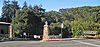
April 9, 1992 Jct. of Marin and Park Aves.
37°57′10″N 122°19′10″W / 37.952778°N 122.319444°WRichmond 2 Atchison Village Defense Housing Project, Cal. 4171-x 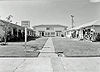
May 30, 2003 Roughly bounded by MacDonald Ave., Ohio St., First St., and Garrard Blvd.
37°55′58″N 122°22′12″W / 37.932778°N 122.37°WRichmond Atchison Village page at Rosie the Riveter Trust website with information about its history. The page also includes a link to the NRHP nomination form. 3 Bank of Pinole 
October 24, 1996 2361 San Pablo Ave.
38°00′20″N 122°17′25″W / 38.005678°N 122.290342°WPinole 4 Black Diamond Mines 
October 2, 1991 Somersville Rd. SE of Antioch
37°57′01″N 121°51′25″W / 37.950278°N 121.856944°WAntioch 5 Maynard and Katharine Buehler House 
December 12, 2006 6 Great Oak Circle
37°51′47″N 122°10′09″W / 37.862942°N 122.169242°WOrinda Frank Lloyd Wright house 6 Clayton Vineyards-DeMartini Winery 
August 30, 1984 5919 Clayton Rd.
37°56′35″N 121°56′11″W / 37.943056°N 121.936389°WClayton 7 Contra Costa County Courthouse Block 
December 28, 1989 625 Court St.
38°01′07″N 122°08′04″W / 38.018742°N 122.134331°WMartinez The original courthouse building at 625 Court St. is now the Contra Costa County Finance Building 8 Contra Costa County Hall of Records 
September 13, 1991 725 Court St.
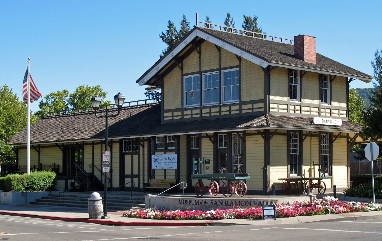
38°01′07″N 122°07′55″W / 38.018611°N 122.131944°WMartinez Now the Contra Costa County Courthouse 9 Danville Southern Pacific Railroad Depot 
August 16, 1994 355 Railroad Ave.
37°49′15″N 122°00′02″W / 37.820706°N 122.000511°WDanville 10 East Brother Island Light Station 
February 12, 1971 On East Brother Island W of Point San Pablo
37°57′48″N 122°25′57″W / 37.963333°N 122.4325°WRichmond 11 Bernardo Fernandez House 
April 11, 1973 100 Tennent Ave.
38°00′40″N 122°17′45″W / 38.011089°N 122.29585°WPinole 12 Ford Motor Company Assembly Plant 
June 23, 1988 1414-1422 Harbour Way, S.
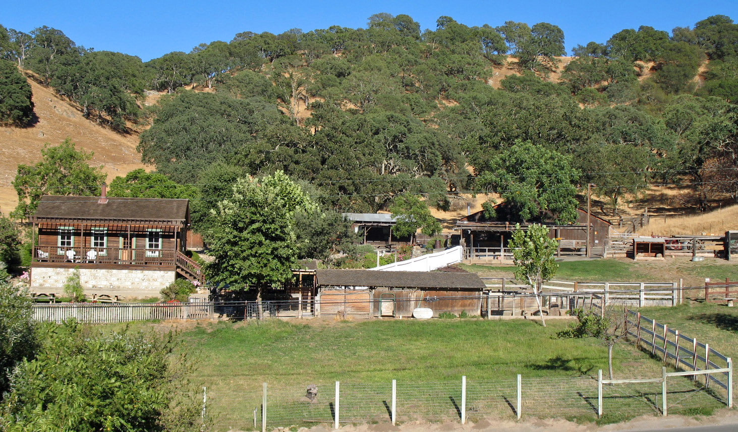
37°54′40″N 122°21′22″W / 37.911111°N 122.356111°WRichmond 13 Forest Home Farms 
June 28, 2002 19953 San Ramon Valley Blvd.
37°44′06″N 121°57′00″W / 37.735°N 121.95°WSan Ramon 14 Don Francisco Galindo House 
May 20, 1988 1721 Amador Ave.
37°58′24″N 122°02′05″W / 37.973369°N 122.034711°WConcord 15 Roswell Butler Hard House 
September 30, 1993 815 W. First St.
38°01′03″N 121°49′00″W / 38.017469°N 121.816681°WAntioch Antioch Press article about the Hard House 16 William T. Hendrick House 
September 8, 1983 218 Center Ave.
37°59′01″N 122°04′12″W / 37.983619°N 122.070122°WPacheco 17 Hercules Village 
August 22, 1980 Kings, Railroad, Santa Fe and Hercules Aves., Talley Way, Bay and Pinole Sts.
38°01′01″N 122°17′21″W / 38.016944°N 122.289167°WHercules 18 Tilden Park Merry-Go-Round 
September 29, 1976 E of Berkeley in Tilden Regional Park
37°54′05″N 122°15′21″W / 37.901389°N 122.255833°WBerkeley 19 John Muir National Historic Site 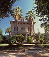
October 15, 1966 4202 Alhambra Ave.
37°59′29″N 122°7′49″W / 37.99139°N 122.13028°WMartinez 20 John Marsh House 
October 7, 1971 6 mi. W of Byron on Marsh Creek Rd.
37°53′32″N 121°43′19″W / 37.892222°N 121.721944°WByron 21 Martinez City Library 
January 31, 2008 740 Court St.
38°01′04″N 122°08′03″W / 38.017908°N 122.13415°WMartinez 22 Charles W. Merrill House April 7, 2005 407 Camino Sobrante
37°53′51″N 122°11′17″W / 37.8975°N 122.188056°WOrinda 23 Moraga Adobe 
March 16, 1972 24 Adobe Lane
37°50′36″N 122°09′09″W / 37.843333°N 122.1525°WOrinda 24 New Hotel Carquinez 
May 7, 1992 410 Harbour Way
37°56′14″N 122°21′34″W / 37.937222°N 122.359444°WRichmond 25 Old Borges Ranch 
July 7, 1981 1035 Castlerock Rd.
37°53′24″N 122°00′09″W / 37.890111°N 122.002522°WWalnut Creek 26 Don Fernando Pacheco Adobe 
June 6, 1980 3119 Grant St.
37°59′46″N 122°02′33″W / 37.996111°N 122.0425°WConcord 27 Point Richmond Historic District 
November 5, 1979 Off CA 17
37°55′34″N 122°23′07″W / 37.926111°N 122.385278°WRichmond 28 Port Costa School 
May 25, 1988 Plaza El Hambre
38°02′41″N 122°11′19″W / 38.044769°N 122.188497°WPort Costa 29 Richmond Shipyard Number Three 
April 28, 2000 Point Potrero
37°54′34″N 122°21′59″W / 37.909444°N 122.366389°WRichmond 30 Riverview Union High School Building 
October 14, 1998 1500 W. 4th St.
38°00′59″N 121°49′36″W / 38.016308°N 121.826572°WAntioch 31 Patrick Rodgers Farm 
March 22, 1991 315 Cortsen Rd.
37°56′35″N 122°05′13″W / 37.943067°N 122.086911°WPleasant Hill 32 Rosie the Riveter-World War II Home Front National Historical Park 
January 31, 2001 Shipyards of Richmond Richmond 33 Shadelands Ranch House 
August 29, 1985 2660 Ygnacio Valley Rd.
37°55′33″N 122°01′13″W / 37.925744°N 122.020139°WWalnut Creek 34 Shannon-Williamson Ranch 
January 29, 1987 RR 1/Lone Tree Way
37°57′41″N 121°45′45″W / 37.961314°N 121.762592°WAntioch Geocode coords are the current location of the ranch house. 35 SS Red Oak Victory (victory ship) 
January 30, 2001 1500 Dornan Dr, Terminal One, Port of Richmond
37°54′17″N 122°21′52″W / 37.904836°N 122.364436°WRichmond 36 Tao House 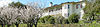
May 6, 1971 1.5 mi. W of Danville
37°49′28″N 122°01′47″W / 37.824444°N 122.029722°WDanville Residence of Eugene O'Neill> 37 Tucker House 
December 17, 1999 110 Escobar St.
38°00′55″N 122°08′28″W / 38.015253°N 122.141219°WMartinez 38 Winehaven 
October 2, 1978 Point Molate
37°57′05″N 122°25′03″W / 37.951306°N 122.417444°WRichmond See also
- National Register of Historic Places listings in California
- List of National Historic Landmarks in California
References
- ^ The latitude and longitude information provided in this table was derived originally from the National Register Information System, which has been found to be fairly accurate for about 99% of listings. For about 1% of NRIS original coordinates, experience has shown that one or both coordinates are typos or otherwise extremely far off; some corrections may have been made. A more subtle problem causes many locations to be off by up to 150 yards, depending on location in the country: most NRIS coordinates were derived from tracing out latitude and longitudes off of USGS topographical quadrant maps created under the North American Datum of 1927, which differs from the current, highly accurate WGS84 GPS system used by Google maps. Chicago is about right, but NRIS longitudes in Washington are higher by about 4.5 seconds, and are lower by about 2.0 seconds in Maine. Latitudes differ by about 1.0 second in Florida. Some locations in this table may have been corrected to current GPS standards.
- ^ "National Register of Historic Places: Weekly List Actions". National Park Service, United States Department of the Interior. Retrieved on November 10, 2011.
- ^ Numbers represent an ordering by significant words. Various colorings, defined here, differentiate National Historic Landmark sites and National Register of Historic Places Districts from other NRHP buildings, structures, sites or objects.
- ^ "National Register Information System". National Register of Historic Places. National Park Service. . http://nrhp.focus.nps.gov/natreg/docs/All_Data.html.
U.S. National Register of Historic Places Topics Lists by states Alabama • Alaska • Arizona • Arkansas • California • Colorado • Connecticut • Delaware • Florida • Georgia • Hawaii • Idaho • Illinois • Indiana • Iowa • Kansas • Kentucky • Louisiana • Maine • Maryland • Massachusetts • Michigan • Minnesota • Mississippi • Missouri • Montana • Nebraska • Nevada • New Hampshire • New Jersey • New Mexico • New York • North Carolina • North Dakota • Ohio • Oklahoma • Oregon • Pennsylvania • Rhode Island • South Carolina • South Dakota • Tennessee • Texas • Utah • Vermont • Virginia • Washington • West Virginia • Wisconsin • WyomingLists by territories Lists by associated states Other Categories:- History of Contra Costa County, California
- Contra Costa County, California
- National Register of Historic Places in the San Francisco Bay Area
- National Register of Historic Places in California by county
-


Wikimedia Foundation. 2010.