- National Register of Historic Places listings in Copiah County, Mississippi
-
 Location of Copiah County in Mississippi
This is a list of the National Register of Historic Places listings in Copiah County, Mississippi.
This is intended to be a complete list of the properties and districts on the National Register of Historic Places in Copiah County, Mississippi, United States. Latitude and longitude coordinates are provided for many National Register properties and districts; these locations may be seen together in a Google map.[1]
There are 32 properties and districts listed on the National Register in the county.
-
- This National Park Service list is complete through NPS recent listings posted November 10, 2011.[2]
Current listings
[3] Landmark name [4] Image Date listed Location City or town Summary 1 Ailes House April 9, 1991 Rhymes Rd. near its junction with Mississippi Highway 27
32°01′30″N 90°22′15″W / 32.025°N 90.370833°WCrystal Springs 2 Alford-Little House October 19, 1982 South of Georgetown off Mississippi Highway 27
31°47′35″N 90°08′45″W / 31.793056°N 90.145833°WGeorgetown 3 Bayou Pierre Bridge June 10, 2005 Mississippi Highway 18
32°00′10″N 90°41′23″W / 32.002778°N 90.689722°WCarpenter 4 Carpenter United Methodist Church June 28, 1996 Carpenter Rd., 1.1 miles north of its junction with Mississippi Highway 18
32°02′08″N 90°40′53″W / 32.035556°N 90.681389°WUtica 5 Cherry Grove August 10, 1990 Old U.S. Route 51, north of its junction with Mississippi Highway 27
32°02′32″N 90°19′20″W / 32.042222°N 90.322222°WCrystal Springs 6 Cook House December 8, 1983 222 Extension St.
31°51′32″N 90°23′48″W / 31.858889°N 90.396667°WHazlehurst 7 George Washington Copley House March 1, 1996 210 Copley St.
31°59′07″N 90°21′43″W / 31.985278°N 90.361944°WCrystal Springs 8 Robert L. Covington House 
March 1, 1984 240 S. Extension St.
31°51′23″N 90°23′50″W / 31.856389°N 90.397222°WHazlehurst Designed by architect George Franklin Barber 9 Crystal Springs Historic District March 14, 1997 Roughly bounded by Independence, Pearl, Newton, and Marion Sts.
31°59′14″N 90°21′28″W / 31.987222°N 90.357778°WCrystal Springs 10 Isaac Newton Ellis House November 2, 1987 258 S. Extension St.
31°51′19″N 90°23′49″W / 31.855278°N 90.396944°WHazlehurst Designed by architect George Franklin Barber 11 Gallman Historic District March 31, 1986 Roughly U.S. Route 51 and Church St.
31°55′53″N 90°23′27″W / 31.931389°N 90.390833°WGallman 12 Gatesville Bridge November 16, 1988 Spans the Pearl River on a county road east of Gatesville
31°59′46″N 90°13′26″W / 31.996111°N 90.223889°WGatesville Extends into Simpson County 13 Hargrave House April 5, 1993 Mississippi Highway 28, 14 miles west of Hazlehurst
31°45′04″N 90°34′55″W / 31.751111°N 90.581944°WHazlehurst 14 Hazlehurst Historic District November 5, 1998 Roughly bounded by S. Extension, Georgetown, Gallatin, and Monticello Sts.
31°51′40″N 90°23′41″W / 31.861111°N 90.394722°WHazlehurst 15 Homochitto River Bridge November 16, 1988 Spans the Homochitto River on a county road
31°42′48″N 90°40′01″W / 31.713333°N 90.666944°WHazlehurst 16 Charles Morris Huber House November 10, 1994 199 N. Jackson St.
31°59′29″N 90°21′11″W / 31.991389°N 90.353056°WCrystal Springs 17 Illinois Central Railroad Passenger Depot March 1, 1996 138 N. Ragsdale Ave.
31°51′39″N 90°23′39″W / 31.860833°N 90.394167°WHazlehurst 18 Dr. William Little House March 4, 1993 1022 Collier St.
31°41′52″N 90°23′47″W / 31.697778°N 90.396389°WWesson 19 Marchetti Farm March 1, 1996 134 Dale Dr.
31°51′09″N 90°24′11″W / 31.8525°N 90.403056°WHazlehurst 20 Mississippi Mills Packing and Shipping Rooms March 1, 1996 2058 U.S. Route 51
31°42′05″N 90°23′50″W / 31.701389°N 90.397222°WWesson 21 Mount Hope March 21, 1985 Off Route 2 across from Mt. Hope Cemetery
31°52′43″N 90°34′38″W / 31.878611°N 90.577222°WHazlehurst 22 Old Wesson Public School Building October 16, 1980 Off U.S. Route 51
31°42′08″N 90°23′22″W / 31.702222°N 90.389444°WWesson 23 C.H. Parsons House September 7, 1984 208 W. Georgetown St.
31°59′18″N 90°21′33″W / 31.988333°N 90.359167°WCrystal Springs 24 Pearl River Bridge on Mississippi Highway 28 June 10, 2005 Mississippi Highway 28
31°52′31″N 90°08′17″W / 31.875278°N 90.138056°WGeorgetown 25 Pleasant Valley Methodist Church August 1, 1996 Pleasant Valley Rd., 0.8 miles east of its junction with Mississippi Highway 28
31°45′38″N 90°33′13″W / 31.760556°N 90.553611°WHazlehurst 26 Dr. Robert W. Rea House November 1, 1996 1034 Church St.
31°42′01″N 90°23′53″W / 31.700278°N 90.398056°WWesson 27 James Samuel Rea House March 1, 1996 1193 U.S. Route 51
31°41′53″N 90°24′04″W / 31.698056°N 90.401111°WWesson 28 Tabernacle Methodist Church June 28, 1996 Dentville Rd., 4.6 miles north of its junction with Mississippi Highway 28
31°54′37″N 90°28′17″W / 31.910278°N 90.471389°WHazlehurst 29 US Post Office-Crystal Springs March 18, 1993 224 E. Marion St.
31°59′09″N 90°21′25″W / 31.985833°N 90.356944°WCrystal Springs 30 US Post Office-Hazlehurst March 18, 1993 130 Caldwell Dr.
31°51′41″N 90°23′44″W / 31.861389°N 90.395556°WHazlehurst 31 Jenkins H. Welch House June 30, 1988 ½ mile north of Mississippi Highway 28 on Dentville Rd.
31°52′50″N 90°24′57″W / 31.880556°N 90.415833°WHazlehurst 32 Col. William James Willing House July 10, 1992 272 S. Jackson St.
31°58′59″N 90°21′28″W / 31.983056°N 90.357778°WCrystal Springs See also
- List of National Historic Landmarks in Mississippi
- National Register of Historic Places listings in Mississippi
References
- ^ The latitude and longitude information provided in this table was derived originally from the National Register Information System, which has been found to be fairly accurate for about 99% of listings. For about 1% of NRIS original coordinates, experience has shown that one or both coordinates are typos or otherwise extremely far off; some corrections may have been made. A more subtle problem causes many locations to be off by up to 150 yards, depending on location in the country: most NRIS coordinates were derived from tracing out latitude and longitudes off of USGS topographical quadrant maps created under North American Datum of 1927, which differs from the current, highly accurate GPS system used by Google maps. Chicago is about right, but NRIS longitudes in Washington are higher by about 4.5 seconds, and are lower by about 2.0 seconds in Maine. Latitudes differ by about 1.0 second in Florida. Some locations in this table may have been corrected to current GPS standards.
- ^ "National Register of Historic Places: Weekly List Actions". National Park Service, United States Department of the Interior. Retrieved on November 10, 2011.
- ^ Numbers represent an ordering by significant words. Various colorings, defined here, differentiate National Historic Landmark sites and National Register of Historic Places Districts from other NRHP buildings, structures, sites or objects.
- ^ "National Register Information System". National Register of Historic Places. National Park Service. . http://nrhp.focus.nps.gov/natreg/docs/All_Data.html.
U.S. National Register of Historic Places Topics Lists by states Alabama • Alaska • Arizona • Arkansas • California • Colorado • Connecticut • Delaware • Florida • Georgia • Hawaii • Idaho • Illinois • Indiana • Iowa • Kansas • Kentucky • Louisiana • Maine • Maryland • Massachusetts • Michigan • Minnesota • Mississippi • Missouri • Montana • Nebraska • Nevada • New Hampshire • New Jersey • New Mexico • New York • North Carolina • North Dakota • Ohio • Oklahoma • Oregon • Pennsylvania • Rhode Island • South Carolina • South Dakota • Tennessee • Texas • Utah • Vermont • Virginia • Washington • West Virginia • Wisconsin • WyomingLists by territories Lists by associated states Other  Category:National Register of Historic Places •
  Portal:National Register of Historic Places
Municipalities and communities of Copiah County, Mississippi County seat: Hazlehurst Cities 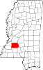
Towns Villages Unincorporated
communitiesCarpenter | Dentville | Gallman | Hopewell | Martinsville | Ruby
Categories:- Copiah County, Mississippi
- National Register of Historic Places in Mississippi by county
- Buildings and structures in Copiah County, Mississippi
-


Wikimedia Foundation. 2010.