- National Register of Historic Places listings in Cowlitz County, Washington
-
List of entries on the National Register of Historic Places in Cowlitz County, Washington
-
- This National Park Service list is complete through NPS recent listings posted November 10, 2011.[1]
Contents
[2] Landmark name [3] Image Date listed Location City or town Summary 1 Berwind-Purcell House July 6, 2010 808 Lone Oak Rd.
46°10′56″N 122°57′58″W / 46.182222°N 122.966111°WLongview 2 Big Four Furniture Building 
December 5, 1985 1329 Commerce Ave.
46°08′18″N 122°55′54″W / 46.138333°N 122.931667°WLongview Built in 1924 for Lumberman's Bank. 3 Adam Catlin House December 9, 1994 202 NW. Second Ave.
46°08′49″N 122°54′55″W / 46.146944°N 122.915278°WKelso 4 Columbia Theater 
December 5, 1985 1225 Vandercook Way
46°08′27″N 122°55′53″W / 46.140833°N 122.931389°WLongview 5 First Christian Church December 5, 1985 2000 E. Kessler Blvd.
46°07′53″N 122°56′45″W / 46.131389°N 122.945833°WLongview 6 Jim Creek Bridge March 28, 1995 WA 503 over Jim Cr.
45°59′45″N 122°30′55″W / 45.995833°N 122.515278°WWoodland Bridges of Washington State MPS 7 Hulda Klager Lilac Gardens 
July 17, 1975 115 S. Pekin Rd.
45°53′51″N 122°45′07″W / 45.8975°N 122.751944°WWoodland 8 Lake Sacajawea Park December 5, 1985 Bounded by Nichols and Kessler Blvds.
46°08′14″N 122°56′46″W / 46.137222°N 122.946111°WLongview 9 Laughlin Round Barn May 15, 1986 8249 Barnes Dr.
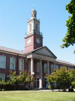
46°20′25″N 122°55′24″W / 46.340278°N 122.923333°WCastle Rock 10 Robert Alexander Long High School 
December 5, 1985 2903 Nichols Blvd.
46°08′27″N 122°57′15″W / 46.140833°N 122.954167°WLongview Built in 1927, this is the oldest high school in Longview. 11 Longview Bridge 
July 16, 1982 Spans Columbia river
46°06′48″N 122°57′10″W / 46.113333°N 122.952778°WLongview Also known as the Lewis and Clark Bridge and the Rainier Bridge.
Historic Bridges and Tunnels in Washington TR12 Longview Civic Center Historic District December 5, 1985 Bounded by Maple St., Sixteenth Ave., Hemlock St., and Eighteenth Ave.
46°08′23″N 122°56′16″W / 46.139722°N 122.937778°WLongview 13 Longview Community Church December 5, 1985 2323 Washington Way
46°08′03″N 122°56′55″W / 46.134167°N 122.948611°WLongview 14 Longview Community Church-Saint Helen's Addition December 5, 1985 416 Twentieth Ave.
46°07′28″N 122°57′32″W / 46.124444°N 122.958889°WLongview 15 Longview Community Store December 5, 1985 421 Twentieth Ave.
46°07′29″N 122°57′05″W / 46.124722°N 122.951389°WLongview 16 Longview Women's Clubhouse December 5, 1985 835 Twenty-first Ave.
46°07′57″N 122°56′46″W / 46.1325°N 122.946111°WLongview 17 Mills Building 
December 5, 1985 1239 Commerce Ave.
46°08′11″N 122°56′00″W / 46.136389°N 122.933333°WLongview 18 Pacific Telephone and Telegraph Building 
December 5, 1985 1304 Vandercook Way
46°08′27″N 122°55′57″W / 46.140833°N 122.9325°WLongview 19 Pounder Building 
December 5, 1985 1208 Commerce Ave.
46°08′10″N 122°56′01″W / 46.136111°N 122.933611°WLongview 20 Schumann Building 
December 5, 1985 1233 Commerce Ave.
46°08′11″N 122°55′58″W / 46.136389°N 122.932778°WLongview 21 Sevier and Weed Building December 5, 1985 1266 Twelfth Ave.
46°08′12″N 122°55′53″W / 46.136667°N 122.931389°WLongview 22 Nat Smith House March 3, 1975 110 W. Grant St.
46°08′48″N 122°54′56″W / 46.146667°N 122.915556°WKelso 23 Stella Blacksmith Shop December 19, 1985 8530 Ocean Beach Hwy.
46°11′30″N 123°07′13″W / 46.191667°N 123.120278°WStella 24 J. D. Tennant House April 12, 1984 420 Rutherglen Rd.
46°09′06″N 122°59′30″W / 46.151667°N 122.991667°WLongview 25 Tyni Building 
December 5, 1985 1166 Commerce Ave.
46°08′05″N 122°56′02″W / 46.134722°N 122.933889°WLongview 26 US Post Office-Kelso Main 
August 7, 1991 304 Academy St.
46°08′44″N 122°54′31″W / 46.145556°N 122.908611°WKelso 27 US Post Office-Longview Main May 30, 1991 1603 Larch St.
46°08′17″N 122°56′16″W / 46.138056°N 122.937778°WLongview National Register of Historic Places listings in Cowlitz County, Washington
28 Washington Gas and Electric Building December 5, 1985 1346 Fourteenth Ave.
46°08′18″N 122°56′01″W / 46.138333°N 122.933611°WLongview 29 Willard Building December 5, 1985 1403 Twelfth Ave.
46°08′19″N 122°55′53″W / 46.138611°N 122.931389°WLongview References
- ^ "National Register of Historic Places: Weekly List Actions". National Park Service, United States Department of the Interior. Retrieved on November 10, 2011.
- ^ Numbers represent an ordering by significant words. Various colorings, defined here, differentiate National Historic Landmark sites and National Register of Historic Places Districts from other NRHP buildings, structures, sites or objects.
- ^ "National Register Information System". National Register of Historic Places. National Park Service. . http://nrhp.focus.nps.gov/natreg/docs/All_Data.html.
U.S. National Register of Historic Places Topics Lists by states Alabama • Alaska • Arizona • Arkansas • California • Colorado • Connecticut • Delaware • Florida • Georgia • Hawaii • Idaho • Illinois • Indiana • Iowa • Kansas • Kentucky • Louisiana • Maine • Maryland • Massachusetts • Michigan • Minnesota • Mississippi • Missouri • Montana • Nebraska • Nevada • New Hampshire • New Jersey • New Mexico • New York • North Carolina • North Dakota • Ohio • Oklahoma • Oregon • Pennsylvania • Rhode Island • South Carolina • South Dakota • Tennessee • Texas • Utah • Vermont • Virginia • Washington • West Virginia • Wisconsin • WyomingLists by territories Lists by associated states Other  Category:National Register of Historic Places •
  Portal:National Register of Historic PlacesCategories:
- National Register of Historic Places in Washington (state) by county
- Cowlitz County, Washington
-


Wikimedia Foundation. 2010.