- National Register of Historic Places listings in Crow Wing County, Minnesota
-
This is a List of properties on the National Register of Historic Places in Crow Wing County, Minnesota.
Crow Wing County is a county located in the central part of the U.S. state of Minnesota.
-
- This National Park Service list is complete through NPS recent listings posted November 10, 2011.[1]
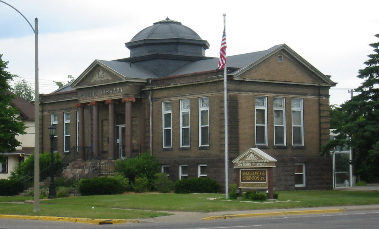
[2] Landmark name Image Date listed Location City or town Summary 1 Brainerd Public Library 
May 23, 1980 206 N. 7th St.
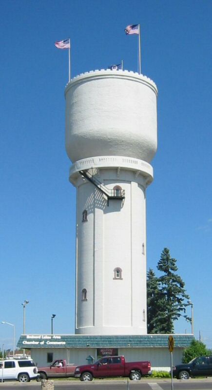
46°21′30″N 94°11′55″W / 46.358333°N 94.198611°WBrainerd 2 Brainerd Water Tower 
July 17, 1974 Washington at 6th St.
46°21′30″N 94°11′59″W / 46.358333°N 94.199722°WBrainerd 3 Bridge No. 5265-Garrison 
June 29, 1998 U.S. Route 169 near Mille Lacs Lake
46°17′19″N 93°49′29″W / 46.288611°N 93.824722°WGarrison 4 H. H. Broach House May 23, 1980 Pequot Boulevard
46°35′53″N 94°19′31″W / 46.598056°N 94.325278°WPequot Lakes 5 A.L. Cole Memorial Building 
May 26, 2004 4285 Tower Square
46°36′13″N 94°18′51″W / 46.603611°N 94.314167°WPequot Lakes Museum of the Pequot Lakes Historical Society. 6 Crow Wing County Courthouse and Jail 
May 23, 1980 326 Laurel St.
46°21′19″N 94°12′14″W / 46.355278°N 94.203889°WBrainerd 7 Crow Wing State Park 
July 28, 1970 Off Minnesota Highway 371
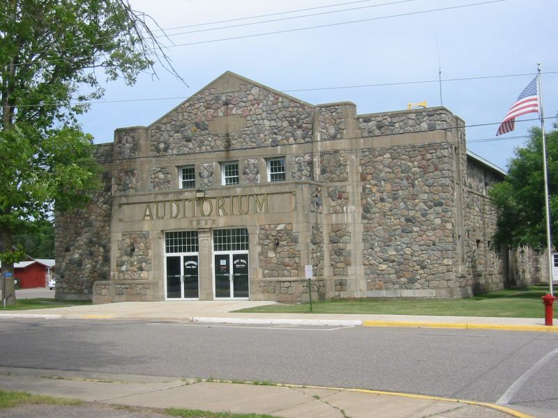
46°16′39″N 94°20′40″W / 46.2775°N 94.344444°WBaxter 8 Deerwood Auditorium 
November 29, 1995 27 E. Forest Rd.
46°28′30″N 93°53′58″W / 46.475°N 93.899444°WDeerwood 9 Elevated Metal Water Tank, Crosby 
October 22, 1980 Western side of 1st Ave. E., between 1st and 2nd Sts., N.
46°29′02″N 93°57′02″W / 46.483889°N 93.950556°WCrosby 10 Elevated Metal Water Tank, Cuyuna October 22, 1980 Northern side of North St. west of Chicago Ave.
46°31′09″N 93°55′20″W / 46.519167°N 93.922222°WCuyuna 11 Elevated Metal Water Tank, Deerwood October 22, 1980 211 Maple St.
46°28′33″N 93°53′57″W / 46.475833°N 93.899167°WDeerwood 12 Elevated Metal Water Tank, Ironton October 22, 1980 Southern side of 7th St. west of Viola Ave.
46°28′28″N 93°58′33″W / 46.474444°N 93.975833°WIronton 13 Elevated Metal Water Tank, Trommald October 22, 1980 In Trommald
46°30′26″N 94°01′13″W / 46.507222°N 94.020278°WTrommald 14 Wilford H. Fawcett House May 23, 1980 Off County Highway 4
46°35′24″N 94°12′28″W / 46.59°N 94.207778°WBreezy Point 15 Fort Flatmouth Mounds August 14, 1973 Address Restricted Crosslake 16 Franklin Junior High School 
June 4, 2009 1001 Kingwood St.
46°21′33″N 94°11′40″W / 46.359114°N 94.194528°WBrainerd 17 Gordon-Schaust Site December 23, 1974 Address Restricted Crosslake 18 Grand View Lodge 
May 23, 1980 Off County Highway 77
46°29′36″N 94°18′55″W / 46.493333°N 94.315278°WNisswa One of the most well-preserved examples of early log resort construction in Minnesota [3] 19 Werner Hemstead House 
May 23, 1980 303 N. 4th St.
46°21′33″N 94°12′14″W / 46.359167°N 94.203889°WBrainerd 20 Ironton City Hall 
June 14, 2002 309 3rd St.
46°28′44″N 93°58′37″W / 46.478889°N 93.976944°WIronton 21 Ironton Sintering Plant Complex 
September 11, 1980 County Highway 30
46°29′22″N 93°58′26″W / 46.489444°N 93.973889°WCrosby 22 Milford Mine Historic District August 10, 2011 1 mile southwest of junction of MN 6 and County Road 30
46°32′05″N 93°58′15″W / 46.534722°N 93.970833°WWolford Township vicinity 23 Minnesota and International Railroad Freight House and Shelter Shed 
May 27, 1980 County Highway 30
46°30′06″N 94°15′29″W / 46.501667°N 94.258056°WNisswa Only remaining open-air depot remaining in the United States, built in 1896[4] 24 Minnewawa Lodge 
August 11, 1980 County Highway 13
46°30′34″N 94°15′59″W / 46.509444°N 94.266389°WNisswa 1890s resort on Clark Lake, one of the earliest surviving resorts in Minnesota[5] 25 Northern Pacific Railroad Shops Historic District 
January 3, 1989 Roughly bounded by the Burlington Northern railroad tracks, Laurel, and 13th Sts.
46°21′23″N 94°11′03″W / 46.356389°N 94.184167°WBrainerd 26 Parker Building 
May 23, 1980 623 Laurel St.
46°21′21″N 94°11′57″W / 46.355833°N 94.199167°WBrainerd 27 Red River Trail: Crow Wing Section February 6, 1991 Off County Highway 27 in Crow Wing State Park
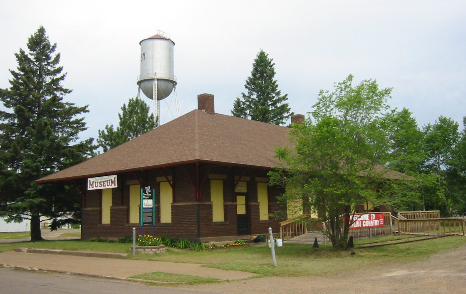
46°16′25″N 94°20′24″W / 46.273611°N 94.34°WFort Ripley Township 28 Sebre Lake Site (21-CW-55) November 16, 1984 Address Restricted Fort Ripley 29 Soo Line Depot 
November 25, 1980 1st St., N. and 1st Ave., E.
46°29′01″N 93°57′00″W / 46.483611°N 93.95°WCrosby 30 Spina Hotel 
May 23, 1980 Curtis Ave. and 4th St.
46°28′40″N 93°58′35″W / 46.477778°N 93.976389°WIronton 31 St. Columba Mission Site December 18, 1973 Address Restricted Nisswa 32 Upper Hay Lake Archeological District January 21, 1974 Address Restricted Jenkins See also
References
- ^ "National Register of Historic Places: Weekly List Actions". National Park Service, United States Department of the Interior. Retrieved on November 10, 2011.
- ^ Numbers represent an ordering by significant words. Various colorings, defined here, differentiate National Historic Landmark sites and National Register of Historic Places Districts from other NRHP buildings, structures, sites or objects.
- ^ Grand View Lodge History
- ^ Sign posted on site
- ^ "Minnewawa Lodge: National Register of Historic Places: mnhs.org". Minnesota Historical Society. 2007. http://nrhp.mnhs.org/property_overview.cfm?propertyID=66. Retrieved 2011-07-31.
Nord, Mary Ann (2003). The National Register of Historic Places in Minnesota. Minnesota Historical Society. ISBN 0-87351-448-3.
External links
- A list of the above sites, with street addresses and other information, is available at Crow Wing County, MN listing of National Register of Historic Places.Com, a private site serving up NRHP information.
U.S. National Register of Historic Places Topics Lists by states Alabama • Alaska • Arizona • Arkansas • California • Colorado • Connecticut • Delaware • Florida • Georgia • Hawaii • Idaho • Illinois • Indiana • Iowa • Kansas • Kentucky • Louisiana • Maine • Maryland • Massachusetts • Michigan • Minnesota • Mississippi • Missouri • Montana • Nebraska • Nevada • New Hampshire • New Jersey • New Mexico • New York • North Carolina • North Dakota • Ohio • Oklahoma • Oregon • Pennsylvania • Rhode Island • South Carolina • South Dakota • Tennessee • Texas • Utah • Vermont • Virginia • Washington • West Virginia • Wisconsin • WyomingLists by territories Lists by associated states Other Categories:- Crow Wing County, Minnesota
- National Register of Historic Places in Minnesota by county
- Buildings and structures in Crow Wing County, Minnesota
-


Wikimedia Foundation. 2010.