- National Register of Historic Places listings in Cuyahoga Valley National Park
-
This is a list of the National Register of Historic Places listings in Cuyahoga Valley National Park.
This is intended to be a complete list of the properties and districts on the National Register of Historic Places in Cuyahoga Valley National Park, Ohio, United States. The locations of National Register properties and districts for which the latitude and longitude coordinates are included below, may be seen in a Google map.[1]
There are 61 properties and districts listed on the National Register in the park, one of which is a National Historic Landmark.
-
- This National Park Service list is complete through NPS recent listings posted November 10, 2011.[2]
Current listings
[3] Landmark name[4] Image Date listed Location City or Town Summary 1 Barker Village Site April 19, 1978 North of central Akron[5] 2 Botzum Farm 
October 21, 1999 3486 Riverview Rd.
41°10′29″N 81°34′54″W / 41.17472°N 81.58167°WCuyahoga Falls 3 Jim Brown House 
March 2, 1979 South of Peninsula at 3491 Akron Peninsula Rd.
41°10′54″N 81°34′42″W / 41.18167°N 81.57833°WCuyahoga Falls 4 Jim Brown Tavern 
December 11, 1979 Boston Mills Rd.
41°15′48″N 81°33′31″W / 41.26333°N 81.55861°WBoston Township 5 William Burt House March 22, 1979 9525 Brecksville Rd.
41°18′10″N 81°37′36″W / 41.30278°N 81.62667°WBrecksville 6 H. Karl Butler Memorial January 2, 1997 Truxell Rd., southeast of its junction with Peninsula Rd., Camp Manatoc
41°13′19″N 81°31′49″W / 41.22194°N 81.53028°WBoston Township 7 Camp Manatoc Concord Lodge and Adirondacks Historic District January 2, 1997 Truxell Rd., southeast of its junction with Peninsula Rd., Camp Manatoc
41°13′7″N 81°31′46″W / 41.21861°N 81.52944°WBoston Township 8 Camp Manatoc Dining Hall January 2, 1997 Truxell Rd., southeast of its junction with Peninsula Rd., Camp Manatoc
41°13′15″N 81°31′44″W / 41.22083°N 81.52889°WBoston Township 9 Camp Manatoc Foresters Lodge and Kit Carson-Dan Boone Cabins Historic District January 2, 1997 Truxell Rd., southeast of its junction with Peninsula Rd., Camp Manatoc
41°13′39″N 81°31′58″W / 41.2275°N 81.53278°WBoston Township 10 Camp Manatoc Legion Lodge January 2, 1997 Truxell Rd., southeast of its junction with Peninsula Rd., Camp Manatoc
41°13′7″N 81°31′46″W / 41.21861°N 81.52944°WBoston Township 11 Albert Cofta Farmstead 
November 4, 2004 2966 Brush Rd., northeast of Richfield
41°15′13″N 81°36′56″W / 41.25361°N 81.61556°WRichfield Township 12 Jonas Coonrad House 
July 24, 1979 Southeast of Brecksville at 10340 Riverview Rd.
41°16′50″N 81°34′21″W / 41.28056°N 81.5725°WBrecksville 13 Edward Cranz Farm 
March 12, 1993 2780 Oak Hill Dr., south of Peninsula
41°11′50″N 81°35′31″W / 41.19722°N 81.59194°WBath Township 14 William and Eugene Cranz Farm March 12, 1993 2401 Ira Rd., south of Peninsula
41°11′15″N 81°35′31″W / 41.1875°N 81.59194°WBath Township 15 Michael Duffy Farm 
March 12, 1993 4965 Quick Rd., southeast of Peninsula
41°12′15″N 81°30′58″W / 41.20417°N 81.51611°WBoston Township 16 Everett Historic District 
January 14, 1993 4731-4642 Riverview Rd. and 2151-2279 Everett Rd., south of Peninsula, in the Cuyahoga Valley National Park
41°12′16″N 81°34′29″W / 41.20444°N 81.57472°WBoston Township 17 Everett Knoll Complex May 25, 1977 Southern side of Everett Rd., west of its junction with Riverview Rd.
41°12′15.5″N 81°34′32.75″W / 41.204306°N 81.5757639°W[6]Boston Township 18 Fort Island Works December 2, 1970 In Fort Island Park, at 413 Tunko Rd.
41°7′9.56″N 81°37′2.64″W / 41.1193222°N 81.6174°W[7]Fairlawn 19 Stephen Frazee House 
May 4, 1976 7733 Canal Rd.
41°21′10″N 81°35′34″W / 41.35278°N 81.59278°WValley View 20 Furnace Run Aqueduct December 11, 1979 Furnace Run
41°12′6″N 81°34′22″W / 41.20167°N 81.57278°WCuyahoga Falls 21 Edmund Gleason House 
December 18, 1978 7243 Canal Rd.
41°22′2″N 81°36′38″W / 41.36722°N 81.61056°WValley View 22 Hunt-Wilke Farm March 12, 1993 2049 Bolanz Rd.
41°12′4″N 81°34′19″W / 41.20111°N 81.57194°WCuyahoga Falls 23 Jaite Mill Historic District 
May 21, 1979 Southeast of Brecksville at Riverview and Vaughan Rds.
41°17′10″N 81°34′6″W / 41.28611°N 81.56833°WSagamore Hills Township Extends into Brecksville in Cuyahoga County 24 Virginia Kendall State Park Historic District 
January 2, 1997 701, 801, and 1000 Truxell Rd. and 434 W. Streetsboro, southeast of Peninsula
41°13′4″N 81°31′15″W / 41.21778°N 81.52083°WBoston Township 25 William Knapp House 
March 19, 1979 7101 Canal Rd.
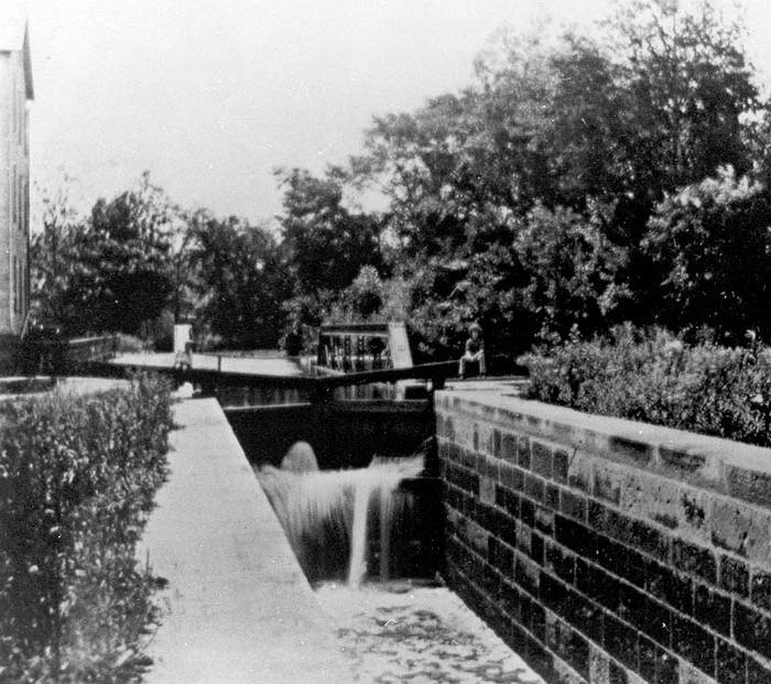
41°22′20″N 81°36′42″W / 41.37222°N 81.61167°WValley View 26 Lock No. 26 
December 11, 1979 3.3 mi (5.3 km) north of Ira Rd.
41°11′8″N 81°34′53″W / 41.18556°N 81.58139°WCuyahoga Falls 27 Lock No. 27 
December 11, 1979 Approximately 400 ft (120 m) east of the intersection of Riverview and Everett Rds. at Everett
41°12′11″N 81°34′15″W / 41.20306°N 81.57083°WBoston Township 28 Lock No. 28 
December 11, 1979 Deep Lock Q Quarry Metro Park
41°13′58″N 81°33′9″W / 41.23278°N 81.5525°WPeninsula 29 Lock No. 29 and Aqueduct 
December 11, 1979 Off State Route 303
41°14′34″N 81°33′2″W / 41.24278°N 81.55056°WPeninsula 30 Lock No. 30 and Feeder Dam 
December 11, 1979 Off State Route 303
41°14′41″N 81°33′14″W / 41.24472°N 81.55389°WPeninsula 31 Lock No. 31 
December 11, 1979 200 ft (61 m) east of the Cuyahoga River and approximately 0.5 mi (0.80 km) south of the Ohio Turnpike
41°15′6″N 81°32′46″W / 41.25167°N 81.54611°WPeninsula 32 Lock No. 32 
December 11, 1979 800 ft (240 m) north of Boston Mills
41°15′58″N 81°33′32″W / 41.26611°N 81.55889°WBoston Township 33 Lock No. 33 
December 11, 1979 1 mi (1.6 km) south of Highland Rd.
41°16′36″N 81°33′40″W / 41.27667°N 81.56111°WBoston Township 34 Lock No. 34 
December 17, 1979 Highland Rd.
41°17′21″N 81°33′53″W / 41.28917°N 81.56472°WSagamore Hills Township 35 Lock No. 35 
December 11, 1979 Off State Route 82
41°18′38″N 81°34′56″W / 41.31056°N 81.58222°WSagamore Hills Township 36 Lock No. 37 and Spillway 
December 11, 1979 Fitzwater Rd.
41°21′24″N 81°35′50″W / 41.35667°N 81.59722°WValley View 37 Lock No. 38 and Spillway 
December 11, 1979 Hillside Rd.
41°22′21.35″N 81°36′46.05″W / 41.3725972°N 81.6127917°WValley View 38 Lock No. 39 and Spillway 
December 11, 1979 Canal Rd.
41°23′25″N 81°37′30″W / 41.39028°N 81.625°WValley View 39 Lock Tender's House and Inn December 11, 1979 7104 Canal Rd.
41°22′21″N 81°36′47″W / 41.3725°N 81.61306°WValley View 40 Lutz-Martin Farm 
July 3, 2003 2470 Martin Rd.
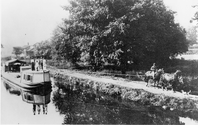
41°10′28″N 81°35′30″W / 41.17444°N 81.59167°WBath Township 41 Ohio and Erie Canal 
November 13, 1966 State Route 631
41°22′14″N 81°36′59″W / 41.37056°N 81.61639°WValley View 42 Ohio and Erie Canal Deep Lock September 9, 1974 South of Peninsula on Riverview Rd.
41°13′58″N 81°33′9″W / 41.23278°N 81.5525°WPeninsula 43 Packard-Doubler House 
March 9, 1979 7634 Riverview Rd.
41°21′18″N 81°36′12″W / 41.355°N 81.60333°WIndependence 44 Peninsula Village Historic District 
August 23, 1974 Both sides of State Route 303
41°14′24″N 81°33′3″W / 41.24°N 81.55083°WPeninsula 45 Nathaniel Point Farm 
September 3, 1999 4606 and 4631 Akron-Peninsula Rd., south of Peninsula
41°12′20″N 81°33′46″W / 41.20556°N 81.56278°WBoston Township 46 Charles B. Rich House February 22, 1979 9367 Brecksville Rd.
41°18′25″N 81°37′36″W / 41.30694°N 81.62667°WBrecksville 47 Russ and Holland Snow Houses September 28, 1982 12911 and 13114 Snowville Rd.
41°16′59″N 81°35′39″W / 41.28306°N 81.59417°WBrecksville 48 South Park Site June 22, 1976 On a promontory above the western bank of the Cuyahoga River, 7 miles from Lake Erie
41°22′42.5″N 81°37′20″W / 41.378472°N 81.62222°W[8]Independence 49 George Stanford Farm 
February 17, 1982 6093 Stanford Rd., north of Peninsula
41°16′16″N 81°33′25″W / 41.27111°N 81.55694°WBoston Township 50 Station Road Bridge 
March 7, 1979 East of Brecksville at the Cuyahoga River
41°19′10″N 81°35′16″W / 41.31944°N 81.58778°WSagamore Hills Township Extends into Brecksville in Cuyahoga County 51 Stebbens Farm April 17, 1996 8255 Riverview Rd.
41°20′19″N 81°35′40″W / 41.33861°N 81.59444°WBrecksville 52 Stumpy Basin December 11, 1979 200 ft (61 m) east of the Cuyahoga River and approximately 0.5 mi (0.80 km) south of the Ohio Turnpike, north of Peninsula
41°15′9″N 81°32′45″W / 41.2525°N 81.54583°WBoston Township 53 Terra Vista Archeological District May 23, 1978 On the edge of a bluff above the Cuyahoga River, north of its confluence with Tinkers Creek
41°22′6″N 81°36′37″W / 41.36833°N 81.61028°W[9]Valley View 54 Daniel Tilden House 
June 20, 1985 2325 Stine Rd., west of Peninsula
41°14′48″N 81°35′17″W / 41.24667°N 81.58806°WBoston Township 55 Tinkers Creek Aqueduct 
December 11, 1979 Tinkers Creek
41°21′53″N 81°36′33″W / 41.36472°N 81.60917°WValley View 56 Abraham Ulyatt House 
February 27, 1979 6579 Canal Rd.
41°23′10″N 81°37′11″W / 41.38611°N 81.61972°WValley View 57 Valley Railway Historic District May 17, 1985 Cuyahoga Valley between Rockside Rd. at the Cuyahoga Valley National Park and Howard St. at Little Cuyahoga Valley
41°13′38″N 81°34′13″W / 41.22722°N 81.57028°WBrecksville and Independence Extends into Summit County 58 Richard Vaughn Farm 
March 12, 1993 9570 Riverview Rd.
41°18′3″N 81°34′58″W / 41.30083°N 81.58278°WBrecksville 59 Wallace Farm 
June 27, 1985 8230 Brandywine Rd.
41°16′40″N 81°32′26″W / 41.27778°N 81.54056°WNorthfield Center Township 60 Allen Welton House 
May 7, 1979 Southwest of Peninsula at 2485 Major Rd.
41°14′0″N 81°35′1″W / 41.233333°N 81.58361°WBoston Township 61 Wilson Feed Mill December 17, 1979 7604 Canal Rd.
41°21′22″N 81°35′48″W / 41.35611°N 81.59667°WValley View See also
- National Register of Historic Places listings in Summit County, Ohio
- National Register of Historic Places listings in Cuyahoga County, Ohio
- National Register of Historic Places listings in Akron, Ohio
- List of National Historic Landmarks in Ohio
- National Register of Historic Places listings in Ohio
References
- Miller, Carol Poh. National Register of Historic Places Inventory - Nomination Form: Ohio and Erie Canal. National Park Service November 20, 1978 [1]
- National Register of Historic Places Multiple Property Documentation Form Form: Agricultural Resources of the Cuyahoga Valley. National Park Service November 20, 1978 [2]
- Winstel, Jeff; Mulhauser, Kurt. National Register of Historic Places Multiple Property Documentation Form: Recreation and Conservation Resources of Cuyahoga Valley 1870-1945. National Park Service October 3, 1994 [3]
- ^ The latitude and longitude information provided in this table was derived originally from the National Register Information System, which has been found to be fairly accurate for about 99% of listings. For about 1% of NRIS original coordinates, experience has shown that one or both coordinates are typos or otherwise extremely far off; some corrections may have been made. A more subtle problem causes many locations to be off by up to 150 yards, depending on location in the country: most NRIS coordinates were derived from tracing out latitude and longitudes off of USGS topographical quadrant maps created under North American Datum of 1927, which differs from the current, highly accurate GPS system used by Google maps. Chicago is about right, but NRIS longitudes in Washington are higher by about 4.5 seconds, and are lower by about 2.0 seconds in Maine. Latitudes differ by about 1.0 second in Florida. Some locations in this table may have been corrected to current GPS standards.
- ^ "National Register of Historic Places: Weekly List Actions". National Park Service, United States Department of the Interior. Retrieved on November 10, 2011.
- ^ Numbers represent an ordering by significant words. Various colorings, defined here, differentiate National Historic Landmark sites and National Register of Historic Places Districts from other NRHP buildings, structures, sites or objects.
- ^ "National Register Information System". National Register of Historic Places. National Park Service. 2008-04-24. http://nrhp.focus.nps.gov/natreg/docs/All_Data.html.
- ^ Location derived from its Federal Register notice; the NRIS lists the site as "Address Restricted"
- ^ Location derived from Brose, David S. "The Everett Knoll: A Late Hopewellian Site in Northeastern Ohio", 38-39. The NRIS lists the site as "Address Restricted".
- ^ Location derived from this Fairlawn city webpage; the NRIS lists the site as "Address Restricted".
- ^ Location derived from Brose, David S. The South Park Village Site and the Late Prehistoric Whittlesey Tradition of Northeastern Ohio. "Monographs in World Archaeology" 20. Madison: Prehistory, 1994, 18-19. The NRIS lists the site as "Address Restricted"
- ^ Location derived from this National Park Service webpage; the NRIS lists the site as "Address Restricted"
National Register of Historic Places in Cuyahoga Valley National Park National Historic Landmark District Other historic districts Botzum Farm | Camp Manatoc Foresters Lodge and Kit Carson-Dan Boone Cabins Historic District | Edward Cranz Farm | William and Eugene Cranz Farm | Michael Duffy Farm | Everett Historic District | Everett Knoll Complex | Jaite Mill Historic District | Virginia Kendall State Park Historic District | Peninsula Village Historic District | Terra Vista Archeological District | Valley Railway Historic District
National Register properties Barker Village Site | Jim Brown House] | Jim Brown Tavern | William Burt House | H. Karl Butler Memorial | Camp Manatoc Concord Lodge and Adirondacks Historic District | Camp Manatoc Dining Hall | Camp Manatoc Legion Lodge | Albert Cofta Farmstead | Jonas Coonrad House | Fort Island Works | Stephen Frazee House | Furnace Run Aqueduct | Edmund Gleason Farm | Hunt-Wilke Farm | William Knapp House | Lock No. 26 | Lock No. 27 | Lock No. 28 | Lock No. 29 and Aqueduct | Lock No. 30 and Feeder Dam | Lock No. 31 | Lock No. 32 | Lock No. 33 | Lock No. 34 | Lock No. 35 | Lock No. 37 and Spillway | Lock No. 38 and Spillway | Lock No. 39 and Spillway | Lock Tender's House and Inn | Lutz-Martin Farm | Ohio and Erie Canal Deep Lock | Packard-Doubler House | Nathaniel Point Farm | Charles B. Rich House | Russ and Holland Snow Houses | South Park Site | George Stanford Farm | Station Road Bridge | Stebbens Farm | Stumpy Basin | Daniel Tilden House | Tinkers Creek Aqueduct | Abraham Ulyatt House | Richard Vaughn Farm | Wallace Farm | Allen Welton House | Wilson Feed Mill
See also: National Register of Historic Places listings in Cuyahoga Valley National Park U.S. National Register of Historic Places Topics Lists by states Alabama • Alaska • Arizona • Arkansas • California • Colorado • Connecticut • Delaware • Florida • Georgia • Hawaii • Idaho • Illinois • Indiana • Iowa • Kansas • Kentucky • Louisiana • Maine • Maryland • Massachusetts • Michigan • Minnesota • Mississippi • Missouri • Montana • Nebraska • Nevada • New Hampshire • New Jersey • New Mexico • New York • North Carolina • North Dakota • Ohio • Oklahoma • Oregon • Pennsylvania • Rhode Island • South Carolina • South Dakota • Tennessee • Texas • Utah • Vermont • Virginia • Washington • West Virginia • Wisconsin • WyomingLists by territories Lists by associated states Other  Category:National Register of Historic Places •
  Portal:National Register of Historic PlacesCategories:
- National Register of Historic Places lists in the National Park Service
- Cuyahoga Valley National Park
-


Wikimedia Foundation. 2010.