- National Register of Historic Places listings in Davison County, South Dakota
-
 Location of Davison County in South Dakota
This is a list of the National Register of Historic Places listings in Davison County, South Dakota.
This is intended to be a complete list of the properties and districts on the National Register of Historic Places in Davison County, South Dakota, United States. The locations of National Register properties and districts for which the latitude and longitude coordinates are included below, may be seen in a Google map.[1]
There are 23 properties and districts listed on the National Register in the county, including 1 National Historic Landmark.
-
- This National Park Service list is complete through NPS recent listings posted November 10, 2011.[2]
Current listings
[3] Landmark name [4] Image Date listed Location City or town Summary 1 John F. Anderson House July 1, 1982 323 N. Duff
43°42′39″N 98°01′45″W / 43.710833°N 98.029167°WMitchell 2 Whittier and Virginia Bauer House March 1, 2010 600 E. 4th Ave.
43°42′45″N 98°01′07″W / 43.712519°N 98.018533°WMitchell 3 Louis Beckwith House July 1, 1982 1311 S. Duff Dr.
43°41′51″N 98°01′42″W / 43.6975°N 98.028333°WMitchell 4 E. B. Bobb House October 31, 2002 501 E. 4th St.
43°42′45″N 98°01′12″W / 43.7125°N 98.02°WMitchell 5 C. E. Chambers House January 26, 1990 322 W. 11th St.
43°43′11″N 98°01′45″W / 43.719722°N 98.029167°WMitchell 6 Dakota Wesleyan University December 22, 1976 Bounded by E. and W. University Aves. and McCabe St.
43°41′55″N 98°01′51″W / 43.698611°N 98.030833°WMitchell 7 Ellis and Roberta Henline Farmstead November 29, 2010 39987 252nd St.
43°43′54″N 98°12′32″W / 43.731667°N 98.208889°WMount Vernon vicinity 8 W. S. Hill House June 19, 2009 520 East 6th Avenue
43°42′52″N 98°01′11″W / 43.714556°N 98.019694°WMitchell 9 Holy Family Church, School, and Rectory December 12, 1976 Kimball and Davison Sts., E. 2nd and E. 3rd Aves.
43°42′40″N 98°01′18″W / 43.711111°N 98.021667°WMitchell 10 Kibbee-Nepstad House September 22, 1995 409 E. 5th Ave.
43°42′49″N 98°01′19″W / 43.713611°N 98.021944°WMitchell 11 Koch Apartments October 31, 1996 209 W. 2nd Ave.
43°42′39″N 98°01′38″W / 43.710833°N 98.027222°WMitchell 12 William Koch House October 31, 1996 201 W. 2nd St.
43°42′39″N 98°01′36″W / 43.710833°N 98.026667°WMitchell 13 Mitchell Historic Commercial District 
June 27, 1975 210 S.-604 N. Main, 119-201 W. 3rd St., 117-219 E. 4th St., and 112-220 W. 5th St.; also roughly bounded by Duff, Railroad and Lawler Sts.
43°42′39″N 98°01′29″W / 43.710833°N 98.024722°WMitchell Second set of boundaries represents a boundary increase 14 Mitchell Lustron Historic District December 2, 1998 Roughly along Vincent Place, from Miller Ave. to Mitchell Boulevard
43°41′55″N 98°02′21″W / 43.698611°N 98.039167°WMitchell 15 Mitchell Site October 15, 1966 Address Restricted Mitchell 16 Mitchell West Central Residential Historic District June 16, 1999 Roughly bounded by 1st and 7th Aves.
43°42′46″N 98°01′40″W / 43.712778°N 98.027778°WMitchell 17 Site 39DV24 January 31, 1984 Address Restricted Mitchell 18 Site 39DV9 January 31, 1984 Address Restricted Riverside 19 South Dakota Dept. of Transportation Bridge No. 18-040-137 December 9, 1993 Local road over Enemy Creek
43°38′52″N 98°14′45″W / 43.647778°N 98.245833°WMitchell 20 South Dakota Dept. of Transportation Bridge No. 18-060-202 December 9, 1993 Local road over Twelve Mile Creek
43°36′59″N 98°12′11″W / 43.616389°N 98.203056°WMitchell 21 South Dakota Dept. of Transportation Bridge No. 18-100-052 December 9, 1993 Local road over Firesteel Creek
43°44′55″N 98°06′22″W / 43.748611°N 98.106111°WLoomis 22 L.J. Welch House October 19, 1989 608 E. 4th Ave.
43°42′45″N 98°01′02″W / 43.7125°N 98.017222°WMitchell 23 Whittier School January 25, 2007 410 W. 2nd Ave.
43°42′46″N 98°01′49″W / 43.712778°N 98.030278°WMitchell See also
- List of National Historic Landmarks in South Dakota
- National Register of Historic Places listings in South Dakota
References
- ^ The latitude and longitude information provided in this table was derived originally from the National Register Information System, which has been found to be fairly accurate for about 99% of listings. For about 1% of NRIS original coordinates, experience has shown that one or both coordinates are typos or otherwise extremely far off; some corrections may have been made. A more subtle problem causes many locations to be off by up to 150 yards, depending on location in the country: most NRIS coordinates were derived from tracing out latitude and longitudes off of USGS topographical quadrant maps created under the North American Datum of 1927, which differs from the current, highly accurate WGS84 GPS system used by Google maps. Chicago is about right, but NRIS longitudes in Washington are higher by about 4.5 seconds, and are lower by about 2.0 seconds in Maine. Latitudes differ by about 1.0 second in Florida. Some locations in this table may have been corrected to current GPS standards.
- ^ "National Register of Historic Places: Weekly List Actions". National Park Service, United States Department of the Interior. Retrieved on November 10, 2011.
- ^ Numbers represent an ordering by significant words. Various colorings, defined here, differentiate National Historic Landmark sites and National Register of Historic Places Districts from other NRHP buildings, structures, sites or objects.
- ^ "National Register Information System". National Register of Historic Places. National Park Service. . http://nrhp.focus.nps.gov/natreg/docs/All_Data.html.
U.S. National Register of Historic Places Topics Lists by states Alabama • Alaska • Arizona • Arkansas • California • Colorado • Connecticut • Delaware • Florida • Georgia • Hawaii • Idaho • Illinois • Indiana • Iowa • Kansas • Kentucky • Louisiana • Maine • Maryland • Massachusetts • Michigan • Minnesota • Mississippi • Missouri • Montana • Nebraska • Nevada • New Hampshire • New Jersey • New Mexico • New York • North Carolina • North Dakota • Ohio • Oklahoma • Oregon • Pennsylvania • Rhode Island • South Carolina • South Dakota • Tennessee • Texas • Utah • Vermont • Virginia • Washington • West Virginia • Wisconsin • WyomingLists by territories Lists by associated states Other Municipalities and communities of Davison County, South Dakota City 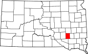
Town CDP Categories:- Davison County, South Dakota
- National Register of Historic Places in South Dakota by county
- Buildings and structures in Davison County, South Dakota
-

Wikimedia Foundation. 2010.