- National Register of Historic Places listings in Dawes County, Nebraska
-
 Location of Dawes County in Nebraska
This is a list of the National Register of Historic Places listings in Dawes County, Nebraska.
This is intended to be a complete list of the properties and districts on the National Register of Historic Places in Dawes County, Nebraska, United States. The locations of National Register properties and districts for which the latitude and longitude coordinates are included below, may be seen in a Google map.[1]
There are 15 properties and districts listed on the National Register in the county, including 1 National Historic Landmark.
-
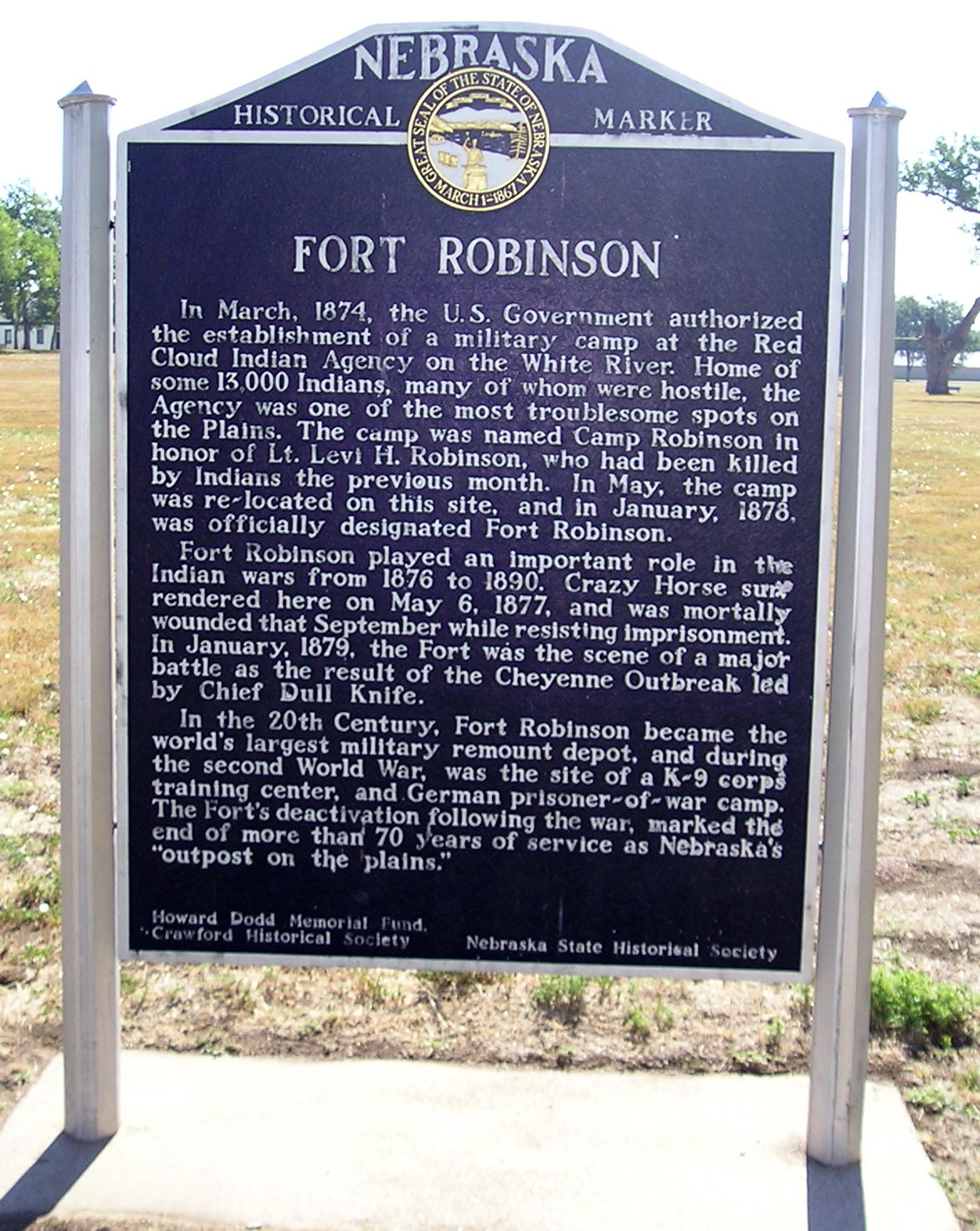
- This National Park Service list is complete through NPS recent listings posted November 10, 2011.[2]
Current listings
[3] Landmark name Image Date listed Location City or town Summary 1 Army Theatre 
July 7, 1988 Fort Robinson State Park
42°39′59″N 103°27′58″W / 42.666389°N 103.466111°WCrawford 2 Bordeaux Trading Post 
March 16, 1972 3 miles east of Chadron on U.S. Route 20
42°49′25″N 102°55′27″W / 42.823611°N 102.924167°WChadron 3 Chadron Commercial Historic District 
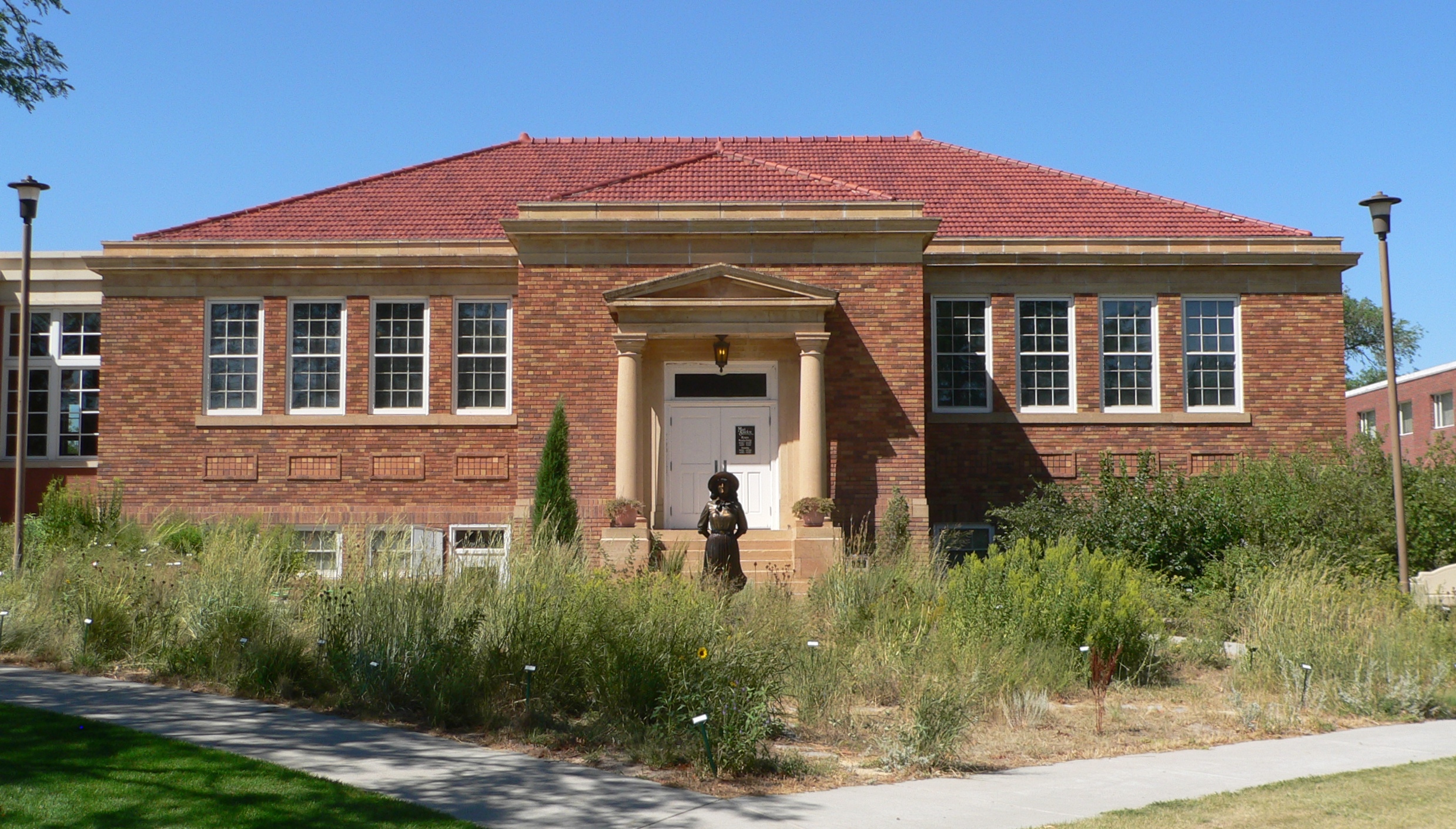
March 27, 2007 Main St. and 2nd St. Chadron 4 Chadron Public Library 
June 21, 1990 507 Bordeaux St.
42°49′35″N 102°59′58″W / 42.826389°N 102.999444°WChadron 5 Co-operative Block Building 
September 12, 1985 435-445 2nd
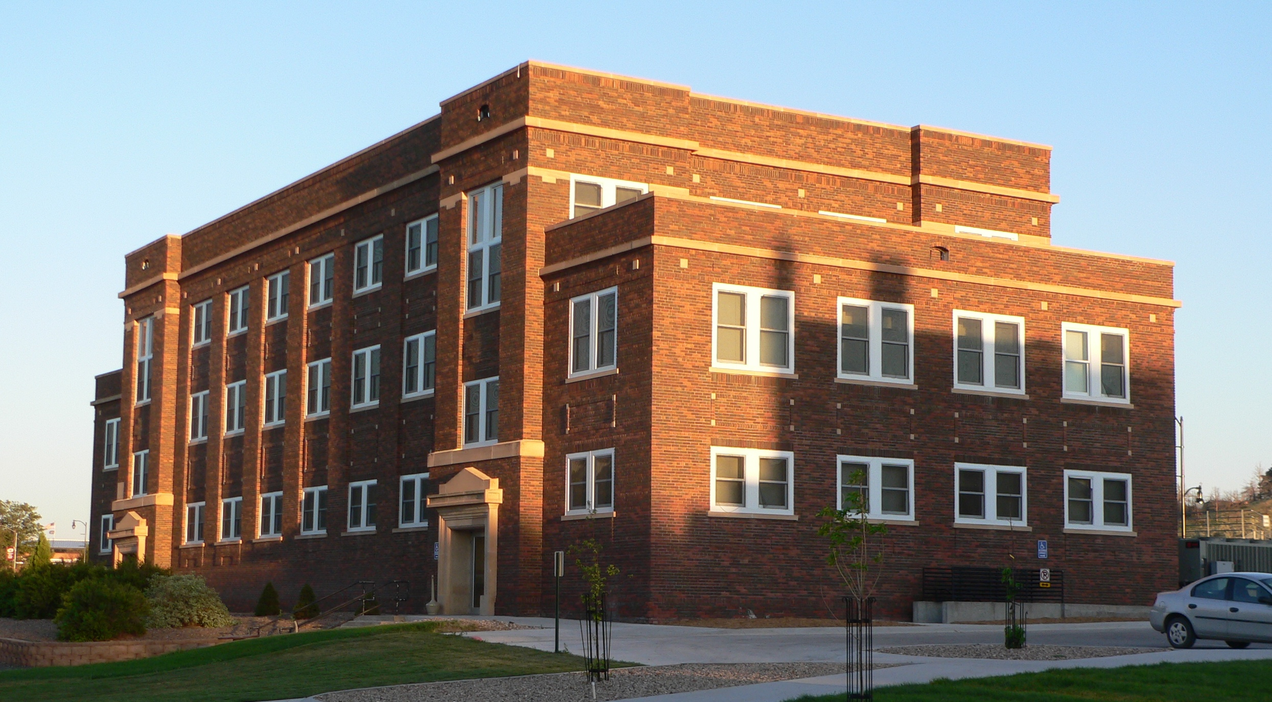
42°41′06″N 103°24′47″W / 42.685°N 103.413056°WCrawford 6 Crites Hall 
September 8, 1983 10th and Main Sts.
42°49′13″N 103°00′01″W / 42.820278°N 103.000278°WChadron Student services for Chadron State College 7 Dawes County Courthouse 
July 5, 1990 S. Main St. between 4th and 5th Sts.
42°49′57″N 103°19′51″W / 42.8325°N 103.330833°WChadron 8 Fort Robinson and Red Cloud Agency 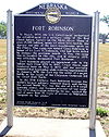
October 15, 1966 2 miles west of Crawford
42°40′02″N 103°27′13″W / 42.667222°N 103.453611°WCrawford Extends into Sioux County 9 Hotel Chadron 
August 15, 2002 115 Main St.
42°49′56″N 103°00′02″W / 42.832222°N 103.000556°WChadron 10 Library 
September 8, 1983 10th and Main Sts.
42°49′12″N 103°00′08″W / 42.82°N 103.002222°WChadron Now the Mari Sandoz High Plains Heritage Center[4] 11 Miller Hall 
September 8, 1983 10th and Main Sts.
42°51′51″N 103°00′03″W / 42.864167°N 103.000833°WChadron Academic offices, classrooms and IT for Chadron State College 12 Sparks Hall 
September 8, 1983 10th and Main Sts.
42°49′11″N 103°00′00″W / 42.819722°N 103.0°WChadron Administration for Chadron State College 13 US Post Office-Crawford 
May 11, 1992 144 Main St.
42°41′14″N 103°24′46″W / 42.687222°N 103.412778°WCrawford 14 Henry Wohlers, Sr. Homestead 
October 15, 2004 Address restricted Crawford Now operated as Pine Ridge Hunting and Lodging.[5] 15 Edna Work Hall 
September 8, 1983 10th and Main Sts.
42°49′14″N 103°00′07″W / 42.820556°N 103.001944°WChadron Dormitory for Chadron State College See also
- List of National Historic Landmarks in Nebraska
- National Register of Historic Places listings in Nebraska
References
- ^ The latitude and longitude information provided in this table was derived originally from the National Register Information System, which has been found to be fairly accurate for about 99% of listings. For about 1% of NRIS original coordinates, experience has shown that one or both coordinates are typos or otherwise extremely far off; some corrections may have been made. A more subtle problem causes many locations to be off by up to 150 yards, depending on location in the country: most NRIS coordinates were derived from tracing out latitude and longitudes off of USGS topographical quadrant maps created under North American Datum of 1927, which differs from the current, highly accurate GPS system used by Google maps. Chicago is about right, but NRIS longitudes in Washington are higher by about 4.5 seconds, and are lower by about 2.0 seconds in Maine. Latitudes differ by about 1.0 second in Florida. Some locations in this table may have been corrected to current GPS standards.
- ^ "National Register of Historic Places: Weekly List Actions". National Park Service, United States Department of the Interior. Retrieved on November 10, 2011.
- ^ Numbers represent an ordering by significant words. Various colorings, defined here, differentiate National Historic Landmark sites and National Register of Historic Places Districts from other NRHP buildings, structures, sites or objects.
- ^ "History of the Mari Sandoz High Plains Heritage Center". Sandoz Center website. Retrieved 2010-09-01.
- ^ Pine Ridge Hunting and Lodging. Retrieved 2010-08-10.
U.S. National Register of Historic Places Topics Lists by states Alabama • Alaska • Arizona • Arkansas • California • Colorado • Connecticut • Delaware • Florida • Georgia • Hawaii • Idaho • Illinois • Indiana • Iowa • Kansas • Kentucky • Louisiana • Maine • Maryland • Massachusetts • Michigan • Minnesota • Mississippi • Missouri • Montana • Nebraska • Nevada • New Hampshire • New Jersey • New Mexico • New York • North Carolina • North Dakota • Ohio • Oklahoma • Oregon • Pennsylvania • Rhode Island • South Carolina • South Dakota • Tennessee • Texas • Utah • Vermont • Virginia • Washington • West Virginia • Wisconsin • WyomingLists by territories Lists by associated states Other  Category:National Register of Historic Places •
  Portal:National Register of Historic Places
Municipalities and communities of Dawes County, Nebraska County seat: Chadron Cities 
Village Unincorporated
communityCategories:- National Register of Historic Places in Nebraska by county
- Dawes County, Nebraska
- Buildings and structures in Dawes County, Nebraska
-


Wikimedia Foundation. 2010.